When thinking about UMKC campus and its interface connection to the city as it stands, one word I have to describe it is disconnected. Campus is integrated into the heart of KCMO. Minutes from the Plaza, Westport, and so much more, UMKC’s campus has the potential to be involved in the city and provide amenities to those on campus but also in surrounding neighborhoods.
Integrating campus into the community is a great way to get a better connection between the two. I chose Oak st. because the possibilities are endless.
Encouraging Oak St. Corridor to become a pedestrian friendly street opens up opportunities for community/public engagement and creates a good interface connection. Being minutes from KC assets like the Nelson Atkins Museum is a great motivator for a pedestrian friendly street. Those traveling down Oak on foot get a sense of campus community when approaching the redeveloped stairs of Oak St./The entrance of campus.
Promoting Oak as a walkable, pedestrian activated street creates a connection to other parts of the city as well as the Trolley Track Trail additions.
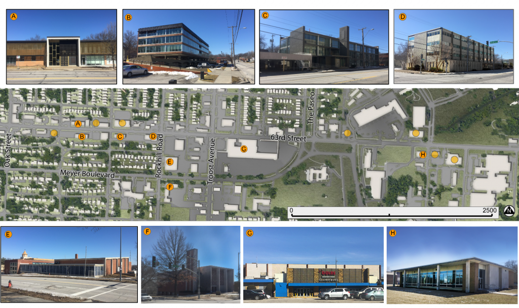
The major architectural character of the 63rd Street Corridor, between Oak and Prospect, has two prominent styles and an interesting sub-style.
The first major style is Spanish Revival. Notable for its mixture of red and buff brick, tiled roofs, towers, and terracotta decoration; this style dates to the 1920’s. While there are relatively few buildings in this style along the corridor, their baroque decoration, interesting color palate, and prominent locations make them stand out among more contemporary structures.
Small Commercial strip in a Spanish Revival style at 63rd and Oak. Note the tower, tiled roof and terracotta accents. This example is prominently located at the busy corner of 63rd and Troost.A 3-unit commercial structure on 63rd, between Tracy and The Paseo. The Convent of Christ the King dates to a later period than many other of the nearby examples (1940) but maintains the hallmarks of the style. It’s tower is visible from many points in the area. The relative locations of the Spanish Revival buildings
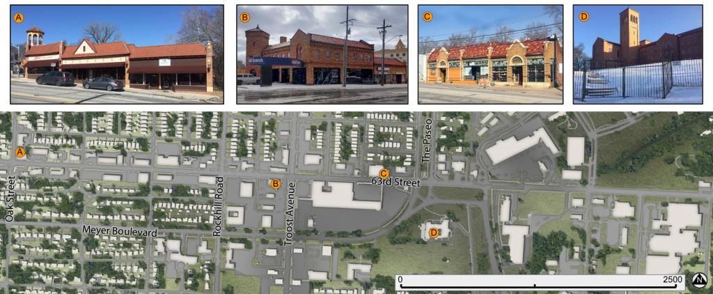
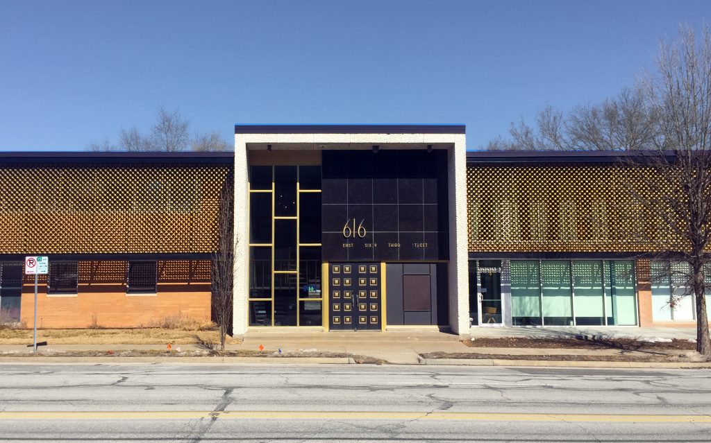
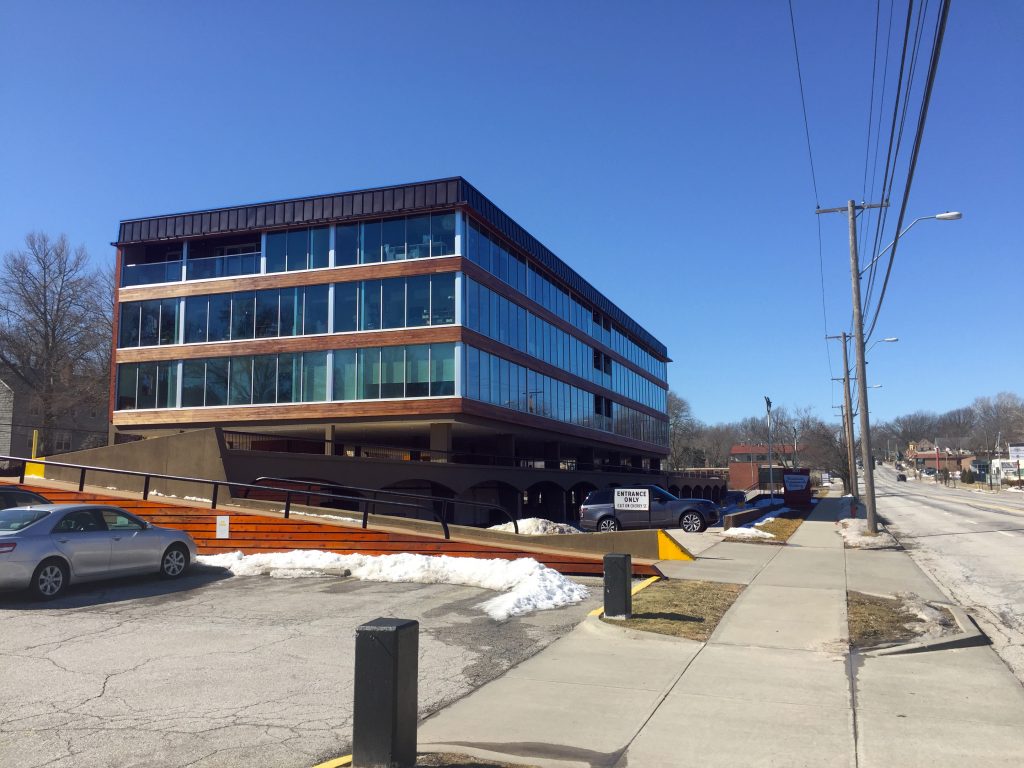
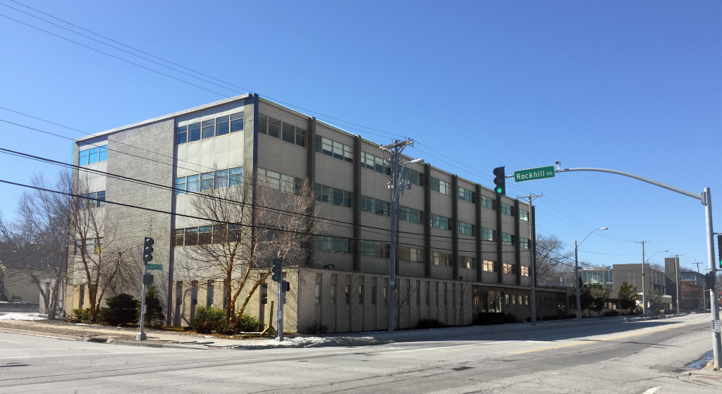
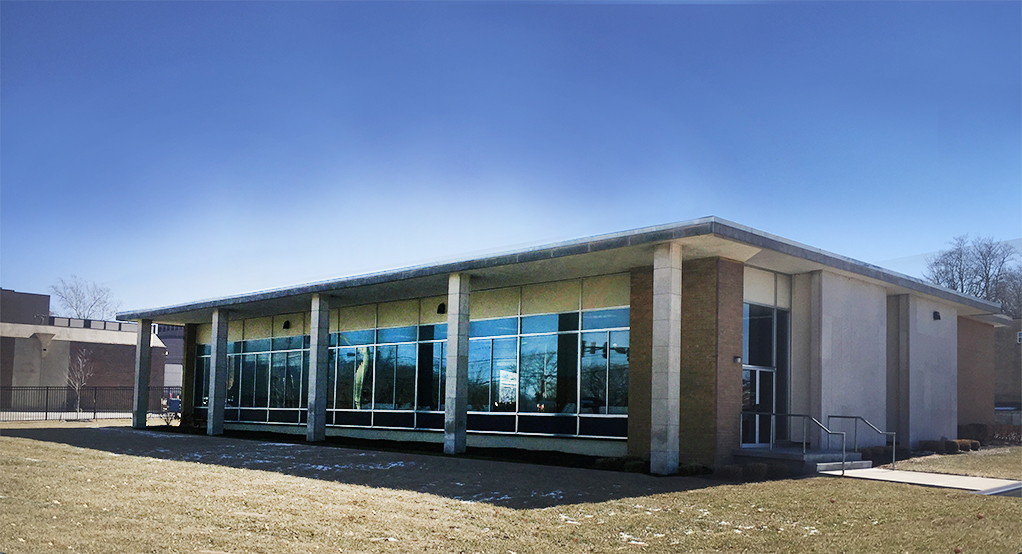
The second major style, and one that dominates the western portion of 63rd Street, is Modernism. Identified by the style’s clean lines, concrete, steel, and glass construction, and lack of ornamentation; these structures can be found in many forms along the corridor. A subsection of these structures feature concrete or metal screens which partially shield the structures from view.
Many of these modernist structures have integrated, structural parking adjacent to their usable space; evidence of their later period of development, well into the motor age.
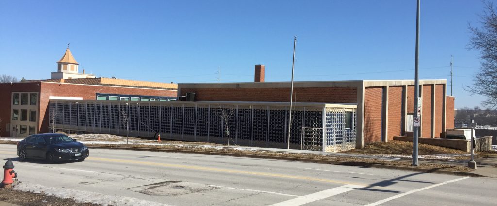
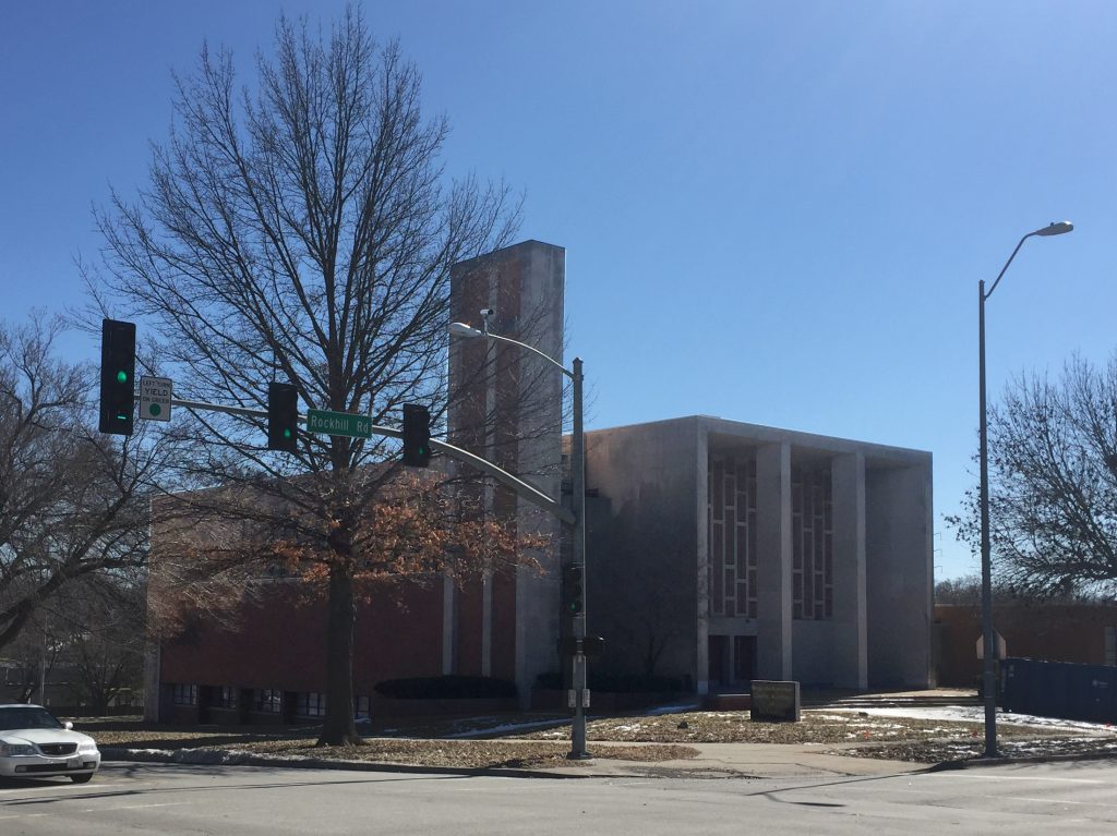
A low-rise office building with a patterned screen shielding its second floor. Found near Cherry on 63rd Street. A modernist mid-rise office building is vaulted over its parking garage; which is partially below street-level. Found at Cherry & 63rd. This structure and the one below are separated by their shared parking structure; seen to the left of this photo. This example is less dramatic than its neighbors but sits at the prominent corner of Rockhill Road and 63rd. It shares its parking structure with the building in the photo above. This former school building features a patterned metal screen along the lower portion of its facade on Rockhill Road. The visible structural concrete is another hallmark of modernist design. Found at Meyer Boulevard and Rockhill Road.This former church, just south of the building above, also features prominent structural concrete in its main facade and tower. The main entrance of The Landing shopping center still bears marks of modernist design, despite a number of retrofits throughout the years. Visible structural elements and a patterned concrete screen are evidence of its stylistic roots. This is another example of modernist design in a small structure. This one features a broad rectangular facade of glass shaded by a simple concrete eave and pillars. Relative locations of the featured modernist buildings along with the sites of others in that style.
A fun subsection of modernism make a few appearances along the corridor in the form of highly stylized small structures with prominent automobile accommodations. These quirky structures bring a lot of mid-century character to the corridor and some have been re-purposed for contemporary uses.
A small, truncated A-Frame structure with matching automobile passage. The glass front of this building also features a patterned screen of concrete circles.Simple modernist boxes are stacked off-center, leaving an open carport below a portion of the second floor. Just west of Rockhill Road on 63rd. This former gas station has space-age angles in its awning and sign post. Located at Bushman Drive and 63rd Street.Locations of the sub-style auto-centric modernist structures.
While there are a number of other architectural styles represented in the corridor, the dominating character is defined by these examples. Any new development in the area should look to complement these existing structures.
After
completing a full analysis of our study area, there was much knowledge to even
begin to display. Looking at the most recent Census data for our six tracts, it
is seen that Troost Avenue is still a racial dividing line of Kansas City,
Missouri. As our class suspected, the tracts to the west of Troost Avenue held
a majority population consisting of whites while the east tracts were majority
blacks. This was not the only variable dividing the west and east of Troost
Avenue, but there was a stark difference in income levels, house value, vacant
structures, school attendance, and even a dramatic difference in the age of the
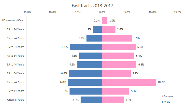
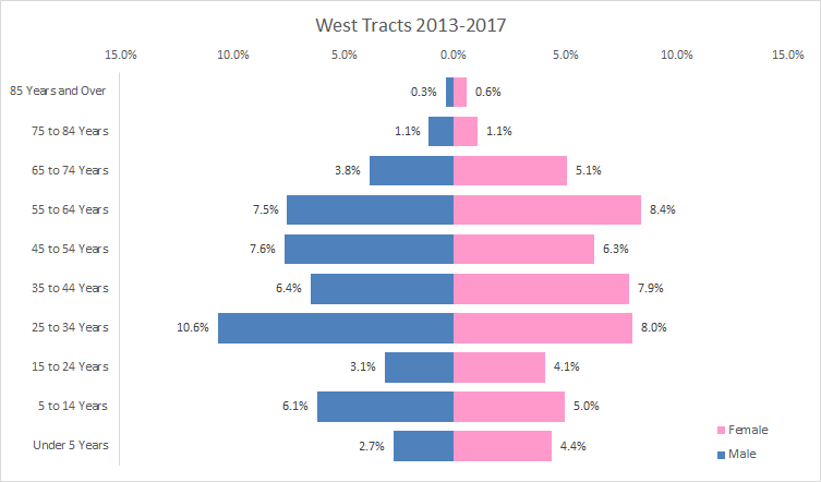
population. The differences in age groups of the west and east study tracts is
something I was not expecting to see, and it can be associated with the types
of businesses seen on both sides of Troost Avenue. Figures 1 and 2 show the
variation of age levels in the west and east study tracts. The largest percent
of population in the west study tracts lie within the age group of 25-34 years
old. However, the largest percent of population in the east study tracts lie
within the age group of 15-24 years old. The west study tracts have fewer
children and a larger mid aged population, while the east study tracts have
more children and a more equal distribution throughout the age groups.
Figure 1. Population Pyramid of East Study Tracts created by Cristina Aurich 02/2019Figure 2. Population Pyramid of West Study Tracts created by Cristina Aurich 02/2019
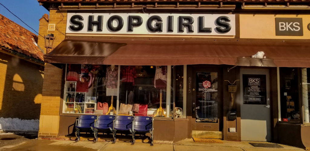
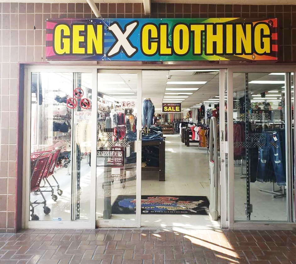
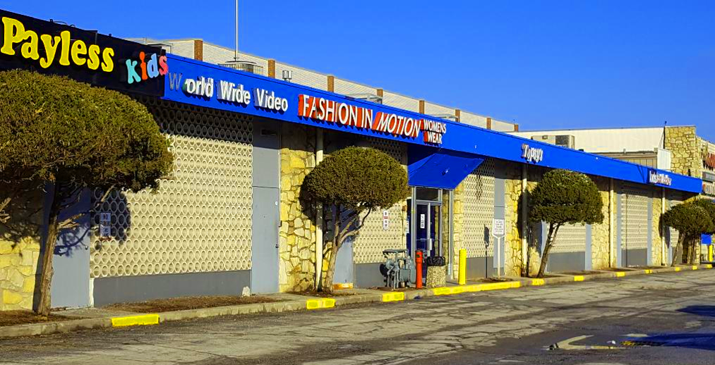
The difference in age across Troost Avenue is relatable to the types of businesses in our study area. Within our six tracts, I was able to only find five child day care services, from looking at Kansas City’s active business license, and all five were located in the east study tracts. Another big finding, relating to age and businesses, were the different clothing stores. Figure 3 shows a typical clothing store that can be spotted in the west study tracts and figure 4 shows one that can be observed in the east study tracts. The west study tracts are filled with locally owned boutiques with pricey, one of a kind, high quality material clothes. Compared to clothing shops in the east study tracts, which consist of factory made, low quality material, disposable clothes. An older population generally buys for long term and a younger population buys short term.The difference in age across Troost Avenue is relatable to the types of businesses in the study area. Within our six tracts I was able to only find five child day care services, from looking at Kansas City’s active business license, and all five were located in the east study tracts. Another big finding relating to age and businesses were the different clothing stores. Figure 3 shows a typical clothing store that can be spotted in the west study tracts and figure 4 shows one that can be observed in the east study tracts. The west tracts are filled with locally owned boutiques with pricey, one of a kind, high quality material clothes. Compared to clothing shops in the east study tracts, which consist of factory made, low quality material, disposable clothes. An older population generally buys for long term and a younger population buys short term.
Shop Girls Boutique in East Brookside taken by Bryce Morgan 02/2019 Gen X Clothing Store Inside The Landing Mall taken by Cristina Aurich 02/2019
Overall, looking at all the business license within our study tracts, there were similarities in the top business types for both the west and east study tracts. Professional scientific & technical services, salon/barbershops and commercial & institutional building construction businesses were at the top of the list for businesses on each side of Troost Avenue. Overall, looking at all the business license within our study tracts there were similarities in the top business types for both the west and east study tracts. Professional scientific & technical services, salon/barbershops and commercial & institutional building construction businesses were at the top of the list for businesses on each side of Troost Avenue.
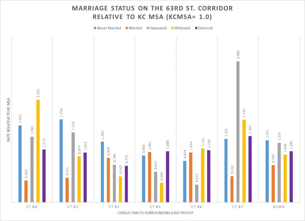
Source: US Census American Community Survey 5 Year Data 2013-2017.
Is there geographic variation in the marital status of the population in Kansas City? Yes, this graph shows that marital status varies across the census tracts surrounding the Landing Site on the 63rd Street Corridor. Census tracts 80, 81 and 87 all have a lower rate of marriage than both the City of Kansas City and a much lower rate of marriage than the Kansas City Metropolitan Area. Perhaps the most surprising data are the high rates of marital separation and widowhood in tracts 80 and 87. Note that the marriage rate in Kansas City is substantially less than the rate in the Kansas City Metropolitan Area.
How do you read the data in the chart? All of the data are from the US Census American Community Survey 5 year tabulation of data from 2013 to 2017. Data on the number of poeple age 15 and older by marital status were downloaded from the Census site. Then rates were calculated by comparing the proportion in the tract and in Kansas City, MO to the rate for the Kansas City Metropolitan Area. The rates for the KC MSA are equal to 1. The indexed marriage rate of .460 for Census Tract 80 means that the rate in that census tract is 46% of the KC MSA rate. This means that the number of married people in this tract is less than half what you would expect applying the metro wide average. The 2.164 rate of widowhood in Census Tract 80 means that there are 216.4% more widows in this tract.
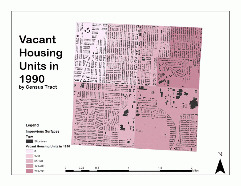
When looking at housing unit data for the area surrounding The Landing, data was pulled for census tracts 80-83,86, and 87 to have a good amount of area around the site. Data was gathered for years 1990-2017 and included the Decennial Census Data and ACS 5-year estimates. When looking at the data, I thought the most useful information for us to know would be the vacancy numbers for housing units and the housing type. Majority of the homes were single family detached which then narrowed down my focus to vacancy.
I first looked at the number of housing units in total to see how they changed throughout the years. The above image should be a GIF but if it is not changing images the link has been included as well to download and watch it. I thought it would be interesting to first analyze how the neighborhood grew, which in relation to Kansas City, Missouri, it grew at a comparable rate.
When looking at the vacant units and especially the change over time, appears to be growing more and more vacant. Because of this, I decided to look at the percent vacant to get a clear numerical image of where our census tracts really are. Doing so has shown an increase in vacancy over time as the number of housing units has decreased.
Vacancy
Units in Total
Percent Vacant
1990
700
9,037
7.7%
2000
518
8,751
5.9%
2012
995
8,826
11.2%
2017
1,147
8,894
12.8%
Seeing as I did only look into the housing units and the occupancy status based on housing, it would be interesting to conduct a further analysis of occupancy considering all structures in these tracts. All in all, I think we have an opportunity with the site to create something to bring families back into the area and decrease the amount of vacancy and possibly increase the amount of structures. If the demand can be created then we can produce the necessary neighborhood units to supply the people with what they need.
The area around The Landing Mall began as a suburban escape from the urban core. The southern expansion of Kansas City can be noted by curvy streets and larger parking lots. The surrounding neighborhoods were built around the park and boulevards system in Kansas City, making it a desirable place to live when it began. As suspected, the area surrounding the Landing was not very populated in the 1920s but in the 19603, around when the Landing was built, the area became pretty dense. Since then it has seen some demolition of buildings and the ground is less packed.
1963 Figure Ground Map Surrounding The Landing (1″=200′). Made by Adair Bright2018 Figure Ground Map Surrounding The Landing (1″=200′). Made by Adair Bright
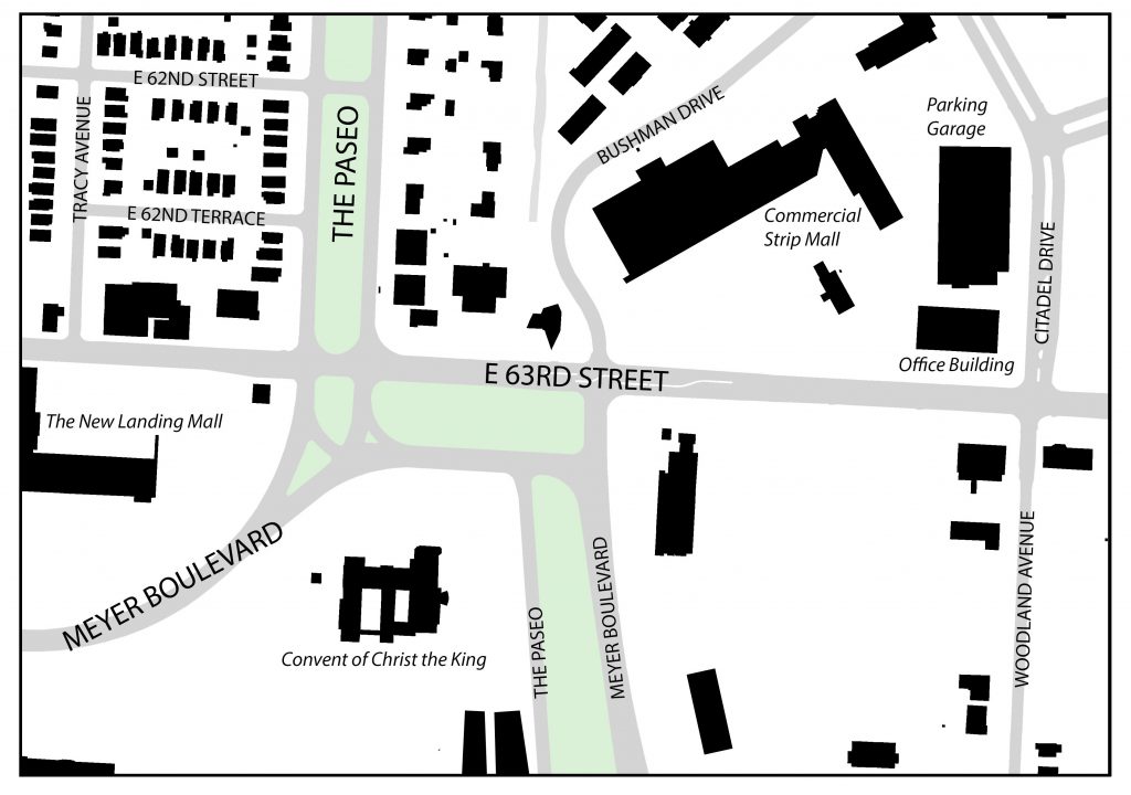
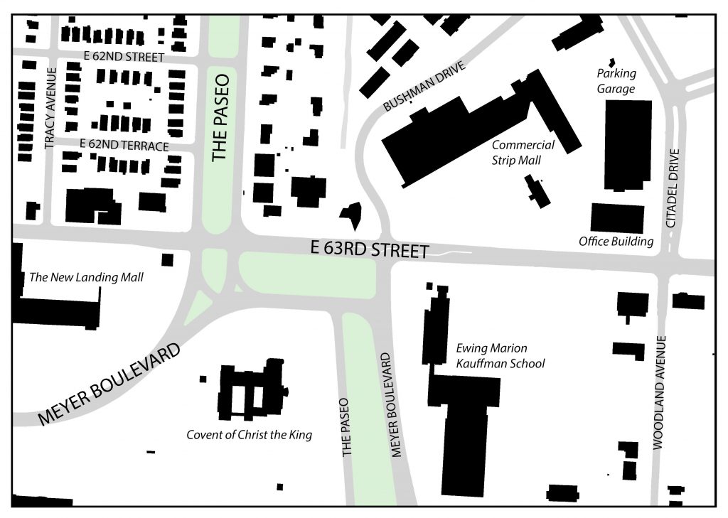
Describing the seemingly complex intersection of 63rd Street, Meyer Boulevard and The Paseo, famed Architect and Urban Designer, Ted Seligson, refers to it as “the knuckle” of Kansas City’s boulevard system. Viewing the intersection from an aerial view, Seligson’s analogy becomes clear. The way Meyer Boulevard merges into The Paseo, then briefly runs parallel with 63rd Street, before finally turning back down into itself, looks like a person’s finger joints. The knuckle, which lies just East of The Landing (which was discussed in my last blog), is a node that various different land uses gather around. Not only is this the case for present day (currently a mix of residential, commercial and institutional uses surround the knuckle) but it has been the case for the past 100 or so years. This post will look at how the area immediately surround the knuckle has developed over time.
1925 Figure Ground Map – 63rd Street between Tracy and Woodland Avenues. Source: Jared Islas, 2019.
The earliest developments in the area were mostly single-family residences. These homes mostly originated along Tracy and Woodland Avenues, with some additional homes appearing on either side of The Paseo. Many of the homes on Tracy and The Paseo will remain intact through to present day, but the same can not be said for those on Woodland.
According to the 1925 Atlas of Kansas City, the present-day Landing site was formerly home to two large greenhouses known as “William L. Rock Flower Company.” These greenhouses would also not last long, as they would be sold to JC Nichols in the mid to late 1940’s who would go on to develop The Landing Mall (Kansas City Star, 1947).
Also, just Northeast of the knuckle, sat the Blue Hills Golf Club. This would remain an important part of the neighborhood up the site was redeveloped for a suburban-esque retail shopping center and neighborhood.
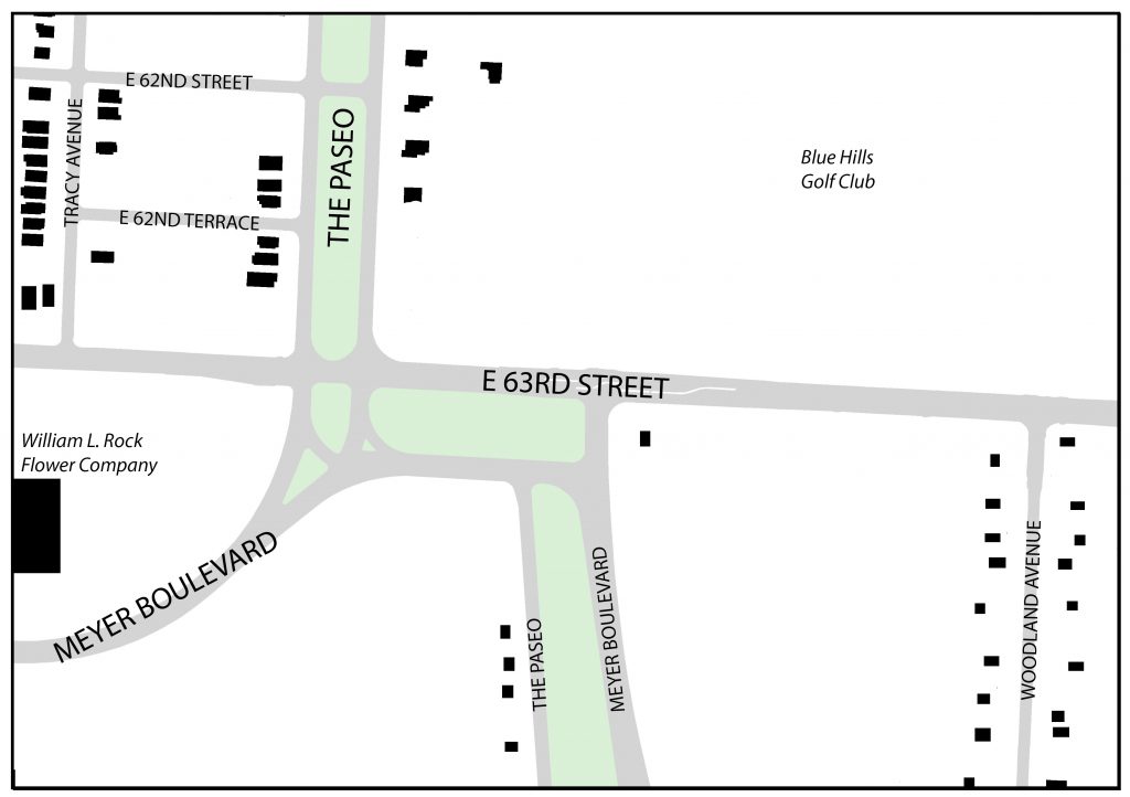
1963 Figure Ground Map – 63rd Street between Tracy and Woodland Avenues. Source: Jared Islas, 2019.
By 1963, more single-family residences had filled up the area Northwest of the knuckle and almost all of the houses that had been fronting Woodland Avenue had disappeared. Also, Convent of Christ the King, and some other institutional/office buildings sprung up South of 63rd Street. And The Landing mall was constructed on the former site of the two large greenhouses.
1991 Figure Ground Map – 63rd Street between Tracy and Woodland Avenues. Source: Jared Islas, 2019.
By the early 1990’s, the Blue Hills Golf Club was gone and replaced by the suburban-esque strip mall, a six-story office building and a three-story parking garage. Commercial pad sites began developing around the knuckle and other intersections along 63rd Street.
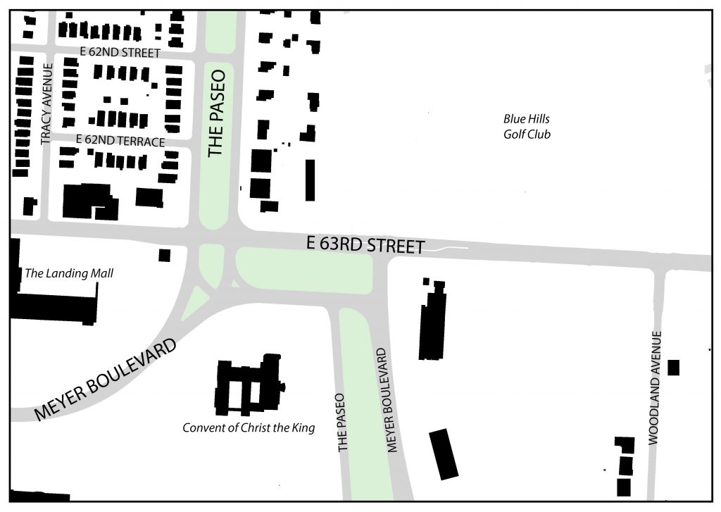
2019 Figure Ground Map – 63rd Street between Tracy and Woodland Avenues. Source: Jared Islas, 2019.
As of today, the area around the knuckle has not changed much since the early 90’s. The only major difference is the large additions to building at the Southeast corner of 63rd and Meyer. These buildings ultimately became the campus for the Ewing Marion Kauffman School, which is a public charter school.
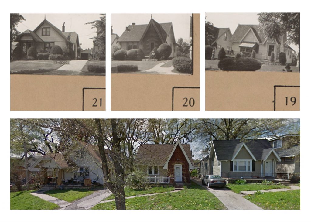
While the structures and their uses surrounding the knuckle have changed in the last 100 years, there are some things that have remained the same. The first being some of the older, now historic, single-family homes on 62nd Terrace. The picture below shows these homes first in 1940, as part of the 1940 Tax Assessment photos, and then again in 2015 through Google Maps Street View.
Comparison of single family homes on 62nd Terrace Source: 1940 Tax Assessor photos and 2015 Google Street View
These structures have remained relatively untouched during the almost 80 year gap that these photos were taken. The only things that have changed are expected renovations in older homes like these – materiality and landscaping.
The next set of photos, comes to the same conclusion. This commercial building, located halfway in between Tracy Avenue and The Paseo on the North side of 63rd Street has also remained relatively unchanged.
Comparison of a commercial building on 63rd Street. Source: 1940 Tax Assessor photos and 2018 Google Street View.
These historic photos show that while there have been some structures that have been around for the better part of the last 80 years, nothing compares to the longevity of the knuckle.
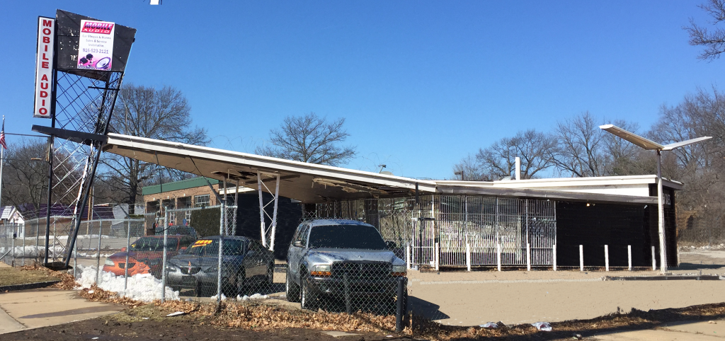
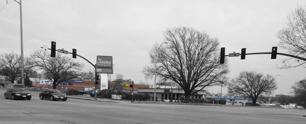
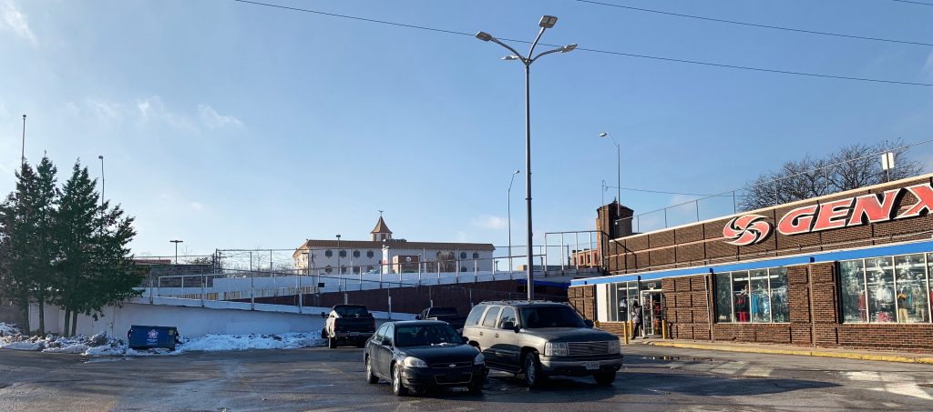
Figure 1. From 63rd , looking across Troost Ave.: The Landing Appears to be a small commercial strip. The majority of the complex is hidden by topographical changes. Photo by Tom Meyer
When arriving from the north, the first impression of The Landing shopping center is rather misleading. The first thing you will see is a small strip of commercial activity with a deep setback from Troost Ave. and abundant parking. From the corner of 63rd and Troost (Figure 1) it could easily be mistaken for the extent of the development. However, if you traveled further south on Troost or east on 63rd, you would see that the ground level drops dramatically in each direction revealing the majority of the mall which lies below the ground level of this prominent corner.
Figure 2. From Meyer Blvd, looking across Troost. The mall’s setback from Meyer Blvd is so deep that it makes little visual impact from this major corner. Photo by Dayna Meyer
From the intersection of Meyer Blvd and Troost Ave, a block to the south, the topography and other elements of the site continue to mask the view of the large complex (Figure 2). The rise of Troost and the deep parking lot fronting Meyer Blvd. obscure the storefronts at the west of the site. The parking lot, a fast food restaurant, and large trees hide the rest of the mall as it stretches east.
The lack of a strong visual presence may be negatively impacting the prospects of the retail activity conducted on the mall’s premises. People who pass the site may not be aware of the commercial opportunities hidden by topography and the low-rise structures.
Future developments could remedy this effect by siting buildings closer to the street. The low-elevation could also be countered with taller structures.
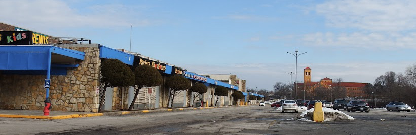
However, the topography which helps to hide the mall can also be seen as an advantage when taken together with elements of the built environment surrounding the site. Three vertical landmarks are easily, and pleasantly, visible from many points on the site. To the west the pinnacle of the Rockhill Plaza office building and the tower of the U.S. Bank building rise high enough that they can be seen from almost anywhere on the southern and eastern sides of the site (Figure 3).
Figure 3. Looking northwest from the Mall’s southern parking lot, the towers of Rockhill Plaza and the U.S. Bank building are easily visible. Photo by Dayna Meyer
To the east, the dramatic tower and red roof of the Convent of Christ the King can be seen from almost anywhere on the site, excepting the northwest corner (Figure 4).
Figure 4. Looking to the east, the Tower of the Christ the King Convent is visible from almost any vantage point of the mall site. Photo by Tom Meyer
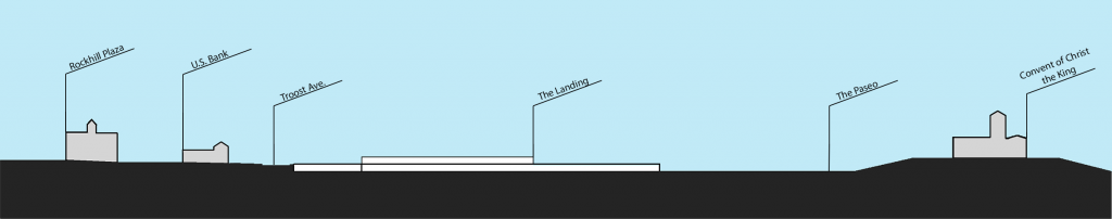
In both directions the views of these landmarks are made possible by the topography of the site. The mall is sited in a relatively deep bowl of a valley and the verticality of the towers is enhanced by their siting on the surrounding higher ground (Figure 5).
A section of the site and surrounding area shows how the topography highlights the surrounding towers and de-emphasizes the large mall site. Diagram by Tom Meyer
Future development on the site could take advantage of this unique topography by preserving the excellent views off of the site.
Regional Context Map. Made by: Adair Bright (ArcGis, UMKC)
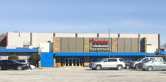
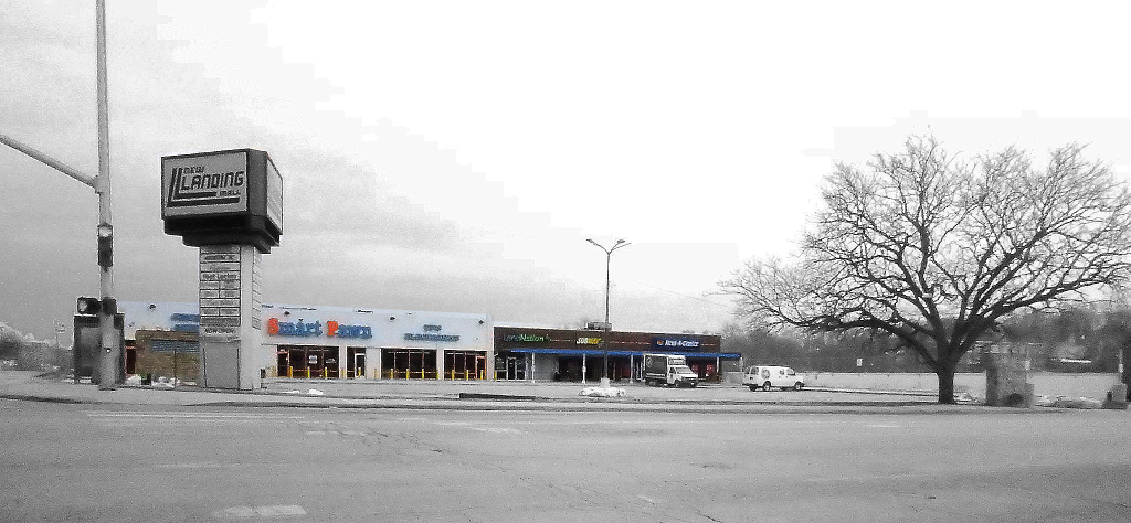
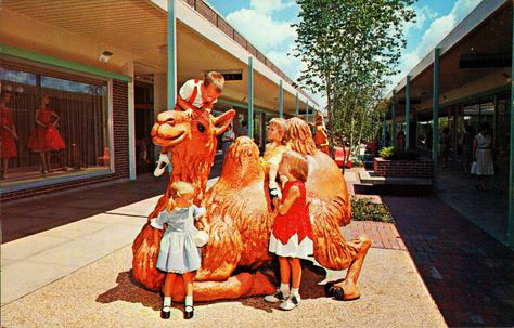
The Landing Mall, inside the red circle pictured above, is located at Troost Avenue and East Meyer Boulevard in Kansas City, Missouri. It sits on the Parks and Boulevards System and is surrounded by four major streets – Troost, Meyer, 63rd Street, and Paseo. Being about 20 blocks south of The Country Club Plaza, it served as a retail space for the surrounding neighborhood. The mall was built in 1960 and was originally an open-air shopping center – something that can be identified when inside the mall. The mall became enclosed in 1970 and was renamed The New Landing Mall.
The Original Landing. Photo by: Adair Bright (January 23, 2018)
Few pieces of the original Landing still remain but it is enough to preserve and recreate. The sign pictured above is on the east side of the building facing the merge of Meyer Boulevard and the Paseo Boulevard. Having the original signage from the mall facing a boulevard is a positive because of the amount of people on those roads and it provides to opportunity to incorporate the boulevards aesthetic.
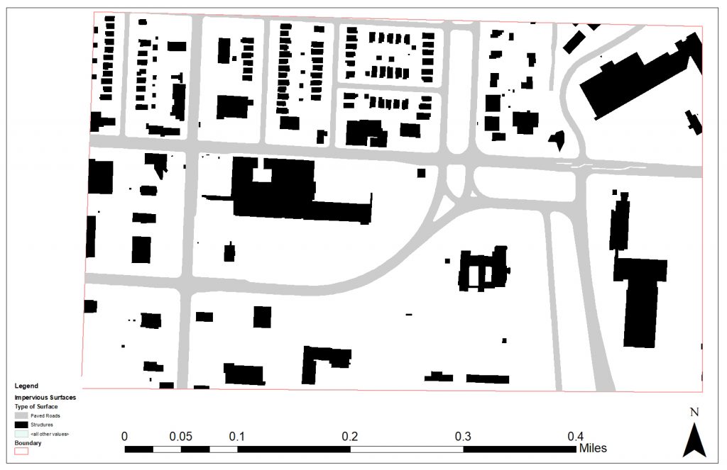
The Quarter Mile Figure Ground Map gives an aerial view of the site. The Landing Mall is highlighted in purple and the red circle represents a quarter mile radius from the center of the mall. A quarter mile radius was used because that is generally the distance people would be willing to walk and still consider it convenient. When looking within the circle, there are many bigger buildings which means there is a lot of retail and institutions surrounding The Landing. This is a good thing when considering the neighborhood just south of the circle because all the places within the circle are there to service the residents. There is also a playing field at the school within the circle which shows there is youth in the area.
A Look at Troost. Photo by: Adair Bright (January 23, 2018)
The image above is standing in the parking lot on the south side of the building while looking at Troost Avenue. It is clear from the picture there is a drastic topography change from the lower level to the upper level of the mall. The ramp was closed when the photo was taken so to get to the upper level, we had to walk to the south end of the parking lot to get onto a sidewalk that led north on Troost. This can be a major inconvenience to people because they want the quickest way to get to another place and therefore they will either drive their car to the upper lot or will not even bother coming here. Despite the current lack of good circulation, the topography does create a secluded place for the mall and in turn makes it feel safe. It also would allow for visitors to see a different view of the mall if they were able to look down at it and see the actual design.
The main impression I got when visiting The Landing was the extreme amount of parking surface. The map above shows the paved surfaces in the area. The building outline is clearly seen which means the entire lot, besides the building, is a paved surface for vehicles. Also, the map shows the abundance of parking elsewhere within the quarter mile radius. At some point, it was probably believed all the parking would be needed to support the abundance of people, but now, it sits empty. When arriving at The Landing, I was confused as to why the parking lot was so big and once we started walking, I realized just how small it made me feel. The mall and the paved surface appear to take up the same amount of the lot – each about half. This becomes uncomfortable when the Northwest side of the mall is pushed up almost to the street and the Southeast side is all parking. The massing should be reconfigured to less parking just on the outside in order to push the building slightly further towards the outer edge.
Conclusion
The Landing has an amazing location and the topography allows for interesting design choices to be made with clear intentions. However, the paved surface needs to be changed and the parking should be reconfigured. When inside, the mall feels old and sad. There is not a lot of light, the planter boxes are empty, and the store fronts do not have residents. The mall needs renovated while preserving its unique features. The original signage should be kept as a reminder of when it was built but the building should be maintained and turned back into a retail space for the residents it serves.
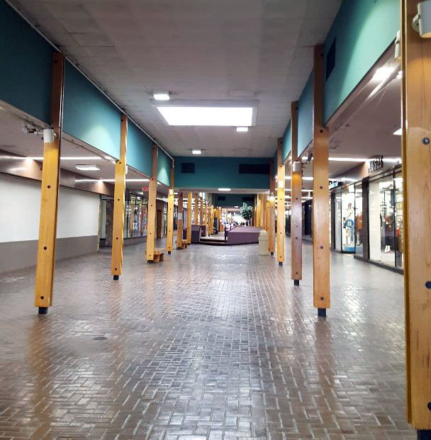
The Landing is a shopping mall that was created by J.C. Nichols and opened to the public in 1960 as an open-air public space with animal-themed play structures for children and trees throughout the central corridor. It still exists today as a covered structure and has some operating places of business inside, although not as high-traffic as it was in its beginning days and without the play structures and greenery.
Photo courtesy of Ryan Khatam http://neat-stuff-blog.blogspot.com/2011/01/landing-mall-1960s.html
Present day interior of KC Landing Mall, Shana Shanteau
The exterior of the building exhibits materiality of stone, paint, and a circular-patterned concrete façade which seems somewhat inconsistent. The major entrances are somewhat unclear and confusing to approach. There are, however, beautiful murals on the exterior walls that promote a strong sense of local pride. Adjacent is its very large parking lot. Most of the surface area of the lot is unused by cars during a typical day and completely void of trees and other greenery. Once inside the building, the space is very warm and inviting. Large windows display several retail stores full of merchandise and ready for customers. I feel that more clear and welcoming entrances to this fantastic interior space would greatly increase public draw to utilize it.
Exterior of The Landing, January, 2019, Shana Shanteau
Accessibility
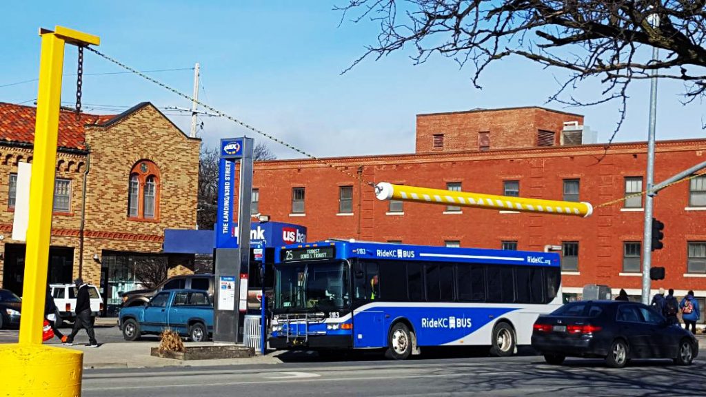
The Landing is located between Troost and The Paseo, along 63rd Street. Due to its proximity to these major streets, its location provides easy accessibility via car and/or bus. Buses stop approximately every 20 minutes and connect with other lines of transportation throughout the city. The site is surrounded by several other businesses, many which are local. Although temperatures were below freezing during this particular day of observation, several pedestrians were observed walking on the surrounding sidewalks and using the crosswalks to cross the wide and busy streets. Because these areas are heavily used, it seems clear that these walkways should be made more safe for pedestrians.
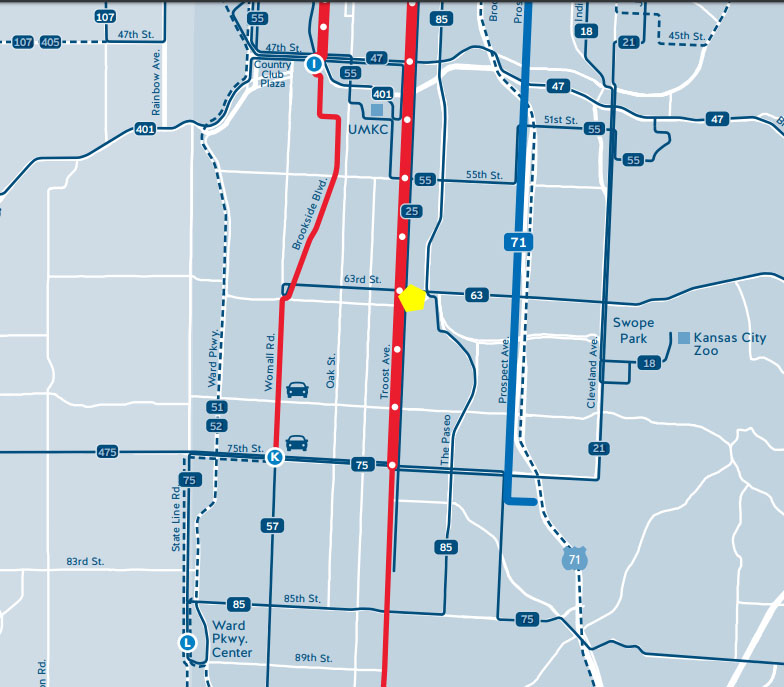
KCATA bus transit map http://ridekc.org/assets/uploads/route-maps/SystemMap.pdf
January, 2019 Shana Shanteau
The space is close to many residential areas and is within excellent proximity to grocery stores. Aldis, Thriftway, and Cosentino’s are all within one mile or less from the site. There are also several schools nearby.
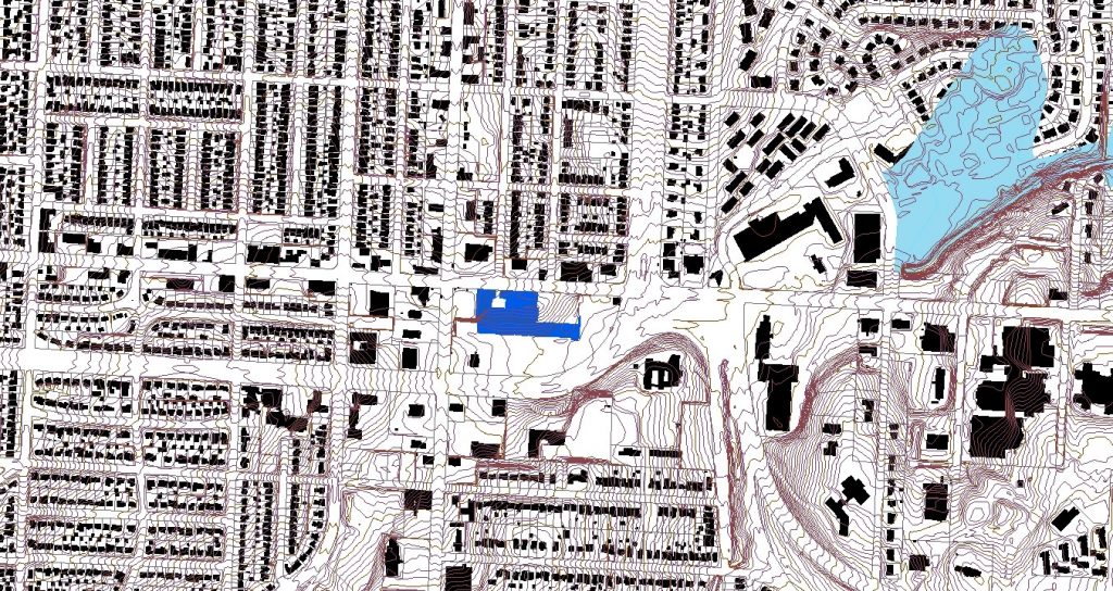
Landscape
The landscape of the area is extremely beautiful and drastic in topography. The site sits lower that its surrounding spaces and the area just to the south is hilly and covered in large majestic trees.
Map showing the drastic topography of the surrounding land
In conclusion, this space has a very energetic atmosphere, great accessibility, rich history, and beautiful landscape. The Landing’s location, which is central to many businesses, schools, and churches, make it a great place to live and work.