When thinking about UMKC campus and its interface connection to the city as it stands, one word I have to describe it is disconnected. Campus is integrated into the heart of KCMO. Minutes from the Plaza, Westport, and so much more, UMKC’s campus has the potential to be involved in the city and provide amenities to those on campus but also in surrounding neighborhoods.
Integrating campus into the community is a great way to get a better connection between the two. I chose Oak st. because the possibilities are endless.
Encouraging Oak St. Corridor to become a pedestrian friendly street opens up opportunities for community/public engagement and creates a good interface connection. Being minutes from KC assets like the Nelson Atkins Museum is a great motivator for a pedestrian friendly street. Those traveling down Oak on foot get a sense of campus community when approaching the redeveloped stairs of Oak St./The entrance of campus.
Promoting Oak as a walkable, pedestrian activated street creates a connection to other parts of the city as well as the Trolley Track Trail additions.
Elements of the public realm are public elements existing within communities. These elements can be things like plazas, courtyards, public streets or parking. Elements of the public realm should embody ideas of circulation and easy access.
Parking is a very important element to the public, especially on university campuses. For this blog, we will be taking a look at University of Missouri – Kansas City’s current parking situation.
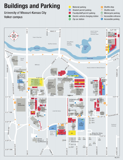
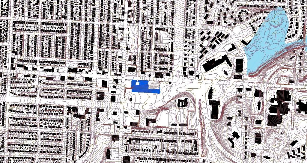
UMKC is a commuter campus, meaning more students live off campus than on campus. Many of these students drive their own personal vehicles which are then needed to be parked on UMKC’s campus or surrounding areas while students are in class. Figure 1.0 shows UMKC’s current parking map displayed on their website.
Figure 1.0 There is a mix between metered parking, student parking (those who have parking permits), and faculty/staff parking. There is also some off campus street parking, but not much in comparison to the amount of assigned parking for UMKC’s campus. Figure 2.0
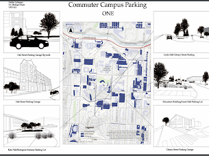
Figure 2.0 above gives a map of campus with all of the parking shown in blue. Some are parking lots, like the Katz Hall lot, and some are parking garages or the public street parking on campus.
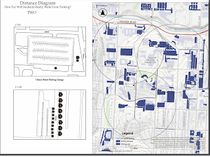
When doing research about how far people will walk from their parking spot to their destination, I wanted to put theories to the test on campus.
I believed that there was enough parking for UMKC Campus students, but that the parking just is not in great areas. I know that when I pay a lot of money for a parking pass, I would really like to be within a five to seven minute walk of my classes. Shown in Figure 3.0 is a map showing the parking locations radius’ in regards to campus and its amenities. The distance is about .2 miles or about a five minute walk.
Figure 3.0 As you can see, campus parking is actually all within a 5-7 minute walk of campus and its amenities. I was surprised to find this information out. I also wanted to show some sketches of a campus parking garage on Cherry St. and the Katz Hall small lot that most of us park in currently when attending classes on campus in the UPD Program.
Overall, I think it is important to note that campus has a lot of parking and it is all relatively close to classes and other places students need to get to on campus. What a more prevalent issue may be is how to make campus feel more walkable so those 5-7 minutes feel like 2-3 and the walk is smoother to class than it currently is. This could be solved through topographic interventions and other related resources.
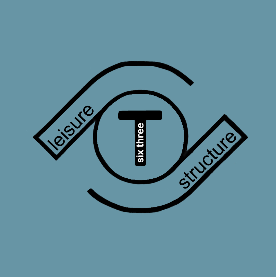
Six-Three T Logo; Created by Adair Bright on Adobe Photoshop
When it comes to developing The Landing Site and its immediate surroundings on 63rd and Troost, I had to reflect on my first impressions of the site back in January. When doing so I found that my thoughts concerning the site were to better incorporate the parks and boulevards aesthetic, include the youth in the area, the views out of the site and in to it, and that the topography allows for interesting design choices that are made with clear intentions.
Looking back on my first impressions and the design I was already beginning to formulate, my impressions were shown in the design choices I began to make. I wanted to line both sides of Meyer with trees and had to make sure to not include any retail directly on the boulevard. When it came to addressing the youth, I got stuck because I did not want to put a playground on the site and call it good. I wanted something for all ages of youth to keep teenagers out of trouble and to stimulate young kid’s minds. In order to achieve this, I am planning on including a ton of outdoor furniture intended to be skateboarded on without putting in a skate park. For the young kids, I am planning a center that includes arts and also an open learning center with kids toys. The last two, the views into and out of the site and the topography, go hand in hand and for that, I have decided to include a balcony at the highest point on the landing site so people can see what is actually happening. I have also decided to relate to the U-Drive for the school across Meyer Boulevard by designing my buildings to mimic the U-Drive and including an open green space.
With all of that being said, I have boiled down my design to be the happy medium between structure and leisure. The leisure comes from the inclusion of youth, the open green space, the retail, and the restaurants. The structure comes from the Parks and boulevards Standards and the structure of the buildings. Therefore, I have concluded that the development will be called Six-Three T and will include the logo pictured above for branding.
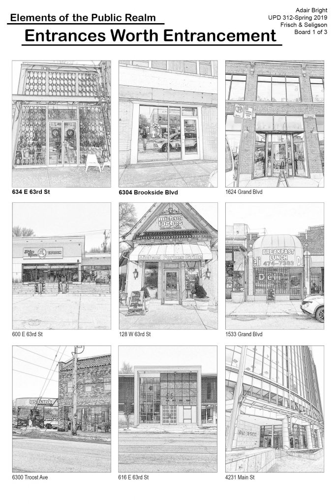
When looking at the public realm, I was assigned entrances. I was confused at first because it could mean entrances to buildings, districts, parking lots, private homes, etc. So, I walked the corridor and looked at what it had to offer. I was looking at private home entrances and then thought about how this is elements of the public realm and I wanted to focus more on entrances that could be used by anyone. I focused in on coffee shops/bakeries, restaurants, and office buildings. I started with 2/3 of the photos being on the corridor and then went all throughout Kansas City to see how the same business types compared.
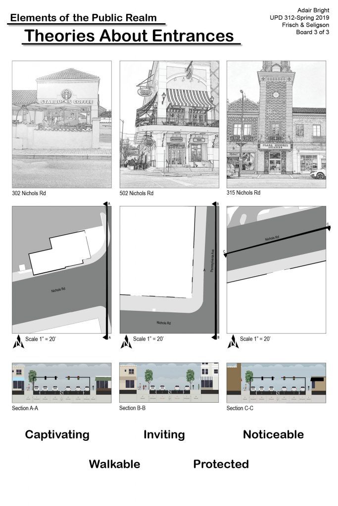
I started to draw theories about entrances so I wanted to go to the Country Club Plaza and see how my theories compared to a part of Kansas City most people consider to be successful. I noticed the Plaza had most of my theories apply and those are what I will explain now.
In all these entrances I noticed things that I thought made a good entrance. I picked put five words – captivating, walkable, inviting, protected, and noticeable. I think an entrance needs to be captivating in order to grab someone’s attention and make them want to see what is inside. That being said, it needs to be walkable, which, to me, means the entrance should be on the sidewalk or close to it. Entrances with big parking lots in front aren’t places you stumble upon but rather a quick errand. It also needs to be inviting because there are places where you feel like you can’t go in because you aren’t from around there or it feels too exclusive. Entrances should also be protected which goes along with the walkability because they need to be protected from cars by having a big green buffer or a row of parking. i noticed along 63rd towards Rockhill I felt very unsafe crossing intersections because the speed limit is so high and there is nothing between me and the cars. However, in Brookside on 63rd I felt safer because of the crosswalks and the street parking to block me. Lastly, entrances need to be noticeable and not blend in with the building. I noticed it more in office buildings where the building will be a few stories high but the door is so small and barely noticeable.
All in all, these are just my theories and what I think is important. the 63rd Street corridor has many successes and some failures just like every other place in Kansas City. This is definitely something I will need to keep in mind when redesigning a part of this corridor.
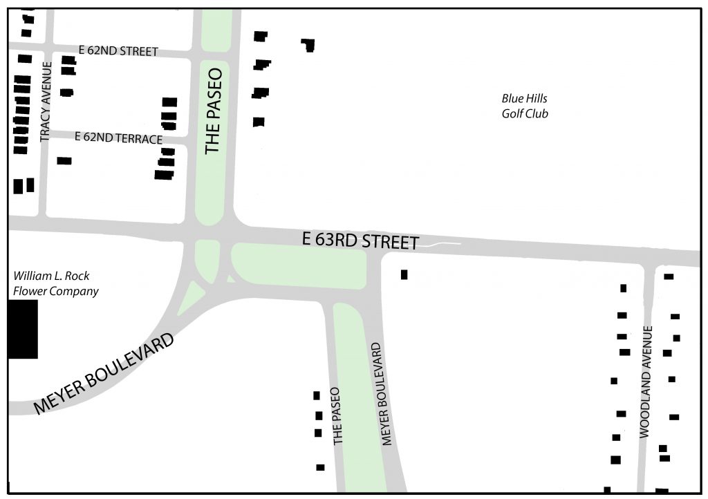
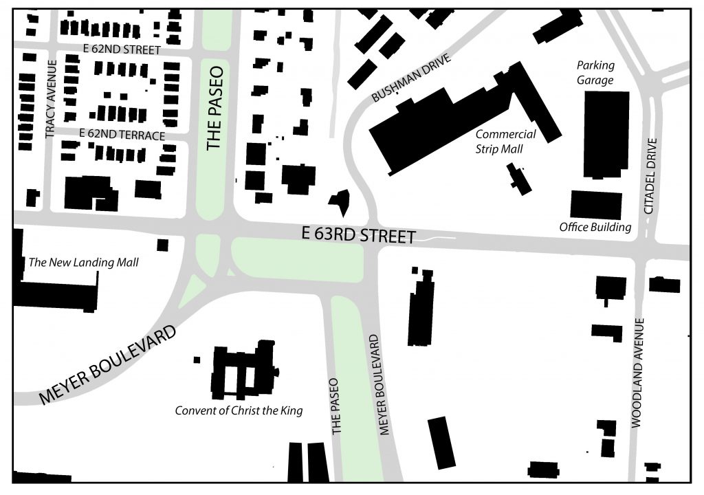
Describing the seemingly complex intersection of 63rd Street, Meyer Boulevard and The Paseo, famed Architect and Urban Designer, Ted Seligson, refers to it as “the knuckle” of Kansas City’s boulevard system. Viewing the intersection from an aerial view, Seligson’s analogy becomes clear. The way Meyer Boulevard merges into The Paseo, then briefly runs parallel with 63rd Street, before finally turning back down into itself, looks like a person’s finger joints. The knuckle, which lies just East of The Landing (which was discussed in my last blog), is a node that various different land uses gather around. Not only is this the case for present day (currently a mix of residential, commercial and institutional uses surround the knuckle) but it has been the case for the past 100 or so years. This post will look at how the area immediately surround the knuckle has developed over time.
1925 Figure Ground Map – 63rd Street between Tracy and Woodland Avenues. Source: Jared Islas, 2019.
The earliest developments in the area were mostly single-family residences. These homes mostly originated along Tracy and Woodland Avenues, with some additional homes appearing on either side of The Paseo. Many of the homes on Tracy and The Paseo will remain intact through to present day, but the same can not be said for those on Woodland.
According to the 1925 Atlas of Kansas City, the present-day Landing site was formerly home to two large greenhouses known as “William L. Rock Flower Company.” These greenhouses would also not last long, as they would be sold to JC Nichols in the mid to late 1940’s who would go on to develop The Landing Mall (Kansas City Star, 1947).
Also, just Northeast of the knuckle, sat the Blue Hills Golf Club. This would remain an important part of the neighborhood up the site was redeveloped for a suburban-esque retail shopping center and neighborhood.
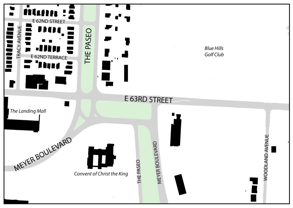
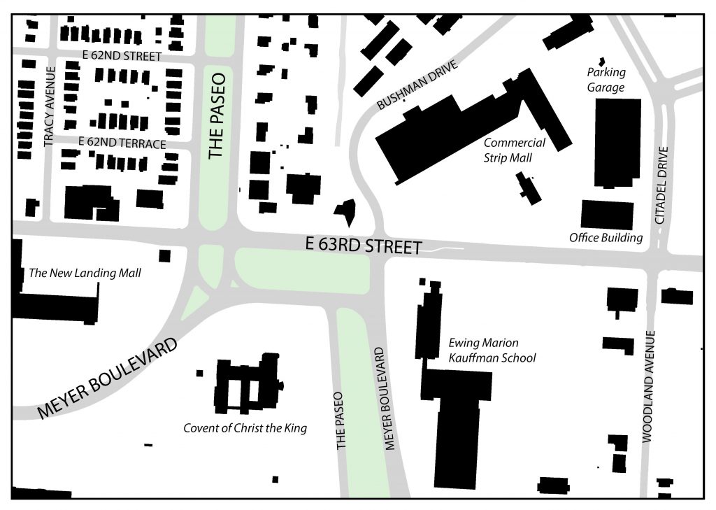
1963 Figure Ground Map – 63rd Street between Tracy and Woodland Avenues. Source: Jared Islas, 2019.
By 1963, more single-family residences had filled up the area Northwest of the knuckle and almost all of the houses that had been fronting Woodland Avenue had disappeared. Also, Convent of Christ the King, and some other institutional/office buildings sprung up South of 63rd Street. And The Landing mall was constructed on the former site of the two large greenhouses.
1991 Figure Ground Map – 63rd Street between Tracy and Woodland Avenues. Source: Jared Islas, 2019.
By the early 1990’s, the Blue Hills Golf Club was gone and replaced by the suburban-esque strip mall, a six-story office building and a three-story parking garage. Commercial pad sites began developing around the knuckle and other intersections along 63rd Street.
2019 Figure Ground Map – 63rd Street between Tracy and Woodland Avenues. Source: Jared Islas, 2019.
As of today, the area around the knuckle has not changed much since the early 90’s. The only major difference is the large additions to building at the Southeast corner of 63rd and Meyer. These buildings ultimately became the campus for the Ewing Marion Kauffman School, which is a public charter school.
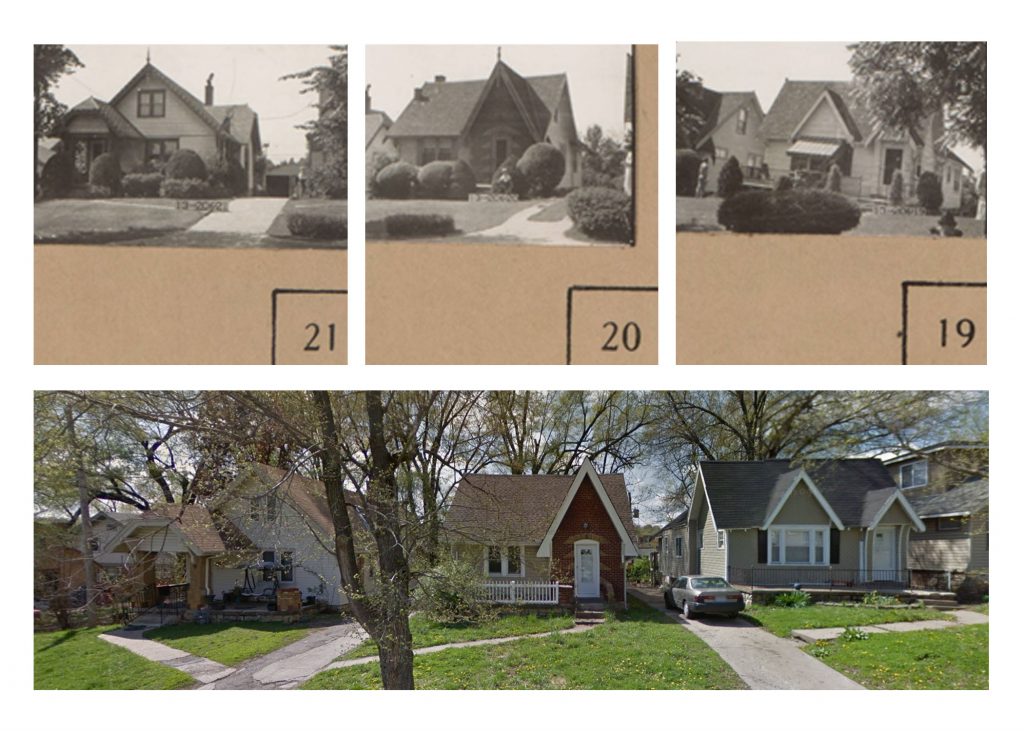
While the structures and their uses surrounding the knuckle have changed in the last 100 years, there are some things that have remained the same. The first being some of the older, now historic, single-family homes on 62nd Terrace. The picture below shows these homes first in 1940, as part of the 1940 Tax Assessment photos, and then again in 2015 through Google Maps Street View.
Comparison of single family homes on 62nd Terrace Source: 1940 Tax Assessor photos and 2015 Google Street View
These structures have remained relatively untouched during the almost 80 year gap that these photos were taken. The only things that have changed are expected renovations in older homes like these – materiality and landscaping.
The next set of photos, comes to the same conclusion. This commercial building, located halfway in between Tracy Avenue and The Paseo on the North side of 63rd Street has also remained relatively unchanged.
Comparison of a commercial building on 63rd Street. Source: 1940 Tax Assessor photos and 2018 Google Street View.
These historic photos show that while there have been some structures that have been around for the better part of the last 80 years, nothing compares to the longevity of the knuckle.
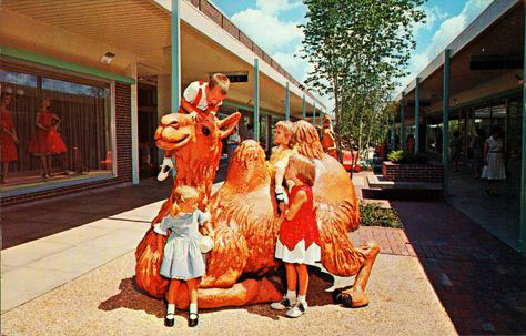
The Landing is a shopping mall that was created by J.C. Nichols and opened to the public in 1960 as an open-air public space with animal-themed play structures for children and trees throughout the central corridor. It still exists today as a covered structure and has some operating places of business inside, although not as high-traffic as it was in its beginning days and without the play structures and greenery.
Photo courtesy of Ryan Khatam http://neat-stuff-blog.blogspot.com/2011/01/landing-mall-1960s.html
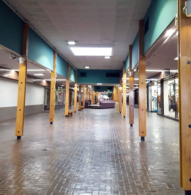
Present day interior of KC Landing Mall, Shana Shanteau
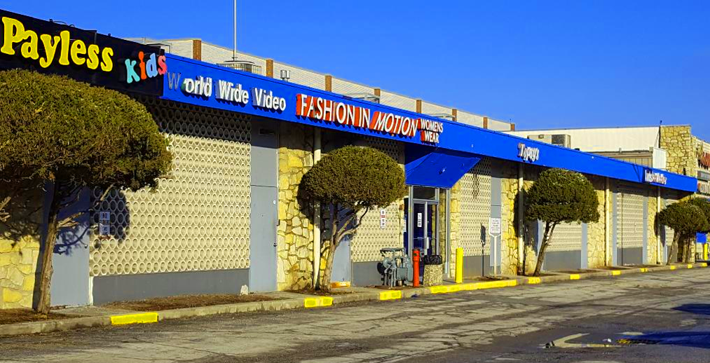
The exterior of the building exhibits materiality of stone, paint, and a circular-patterned concrete façade which seems somewhat inconsistent. The major entrances are somewhat unclear and confusing to approach. There are, however, beautiful murals on the exterior walls that promote a strong sense of local pride. Adjacent is its very large parking lot. Most of the surface area of the lot is unused by cars during a typical day and completely void of trees and other greenery. Once inside the building, the space is very warm and inviting. Large windows display several retail stores full of merchandise and ready for customers. I feel that more clear and welcoming entrances to this fantastic interior space would greatly increase public draw to utilize it.
Exterior of The Landing, January, 2019, Shana Shanteau
Accessibility
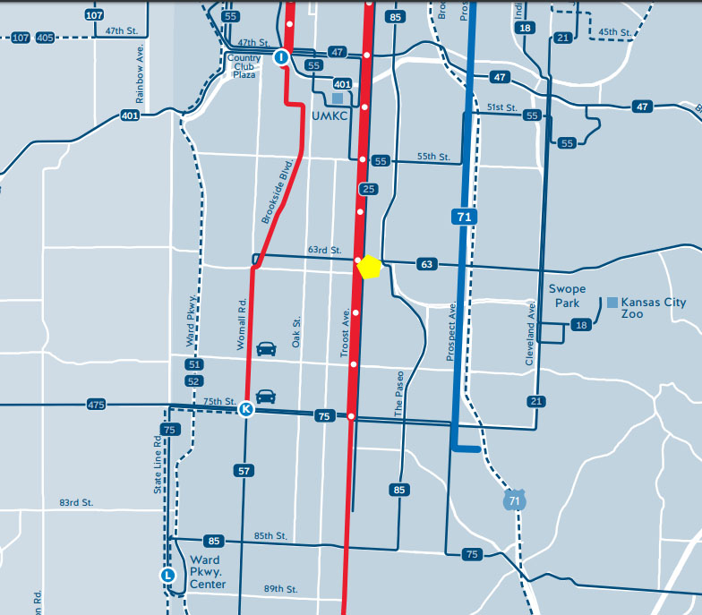
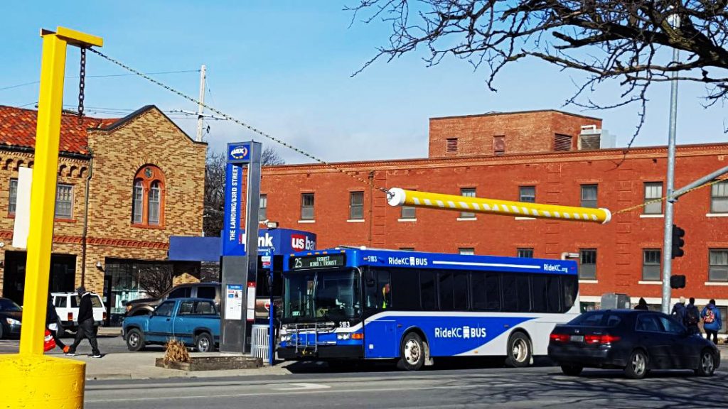
The Landing is located between Troost and The Paseo, along 63rd Street. Due to its proximity to these major streets, its location provides easy accessibility via car and/or bus. Buses stop approximately every 20 minutes and connect with other lines of transportation throughout the city. The site is surrounded by several other businesses, many which are local. Although temperatures were below freezing during this particular day of observation, several pedestrians were observed walking on the surrounding sidewalks and using the crosswalks to cross the wide and busy streets. Because these areas are heavily used, it seems clear that these walkways should be made more safe for pedestrians.
KCATA bus transit map http://ridekc.org/assets/uploads/route-maps/SystemMap.pdf
January, 2019 Shana Shanteau
The space is close to many residential areas and is within excellent proximity to grocery stores. Aldis, Thriftway, and Cosentino’s are all within one mile or less from the site. There are also several schools nearby.
Landscape
The landscape of the area is extremely beautiful and drastic in topography. The site sits lower that its surrounding spaces and the area just to the south is hilly and covered in large majestic trees.
Map showing the drastic topography of the surrounding land
In conclusion, this space has a very energetic atmosphere, great accessibility, rich history, and beautiful landscape. The Landing’s location, which is central to many businesses, schools, and churches, make it a great place to live and work.