Tag Archives: Missouri

Why is now perfect for redevelopment?

Six-Three T Logo; Created by Adair Bright on Adobe Photoshop

When it comes to developing The Landing Site and its immediate surroundings on 63rd and Troost, I had to reflect on my first impressions of the site back in January. When doing so I found that my thoughts concerning the site were to better incorporate the parks and boulevards aesthetic, include the youth in the area, the views out of the site and in to it, and that the topography allows for interesting design choices that are made with clear intentions.

Looking back on my first impressions and the design I was already beginning to formulate, my impressions were shown in the design choices I began to make. I wanted to line both sides of Meyer with trees and had to make sure to not include any retail directly on the boulevard. When it came to addressing the youth, I got stuck because I did not want to put a playground on the site and call it good. I wanted something for all ages of youth to keep teenagers out of trouble and to stimulate young kid’s minds. In order to achieve this, I am planning on including a ton of outdoor furniture intended to be skateboarded on without putting in a skate park. For the young kids, I am planning a center that includes arts and also an open learning center with kids toys. The last two, the views into and out of the site and the topography, go hand in hand and for that, I have decided to include a balcony at the highest point on the landing site so people can see what is actually happening. I have also decided to relate to the U-Drive for the school across Meyer Boulevard by designing my buildings to mimic the U-Drive and including an open green space.

With all of that being said, I have boiled down my design to be the happy medium between structure and leisure. The leisure comes from the inclusion of youth, the open green space, the retail, and the restaurants. The structure comes from the Parks and boulevards Standards and the structure of the buildings. Therefore, I have concluded that the development will be called Six-Three T and will include the logo pictured above for branding.

History of the landing site

The area around The Landing Mall began as a suburban escape from the urban core. The southern expansion of Kansas City can be noted by curvy streets and larger parking lots. The surrounding neighborhoods were built around the park and boulevards system in Kansas City, making it a desirable place to live when it began. As suspected, the area surrounding the Landing was not very populated in the 1920s but in the 19603, around when the Landing was built, the area became pretty dense. Since then it has seen some demolition of buildings and the ground is less packed.

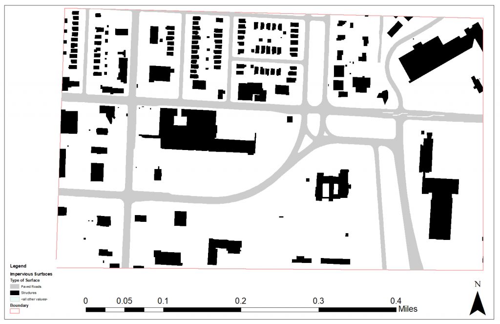
1963 Figure Ground Map Surrounding The Landing (1″=200′). Made by Adair Bright
2018 Figure Ground Map Surrounding The Landing (1″=200′). Made by Adair Bright

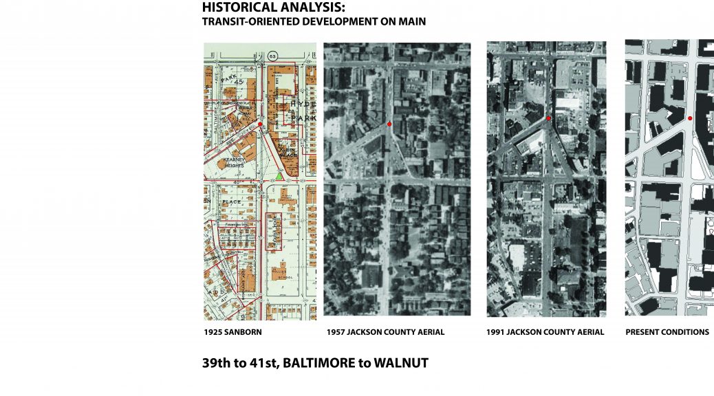
Historical Analysis: Transit-Oriented Development on Main

Historical analysis of sections of the Main Street corridor (39th to 41st, from Walnut to Baltimore)

Four maps, a 1925 Sanborn, 1957 and 1991 Jackson County aerials, and a modern GIS layer of present conditions, give insight into the changing dimensions of the corridor throughout time.  A common scale of each map allows one to readily see  the spatial changes of the built environment.

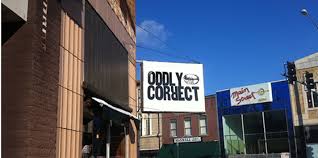
The intersection of Westport Road and Main provides an interesting analytical starting point.  At this node, the built environment stayed largely intact between 1925 and 1951.  The structures immediately on the corner of Westport Road and Main, now housing the Oddly Correct coffee shop, are intact from 1925.

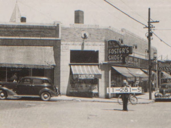
According to the 1940 tax assessment photos, the building housed Foster’s Shoe Store, seen below.

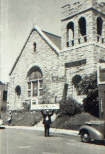
Another significant significant building at this intersection was the Hyde Park Christian Church, seen below in 1940.

.

This structure was constructed in 1905, yet was demolished in the late 1950s.  The church’s activity relocated to 3801 Wyandotte.  A structure of a similar footprint is evident from the 1957 Jackson County aerial.  However, since the building’s destruction, no new structures have been erected in its place.

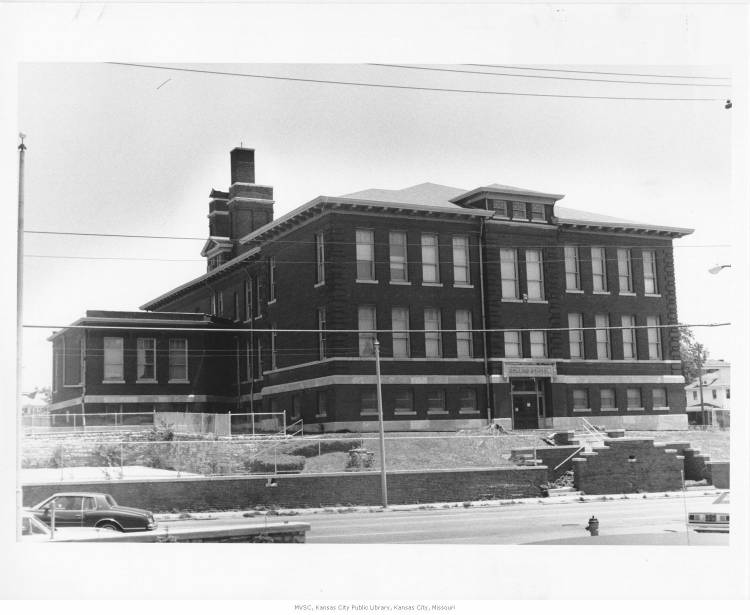
Furthermore, this stretch of the Main Street corridor is noted for other prominent demolitions.  Throughout time, commercial structures that lined Main approaching 39th street have been destroyed to accommodate car-oriented uses (such as the CVS and surface parking lot at the southwest corner of Main and 39th street).  Additionally, in the earlier 20th century, there was significantly more housing directly on or adjacent to Main Street.  According to the 1925 Sanborn, a development known as “Weaver Place” contained 5 3-story apartment buildings.  These appear to have been of the 6-plex brick typology commonly seen throughout Kansas City.  Across the street, 12 2-story apartment structures lined 40th Street Way.  These structures are evident in the 1957 Jackson County aerial, yet were demolished before the 1991 aerial.  Presently, 40th Street Way is a one-way street with relatively little activity.  Commercial uses and surface parking flank the formerly residential district on the north and south sides.  Weaver Place appears to have been destroyed as St. Paul’s Episcopal Church expanded its institutional footprint in ensuing decades.  This expansion included destroying the Rollins School, originally constructed in 1904.

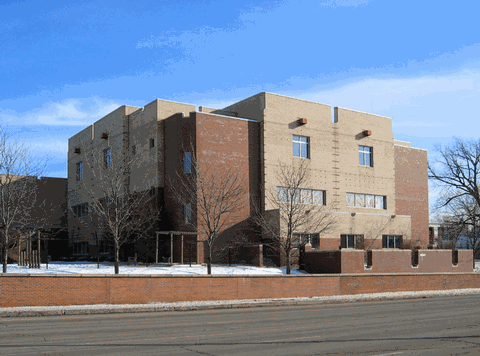
St. Paul’s Episcopal Day School erected a new structure on the site of the former Rollins building.

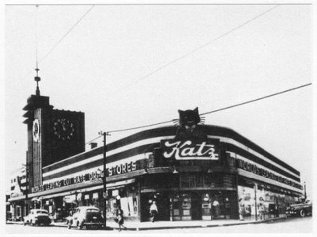
Another culturally significant change along the corridor involves the iconic Katz Drug Store at the corner of Westport Road and Main.  Seen below in 1940, Katz’s personifies an Art Deco charm.

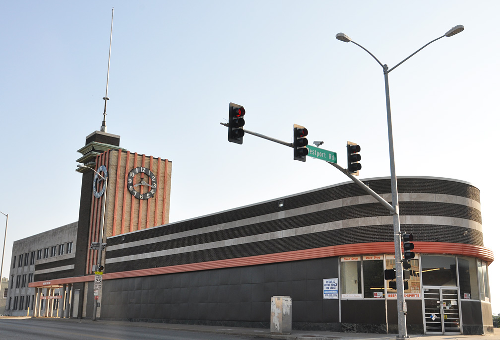
An Osco pharmacy most recently inhabited this structure.  The structure has been largely vacant since 2006, however.  Recently, art pop-ups have given new life to the vacant building.

Undeniably, this stretch of Main has experienced significant change throughout the decades.  The preservation and adaptive reuse of the buildings that survived, however, has contributed to the charms of this Midtown area.

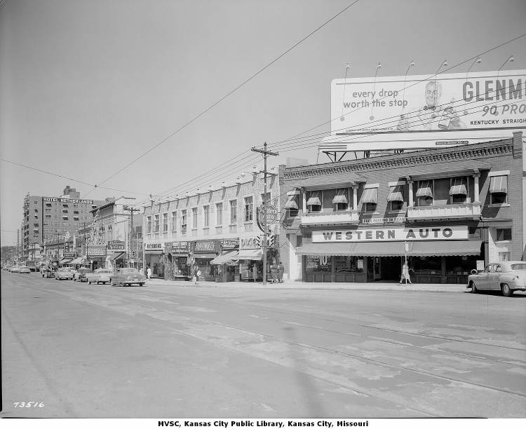
Main Street in 1952, below:

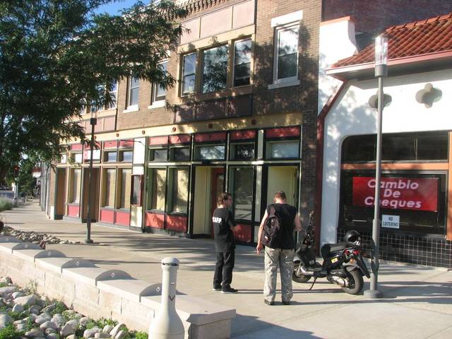
Similar extent more recently:


Signage on Kansas Cities Parks & Boulevards

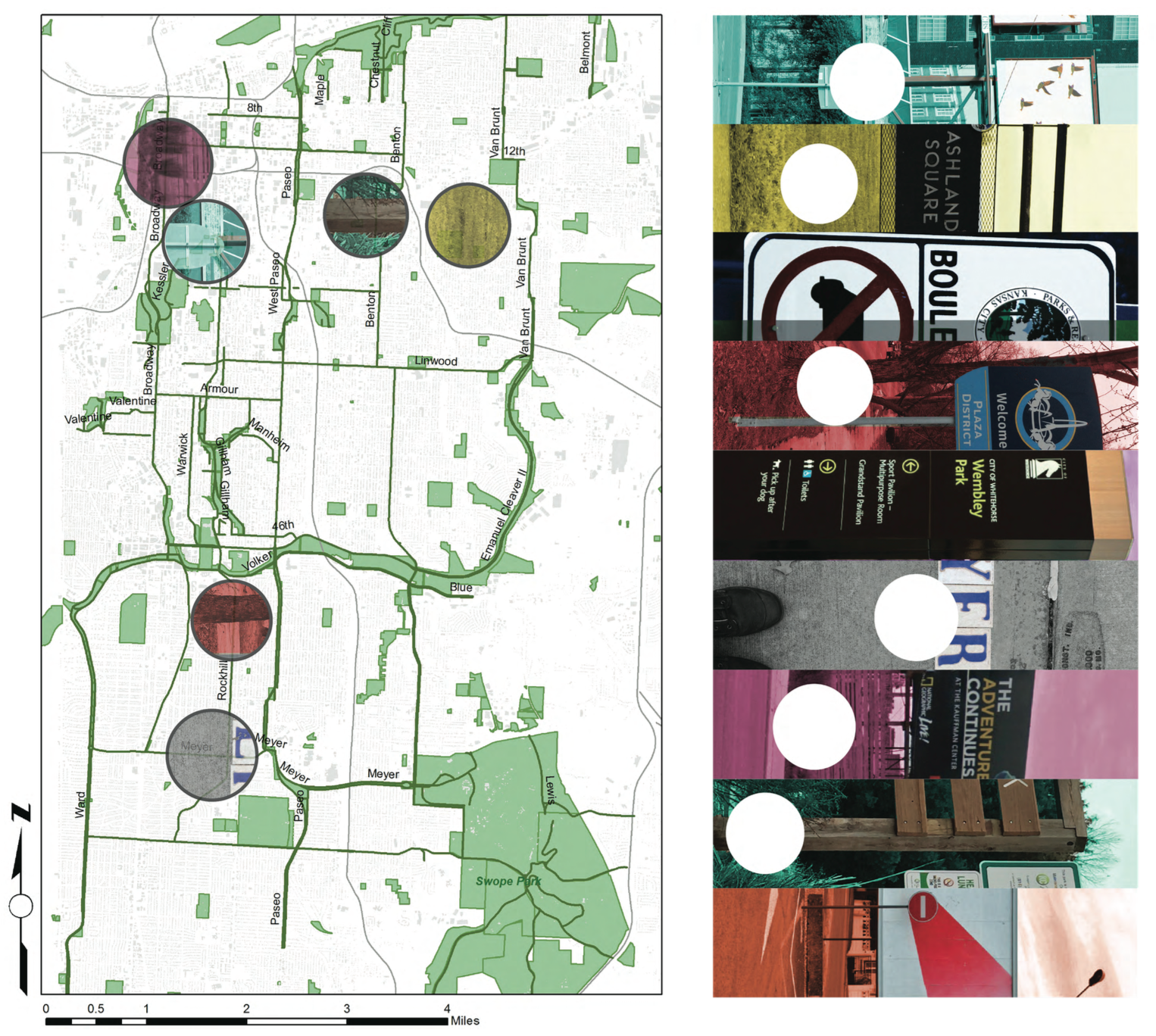
DIAGRAMMATIC MAP OF SIGNAGEScreen Shot 2015-02-17 at 1.53.06 PM

This map shows the relative locations of different kinds of signage that line the parks and boulevards system in Kansas City.


PRECEDENTS OF SIGNAGE ON PARKS & BOULEVARDS

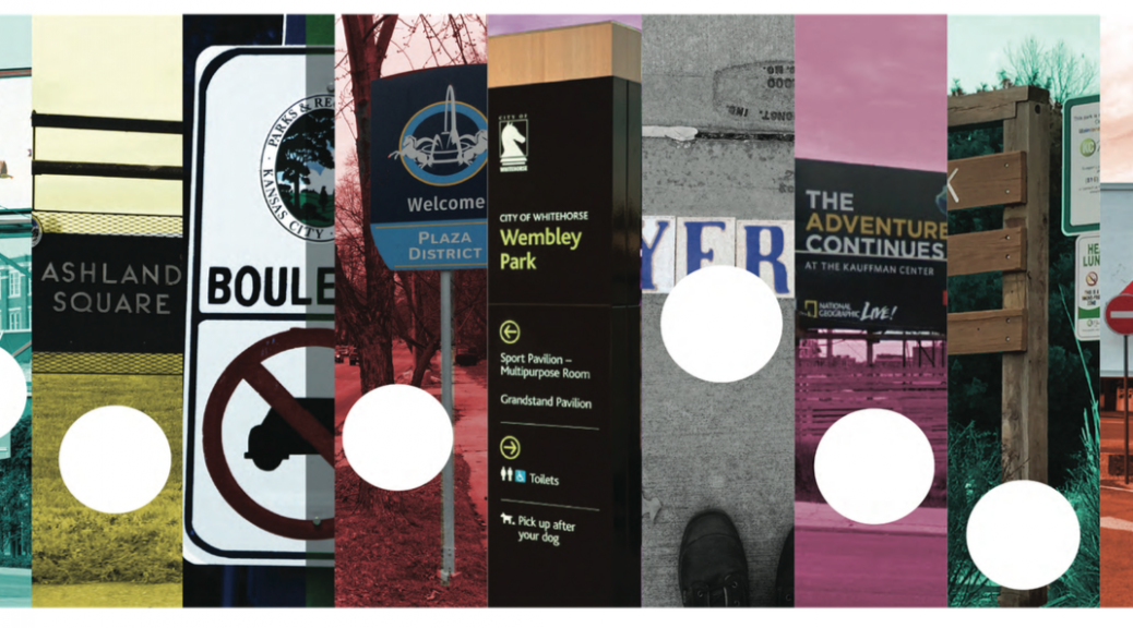
There are a wide array of different kinds of signs in KC. I took as many examples that are representative of the different aspects of this design element.
Screen Shot 2015-02-17 at 1.59.04 PM

Screen Shot 2015-02-17 at 1.59.13 PM

Screen Shot 2015-02-17 at 1.59.33 PM


IMPLEMENTATION

Screen Shot 2015-02-17 at 1.54.52 PM

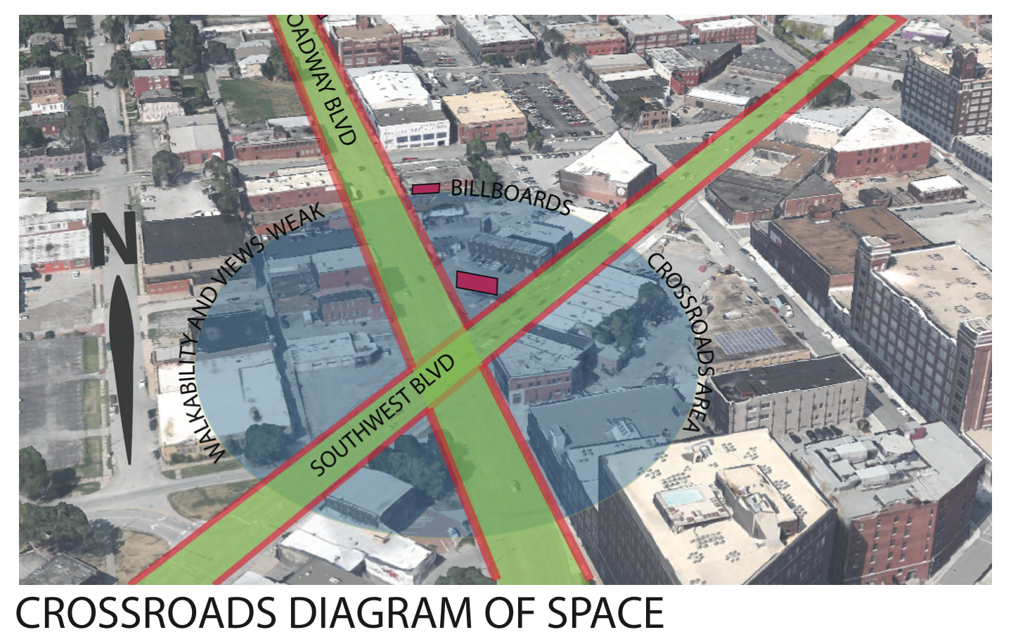
When diagraming the intersection of two famous boulevards in KC I noticed the importance of the crossing. As Broadway and Southwest Boulevard meet, there is an opportunity for a walkable route that could connect people throughout the crossroads.  Currently, the billboards create a very impersonal scale for the pedestrian and also are an inherent negative externality to the passerby.

Screen Shot 2015-02-17 at 1.56.07 PM

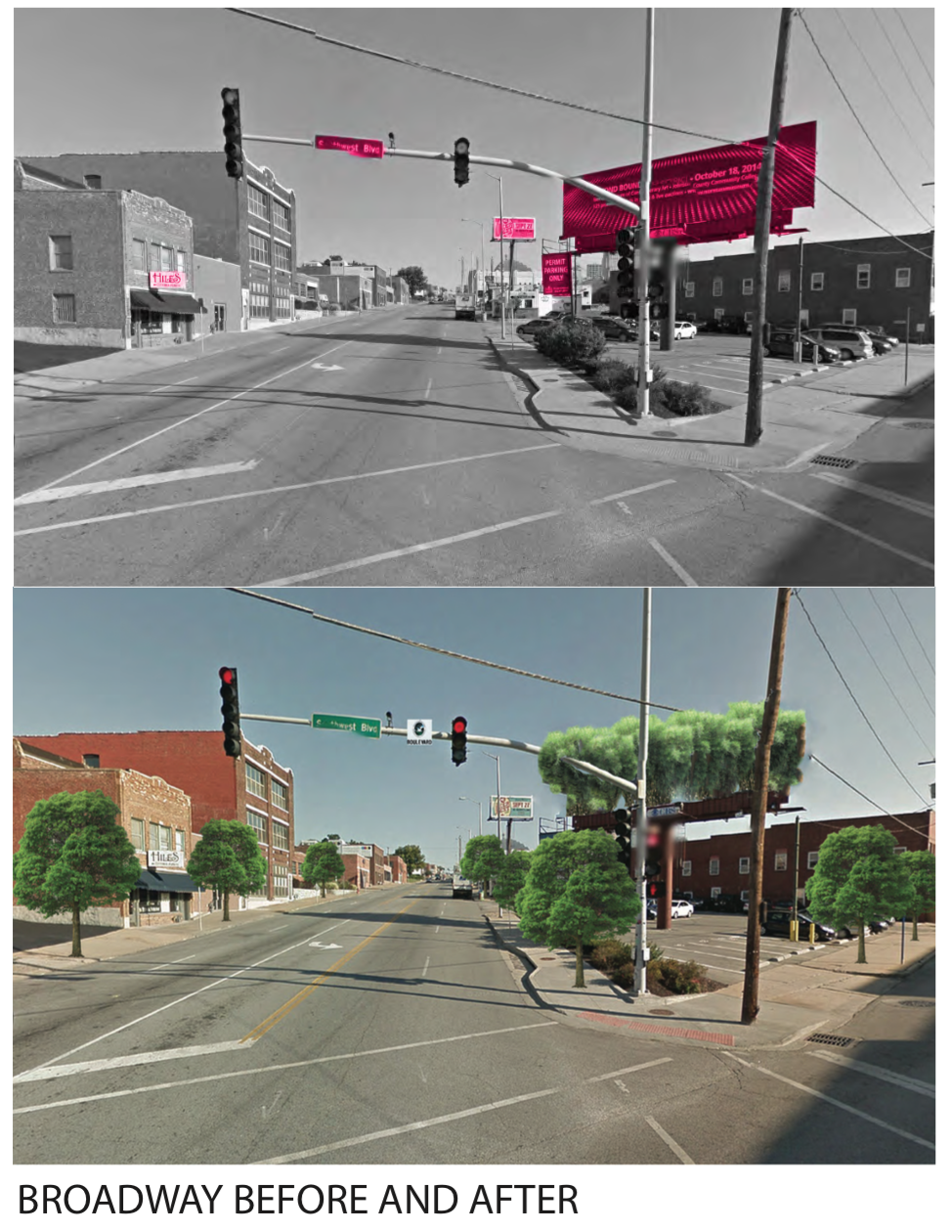
By implementing vegetation along the streets and restoring the streets to exemplify their namesake,  the intersection takes upon an entirely different feeling. I also envisioned having a elevated garden green area where the billboard platform currently resides.

Screen Shot 2015-02-17 at 1.56.26 PM

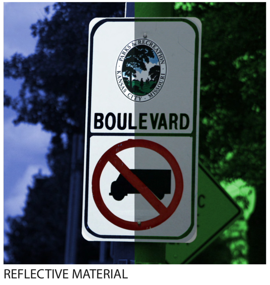
By increasing the brightness and adding a reflective material to new boulevard street signs, the information becomes much more readable.

Screen Shot 2015-02-17 at 1.56.37 PM

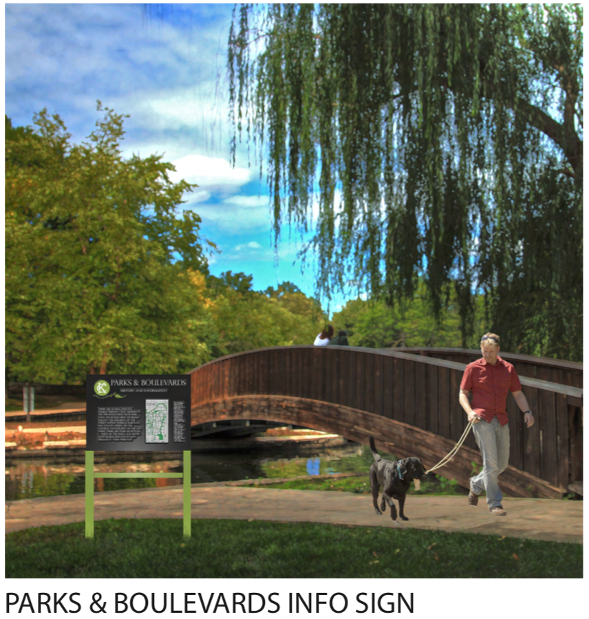
One of the things that I noticed through analysis and study of the Parks system is the lack of a design language. There also is a surprising lack of information and history that is shared in the public physical realm.  I, in turn, envisioned a coherent and consistent park sign that could carry information, context, and history of the parks and boulevard system. People want to know about Kessler, and how the parkways and boulevards follow the topography, interconnecting the park “knuckles” dispersed around the city.