Tag Archives: existing conditions

Existing Conditions + History of Transportation

The beginning of fixed route transit service to the Valentine neighborhood began October 1, 1889 as the Washing and Summit cable car line

• Provided access from West Bottoms to Downtown and the north side of the Valentine neighborhood

• Ran from Union Depot on Ninth to Washington. Washington to about 13th-14th Streets, continuing on13th-14th Summit Street. Summit Street to 29th Street

• Service was reduced to Southwest Boulevard in early 1901

Source: KC History https://kclibrary.org/art-objects/map-greater-kansas-city-suburbs

In 1920 the  Valentine neighborhood was served by the 21 Jackson-Roanoke streetcar route

• Service on the streetcar route from 1910’s

• Destination sign would read Jackson – 24th on Northbound trip

• Destination sign would read Roanoke – 45th or Summit – 39th on Southbound trip

• Streetcar service along Summit Street until widening and repaving of Summit Street in 1951

In 1944 the  Valentine neighborhood was served by the 57 Jackson-Roanoke streetcar route

• Service continued from 21 streetcar route from 1910’s

• Destination sign would read Jackson – 24th on Northbound trip

• Destination sign would read Roanoke – 45th or Summit – 39th on Southbound trip

• Streetcar service along Summit Street until widening and repaving of Summit Street in 1951

Source: KC History https://kchistory.org/image/broadway-boulevard-valentine-road-0

Streetcar service along Broadway Boulevard concluded in 1940’s

• Routes 4 and 48 provided service on Broadway Boulevard from 1920’s to 1940’s

• Route 4 ran from Ward Parkway and 59th Street to Belleview Avenue, winding on Westport Road and Broadway Boulevard to Downtown 

• Route 48 ran from Downtown along Broadway Boulevard to 39th Street, providing service east-west between State Line Road and Broadway

Broadway Boulevard is serviced by a single bus route, traveling from the Plaza to Armour

• Begins at the Plaza Transit Center, travelling up Broadway Boulevard and turning East onto ArmourBoulevard

• Runs on Armour Boulevard / 35th Street to Van Brunt, returning from Van Brunt Loop

• Connects St Luke’s Hospital to the Kansas City VA Medical Center along a dense residential corridor

• Route 35 has 435 daily riders in January 2026

Main MAX service was rerouted to Broadway Boulevard for nearly ten years 

• Provided 20-minute headways either direction from Waldo to River Market and Columbus Park

• Travelled along Grand Boulevard through Downtown, on Pershing Road, turning onto Penn Valley Drive / Broadway Boulevard

• Ran from 5AM to 12AM from Monday – Saturday

• Reduced service on Sundays

The Main Street Extension of the KC Streetcar replaced Main Max service 

• Operates at 10-12 minute frequencies

• Runs from 5 AM to 12 AM Monday-Thursday

• Runs from 5 AM to 1 AM Friday and Saturday

• Runs from 6AM to 12AM Sunday

• Connects River Market to South Plaza, UMKC

• Encourages Transit Oriented Development (TOD) on the Main Street Corridor

• 7,873 daily riders in January 2026

RideKC Route 31 provides East-West connectivity on the 31st Street Corridor at 15 minute frequencies

• 15 minute frequencies make it the most frequent bus route in the state of Missouri

• Not the most frequent bus corridor (Prospect Avenue)

• Runs from 5 AM to 12 AM Monday-Saturday

• Runs from 5 AM to 10 PM on Sunday

• Connects southern Independence to the core of Kansas City

• 1,931 daily riders in January 2026

Route 39 provides East-West transit on the 39th Street Corridor

• Operates at 30 minute frequencies

• Runs from 5 AM to 12 AM Monday-Saturday

• Runs from 5 AM to 10 PM on Sunday

• Connects KU Medical Center and Volker / Roanoke Neighborhoods to the East Side

• Deviation to VA Medical Center

• 584 daily riders in January 2026

Where access is provided, pedestrian and sidewalk infrastructure is well designed

• Southwest Trafficway has few points to cross the roadway

• Certain streets have unsafe crossings

• Road diets to Main Street and Broadway Boulevard have improved walking conditions along the respective corridors

• New tree plantings in the neighborhood will provide shade and clean air

• Short, small blocks improve walkability

architectural character of the 63rd street corridor

The major architectural character of the 63rd Street Corridor, between Oak and Prospect, has two prominent styles and an interesting sub-style.

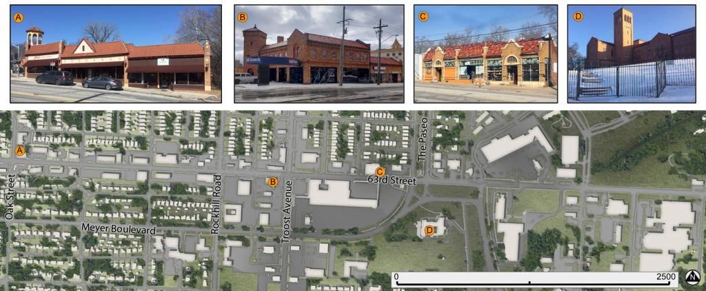
The first major style is Spanish Revival. Notable for its mixture of red and buff brick, tiled roofs, towers, and terracotta decoration; this style dates to the 1920’s. While there are relatively few buildings in this style along the corridor, their baroque decoration, interesting color palate, and prominent locations make them stand out among more contemporary structures.

Small Commercial strip in a Spanish Revival style at 63rd and Oak. Note the tower, tiled roof and terracotta accents.
This example is prominently located at the busy corner of 63rd and Troost.
A 3-unit commercial structure on 63rd, between Tracy and The Paseo.
The Convent of Christ the King dates to a later period than many other of the nearby examples (1940) but maintains the hallmarks of the style. It’s tower is visible from many points in the area.
The relative locations of the Spanish Revival buildings

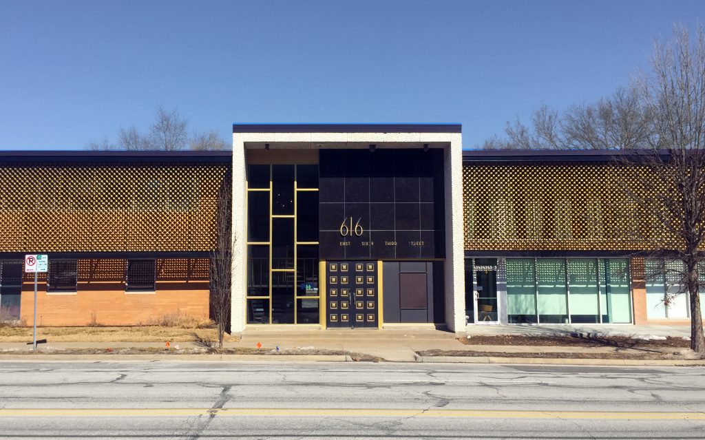
The second major style, and one that dominates the western portion of 63rd Street, is Modernism. Identified by the style’s clean lines, concrete, steel, and glass construction, and lack of ornamentation; these structures can be found in many forms along the corridor. A subsection of these structures feature concrete or metal screens which partially shield the structures from view.

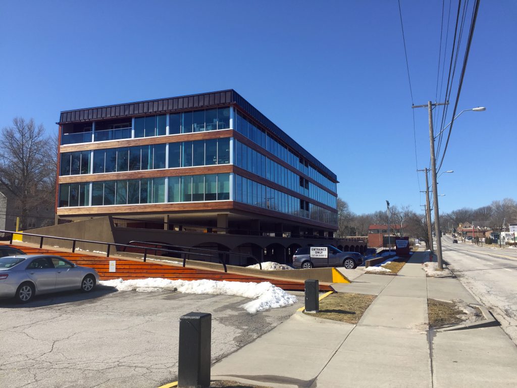
Many of these modernist structures have integrated, structural parking adjacent to their usable space; evidence of their later period of development, well into the motor age.

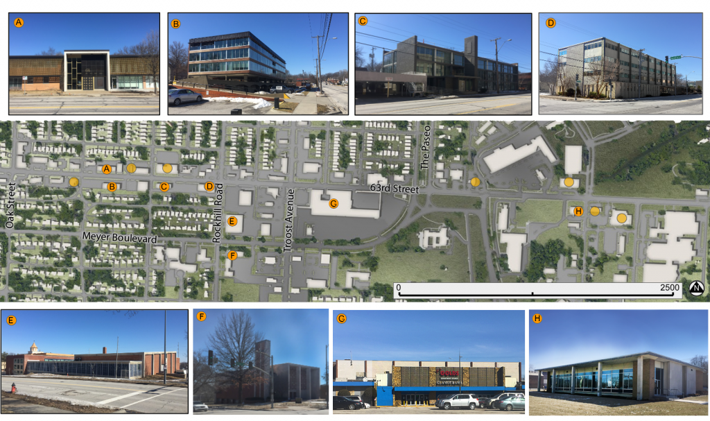
A low-rise office building with a patterned screen shielding its second floor. Found near Cherry on 63rd Street.
A modernist mid-rise office building is vaulted over its parking garage; which is partially below street-level. Found at Cherry & 63rd.
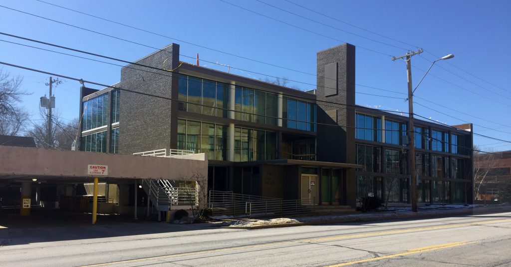
This structure and the one below are separated by their shared parking structure; seen to the left of this photo.
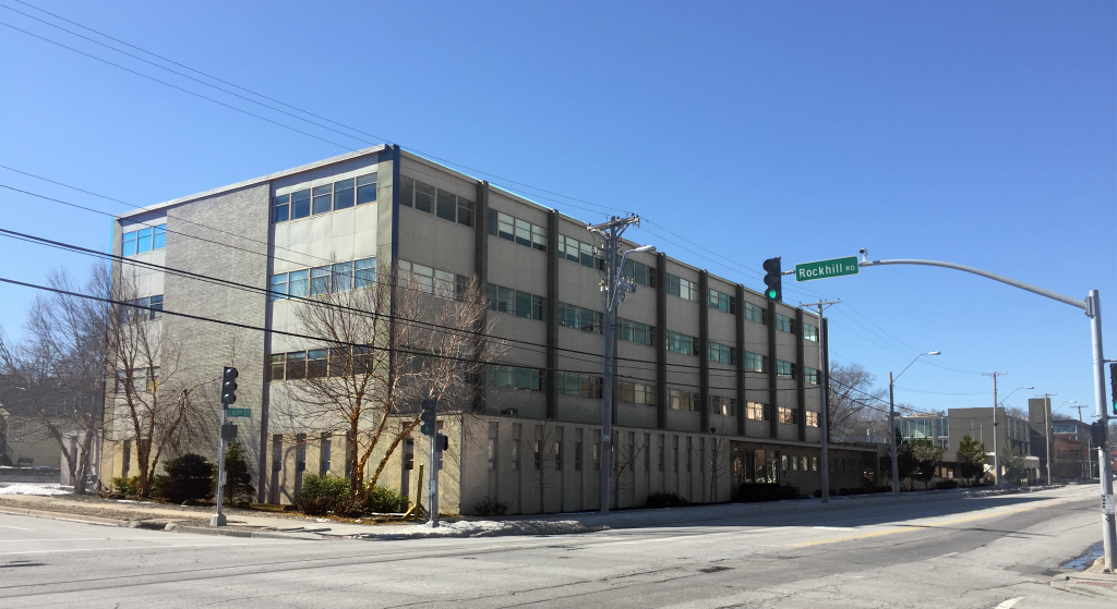
This example is less dramatic than its neighbors but sits at the prominent corner of Rockhill Road and 63rd. It shares its parking structure with the building in the photo above.
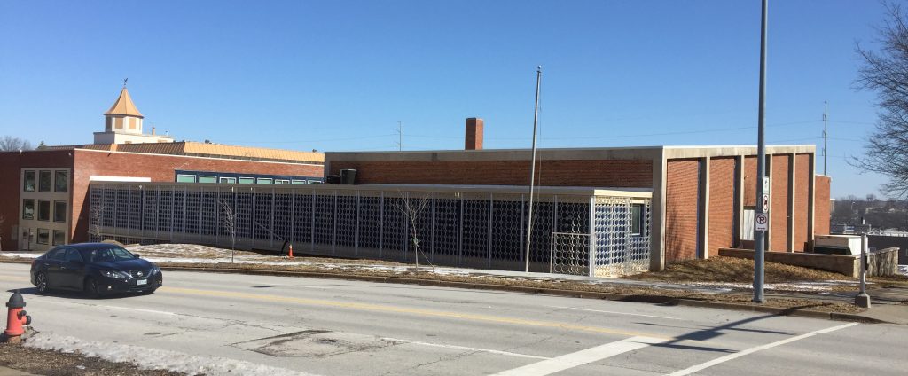
This former school building features a patterned metal screen along the lower portion of its facade on Rockhill Road. The visible structural concrete is another hallmark of modernist design. Found at Meyer Boulevard and Rockhill Road.
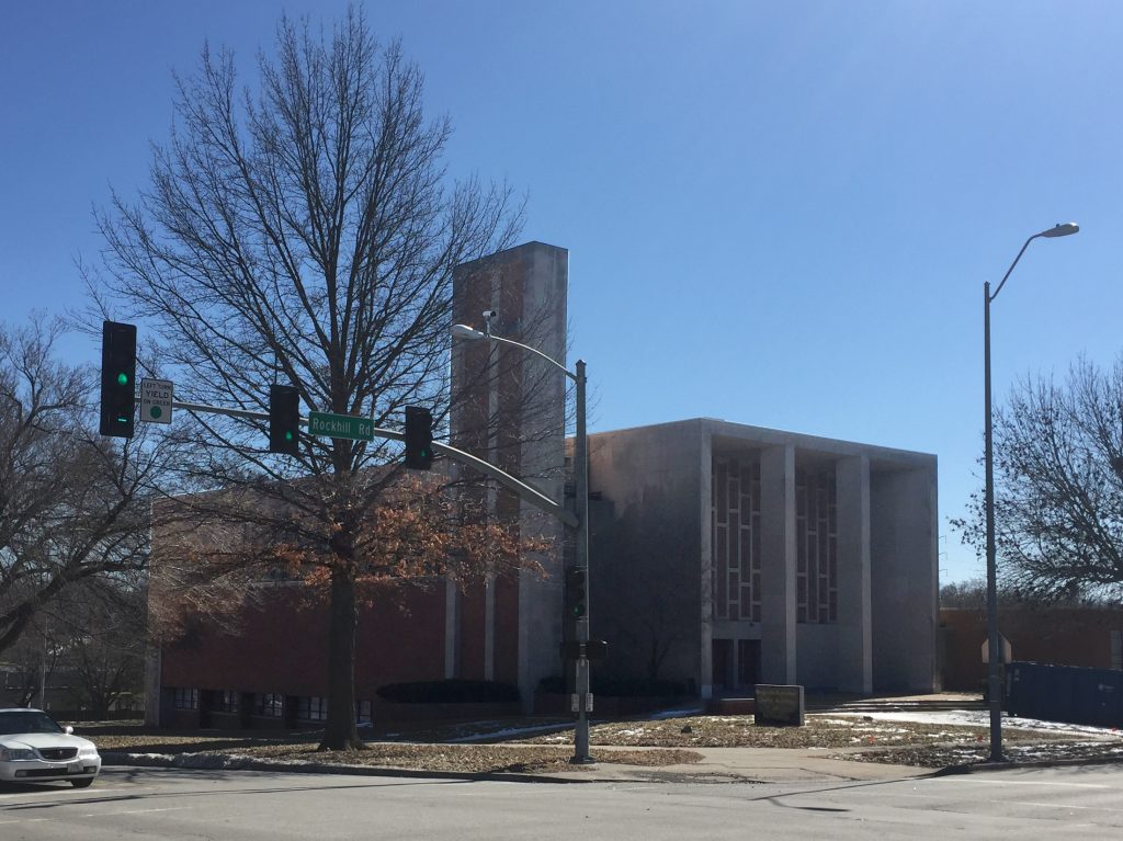
This former church, just south of the building above, also features prominent structural concrete in its main facade and tower.
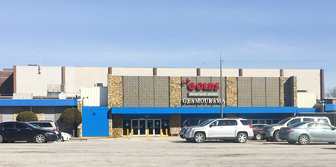
The main entrance of The Landing shopping center still bears marks of modernist design, despite a number of retrofits throughout the years. Visible structural elements and a patterned concrete screen are evidence of its stylistic roots.
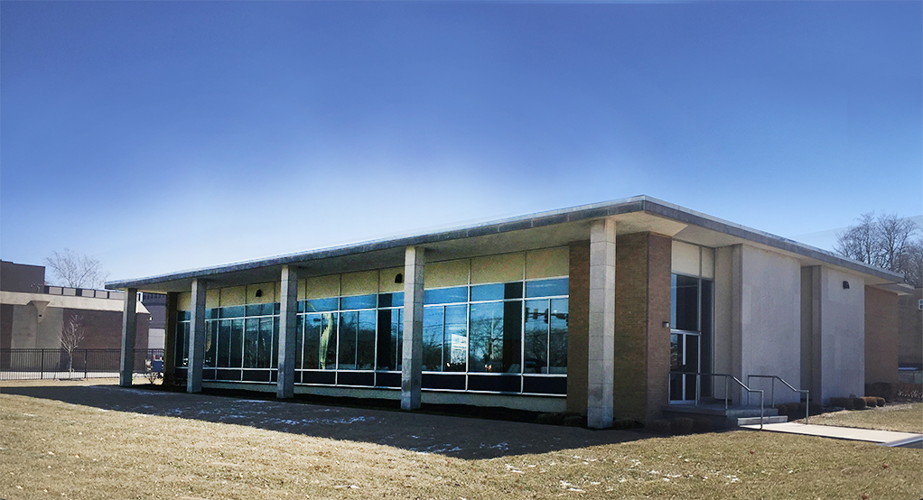
This is another example of modernist design in a small structure. This one features a broad rectangular facade of glass shaded by a simple concrete eave and pillars.
Relative locations of the featured modernist buildings along with the sites of others in that style.

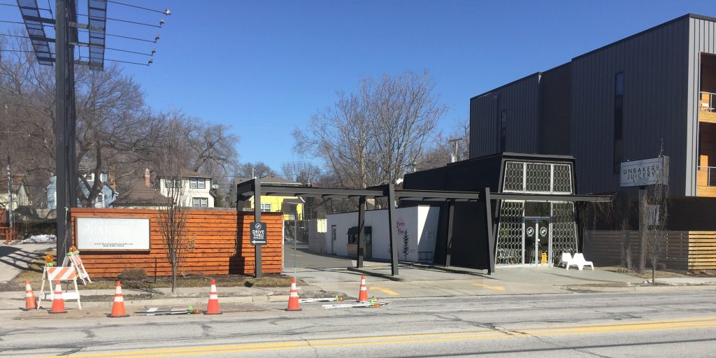
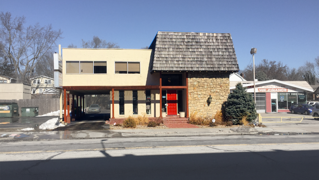
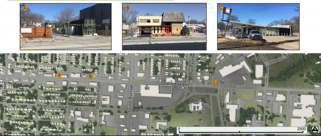
A fun subsection of modernism make a few appearances along the corridor in the form of highly stylized small structures with prominent automobile accommodations. These quirky structures bring a lot of mid-century character to the corridor and some have been re-purposed for contemporary uses.

A small, truncated A-Frame structure with matching automobile passage. The glass front of this building also features a patterned screen of concrete circles.
Simple modernist boxes are stacked off-center, leaving an open carport below a portion of the second floor. Just west of Rockhill Road on 63rd.
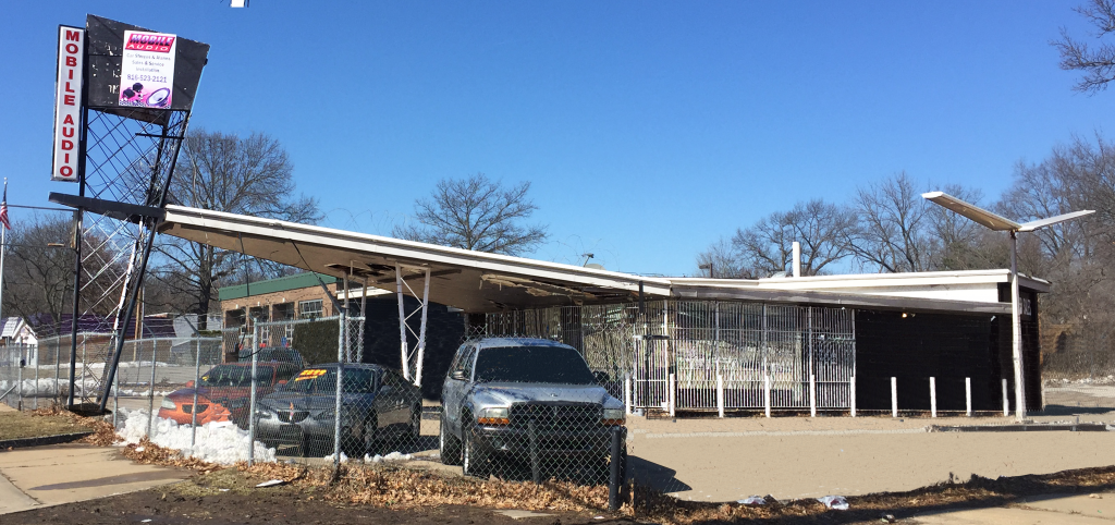
This former gas station has space-age angles in its awning and sign post. Located at Bushman Drive and 63rd Street.
Locations of the sub-style auto-centric modernist structures.

While there are a number of other architectural styles represented in the corridor, the dominating character is defined by these examples. Any new development in the area should look to complement these existing structures.

All photos and maps by Tom Meyer