When thinking about UMKC campus and its interface connection to the city as it stands, one word I have to describe it is disconnected. Campus is integrated into the heart of KCMO. Minutes from the Plaza, Westport, and so much more, UMKC’s campus has the potential to be involved in the city and provide amenities to those on campus but also in surrounding neighborhoods.
Integrating campus into the community is a great way to get a better connection between the two. I chose Oak st. because the possibilities are endless.
Encouraging Oak St. Corridor to become a pedestrian friendly street opens up opportunities for community/public engagement and creates a good interface connection. Being minutes from KC assets like the Nelson Atkins Museum is a great motivator for a pedestrian friendly street. Those traveling down Oak on foot get a sense of campus community when approaching the redeveloped stairs of Oak St./The entrance of campus.
Promoting Oak as a walkable, pedestrian activated street creates a connection to other parts of the city as well as the Trolley Track Trail additions.
Elements of the public realm are public elements existing within communities. These elements can be things like plazas, courtyards, public streets or parking. Elements of the public realm should embody ideas of circulation and easy access.
Parking is a very important element to the public, especially on university campuses. For this blog, we will be taking a look at University of Missouri – Kansas City’s current parking situation.
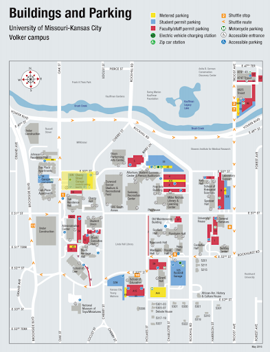
UMKC is a commuter campus, meaning more students live off campus than on campus. Many of these students drive their own personal vehicles which are then needed to be parked on UMKC’s campus or surrounding areas while students are in class. Figure 1.0 shows UMKC’s current parking map displayed on their website.
Figure 1.0 There is a mix between metered parking, student parking (those who have parking permits), and faculty/staff parking. There is also some off campus street parking, but not much in comparison to the amount of assigned parking for UMKC’s campus. Figure 2.0
Figure 2.0 above gives a map of campus with all of the parking shown in blue. Some are parking lots, like the Katz Hall lot, and some are parking garages or the public street parking on campus.
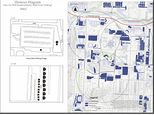
When doing research about how far people will walk from their parking spot to their destination, I wanted to put theories to the test on campus.
I believed that there was enough parking for UMKC Campus students, but that the parking just is not in great areas. I know that when I pay a lot of money for a parking pass, I would really like to be within a five to seven minute walk of my classes. Shown in Figure 3.0 is a map showing the parking locations radius’ in regards to campus and its amenities. The distance is about .2 miles or about a five minute walk.
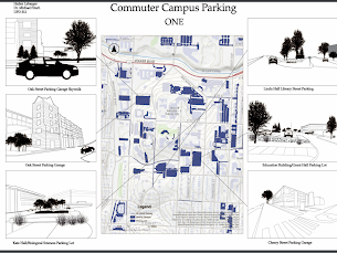
Figure 3.0 As you can see, campus parking is actually all within a 5-7 minute walk of campus and its amenities. I was surprised to find this information out. I also wanted to show some sketches of a campus parking garage on Cherry St. and the Katz Hall small lot that most of us park in currently when attending classes on campus in the UPD Program.
Overall, I think it is important to note that campus has a lot of parking and it is all relatively close to classes and other places students need to get to on campus. What a more prevalent issue may be is how to make campus feel more walkable so those 5-7 minutes feel like 2-3 and the walk is smoother to class than it currently is. This could be solved through topographic interventions and other related resources.
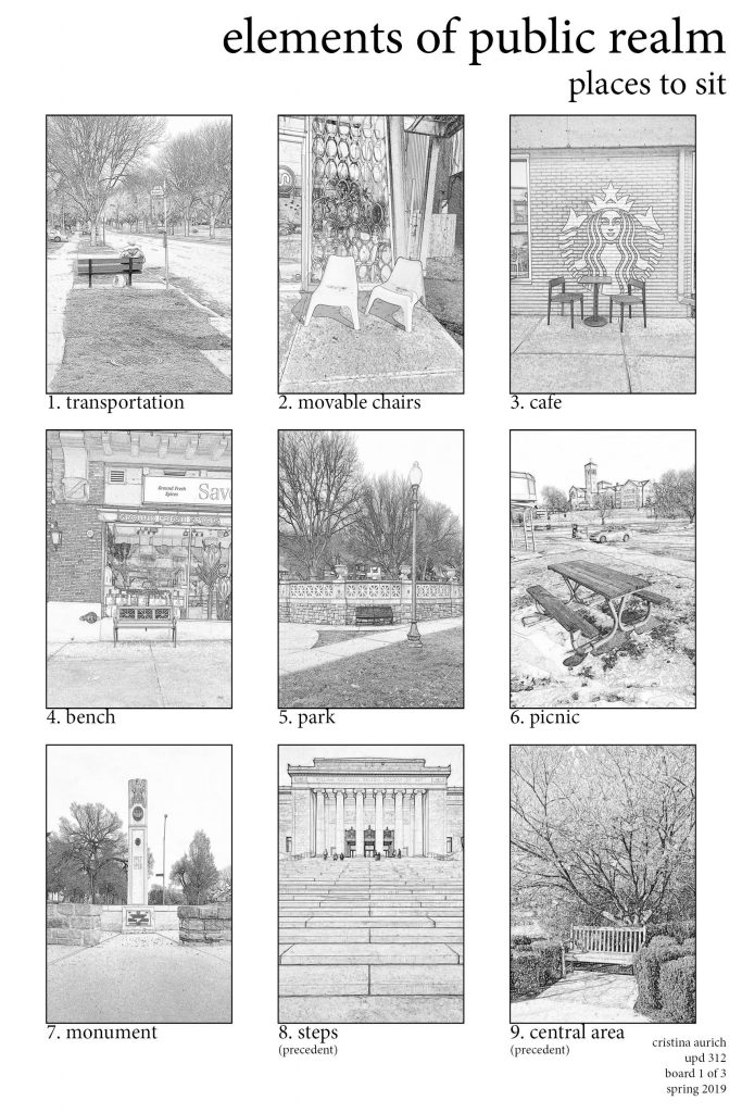
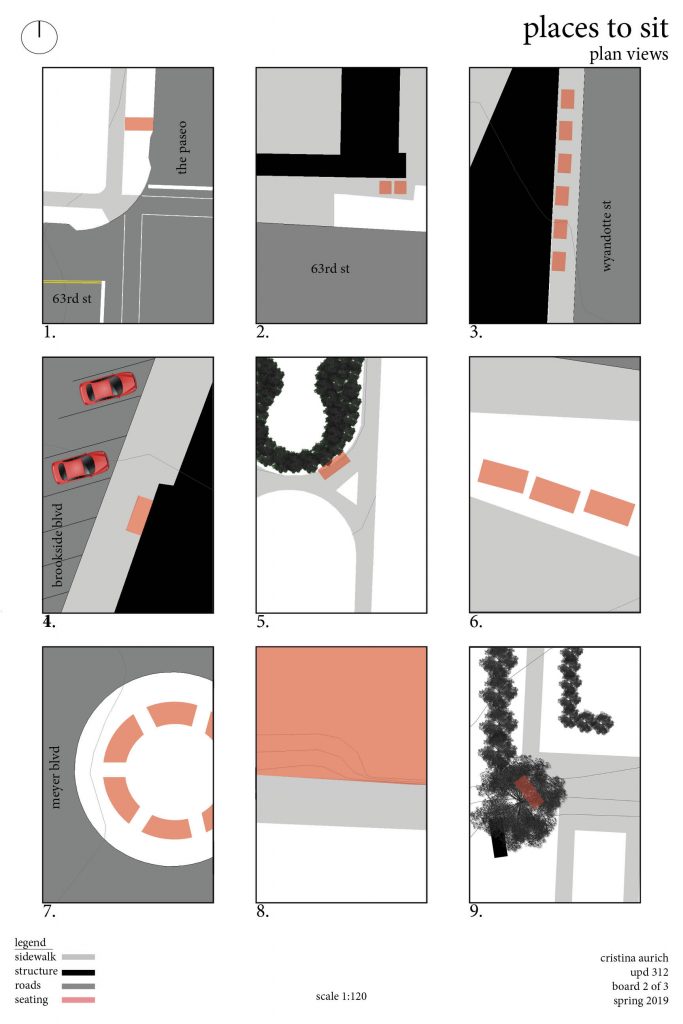
Walking the 63rd street corridor, there were less places to sit than I anticipated. However, the uses and types of seating did vary greatly. When thinking about where to sit I automatically think of a black iron park bench, while many are found on the 63rd street corridor, that was not the only seating I came across. The main purpose of seating, I found along the corridor, was for bus transportation. Bus stops fill street corners and are classically accompanied by seating of some type. Few bus stops have awnings, for weather protection, while others consist of a bare bench with no shelter from the environment. Picture 1, in Figure 1, shows the typical bus stop seating, found on the corridor. Movable chairs and café style seating is my personal favorite type of seating because I have endless options of where to move my chair, but this type of seating is not commonly found along the corridor. More frequent café style seating was found in the west area of our study area, in Brookside, but not on the east side of Troost Avenue.
The seating options I came across on the east side of Troost Ave were more exposed and out of scale compared to the surrounding atmosphere. Pictures 6 and 7, on figure 1, were found on the east side of Troost Avenue and directly faced vehicular traffic. Sitting in both areas made me feel vulnerable to the automobile, however, both seating options gave me a spectacular view. Picture 6 offers a pleasing view of the Convent of Christ the King and picture 7 allows me a sight of a historical monument, in one direction, and a view down the lush Meyer Boulevard, in the other direction.
Figure 1. Places to Sit Along 63rd Street Corridor created by Cristina Aurich 03/2019
Overall, after looking at the location of seating, with assessment to sidewalks, structures, and paved roads, scale plays a key role to where it is desirable to sit. Figure 2 shows the studied seating at plan view. Diagrams 3, 4, and 9 made me feel safe, and almost cozy, because of the proximity of structures, a row of parking, and coverage of vegetation. While diagram 8 allows the sitter to be more visible, there are endless options of where and how one can sit, and the view are infinite.
Figure 2. Diagrams in Plan View Corresponding to Images in Board 1 created by Cristina Aurich 03/2016
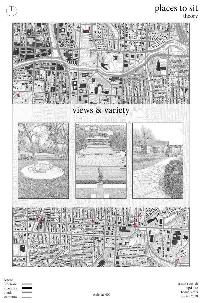
Of all the places to sit in Kansas City, Figure 3 shows my ideal places to sit. The steps of the Nelson Atkins Museum and Jacob L. Loose Park offer all the variety and views I want from public seating. Places to sit is a major element of the public realm and needs to be at the top of the list when redeveloping an area. Creating useful and enjoyable seating seems like and easy task, just throw a bench on the sidewalk every couple of blocks, when in reality, the planning behind seating really makes a difference in whether or not it serves its deliberate purpose.
Figure 3. Context Map Corresponding to Boards 1 & 2 and Views From Pictures 8 & 9 created by Cristina Aurich 03/2019
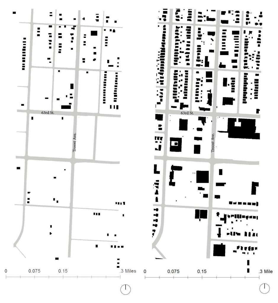
With time comes change. Looking at census data from 1990 to the most recent American Community Survey (ACS) from 2013-2017 changes in population are evident. I looked at the 6 census tracts surrounding the Landing Mall, tracts 80-83, 86, & 87. Slight transformations have occurred within the 6 tracts over the last 30 years. The Landing Mall is located in census tract 87 and has maintained its low population density over the years. Forest Hill Calvary Cemetery and Research Medical Hospital each takes up a quarter of the land on tract 87 which explain why this tract is continuously shown in the lightest blue in figures 1-4. The most dramatic changes are seen between figure 1 and figure 4. Tracts 80 and 86 went from a deep teal to 2 shades lighter indicating lost in population density.
Figure 1. Population Density (per sauare mile) 1990 for census tracts 80-83, 86, & 87 created by Cristina Aurich 02/2019
Figure 2. Population Density (per square mile) 2000 for census tracts 80-83, 86, & 87 created by Cristina Aurich 02/2019
Figure 3. Population Density (per square mile) 2010 for census tracts 80-83, 86, & 87 created by Cristina Aurich 02/2019 2010
Figure 4. Population Density (per square mile) 2013-2017 for census tracts 80-83, 86, & 87 created by Cristina Aurich 02/2019
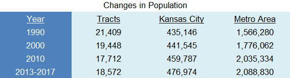
Table 1. Changes in Population comparison between census tracts (80-34, 86, & 87), Kansas City, and the Metropolitan area created by Cristina Aurich 02/2019
Table 1 displays the comparison in population in the 6 tracts of study, Kansas City, and the Metropolitan area. Kansas City and the Metropolitan area have been in parallel with each other and continue to grow in population. Whereas the 6 tracts of study have been steadily decreasing until recently. From 2010 to 2013-2017 Kansas City has seen almost triple the population growth, in less time, than it saw from 1990-2000. Though people have left the area of 63rd Street and Troost Avenue in the past, they are beginning to return. This is a good sign for redevelopment of the Landing Mall and future development of the surroundings.
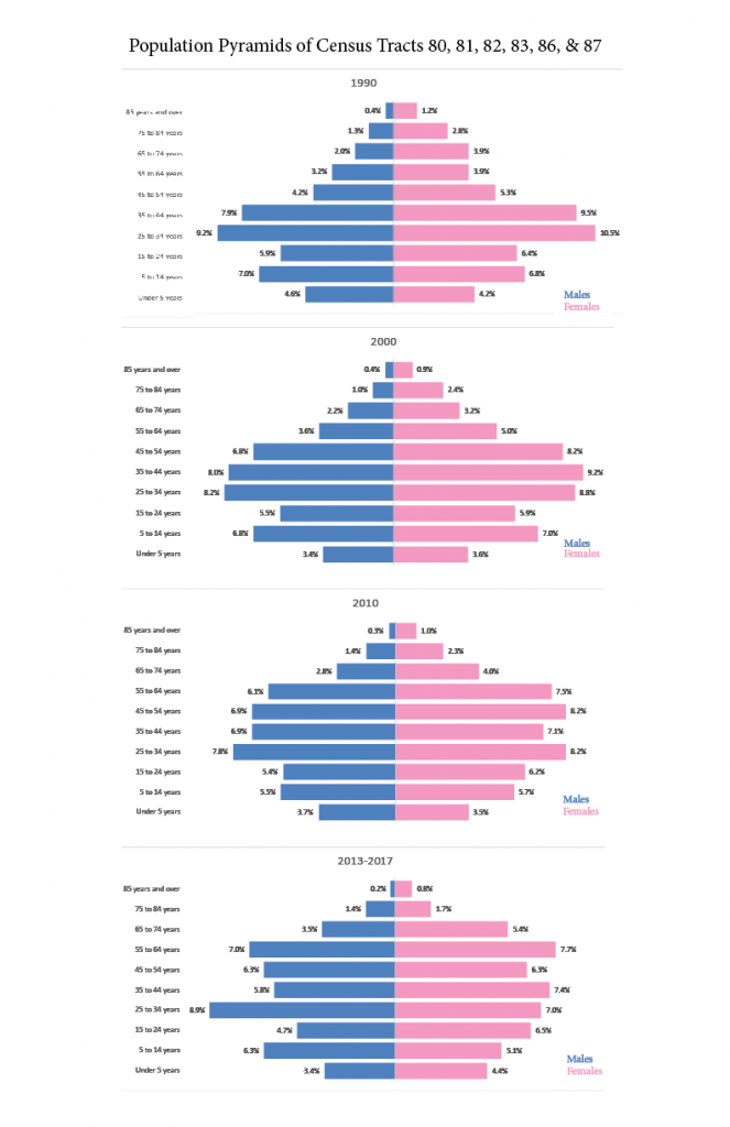
Figure 5. Population Pyramids for census tracts 80-83, 86, & 87 created by Cristina Aurich 02/2019
Figure 5 displays the age groups of the population living in the 6 study tracts. Looking at the pyramids, the highest number of population continues to lie within the age group of 25-34. However, looking at the population pyramids from 1990 and 2000, the population continued to grow to the next class causing the pyramid to swell towards the top. The newest population pyramids from 2010 and 2013-2017 show the population spread more evenly throughout the classes. The population of those living in the class of 65+ years has been growing since 2000, which is also a trend seen through the Metropolitan area.
Simply knowing the statistics of population and age in surrounding neighborhoods can lead to better planning. This is a tool that seems to be forgotten too often when planning with the people in mind.
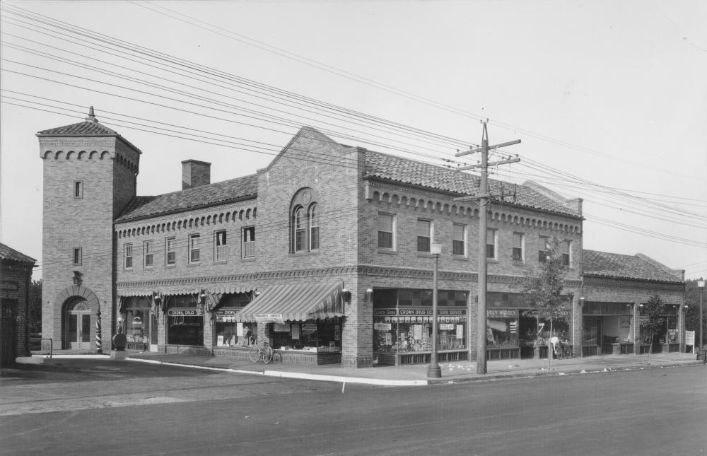
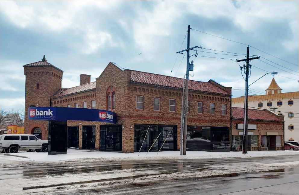
Only less than 100 years ago the area between 62nd street – 66th street and Rockhill Road – Troost Avenue was just beginning its development. A new shopping center on the southwest corner of 63rd st and Troost Ave. was built in the late 20s as neighborhoods began to move away from the city’s core. This shopping center offered a drugstore, barber shop, and restaurants, but has since been replaced with a US Bank and empty units. It is great to see this building is still standing strong and features its original structure, but it does not feel as lively as it looked in the late 20s. Figure 1 shows the 63rd and Troost Shopping Center in 1927 compared to today in 2019 (Figure 2).
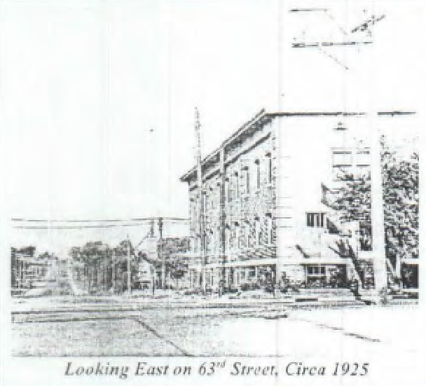
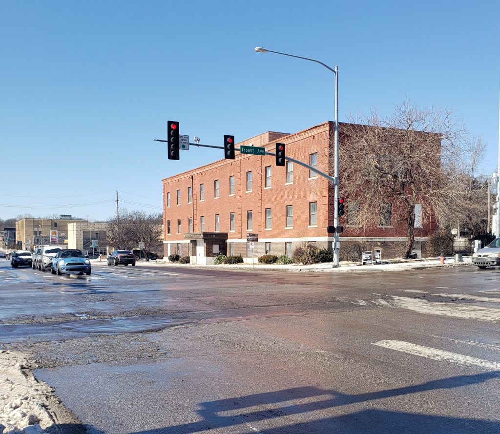
Another building that has stuck around is the Highland Telephone Exchange Building, now called the Blue Hills Building. Located on the northwest corner of 63rd st and Troost Ave. and was placed on the National Register of Historical Places in 2005. Telephone exchange buildings were build in the “heart of the area they would serve” and were necessary for connecting calls during this period. Once an important structure now sits vacant with boarded up doors and broken glass window.
Since 1925, this area has greatly advanced. Blocks that were almost completely empty have been replaced with homes and retail shops. Largest changes in the area can be seen between the 1920s and the 1960s. Residential neighborhoods continue to stay north of this area and commercial structures remain more south. Looking at figure grounds from 1990 and 2019 there is little modifications. Few structures have disappeared leaving behind open land. This open land is opportunity for development and growth.
Figure 5. Figure ground maps of 1925 & 1963 created by Cristina Aurich 02/2019 Figure 6. Figure ground maps of 1990 & 2019 created by Cristina Aurich 02/2019
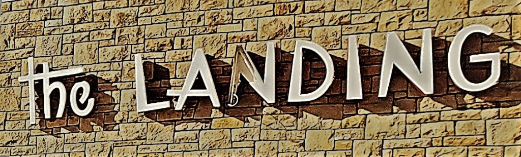
The Landing is unique in its configuration. You catch glimpses of historic features of the shared motif that flows through all of J.C Nichols shopping centers. The Landing is in a perfect location to create a gathering space and congregation area as the parks and boulevards system , as well as many other transit options funnel into this area. As the heavy use of the area begins to show with the structure, the area is in line with future development and seems to be anxiously awaiting some helpful ideas to be put into action.
Photo 7- The Landing – Courtesy : Logan Sours – January 29th 2019 10:20 am
Public Realm
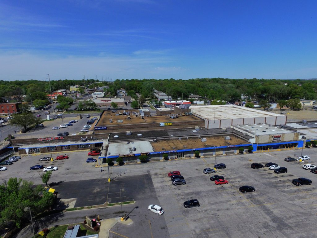
The initial public space that is noticed is the parking lot. As one of the earlier shopping centers in Kansas City, the automobile shaped the landscape and large areas for parking were necessary but over time more shopping centers diluted the concentration of automobiles in the area. The large open space loses a human scale in it’s vast size. The next notable public space that brings the human perspective back into focus is the interior hall of the galleria. With the storefronts facing one another across the hall it brings people into a collective space.
Where are the People?
Although our project has begun in winter there does not seem to be much human activity outdoors , and I find it will most likely be the same in the summer. The public will most likely be gathering indoors. Aside from the mall, there are several other places that people gather, such as Hogan Preparatory Academy sits just to the south of The Landing and a little further to the east is a large convent. Along with many other fast food restaurants and convenience businesses, there people frequently in the area.
Vantage Points
The topography of the area puts the site in a gully with a rise to the north and to the the south. This seems like it funnels people into the area. The hills have caused the use of retaining walls and that gives certain places such as in front of the Rent-A-Center parking lot looking south or the use of parking on top of the shops at the east end of the structure which look across to the parkway and the small wooded space on the Hogan Prep lawn.
Photo 1. View atop East lot Courtesy: Logan Sours-January 25th 2019 3:24 pm
Pleasant Scenes
Views to the north from The Landing peering up Tracy and Forrest avenue have a charm to them with the large trees creating an arboreal archway over the streets that come to an end at the landing. The trees are what give this urban space a more inviting feeling and there are none on the Landing site, they line Meyer Boulevard and crest the hills around Hogan Prep and line the gully that the Landing rests in.
Photo 2. View North on Tracy Ave. Courtesy: Logan Sours- January 25th 2019 3:23 pm
Urban Disturbances
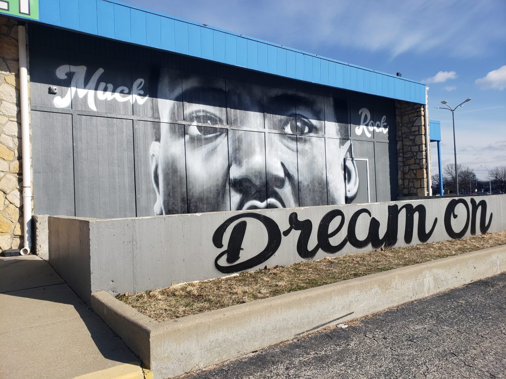
Several garbage cans line the back of the pad site , Wendy’s and seemed to be lingering in the parking lot of the Landing. On the same note the outdoor ramp to the west of the complex is fenced off and locked up. This does not feel very inviting and being along Troost, has many eyes on it. On a more positive note the graffiti on the site was more of street art, where there is a mural of Dr. Martin Luther King .jr facing Meyer Boulevard and another mural type panting to the east, supporting local sports teams.
Photo 4. MLK Dream Courtesy: Logan Sours- January 29th 2019 10:36 AM
Photo 5. KC Knows Landing Courtesy: Logan Sours January 29th 2019 10:20 AM
Bus Stops
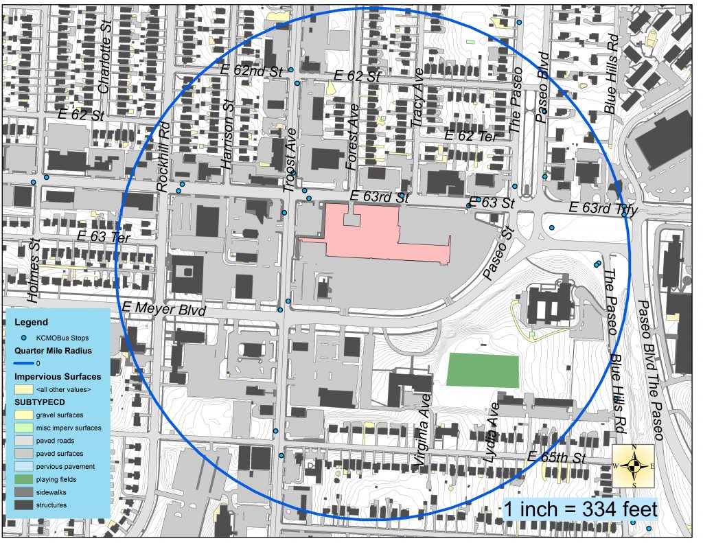
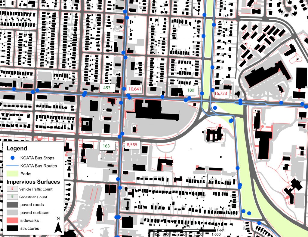
Figure 1. Bus Stops Within a Quarter Mile radius of the Landing – Map Created by Logan Sours
Within a quarter mile radius of the Landing there are 20 bus stops and are frequently used throughout the day. This seems to be a nucleus for transportation with so many stops in such a confined area. Several bus stops have provided benches at smaller nodes while three in the area have covered shelters on the 63rd and Troost pass.
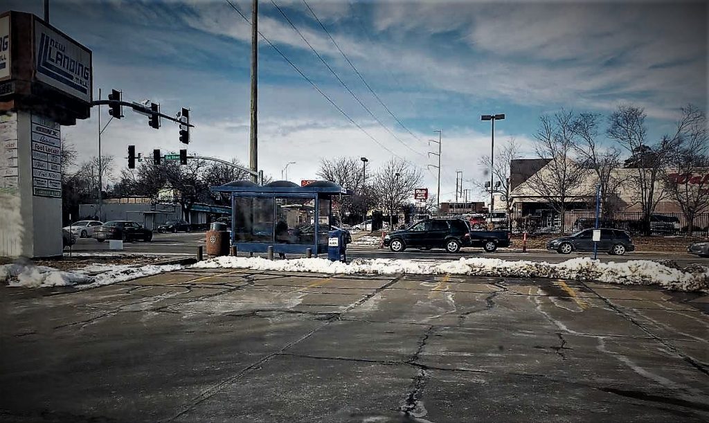
Photo 3. Bus Stop at Troost and 63rd Courtesy: Logan Sours – January 25th 2019 3:18 PM
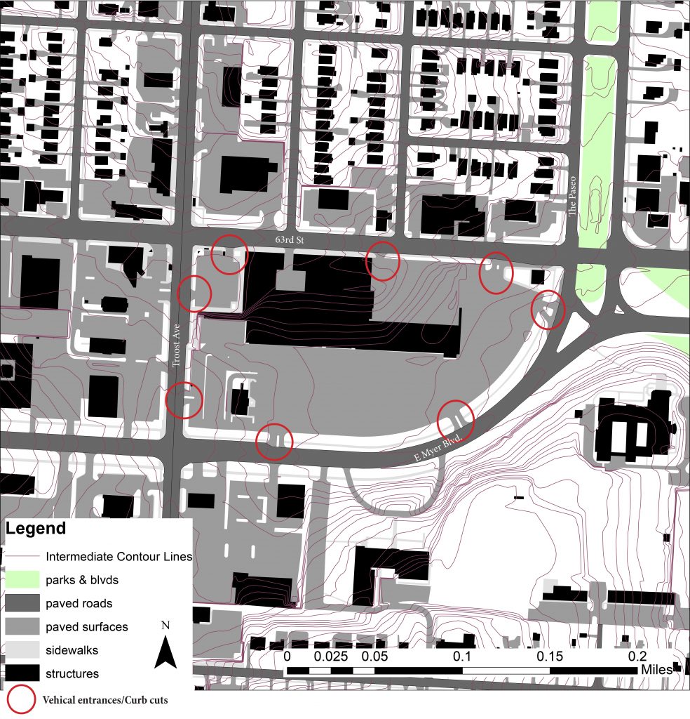
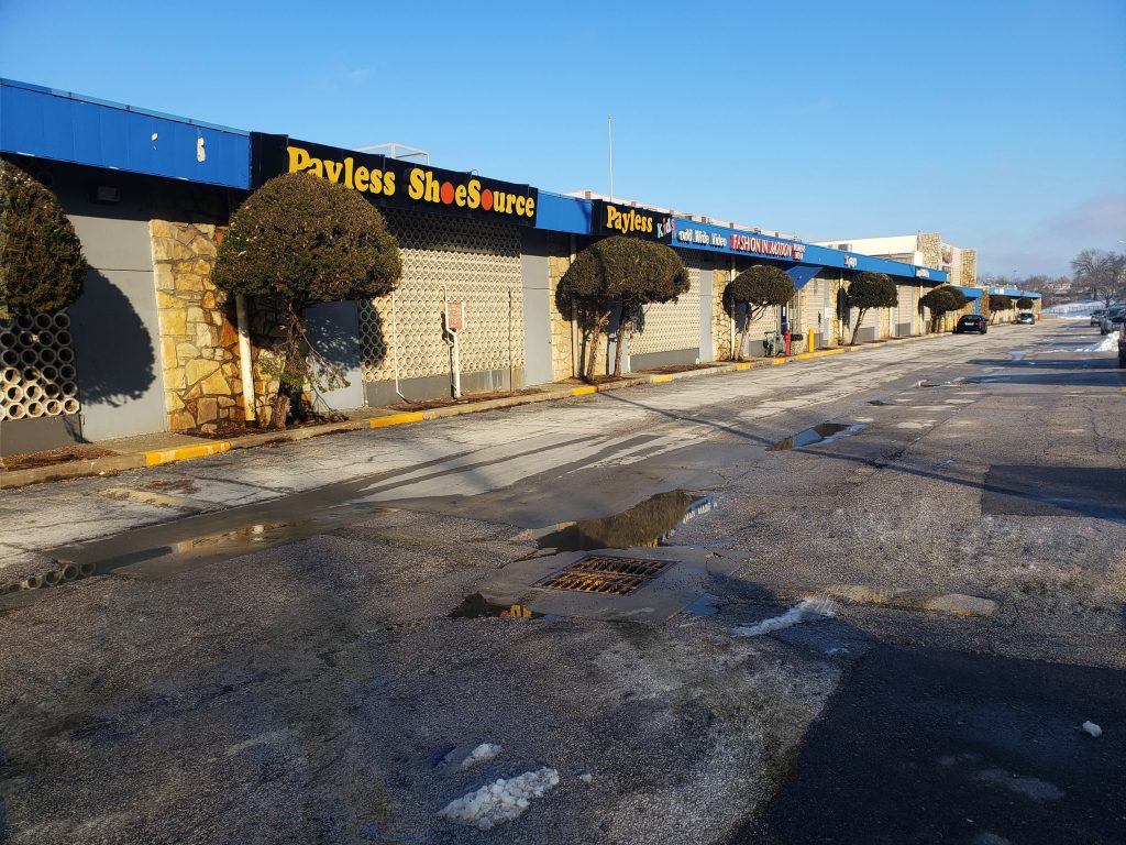
“One of Kansas City’s most identifiable locations” is now up for sale for just under $10 million. I am no realtor, but if I were, I’d agree with Block & Company Inc. The Landing Mall is an “excellent Midtown Center with easy access.” According to Emily Talen, a professor at the School of Geographical Sciences and School of Sustainability at Arizona State University, accessibility is 1 of the 5 key factors to having sustainable urban form. Located near the core of Kansas City, Missouri, is the Landing Mall. The Landing Mall has 8 entrances that are designated for consumer automobile interaction. (See figure 1.) I personally feel 8 curb cuts seem excessive for this area now, but in previous days, it may have been necessary.
Figure 1. Base map of the Landing Mall created by Cristina Aurich 01/2019
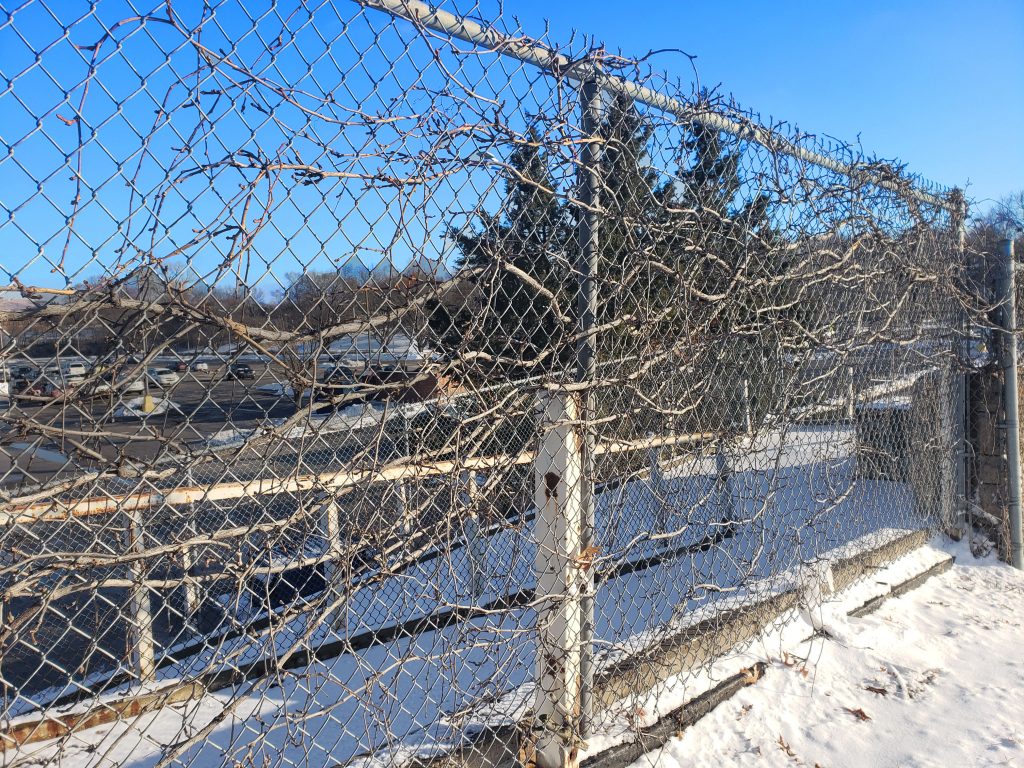
Figure 2. shows accessibility to an ADA ramp which leads to the lower level of the Landing Mall. Standing at the top of this ramp is a great view down on the Landing Mall. Currently this is a massive parking lot, with unattended potholes and little marking to direct traffic, but I envision looking down on functioning rooftops with green space and as little black asphalt as possible. Figure 2. also displays dead vines weaving through the fence. These dead vines replicate what the Landing Mall now, dead. Even though the Landing Mall is located at such as assessible and active location, on the corner of 63rd Street and Troost Avenue, there were few people using the space for its purpose, retail therapy.
Figure 2. Photo of fence on Troost Avenue looking down at the south parking lot of the Landing Mall taken by Cristina Aurich 01/2019
Known for its Noah’s Ark theme, the Landing Mall maintains features that allow one to reminisce on the past. Upon entering the Landing Mall consumers are greeting with a farm-like sent and painted cows sculptures reside in the lower level commons area. I was caught off guard by the foul scent once entering the mall and the sculptures of cows added to mismatch interior design features of the mall. Figure 3. the storefronts of some active businesses in the Landing Mall. From looking at previous historically photos, it is evident the Landing Mall was once a strip mall with an open space in the center. These service doors, seen in figure 3., still remain and added to my confusion of where the mall’s primary entrance was located. This figure likewise shows remnants of flourishing landscape, but it can be viewed as a positive to still see the straight line of trees lining the south side of the mall.
Figure 3. Photo of stores located on the south side of the Landing Mall taken by Cristina Aurich 01/2019
With time, and change of seasons, the vines on the fence and the trees lining the storefronts will continue to grow. They will bloom and thrive, as can the Landing Mall.
The historical development of Kansas City, Missouri can be framed by the Missouri and Blue rivers and their watersheds. Within Kansas City, this has created a street network of long, prominent North-South main streets and shorter, mostly numbered, East-West connector and corridor streets. The study area that I am working is framed by the 63rd Street corridor and Meyer Blvd from the south, and the north-south streets of Rockhill Rd and Paseo Blvd. At the center of this study area are important intersections and the New Landing Mall, built in 1960, at the corner of 63rd and Troost. While visiting the site and exploring it, I have identified multiple positive qualities about the area as well as opportunities for improvement. The purpose of identifying these traits and first impressions of the site is to gain a coherent understanding of what makes the landing mall and its surrounding areas successful as spaces and places; moreover, the upgrades and improvements needed to make it an efficient, sustainable, urban form.
Impressions
A circulation diagram of the site. The intersections at 63rd & Troost and Meyer & Troost are 5 hour day traffic counts. The Paseo, 63rd, and Meyer intersection is a 12 hour day traffic count. Data taken from KC Parcel Viewer, KCATA, and the City of Kansas City
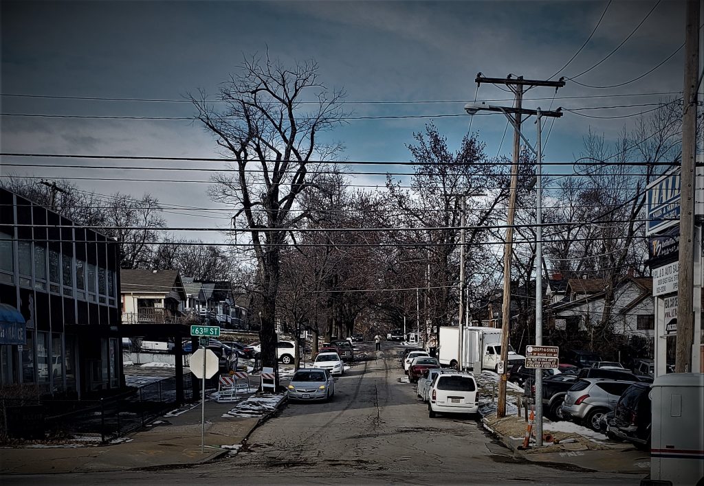
The first and most glaring part of the site is the public transit connectivity and street layout of the surrounding area. There are two major bus lines serviced by the Kansas City Area Transportation Authority (KCATA), the Troost MAX (Metro Area Express) and the 63 bus line, as well, to the east the 85 bus line that runs along Paseo Blvd. These two lines intersect at 63rd St and Troost Ave creating a major transfer point at this intersection. This hub of transportation shows not only the existing level of connectivity to the area but also the potential for the site to increase in connectivity and mobility. The street layout surrounding the site is fascinating in the way that it disrupts the existing and historical street pattern. This is due mostly to the convergence of two boulevards, the Paseo (MLK Jr.) and Meyer. In Kansas City, when two boulevards meet, it is a special event that requires special attention, and for this mall to be at the center of such a moment is quite significant. However, the mall and its parking lot has limited the number of connections through the site and instead has created termination points. This, in turn, limits the connectivity of through streets.
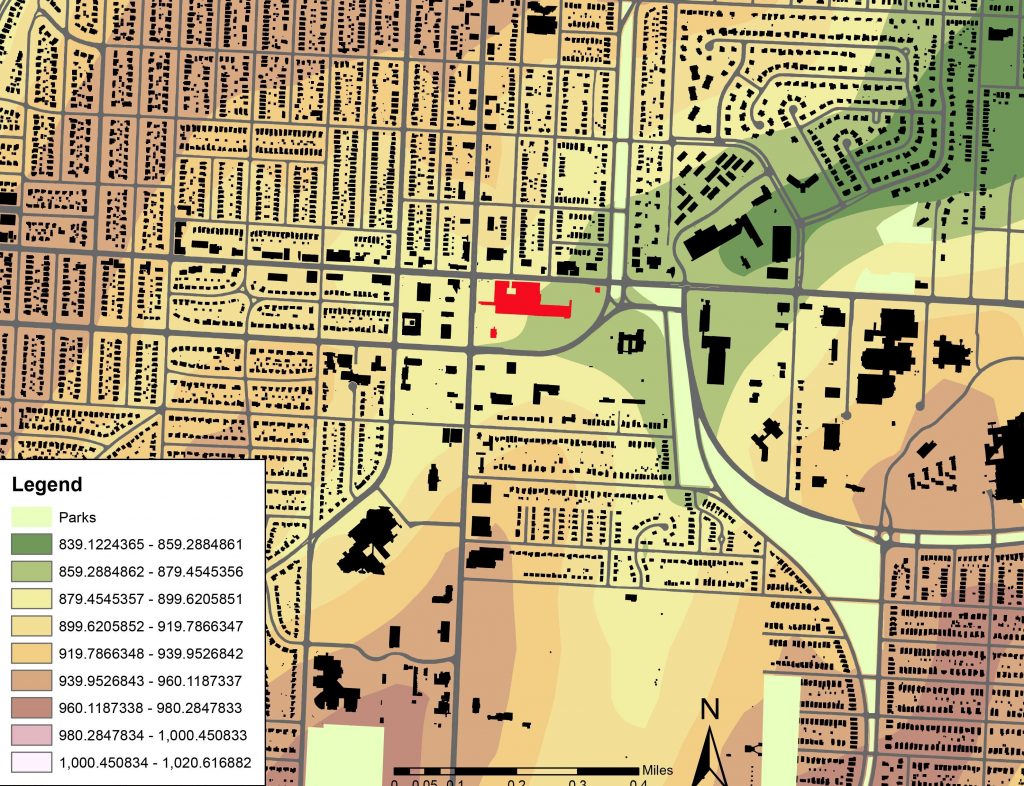
A map showing the topography of the site. Data taken from KC Parcel Viewer
The mall takes its name mostly from its positioning topographically. The mall is situated at one of the lower points of the city due to the proximity to town fork creek, whose terminus is to the east of the site. This topographical vantage point at the bottom of a valley creates an interesting design opportunity and has already created great views out from the mall towards buildings like the Hogan Preparatory Academy and the Convent of Christ the King. The current design of the mall negates this blessing for multiple reasons including the swath of pavement and impervious surfaces with no permeable surface to counteract the effects. As well, while standing at the corner of 63rd and Troost, it is difficult to tell what lies below, with little design guiding patrons to the lower part of the mall.
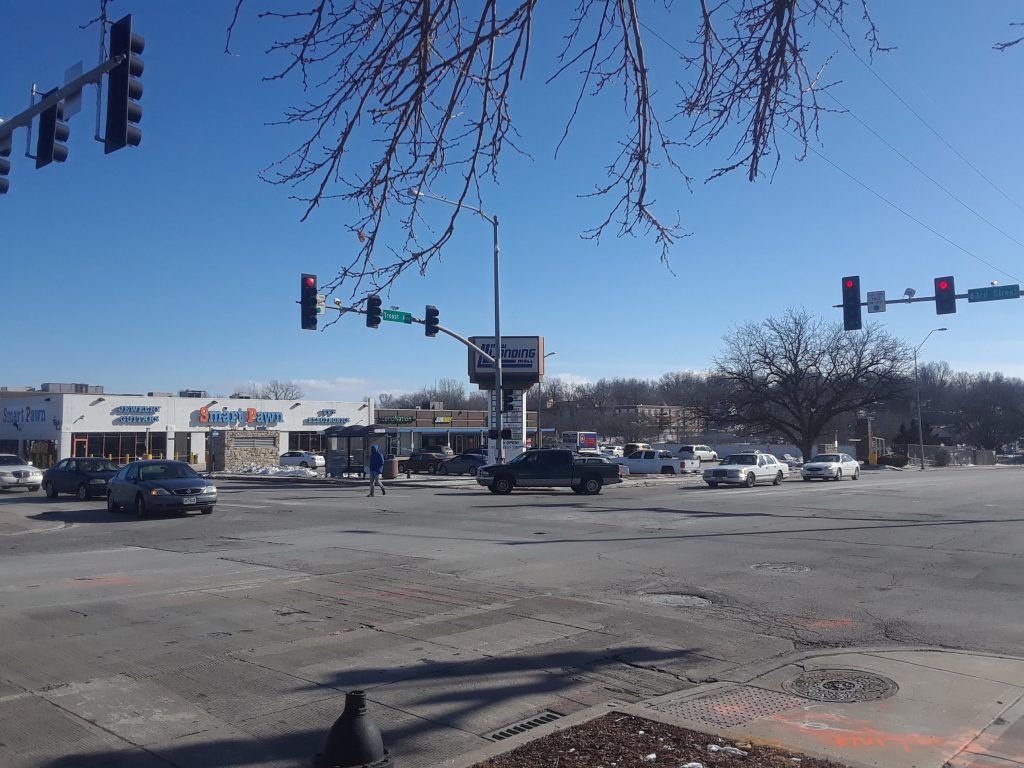
Photo of the intersection at 63rd and Troost. The photo shows the topographical advantage of the site as well as transportation connectivity; however, the amount of pedestrians is lacking
While walking around the site and the mall, while also holding a general idea about the demographics of the specific area, it becomes apparent the main patrons of the mall and surrounding businesses. Without knowledge of past customers, the current customers seem to be low to moderate income persons. The importance of this observation is that this creates a level of sensitivity during the redevelopment and redesign of the mall; so that, the asset that this mall has become stays an asset. Also, this mall does have an already established customer base that can be relied upon immediately after redevelopment.
Conclusion
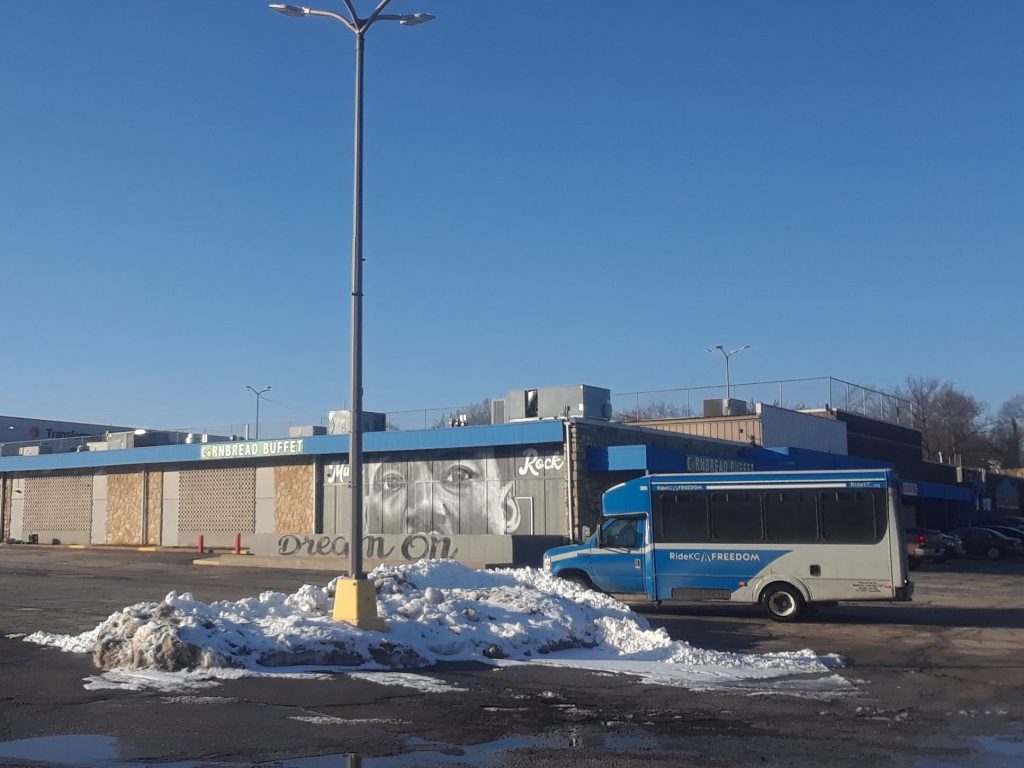
RideKC Freedom is an on-demand service provided by the KCATA in order to provide an accessible transportation option to the elderly, disabled, and disadvantaged. Photo taken on 01/23, a day before the KCMO city council voted to rename Paseo Blvd in honor of Dr. MLK jr.
The New Landing Mall is located at multiple decision points and intersections that are important to the connectivity of the Kansas City, MO transportation system; however, it puts the automobile over the pedestrian and lowers the connectivity of the shopping center with the surrounding neighborhoods. The boulevards coincide with the beauty of looking up out of a valley and the topography of the surrounding land. The metaphor that describes this area is one not of the top of a mountain, but as the land below. As Dr. Martin Luther King Jr. said in his speech, I’ve Been to the Mountaintop: “And he’s allowed me to go to the mountain. And I’ve looked over, and I’ve seen the promised land! I may not get there with you, but I want you to know tonight that we as a people will get to the promised land.” For this site is where the city comes together.