Category Archives: First Impressions

The first blog of Spring 2019 Studio. What we found at the Landing Site in January 2019.

Bi-state Sustainable Reinvestment Corridor RFP and the KC Regional Climate Action Plan

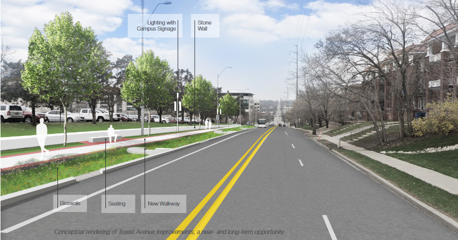
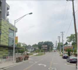
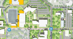
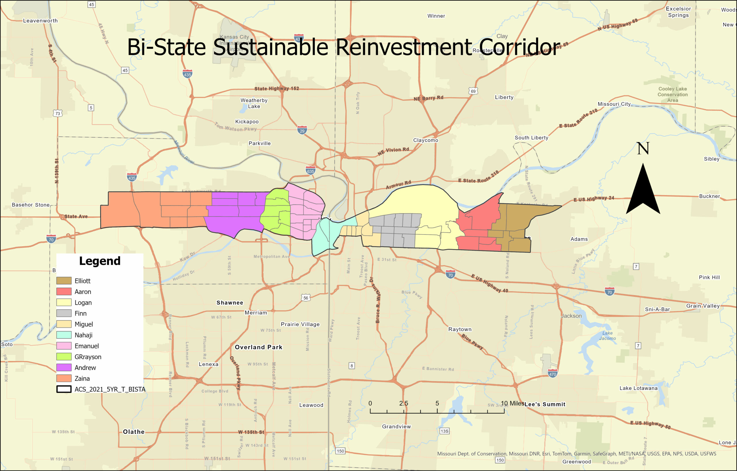
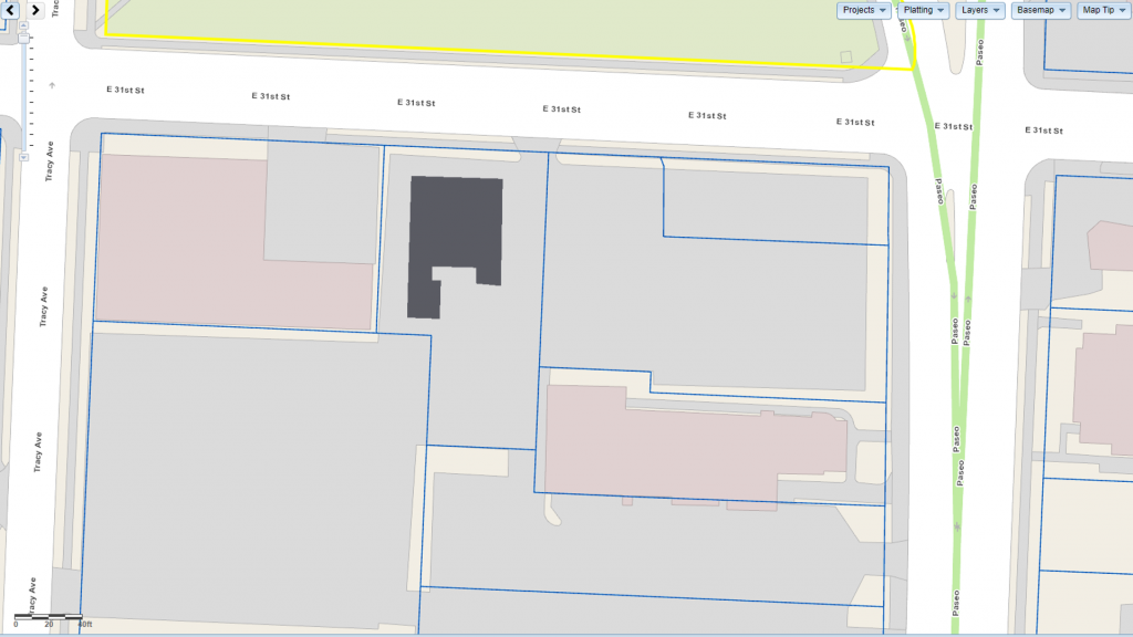
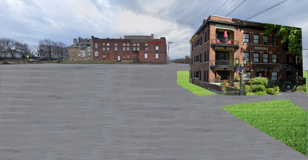
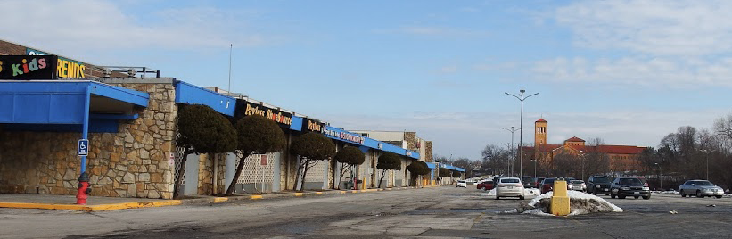
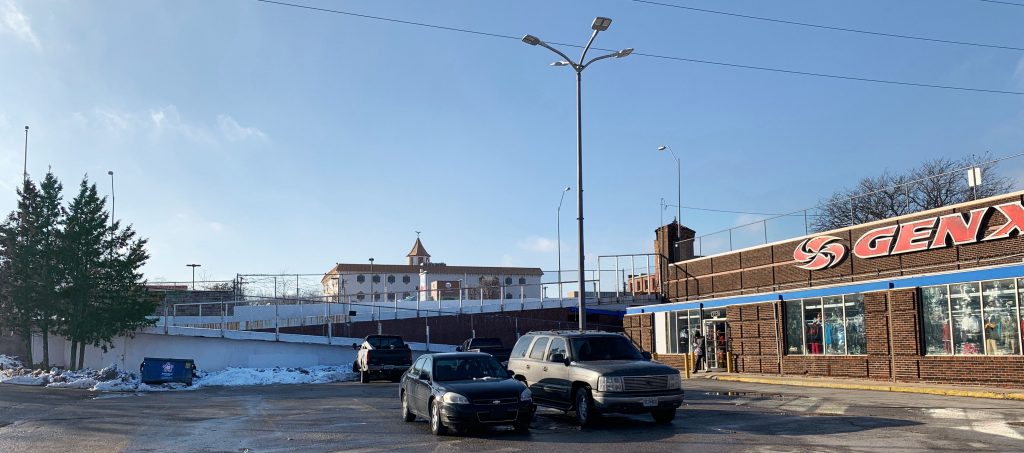
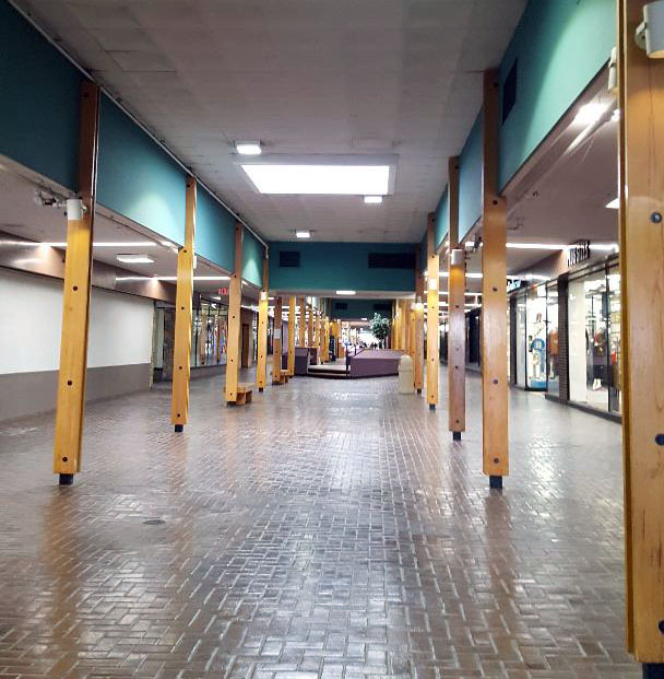
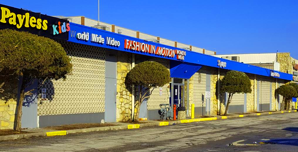
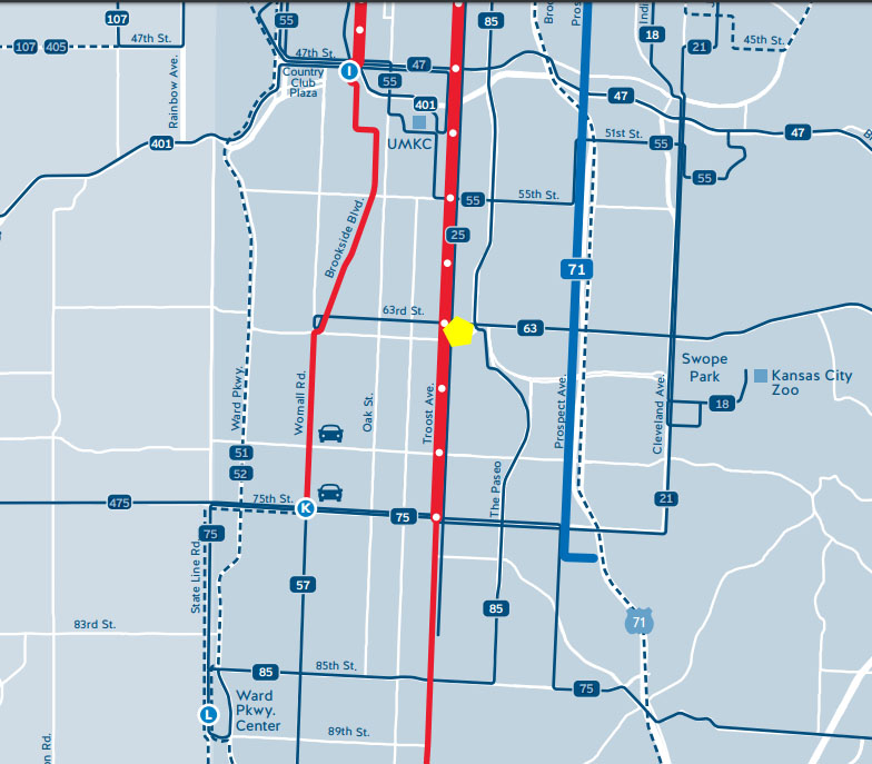
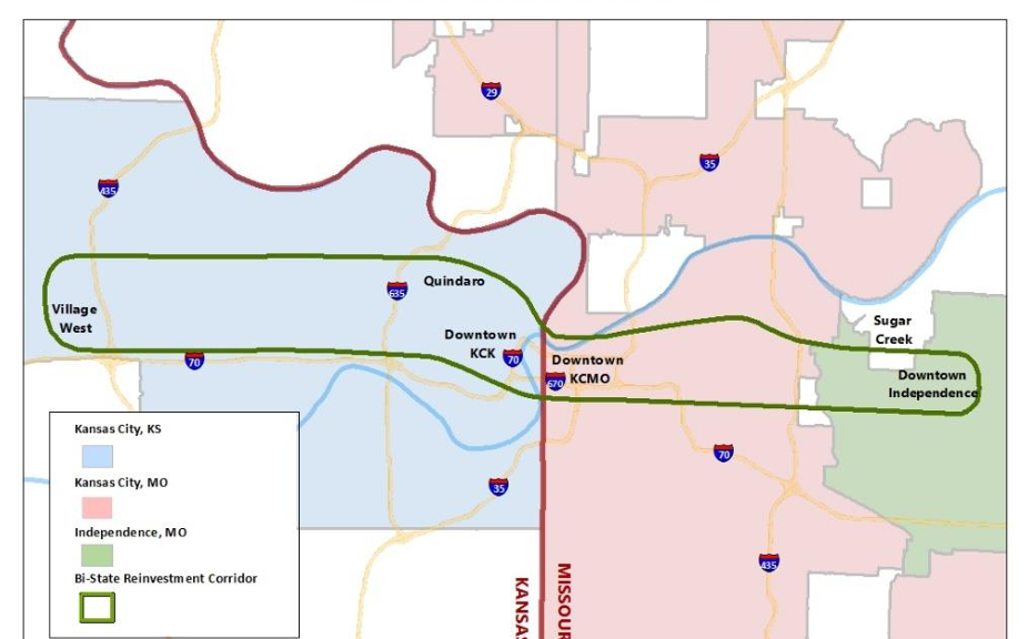
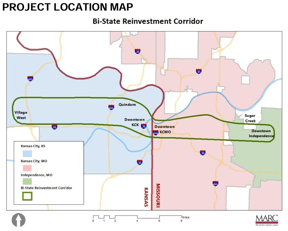
The issued request for proposals for the Bi-state Sustainable Reinvestment Corridor (BSRC) has the potential to fully revitalize communities in the heart of the Kansas City metropolitan area. Kansas City, KS, Kansas City, MO, and Independence, MO, will all benefit from this focus on modern green infrastructure, economic development, and community safety. The BSRC reflects targeted development that can maximize potential. Regional cooperation is essential in transforming everyday life, and this RFP emphasizes the need for participation from all stakeholders in the corridor.

Map showing the boundary of the Bi-state Sustainable Reinvestment Corridor as defined by the Mid-American Regional Council.
Figure 1. Project location map defining the BSRC (MARC, 2023).

I must also recognize the current context in which the BSRC exists. Recent infrastructure laws championed by the Biden administration–namely, the 2021 Infrastructure Investment and Jobs Act and 2022 Inflation Reduction Act–have enabled a wave of sustainable, climate-focused infrastructure developments across the United States. This RFP targets sustainability as the driving factor behind this development, aligning itself with these federal goals. Political support from the administration and local congressional offices will determine how far the BSRC plans will go.

I appreciate the Mid-America Regional Council and its partners for committing to implement numerous existing plans. A pattern exists in the planning world where money and effort get put into development plans that now collect dust. The BSRC RFP affirms that extensive work regarding transportation, climate, trails and bikeways, and economic development has already happened (MARC, 2023, p. 6). All plans should include this history to ensure efficient progress occurs.

Graphic listing climate priorities as identified by the Kansas City Regional Climate Action Plan executive summary.
Figure 2. Kansas City Regional Climate Action Plan priorities and strategies listed in its executive summary (MARC and Climate Action KC, 2021).

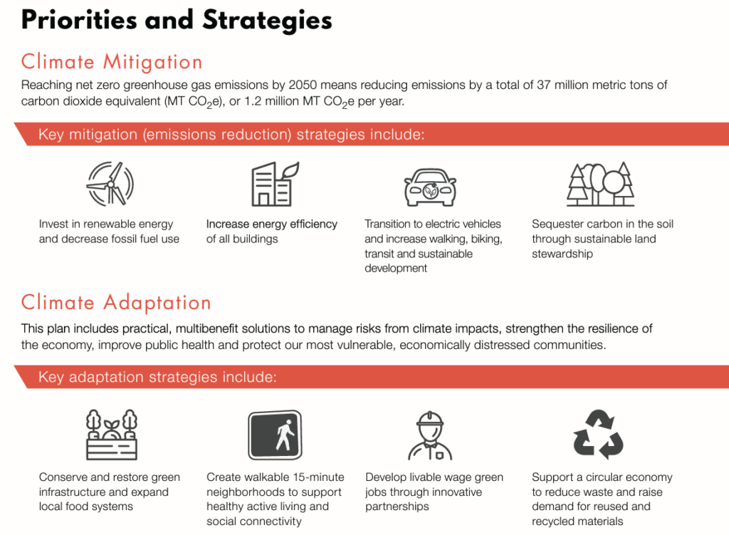
The Kansas City Regional Climate Action Plan is a part of this project’s history (p. 6). I view the BSRC as a direct implementation process of the 2021 action plan developed by MARC and Climate Action KC. The CAP lists recommendations for transportation investments, building efficiency standards, greenhouse gas emissions reductions, and more–all elements listed in the RFP. The CAP should be a reference for every major infrastructure project in the Kansas City region.

It is encouraging to see how intertwined these two plans are. This project will provide a great look into this exciting corridor.

References

Mid-America Regional Council and Climate Action KC. (2021). KC Regional Climate Action Plan Executive Summary. https://kcmetroclimateplan.org/

Mid-America Regional Council and Climate Action KC. (2021). KC Regional Climate Action Plan. https://kcmetroclimateplan.org/

Mid-America Regional Council. (2023, December 19). Bi-state Sustainable Reinvestment Corridor. https://www.marc.org/about-marc/funding-and-rfps/

Response to Campus Master Plan

In the beginning pages of Daltons paper, she discusses five essential planning factors for campus planning. These factors include the following – land use, design, sustainability, economic development and collaboration. Land use is promoting a sense of community, walkability on campus, livability, and safety. Design are the physical components of the space that improve the overall image of the campus. The sustainability component is planning for impact of the campus on the overall ecosystem, and how the campus can relate to common goals of the community. Economic development and collaboration are directly relationship to surrounding neighborhoods and communities while engaging in socioeconomic built environment. The new university master plan addresses many of these components in the 2021 addition with several of their additions made to face challenges on both campuses.  

Scholars in the Dalton paper suggest that land use planning can be achieved through “vibrant and safe social environment to address the evolving needs of higher education institutions” The campus master plan introduces the concept of a renovated historic quad that would provide more gathering spaces, and the new space for the campus heart that would close 51st street providing space for events and interactions. Similarly, Dalton suggests that sustainability on the campus can be directly correlated with transportation infrastructure. UMKC has proposed adding housing on campus that would significantly reduce of traffic counts incoming to campus as well implementing bicycle and pedestrian methods of transportation for students that would reduce the need for cars. The highlight on pedestrian safety specifically along Troost Avenue, 51st Street, and Rockhill Road specifically with the widening of pedestrian walkways will also reduce the traffic crimes. The connection of campus to the rest of Kansas city is important, so the UMKC master plan suggest that the street car extension will further the connection as well bicycle lanes that will also connect to existing bicycle networks throughout the rest of the city. Collaboration was established with several stakeholders as addressed at the beginning of the UMKC master plan.  

The University By the Way

UMKC is a piece-meal university that kind of lingers in the background. It is felt on Troost or Brookside
as you pass the blur of a university. Only further down Troost, you approach Rockhurst University do you
sense a university. Once on the campus, the university is very easy to discern. UMKC has a campus-in-the-park design, and is fairly spread out (I might be biased, the department I am pursuing a degree in is
based out of the furthest building from the rest of campus). Building design consistency on and around
the campus isn’t even an afterthought. Outside the campus on Oak Street (Whole Foods, and those 51st
Street Shops) if you faced away from UMKC you wouldn’t think a university was in the area. In this
picture below we see a South Plaza flag, so if we really weren’t paying attention and somebody asked
where we were – this is the only visual indicator.

There is a missed potential of this university-city
dichotomy. UMKC kind of hangs-out in the background, to the city. And sure, there are issues that come
with being a campus:
➔ studentification (think gentrification but with students),
➔ University expansion and displacement of nonstudent residents
➔ ‘Student behavior is typically the top issue in town-gown relations’ (Dalton 2018)
The streetcar is a really good move forward in
advancing the interface between the university and the
rest of the city. And maybe more students interacting
outside of the campus will help curb some of those
campus issues. UMKC lacks a university- identity
outside of the campus area. There is very little or no
campus-community interface, and this may have more
to do with the number of commuters attending UMKC.
And there is no campus district, no clear indication of
where I am and where the university is in relation to
me.


The UMKC Master Plan 2021 is a well
developed campus master plan that is focused
on renovations of existing buildings, student
driven infill and construction (housing,
engagement space), and creating a sense of
campus identity. There is really good work by
focusing on bringing students on campus; the
plan has also established a need to create
identity, community outreach, and making the
campus less car friendly. There will probably
be the biggest student pushback on the
transformation of 51st street (see picture above (14)). The KC metro loves their cars. The campus as it
needs this plan, to help make the campus more cohesive, sustainable and develop better relations with off campus populace. There may have been something to say about Troost Avenue as it is the connecting
street to both campuses, but that would also require the city approval. I would also like to focus on more
sustainable landscaping as a means to prevent flooding and beautification. Lawns are a waste of resources
and time. Why not have the plants work for us? The next step for the campus is to clarify its interface
with the community by working with the city and the neighborhoods and businesses nearby campuses.
The university is going to have to show how it is a benefit to the community. Hopefully the city can take more notice.

Bi-State Sustainable Reinvestment Corridor

Map of corridor
Census Tracts in the Corridor.

Design and Development in the Bi-State Reinvestment Corridor of Kansas City

This semester UP+D Studio 312 will be examining the Bi-State Sustainable Reinvestment Corridor of Kansas City, This corridor will combine net-zero electric transit with strategic investments to address environmental justice and economic development.

Improving the corridor requires thinking about some major urban issues of the present time. First, How did the big issues of urban change such as redlining, urban renewal, deindustrialization, and highway construction impact the corridor? Then, what are the existing plans for the corridor? How will we address the issue of housing affordability? Housing costs have been rising 3X faster then income in greater Kansas City. What assets do neighborhoods bring to the bi-state corridor plan? What are the present environmental conditions on the corridor and are their environmental justice hotspots? UMKC might best thought of as a “school zone” and a reduced speed on at least Rockhill and Oak Street might greatly improve safety. How will bicycle facilities and trails cross the corridor and connect to improved transit?

We will conduct this study in four parts – We will start with an Existing Conditions Analysis examining economic, transport, social and demographic trends impacting the neighborhoods and areas around corridor; then conduct a detailed analysis of site conditions and on-the-ground impressions of the corridor, identify strategic nodes for student intervention proposals, followed by the development of final design proposal for catalytic “transit-oriented development” that will advance Independence, and both Kansas City, Missouri and Kansas City, Kansas.

Impressions at Troost Park

I chose this single family home because of its character and modernity. This is a home built in 1923, but feels like a more modern version because of its color pallet and because of how well the property is maintained. This home also fits the existing, historic character of the neighborhood around Troost Park due to its architectural design, so it brings vibrancy to the area without looking like it’s out-of-place.

I chose the site due to its relation to the rest of the existing neighborhood. The north and east sides of the park are surrounded by single-family housing, so this was an ideal location for a new home. Additionally, this land is currently vacant and in need of a use. There is an alley that runs behind the church to the west which can be easily extended for a driveway or detached garage. Having the auto-related uses in the back of the unit gives the home a direct connection to the park through the front door.

The floor area ratio on the current site is .15 with a density of 5.8 dwelling units per acre. On the new site, the floor area ratio is .21 with a density of 8.0 dwelling units per acre

I chose these townhomes due to their relation to the street and their suburban feel. These homes’ sidewalks lead right to the front door in order to give the streetscape a human scale. I think this could be very valuable at a human-oriented space like Troost Park.

I chose this site because the long and narrow parcels are very similar to the original parcels these homes came from. It can be challenging to create a cohesive development in areas that have empty parcels shaped like these. I think a townhome development with a suburban feel would fit right into the character of the neighborhood while making use of currently vacant space. This string of parcels is also makes up the entire west side of Troost Park, so adding infill here would help the enclose the park to make it feel more like a destination. Parks surrounded by vacant lots can feel like there is no official end to the area, and it can burden the efforts of place-making.

The floor area ratio on the current site is .65 with a density of 14 dwelling units per acre. On the new site, the floor area ratio is .28 with a density of 6 dwelling units per acre.

I chose this building because of its unique character and sense of place. This is a 8 unit apartment building which is constructed of all brick and wrought iron fencing. This building features a lush garden in the front which gives a strong sense of community and care from the residents.

I chose this site for the building because of the architecture, the proximity to the park, and the ample space for parking. This building’s architecture fits very well with the other uses behind it, but it feels much more residential while the others feel industrial. Having a residential feeling building in an area like this will give a southern edge to Troost Park instead of an ocean of empty parking lots. The space to the east of the building could be filled with amenities for the residents or other buildings of this same type. This would leave plenty of parking in the rear of the buildings which would be ideal for both the residents and the users of the park.

The dwelling units per acre on the current site is 57. On the new site it is 22 dwelling units per acre.

TROOST HOUSING INFILL

Sarah Davis

This is a small single family development originally located at 3917 Valentine Rd. I plan on moving it to Flora Ave, in the study area around Troost Park. I chose this example because it has a nice facade and landscaping. I thought it would fit in well with the surrounding single family dwellings on this street. It is located a couple short blocks from the park, being a selling point for young families. The house currently sits on a 7,019 sq ft parcel, and is developed at 6 dwelling units per acre. This classifies the development as small, it has a floor area ratio .79. Overall, I saw the house as a nice fit for the surrounding context.

Small Development 3917 Valentine Rd

This is a medium multi-family development originally located at 2418 Linwood Blvd. It is currently being used as office space, but it was initially built for apartment homes. I plan to move it to 3014-28 Tracy Ave. For this move, I would have to combine multiple smaller parcels to have enough space for this development. I thought it would blend in well with the surroundings, with the current lot adjacent to an apartment building as well. This development would bring in many new families to the area of different sizes, it would be perfect for single people, adults with no kids or families with kids. The building is developed at 20 dwelling units per acre, making it it a medium development. It has a floor area ratio of 1.39. Being directly across the street from the park would also create around-the-clock eyes on the street to make the park and the area overall a safer place.

Medium Development on Tracy

This is a large multi-family development originally located at 4700 Roanoke Parkway. It has recently been remodeled, making it a perfect pick for a new development for my selected site. I plan to move it to the corner of 30th St. and Tracy Ave, across the street from Troost Park. There is an existing apartment development on the adjacent lot, so the new development would not look out of place on this corner. I believe that developing this intersection would bring attention to the park across the street, and make it a safe place for the residents who live there to walk in the park. This development would also bring a wide array of new residents to the area. it is located near many services such as churches, social services and educational facilities. This apartment is developed at 71 dwelling units per acre making it a very high density development. The added density will certainly add more excitement to the area. The floor area ratio is 3.13. Overall, this development would be perfect to add to this corner adjacent to The Park.

Where is the Landing?

Figure 1. From 63rd , looking across Troost Ave.: The Landing Appears to be a small commercial strip. The majority of the complex is hidden by topographical changes. Photo by Tom Meyer

When arriving from the north, the first impression of The Landing shopping center is rather misleading. The first thing you will see is a small strip of commercial activity with a deep setback from Troost Ave. and abundant parking. From the corner of 63rd and Troost (Figure 1) it could easily be mistaken for the extent of the development. However, if you traveled further south on Troost or east on 63rd, you would see that the ground level drops dramatically in each direction revealing the majority of the mall which lies below the ground level of this prominent corner.

Figure 2. From Meyer Blvd, looking across Troost. The mall’s setback from Meyer Blvd is so deep that it makes little visual impact from this major corner. Photo by Dayna Meyer

From the intersection of Meyer Blvd and Troost Ave, a block to the south, the topography and other elements of the site continue to mask the view of the large complex (Figure 2). The rise of Troost and the deep parking lot fronting Meyer Blvd. obscure the storefronts at the west of the site. The parking lot, a fast food restaurant, and large trees hide the rest of the mall as it stretches east.

The lack of a strong visual presence may be negatively impacting the prospects of the retail activity conducted on the mall’s premises. People who pass the site may not be aware of the commercial opportunities hidden by topography and the low-rise structures.

Future developments could remedy this effect by siting buildings closer to the street. The low-elevation could also be countered with taller structures.

However, the topography which helps to hide the mall can also be seen as an advantage when taken together with elements of the built environment surrounding the site. Three vertical landmarks are easily, and pleasantly, visible from many points on the site. To the west the pinnacle of the Rockhill Plaza office building and the tower of the U.S. Bank building rise high enough that they can be seen from almost anywhere on the southern and eastern sides of the site (Figure 3).

Figure 3. Looking northwest from the Mall’s southern parking lot, the towers of Rockhill Plaza and the U.S. Bank building are easily visible. Photo by Dayna Meyer

To the east, the dramatic tower and red roof of the Convent of Christ the King can be seen from almost anywhere on the site, excepting the northwest corner (Figure 4).

Figure 4. Looking to the east, the Tower of the Christ the King Convent is visible from almost any vantage point of the mall site. Photo by Tom Meyer

In both directions the views of these landmarks are made possible by the topography of the site. The mall is sited in a relatively deep bowl of a valley and the verticality of the towers is enhanced by their siting on the surrounding higher ground (Figure 5).

A section of the site and surrounding area shows how the topography highlights the surrounding towers and de-emphasizes the large mall site. Diagram by Tom Meyer

Future development on the site could take advantage of this unique topography by preserving the excellent views off of the site.

The landing – first impressions

Regional Context Map. Made by: Adair Bright (ArcGis, UMKC)

The Landing Mall, inside the red circle pictured above, is located at Troost Avenue and East Meyer Boulevard in Kansas City, Missouri. It sits on the Parks and Boulevards System and is surrounded by four major streets – Troost, Meyer, 63rd Street, and Paseo. Being about 20 blocks south of The Country Club Plaza, it served as a retail space for the surrounding neighborhood. The mall was built in 1960 and was originally an open-air shopping center – something that can be identified when inside the mall. The mall became enclosed in 1970 and was renamed The New Landing Mall.

The Original Landing. Photo by: Adair Bright (January 23, 2018)

Few pieces of the original Landing still remain but it is enough to preserve and recreate. The sign pictured above is on the east side of the building facing the merge of Meyer Boulevard and the Paseo Boulevard. Having the original signage from the mall facing a boulevard is a positive because of the amount of people on those roads and it provides to opportunity to incorporate the boulevards aesthetic.

Quarter Mile Figure Ground Map. Made by: Adair Bright (ArcGis, UMKC)

The Quarter Mile Figure Ground Map gives an aerial view of the site. The Landing Mall is highlighted in purple and the red circle represents a quarter mile radius from the center of the mall. A quarter mile radius was used because that is generally the distance people would be willing to walk and still consider it convenient. When looking within the circle, there are many bigger buildings which means there is a lot of retail and institutions surrounding The Landing. This is a good thing when considering the neighborhood just south of the circle because all the places within the circle are there to service the residents. There is also a playing field at the school within the circle which shows there is youth in the area.

A Look at Troost. Photo by: Adair Bright (January 23, 2018)

The image above is standing in the parking lot on the south side of the building while looking at Troost Avenue. It is clear from the picture there is a drastic topography change from the lower level to the upper level of the mall. The ramp was closed when the photo was taken so to get to the upper level, we had to walk to the south end of the parking lot to get onto a sidewalk that led north on Troost. This can be a major inconvenience to people because they want the quickest way to get to another place and therefore they will either drive their car to the upper lot or will not even bother coming here. Despite the current lack of good circulation, the topography does create a secluded place for the mall and in turn makes it feel safe. It also would allow for visitors to see a different view of the mall if they were able to look down at it and see the actual design.

Quarter Mile Radius Paved Surfaces Map. Made by: Adair Bright (ArcGis, UMKC)

The main impression I got when visiting The Landing was the extreme amount of parking surface. The map above shows the paved surfaces in the area. The building outline is clearly seen which means the entire lot, besides the building, is a paved surface for vehicles. Also, the map shows the abundance of parking elsewhere within the quarter mile radius. At some point, it was probably believed all the parking would be needed to support the abundance of people, but now, it sits empty. When arriving at The Landing, I was confused as to why the parking lot was so big and once we started walking, I realized just how small it made me feel. The mall and the paved surface appear to take up the same amount of the lot – each about half. This becomes uncomfortable when the Northwest side of the mall is pushed up almost to the street and the Southeast side is all parking. The massing should be reconfigured to less parking just on the outside in order to push the building slightly further towards the outer edge.

Conclusion

The Landing has an amazing location and the topography allows for interesting design choices to be made with clear intentions. However, the paved surface needs to be changed and the parking should be reconfigured. When inside, the mall feels old and sad. There is not a lot of light, the planter boxes are empty, and the store fronts do not have residents. The mall needs renovated while preserving its unique features. The original signage should be kept as a reminder of when it was built but the building should be maintained and turned back into a retail space for the residents it serves.

Impressions of the Landing

I

Then and Now

The Landing is a shopping mall that was created by J.C. Nichols and opened to the public in 1960 as an open-air public space with animal-themed play structures for children and trees throughout the central corridor.  It still exists today as a covered structure and has some operating places of business inside, although not as high-traffic as it was in its beginning days and without the play structures and greenery.

Photo courtesy of Ryan Khatam http://neat-stuff-blog.blogspot.com/2011/01/landing-mall-1960s.html

The exterior of the building exhibits materiality of stone, paint, and a circular-patterned concrete façade which seems somewhat inconsistent.  The major entrances are somewhat unclear and confusing to approach. There are, however, beautiful murals on the exterior walls that promote a strong sense of local pride.  Adjacent is its very large parking lot.  Most of the surface area of the lot is unused by cars during a typical day and completely void of trees and other greenery. Once inside the building, the space is very warm and inviting.  Large windows display several retail stores full of merchandise and ready for customers.  I feel that more clear and welcoming entrances to this fantastic interior space would greatly increase public draw to utilize it.

Exterior of The Landing, January, 2019, Shana Shanteau

Accessibility

The Landing is located between Troost and The Paseo, along 63rd Street.  Due to its proximity to these major streets, its location provides easy accessibility via car and/or bus.  Buses stop approximately every 20 minutes and connect with other lines of transportation throughout the city.  The site is surrounded by several other businesses, many which are local.  Although temperatures were below freezing during this particular day of observation, several pedestrians were observed walking on the surrounding sidewalks and using the crosswalks to cross the wide and busy streets.  Because these areas are heavily used, it seems clear that these walkways should be made more safe for pedestrians.

The space is close to many residential areas and is within excellent proximity to grocery stores.  Aldis, Thriftway, and Cosentino’s are all within one mile or less from the site.  There are also several schools nearby.

Landscape

The landscape of the area is extremely beautiful and drastic in topography.  The site sits lower that its surrounding spaces and the area just to the south is hilly and covered in large majestic trees.

In conclusion, this space has a very energetic atmosphere, great accessibility, rich history, and beautiful landscape. The Landing’s location, which is central to many businesses, schools, and churches, make it a great place to live and work.

The Landing

The Landing is a 1960’s era mall in Kansas City, Missouri. Located at the intersection of four major thoroughfares (Troost Avenue, Meyer Boulevard, The Paseo and 63rd Street), the Landing is still an active mall. However, none of the mall’s original tenants have a presence at the now thrift-centric and outdated shopping center. The building’s unique split-level, indoor/outdoor structure sees businesses facing the parking lot like a modern commercial strip and facing an interior hallway like a suburban mall.

The Landing’s logo proudly displayed along Troost Avenue in the 1960’s.
Source: Malls of America, 2006

The Landing’s location along 63rd Street is shown in the below map. What struck me the most was just how much the Landing, as well as the other commercial sites along the corridor, stand out among the sea of single-family homes West of the site. Furthermore, the extent to which these parcels of land and the surrounding grid of streets, break apart and become larger blocks with non-linear street patterns is striking. The Landing and the intersection of 63rd and Troost really is the beginning point of this transition.

Contrast in block sizes around the 63rd Street corridor.
Source: Jared Islas, 2019.

This point is further proven when looking at the area immediately surrounding the Landing. This reverse figure ground diagram below shows just how quickly the area transitions from a residential neighborhood to a ‘suburban’ retail experience. The diagram also shows how spread out the buildings are from one another and from their fronting streets and sidewalks. This area was obviously designed for the automobile and not the pedestrian, which makes sense considering the time period when the site was originally developed – the 1960’s.

Reverse figure ground diagram of the area.
Source: Jared Islas, 2019.

When we walked around the site, I noticed two different ways that The Landing appears from the sidewalk. The first, in my opinion, was more positive. When walking West on 63rd Street, you see a sign on the side of the building signifying that you’ve reached the shopping mall. By using the same font style that dates back to the mall’s opening in the 1960’s, the sign shows the mall’s historical significance. To me, the sign also gives the mall a sense of unity and identity. Together, these ideas give me a positive and inviting feeling.

View of The Landing on 63rd Street looking West.
Source: Jared Islas, 2019.

The next picture that I took shows a not so inviting view of the mall. Blocked by an inaccessible ramp, pedestrians walking along Troost Avenue have no easy way to get down onto the lower level of the mall. The view from Troost is also one that looks down into the site. From the sidewalk, you can see the vast parking lot and the tops of the buildings including all of the rooftop equipment. By simply cleaning up some of the overgrown brush, opening up the ramp and screening the rooftop equipment, The Landing could give pedestrians a much more intriguing entrance, similar to the one on the East end.

View of The Landing on Troost looking North.
Source: Jared Islas, 2019.

Despite the declining state of the mall from its original state, The Landing and its site do have a number of positives.

  • Location – bounded by four major thoroughfares
  • Parcel size – parcels of this size are hard to come by in the area. redevelopment opportunities are endless
  • Neighborhoods – surrounded by Citadel, Western 49-63, Blenheim and Morningside neighborhoods
  • Institutions – Hogan Preparatory Academy, Convent of Christ the King, Ewing Marion Kauffman School and various other hospitals and schools surround the site
  • Tenants – Cornbread Buffet opened in the mall in August 2018
  • History – Originally developed by JC Nichols in the 1960’s as a suburban shopping mall – one of the first of its kind