Tag Archives: Site Visit

Existing Conditions + History of Transportation

The beginning of fixed route transit service to the Valentine neighborhood began October 1, 1889 as the Washing and Summit cable car line

• Provided access from West Bottoms to Downtown and the north side of the Valentine neighborhood

• Ran from Union Depot on Ninth to Washington. Washington to about 13th-14th Streets, continuing on13th-14th Summit Street. Summit Street to 29th Street

• Service was reduced to Southwest Boulevard in early 1901

Source: KC History https://kclibrary.org/art-objects/map-greater-kansas-city-suburbs

In 1920 the  Valentine neighborhood was served by the 21 Jackson-Roanoke streetcar route

• Service on the streetcar route from 1910’s

• Destination sign would read Jackson – 24th on Northbound trip

• Destination sign would read Roanoke – 45th or Summit – 39th on Southbound trip

• Streetcar service along Summit Street until widening and repaving of Summit Street in 1951

In 1944 the  Valentine neighborhood was served by the 57 Jackson-Roanoke streetcar route

• Service continued from 21 streetcar route from 1910’s

• Destination sign would read Jackson – 24th on Northbound trip

• Destination sign would read Roanoke – 45th or Summit – 39th on Southbound trip

• Streetcar service along Summit Street until widening and repaving of Summit Street in 1951

Source: KC History https://kchistory.org/image/broadway-boulevard-valentine-road-0

Streetcar service along Broadway Boulevard concluded in 1940’s

• Routes 4 and 48 provided service on Broadway Boulevard from 1920’s to 1940’s

• Route 4 ran from Ward Parkway and 59th Street to Belleview Avenue, winding on Westport Road and Broadway Boulevard to Downtown 

• Route 48 ran from Downtown along Broadway Boulevard to 39th Street, providing service east-west between State Line Road and Broadway

Broadway Boulevard is serviced by a single bus route, traveling from the Plaza to Armour

• Begins at the Plaza Transit Center, travelling up Broadway Boulevard and turning East onto ArmourBoulevard

• Runs on Armour Boulevard / 35th Street to Van Brunt, returning from Van Brunt Loop

• Connects St Luke’s Hospital to the Kansas City VA Medical Center along a dense residential corridor

• Route 35 has 435 daily riders in January 2026

Main MAX service was rerouted to Broadway Boulevard for nearly ten years 

• Provided 20-minute headways either direction from Waldo to River Market and Columbus Park

• Travelled along Grand Boulevard through Downtown, on Pershing Road, turning onto Penn Valley Drive / Broadway Boulevard

• Ran from 5AM to 12AM from Monday – Saturday

• Reduced service on Sundays

The Main Street Extension of the KC Streetcar replaced Main Max service 

• Operates at 10-12 minute frequencies

• Runs from 5 AM to 12 AM Monday-Thursday

• Runs from 5 AM to 1 AM Friday and Saturday

• Runs from 6AM to 12AM Sunday

• Connects River Market to South Plaza, UMKC

• Encourages Transit Oriented Development (TOD) on the Main Street Corridor

• 7,873 daily riders in January 2026

RideKC Route 31 provides East-West connectivity on the 31st Street Corridor at 15 minute frequencies

• 15 minute frequencies make it the most frequent bus route in the state of Missouri

• Not the most frequent bus corridor (Prospect Avenue)

• Runs from 5 AM to 12 AM Monday-Saturday

• Runs from 5 AM to 10 PM on Sunday

• Connects southern Independence to the core of Kansas City

• 1,931 daily riders in January 2026

Route 39 provides East-West transit on the 39th Street Corridor

• Operates at 30 minute frequencies

• Runs from 5 AM to 12 AM Monday-Saturday

• Runs from 5 AM to 10 PM on Sunday

• Connects KU Medical Center and Volker / Roanoke Neighborhoods to the East Side

• Deviation to VA Medical Center

• 584 daily riders in January 2026

Where access is provided, pedestrian and sidewalk infrastructure is well designed

• Southwest Trafficway has few points to cross the roadway

• Certain streets have unsafe crossings

• Road diets to Main Street and Broadway Boulevard have improved walking conditions along the respective corridors

• New tree plantings in the neighborhood will provide shade and clean air

• Short, small blocks improve walkability

The landing – first impressions

Regional Context Map. Made by: Adair Bright (ArcGis, UMKC)

The Landing Mall, inside the red circle pictured above, is located at Troost Avenue and East Meyer Boulevard in Kansas City, Missouri. It sits on the Parks and Boulevards System and is surrounded by four major streets – Troost, Meyer, 63rd Street, and Paseo. Being about 20 blocks south of The Country Club Plaza, it served as a retail space for the surrounding neighborhood. The mall was built in 1960 and was originally an open-air shopping center – something that can be identified when inside the mall. The mall became enclosed in 1970 and was renamed The New Landing Mall.

The Original Landing. Photo by: Adair Bright (January 23, 2018)

Few pieces of the original Landing still remain but it is enough to preserve and recreate. The sign pictured above is on the east side of the building facing the merge of Meyer Boulevard and the Paseo Boulevard. Having the original signage from the mall facing a boulevard is a positive because of the amount of people on those roads and it provides to opportunity to incorporate the boulevards aesthetic.

Quarter Mile Figure Ground Map. Made by: Adair Bright (ArcGis, UMKC)

The Quarter Mile Figure Ground Map gives an aerial view of the site. The Landing Mall is highlighted in purple and the red circle represents a quarter mile radius from the center of the mall. A quarter mile radius was used because that is generally the distance people would be willing to walk and still consider it convenient. When looking within the circle, there are many bigger buildings which means there is a lot of retail and institutions surrounding The Landing. This is a good thing when considering the neighborhood just south of the circle because all the places within the circle are there to service the residents. There is also a playing field at the school within the circle which shows there is youth in the area.

A Look at Troost. Photo by: Adair Bright (January 23, 2018)

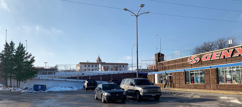
The image above is standing in the parking lot on the south side of the building while looking at Troost Avenue. It is clear from the picture there is a drastic topography change from the lower level to the upper level of the mall. The ramp was closed when the photo was taken so to get to the upper level, we had to walk to the south end of the parking lot to get onto a sidewalk that led north on Troost. This can be a major inconvenience to people because they want the quickest way to get to another place and therefore they will either drive their car to the upper lot or will not even bother coming here. Despite the current lack of good circulation, the topography does create a secluded place for the mall and in turn makes it feel safe. It also would allow for visitors to see a different view of the mall if they were able to look down at it and see the actual design.

Quarter Mile Radius Paved Surfaces Map. Made by: Adair Bright (ArcGis, UMKC)

The main impression I got when visiting The Landing was the extreme amount of parking surface. The map above shows the paved surfaces in the area. The building outline is clearly seen which means the entire lot, besides the building, is a paved surface for vehicles. Also, the map shows the abundance of parking elsewhere within the quarter mile radius. At some point, it was probably believed all the parking would be needed to support the abundance of people, but now, it sits empty. When arriving at The Landing, I was confused as to why the parking lot was so big and once we started walking, I realized just how small it made me feel. The mall and the paved surface appear to take up the same amount of the lot – each about half. This becomes uncomfortable when the Northwest side of the mall is pushed up almost to the street and the Southeast side is all parking. The massing should be reconfigured to less parking just on the outside in order to push the building slightly further towards the outer edge.

Conclusion

The Landing has an amazing location and the topography allows for interesting design choices to be made with clear intentions. However, the paved surface needs to be changed and the parking should be reconfigured. When inside, the mall feels old and sad. There is not a lot of light, the planter boxes are empty, and the store fronts do not have residents. The mall needs renovated while preserving its unique features. The original signage should be kept as a reminder of when it was built but the building should be maintained and turned back into a retail space for the residents it serves.