Tag Archives: Troost Ave.

Why is now perfect for redevelopment?

Six-Three T Logo; Created by Adair Bright on Adobe Photoshop

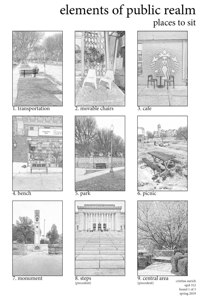
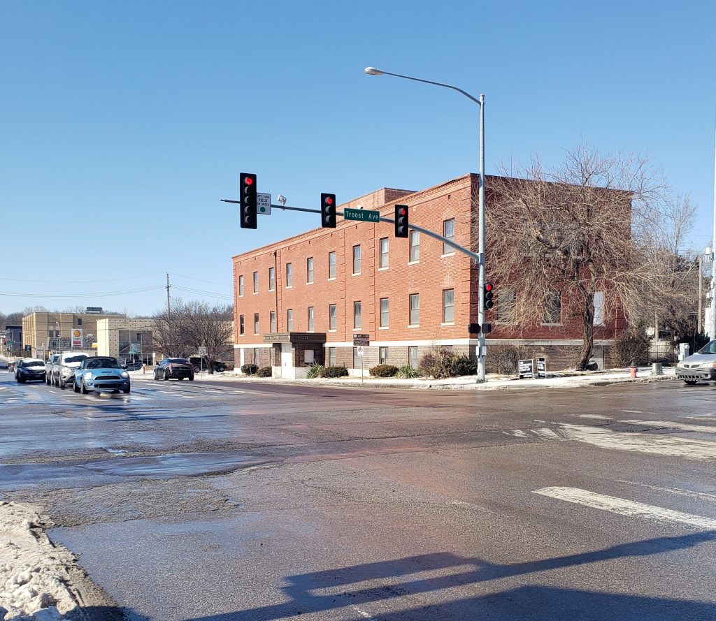
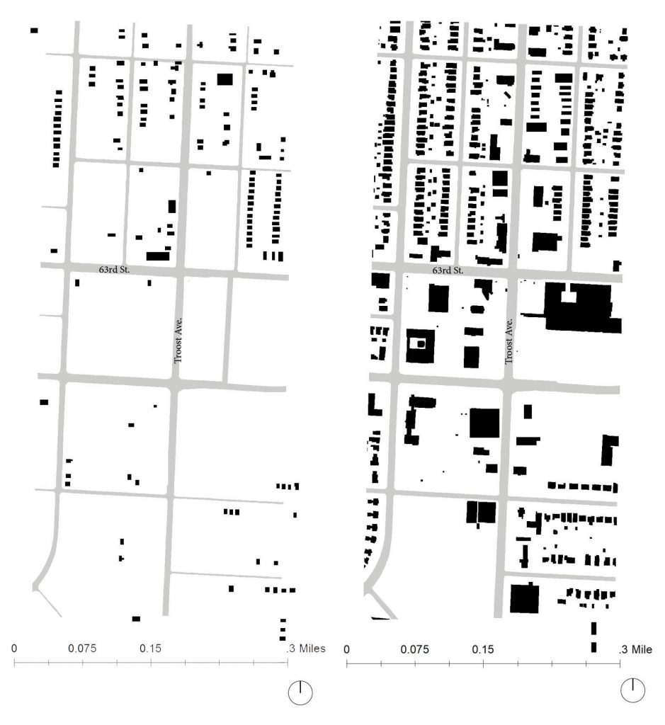
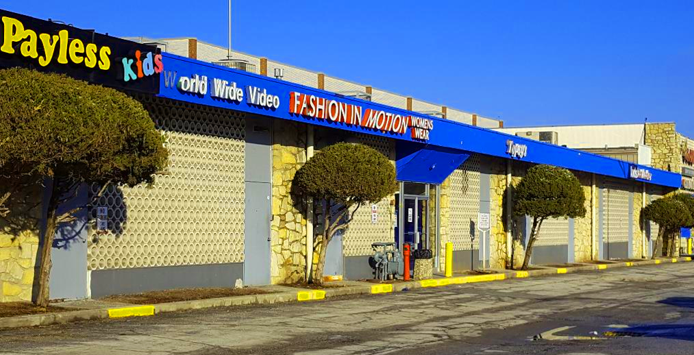
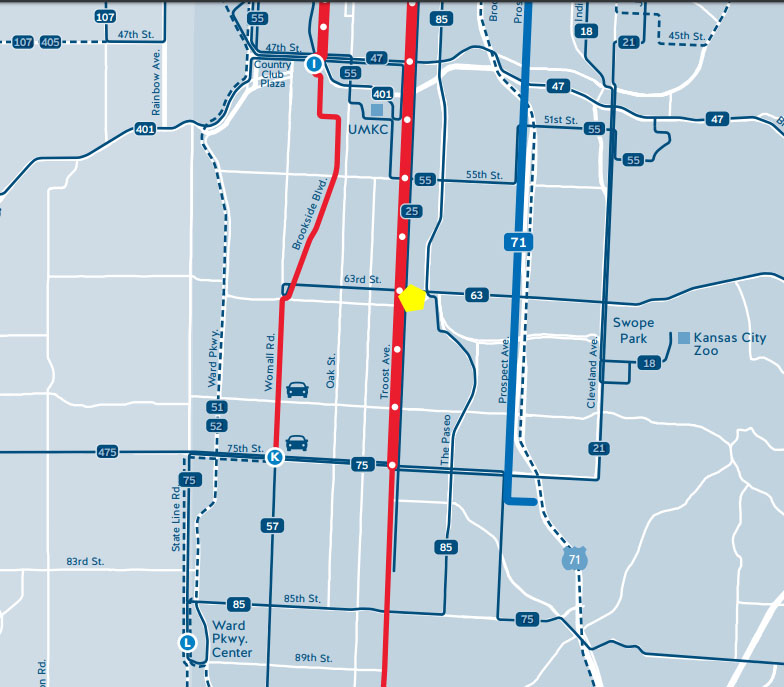
When it comes to developing The Landing Site and its immediate surroundings on 63rd and Troost, I had to reflect on my first impressions of the site back in January. When doing so I found that my thoughts concerning the site were to better incorporate the parks and boulevards aesthetic, include the youth in the area, the views out of the site and in to it, and that the topography allows for interesting design choices that are made with clear intentions.

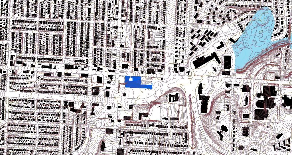
Looking back on my first impressions and the design I was already beginning to formulate, my impressions were shown in the design choices I began to make. I wanted to line both sides of Meyer with trees and had to make sure to not include any retail directly on the boulevard. When it came to addressing the youth, I got stuck because I did not want to put a playground on the site and call it good. I wanted something for all ages of youth to keep teenagers out of trouble and to stimulate young kid’s minds. In order to achieve this, I am planning on including a ton of outdoor furniture intended to be skateboarded on without putting in a skate park. For the young kids, I am planning a center that includes arts and also an open learning center with kids toys. The last two, the views into and out of the site and the topography, go hand in hand and for that, I have decided to include a balcony at the highest point on the landing site so people can see what is actually happening. I have also decided to relate to the U-Drive for the school across Meyer Boulevard by designing my buildings to mimic the U-Drive and including an open green space.

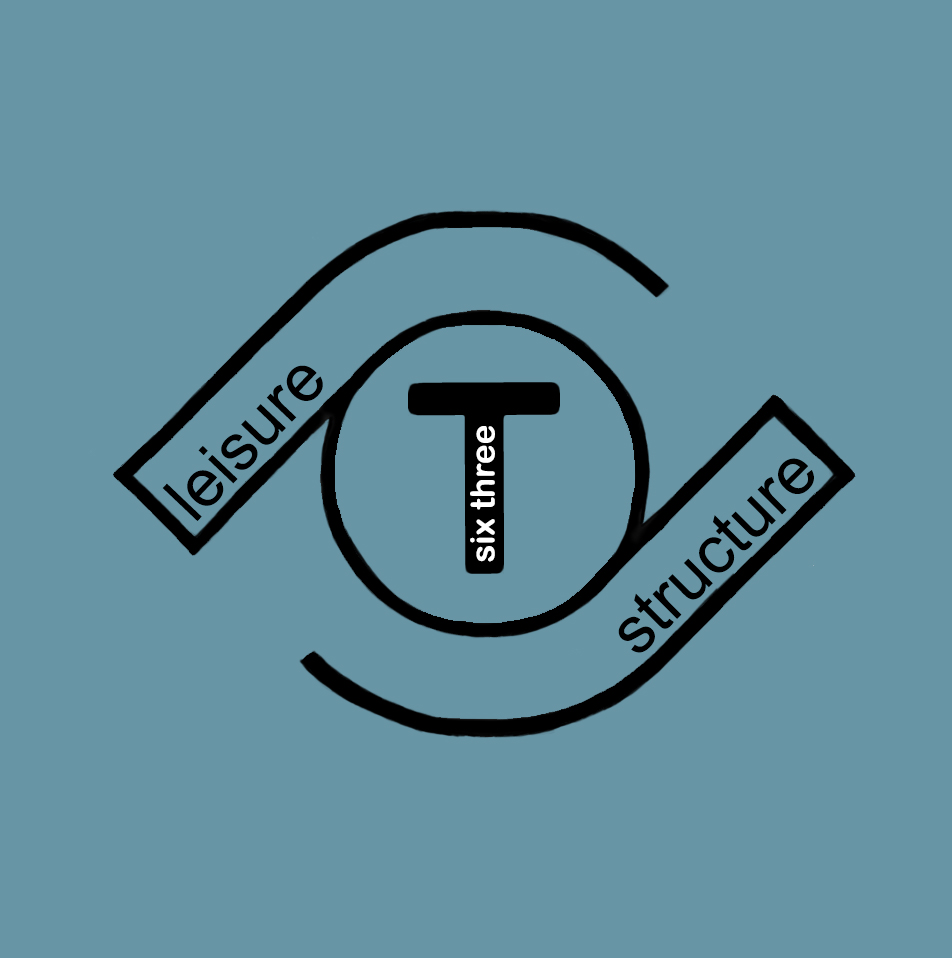
With all of that being said, I have boiled down my design to be the happy medium between structure and leisure. The leisure comes from the inclusion of youth, the open green space, the retail, and the restaurants. The structure comes from the Parks and boulevards Standards and the structure of the buildings. Therefore, I have concluded that the development will be called Six-Three T and will include the logo pictured above for branding.

take A SEAT ON 63RD Street


Walking the 63rd street corridor, there were less places to sit than I anticipated. However, the uses and types of seating did vary greatly. When thinking about where to sit I automatically think of a black iron park bench, while many are found on the 63rd street corridor, that was not the only seating I came across. The main purpose of seating, I found along the corridor, was for bus transportation. Bus stops fill street corners and are classically accompanied by seating of some type. Few bus stops have awnings, for weather protection, while others consist of a bare bench with no shelter from the environment. Picture 1, in Figure 1, shows the typical bus stop seating, found on the corridor. Movable chairs and café style seating is my personal favorite type of seating because I have endless options of where to move my chair, but this type of seating is not commonly found along the corridor. More frequent café style seating was found in the west area of our study area, in Brookside, but not on the east side of Troost Avenue.

The seating options I came across on the east side of Troost Ave were more exposed and out of scale compared to the surrounding atmosphere. Pictures 6 and 7, on figure 1, were found on the east side of Troost Avenue and directly faced vehicular traffic. Sitting in both areas made me feel vulnerable to the automobile, however, both seating options gave me a spectacular view. Picture 6 offers a pleasing view of the Convent of Christ the King and picture 7 allows me a sight of a historical monument, in one direction, and a view down the lush Meyer Boulevard, in the other direction.

Figure 1. Places to Sit Along 63rd Street Corridor created by Cristina Aurich 03/2019

Overall, after looking at the location of seating, with assessment to sidewalks, structures, and paved roads, scale plays a key role to where it is desirable to sit. Figure 2 shows the studied seating at plan view. Diagrams 3, 4, and 9 made me feel safe, and almost cozy, because of the proximity of structures, a row of parking, and coverage of vegetation. While diagram 8 allows the sitter to be more visible, there are endless options of where and how one can sit, and the view are infinite.

Figure 2. Diagrams in Plan View Corresponding to Images in Board 1 created by Cristina Aurich 03/2016

Of all the places to sit in Kansas City, Figure 3 shows my ideal places to sit. The steps of the Nelson Atkins Museum and Jacob L. Loose Park offer all the variety and views I want from public seating. Places to sit is a major element of the public realm and needs to be at the top of the list when redeveloping an area. Creating useful and enjoyable seating seems like and easy task, just throw a bench on the sidewalk every couple of blocks, when in reality, the planning behind seating really makes a difference in whether or not it serves its deliberate purpose.

Figure 3. Context Map Corresponding to Boards 1 & 2 and Views From Pictures 8 & 9 created by Cristina Aurich 03/2019

relation of business age and population

After completing a full analysis of our study area, there was much knowledge to even begin to display. Looking at the most recent Census data for our six tracts, it is seen that Troost Avenue is still a racial dividing line of Kansas City, Missouri. As our class suspected, the tracts to the west of Troost Avenue held a majority population consisting of whites while the east tracts were majority blacks. This was not the only variable dividing the west and east of Troost Avenue, but there was a stark difference in income levels, house value, vacant structures, school attendance, and even a dramatic difference in the age of the population. The differences in age groups of the west and east study tracts is something I was not expecting to see, and it can be associated with the types of businesses seen on both sides of Troost Avenue. Figures 1 and 2 show the variation of age levels in the west and east study tracts. The largest percent of population in the west study tracts lie within the age group of 25-34 years old. However, the largest percent of population in the east study tracts lie within the age group of 15-24 years old. The west study tracts have fewer children and a larger mid aged population, while the east study tracts have more children and a more equal distribution throughout the age groups.

Figure 1. Population Pyramid of East Study Tracts created by Cristina Aurich 02/2019
Figure 2. Population Pyramid of West Study Tracts created by Cristina Aurich 02/2019

The difference in age across Troost Avenue is relatable to the types of businesses in our study area. Within our six tracts, I was able to only find five child day care services, from looking at Kansas City’s active business license, and all five were located in the east study tracts. Another big finding, relating to age and businesses, were the different clothing stores. Figure 3 shows a typical clothing store that can be spotted in the west study tracts and figure 4 shows one that can be observed in the east study tracts. The west study tracts are filled with locally owned boutiques with pricey, one of a kind, high quality material clothes. Compared to clothing shops in the east study tracts, which consist of factory made, low quality material, disposable clothes. An older population generally buys for long term and a younger population buys short term.The difference in age across Troost Avenue is relatable to the types of businesses in the study area. Within our six tracts I was able to only find five child day care services, from looking at Kansas City’s active business license, and all five were located in the east study tracts. Another big finding relating to age and businesses were the different clothing stores. Figure 3 shows a typical clothing store that can be spotted in the west study tracts and figure 4 shows one that can be observed in the east study tracts. The west tracts are filled with locally owned boutiques with pricey, one of a kind, high quality material clothes. Compared to clothing shops in the east study tracts, which consist of factory made, low quality material, disposable clothes. An older population generally buys for long term and a younger population buys short term.

Shop Girls Boutique in East Brookside taken by Bryce Morgan 02/2019
Gen X Clothing Store Inside The Landing Mall taken by Cristina Aurich 02/2019

Overall, looking at all the business license within our study tracts, there were similarities in the top business types for both the west and east study tracts. Professional scientific & technical services, salon/barbershops and commercial & institutional building construction businesses were at the top of the list for businesses on each side of Troost Avenue. Overall, looking at all the business license within our study tracts there were similarities in the top business types for both the west and east study tracts. Professional scientific & technical services, salon/barbershops and commercial & institutional building construction businesses were at the top of the list for businesses on each side of Troost Avenue.

Population boost on troost

With time comes change. Looking at census data from 1990 to the most recent American Community Survey (ACS) from 2013-2017 changes in population are evident. I looked at the 6 census tracts surrounding the Landing Mall, tracts 80-83, 86, & 87. Slight transformations have occurred within the 6 tracts over the last 30 years. The Landing Mall is located in census tract 87 and has maintained its low population density over the years. Forest Hill Calvary Cemetery and Research Medical Hospital each takes up a quarter of the land on tract 87 which explain why this tract is continuously shown in the lightest blue in figures 1-4. The most dramatic changes are seen between figure 1 and figure 4.
Tracts 80 and 86 went from a deep teal to 2 shades lighter indicating lost in population density.

Figure 1. Population Density (per sauare mile) 1990 for census tracts 80-83, 86, & 87 created by Cristina Aurich 02/2019
Figure 2. Population Density (per square mile) 2000 for census tracts 80-83, 86, & 87 created by Cristina Aurich 02/2019

Figure 3. Population Density (per square mile) 2010 for census tracts 80-83, 86, & 87 created by Cristina Aurich 02/2019 2010

Figure 4. Population Density (per square mile) 2013-2017 for census tracts 80-83, 86, & 87 created by Cristina Aurich 02/2019

Table 1. Changes in Population comparison between census tracts (80-34, 86, & 87), Kansas City, and the Metropolitan area created by Cristina Aurich 02/2019

Table 1 displays the comparison in population in the 6 tracts of study, Kansas City, and the Metropolitan area. Kansas City and the Metropolitan area have been in parallel with each other and continue to grow in population. Whereas the 6 tracts of study have been steadily decreasing until recently. From 2010 to 2013-2017 Kansas City has seen almost triple the population growth, in less time, than it saw from 1990-2000. Though people have left the area of 63rd Street and Troost Avenue in the past, they are beginning to return. This is a good sign for redevelopment of the Landing Mall and future development of the surroundings.

Figure 5. Population Pyramids for census tracts 80-83, 86, & 87 created by Cristina Aurich 02/2019

Figure 5 displays the age groups of the population living in the 6 study tracts. Looking at the pyramids, the highest number of population continues to lie within the age group of 25-34. However, looking at the population pyramids from 1990 and 2000, the population continued to grow to the next class causing the pyramid to swell towards the top. The newest population pyramids from 2010 and 2013-2017 show the population spread more evenly throughout the classes. The population of those living in the class of 65+ years has been growing since 2000, which is also a trend seen through the Metropolitan area.

Simply knowing the statistics of population and age in surrounding neighborhoods can lead to better planning. This is a tool that seems to be forgotten too often when planning with the people in mind.

have you heard about 63rd?

Only less than 100 years ago the area between 62nd street – 66th street and Rockhill Road – Troost Avenue was just beginning its development. A new shopping center on the southwest corner of 63rd st and Troost Ave. was built in the late 20s as neighborhoods began to move away from the city’s core. This shopping center offered a drugstore, barber shop, and restaurants, but has since been replaced with a US Bank and empty units. It is great to see this building is still standing strong and features its original structure, but it does not feel as lively as it looked in the late 20s. Figure 1 shows the 63rd and Troost Shopping Center in 1927 compared to today in 2019 (Figure 2).

Figure 1. 63rd & Troost Shopping Center 1927 (The Pendergast Years)
Figure 2. 63rd & Troost Shopping Center 2019 taken by Cristina Aurich 02/2019

Another building that has stuck around is the Highland Telephone Exchange Building, now called the Blue Hills Building. Located on the northwest corner of 63rd st and Troost Ave. and was placed on the National Register of Historical Places in 2005. Telephone exchange buildings were build in the “heart of the area they would serve” and were necessary for connecting calls during this period. Once an important structure now sits vacant with boarded up doors and broken glass window.

Figure 3. Hiland Telephone Exchange Building 1925 (National Register of Historic Places)
Figure 4. Blue Hills Building 2019 taken by Cristina Aurich 02/2019

Since 1925, this area has greatly advanced. Blocks that were almost completely empty have been replaced with homes and retail shops. Largest changes in the area can be seen between the 1920s and the 1960s. Residential neighborhoods continue to stay north of this area and commercial structures remain more south. Looking at figure grounds from 1990 and 2019 there is little modifications. Few structures have disappeared leaving behind open land. This open land is opportunity for development and growth.

Figure 5. Figure ground maps of 1925 & 1963 created by Cristina Aurich 02/2019
Figure 6. Figure ground maps of 1990 & 2019 created by Cristina Aurich 02/2019

Impressions of the Landing

I

Then and Now

The Landing is a shopping mall that was created by J.C. Nichols and opened to the public in 1960 as an open-air public space with animal-themed play structures for children and trees throughout the central corridor.  It still exists today as a covered structure and has some operating places of business inside, although not as high-traffic as it was in its beginning days and without the play structures and greenery.

Photo courtesy of Ryan Khatam http://neat-stuff-blog.blogspot.com/2011/01/landing-mall-1960s.html

The exterior of the building exhibits materiality of stone, paint, and a circular-patterned concrete façade which seems somewhat inconsistent.  The major entrances are somewhat unclear and confusing to approach. There are, however, beautiful murals on the exterior walls that promote a strong sense of local pride.  Adjacent is its very large parking lot.  Most of the surface area of the lot is unused by cars during a typical day and completely void of trees and other greenery. Once inside the building, the space is very warm and inviting.  Large windows display several retail stores full of merchandise and ready for customers.  I feel that more clear and welcoming entrances to this fantastic interior space would greatly increase public draw to utilize it.

Exterior of The Landing, January, 2019, Shana Shanteau

Accessibility

The Landing is located between Troost and The Paseo, along 63rd Street.  Due to its proximity to these major streets, its location provides easy accessibility via car and/or bus.  Buses stop approximately every 20 minutes and connect with other lines of transportation throughout the city.  The site is surrounded by several other businesses, many which are local.  Although temperatures were below freezing during this particular day of observation, several pedestrians were observed walking on the surrounding sidewalks and using the crosswalks to cross the wide and busy streets.  Because these areas are heavily used, it seems clear that these walkways should be made more safe for pedestrians.

The space is close to many residential areas and is within excellent proximity to grocery stores.  Aldis, Thriftway, and Cosentino’s are all within one mile or less from the site.  There are also several schools nearby.

Landscape

The landscape of the area is extremely beautiful and drastic in topography.  The site sits lower that its surrounding spaces and the area just to the south is hilly and covered in large majestic trees.

In conclusion, this space has a very energetic atmosphere, great accessibility, rich history, and beautiful landscape. The Landing’s location, which is central to many businesses, schools, and churches, make it a great place to live and work.