Doing rapid analysis can yield some pretty great results. When a time constraint is given to you, not only do you work faster, but you are forced to edit down to whats important.
Our studio did 3 separate 3 hour studies of the parks and boulevards system. We looked at the system as a whole, history of many of the “knuckles”, and the planning, zoning and land use in said areas.
PUBLIC TRANSPORTATION WITHIN PARKS & BOULEVARDS
Data Gathering
In order to study the relationship of public transportation and the parks and boulevards system in Kansas City, reliable data must be gathered and properly joined. The shape boundaries were taken from the 2010 Census Tract Boundary. The data fields that were used came from Social Explorer and included information from the 2008-2012 American Census Survey. Using commands in ArcGIS, the ACS data was joined to the Tract Boundary shape file and a data dictionary was used to rename specific fields.
The study boundaries for this analysis are from the Missouri River in the north, to the Blue River to the east, to 79th Street in the south, and State Line to the west. The New Park shape file and the ROW shape file were taken from the Parks and Recreation department from Kansas City, Missouri.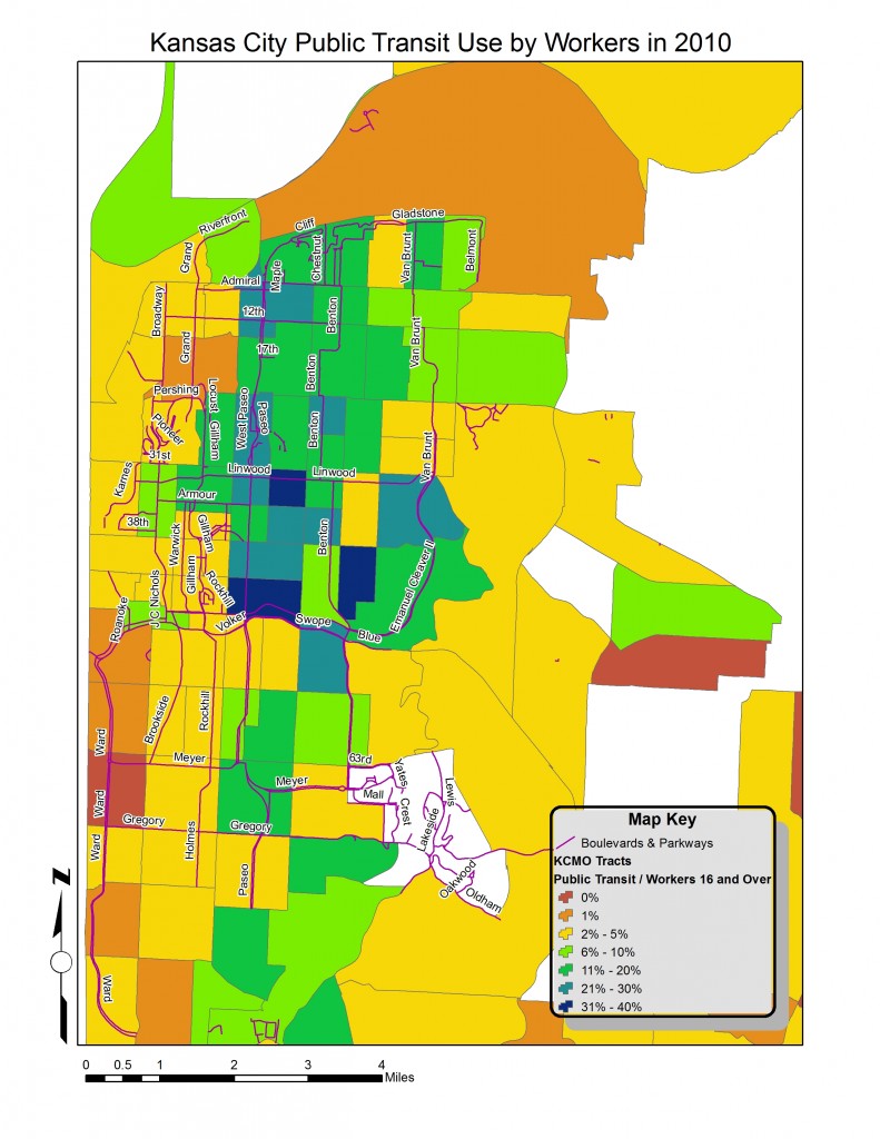
Process and Mapping
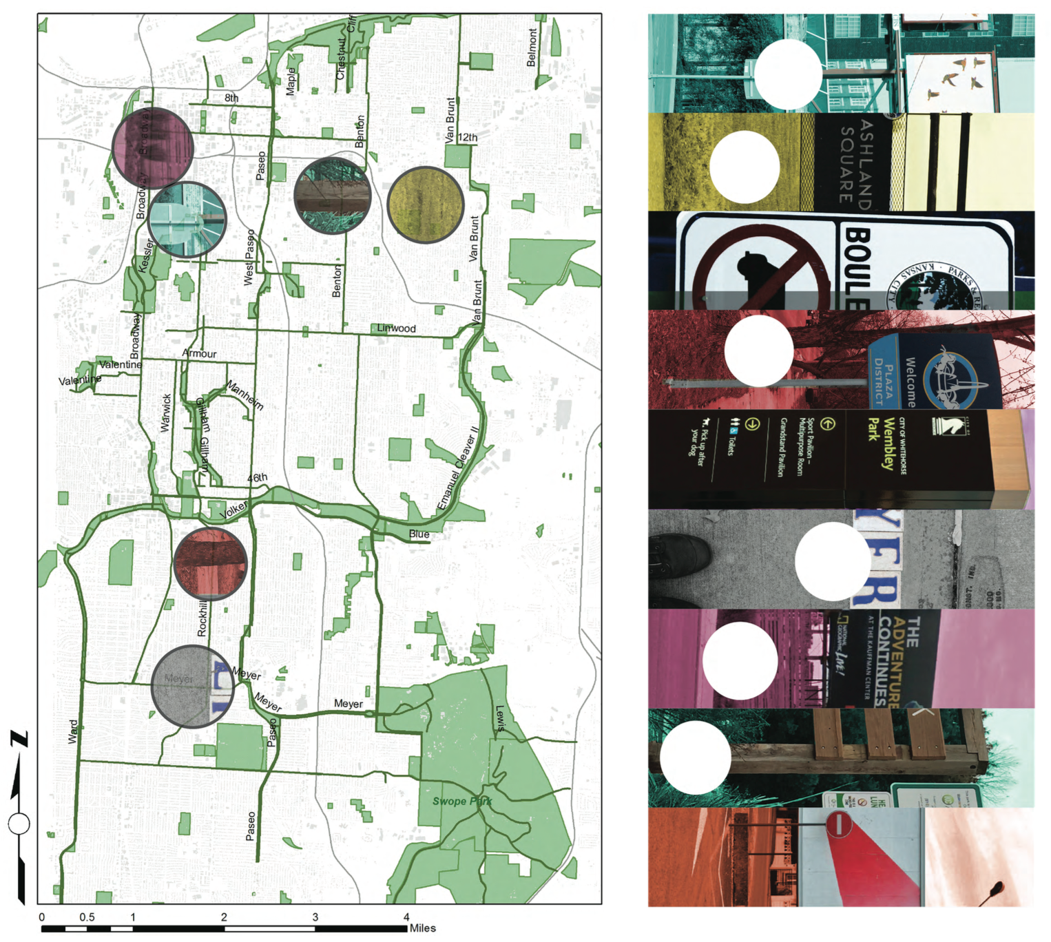
By using symbology, several things were able to be visually represented within the boundaries. The first thing that was vital to the map was a visual description of where people that use public transportation are. This was done by normalizing the (amount of workers who use) public transport data by the overall amount of workers. Another tool that was used were the shapefiles that show were the ROW parks and new parks are located.
By using symbology techniques, the ROW width was calculated by using a calculation of the area divided by the length of the polygon, the result was the width of the actual ROW. I then presented these sizes in an exaggerated rectangular green shape. The New park data was illustrated by showing the area of each park normalized by the total size of all the new parks. These were shown with blue circles whose size reflects the park size compared to the overall parks.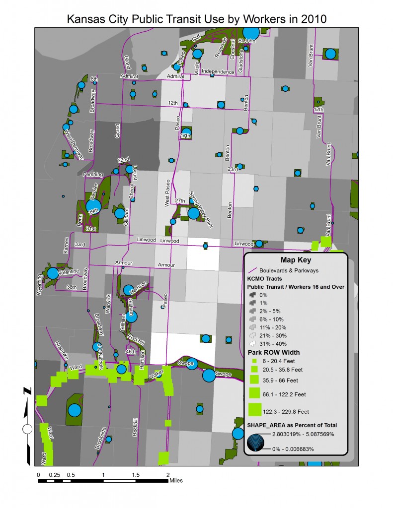
Analysis
There are several patterns that emerge when studying the maps that were created for this analysis. The first is that the majority of public transportation activity is located east of Troost and north of Emanuel Cleaver II/ Volker Parkway. There are census tracts that have 30% – 40% of its workers using public transportation to get to work. For all of Kansas City, MO there is a MEAN AVERAGE OF 6% that use public transportation, A MEDIAN OF 3%, and a STANDARD DEVIATION OF 8%. The AVERAGE WIDTH FOR THE PARK RIGHT OF WAY WIDTH WAS 42 FEET.
ROW’s tend to be in areas where there is low public transportation. When looking at the relationship between the amount of park space and ROW to the use of public transit, it can be seen that the areas using public transit the most, lack the most availability to the parks and boulevards system.
Design Strategies
History
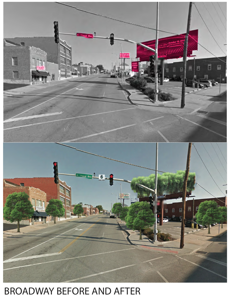
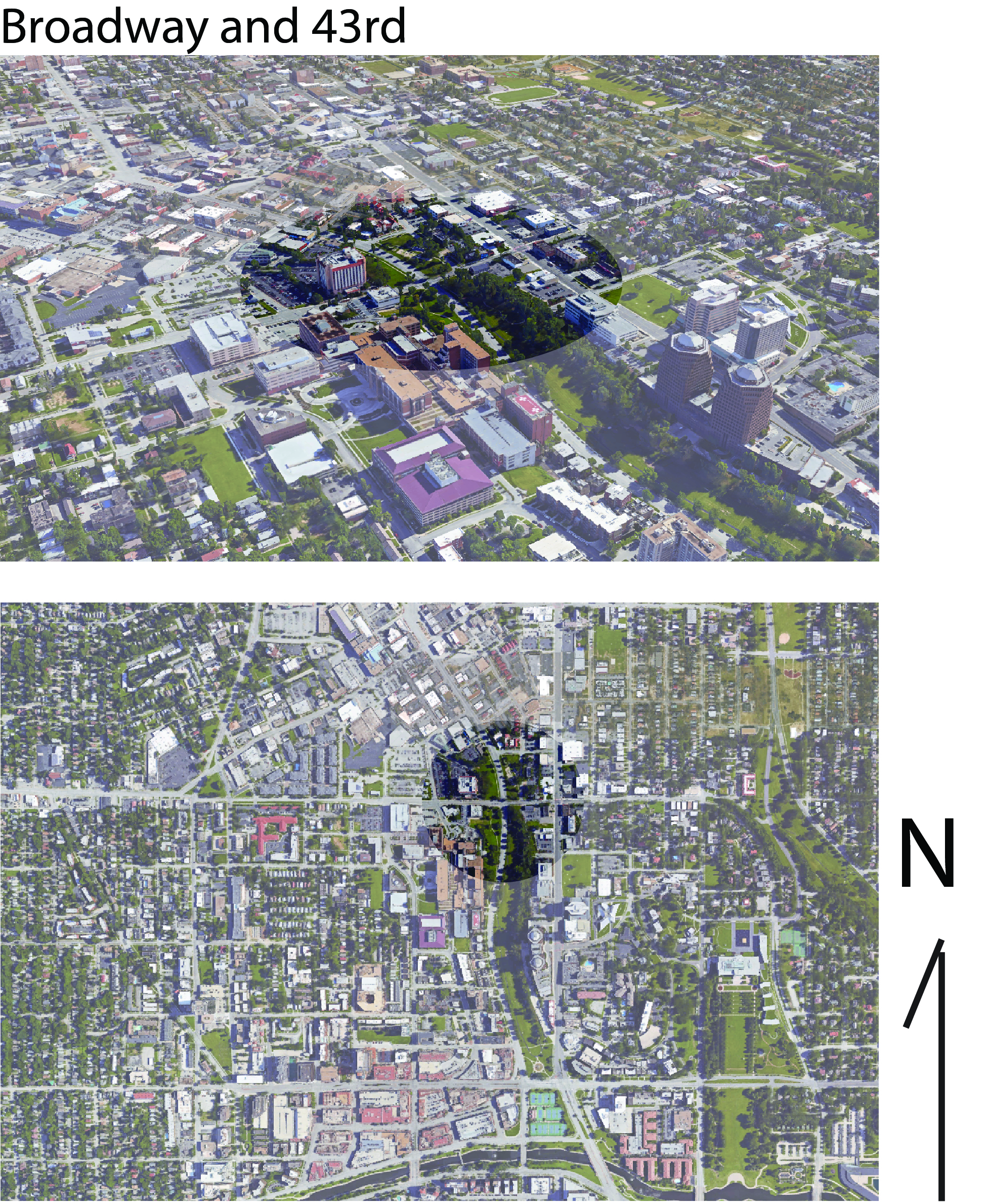
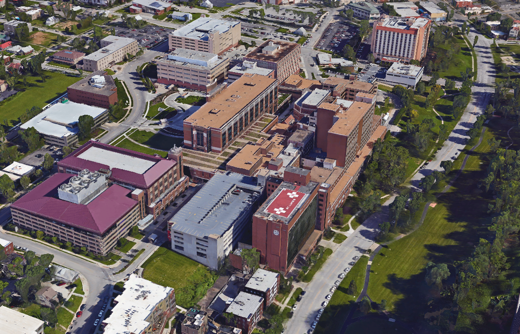
There are several noticeable changes that have happened at the intersection of Mill Creek/Broadway/ JC Nichols and 43rd street. The area in the parks and boulevard system is near the plaza and Westport. Up until the 1990s there was a railway bridge Westport area.
Changes
There is a vast change in several things besides the lack of a railroad. The street grid is completely altered. St. Luke’s hospital has changed the transit ways around the intersection and there is an almost completely different building foot print as well.
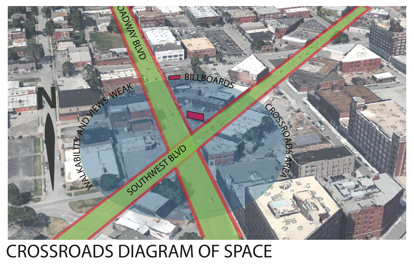
Land Use
The Midtown and Plaza Area have a very complex mix of land use. There are large areas of residential neighborhoods surrounding a mix of commercial businesses and institutional areas. The “knuckle” of Broadway Blvd/ JC Nichols and 43rd street represents this mix of land use that is characteristic of the general area. St. Luke’s represents a large institution and the location is also where the two commercial sectors of the Plaza and Westport collide. Running through all of this is Mill Creek park — the large green space that serves the many neighborhoods in the surrounding.
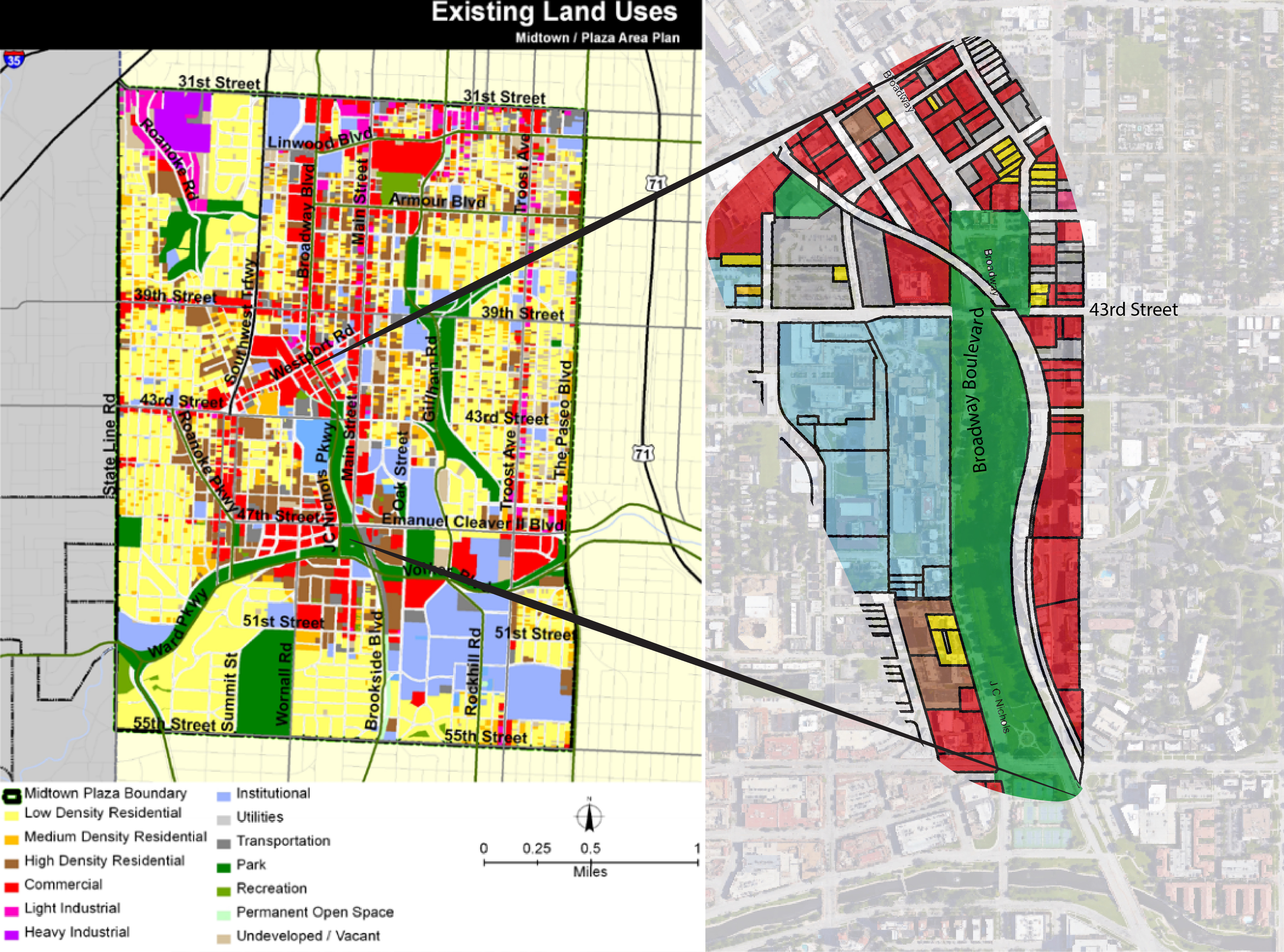
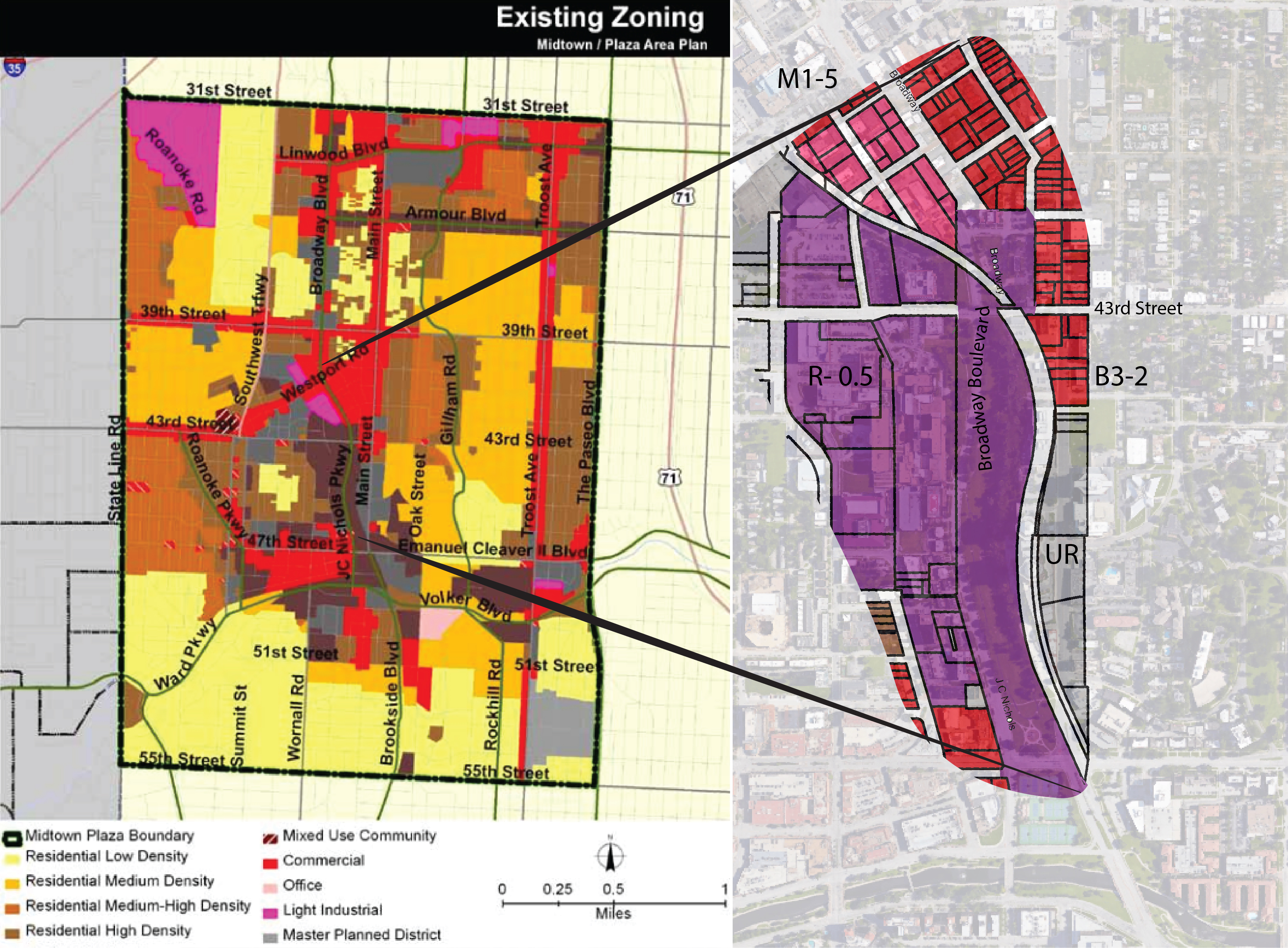
Zoning
The area has several zoning uses that are representative of the mix of zoning that is in the overall area. To the west of Broadway there is a large span of Urban Residential zoned land. To the east there is a Urban Redevelopment zoned area that spans along Main Street. To the north east of the intersection there is a commercially zoned area. As Broadway curves to the North West the zoning along the west side of the street is light industrial.
Other Plans and Land Use Conflicts
Resources
Data was gathered from several sources including Google Maps, Google Earth, Midtown/ Plaza Area Plan by the planning department of Kansas City MO The Nelson Atkins Museum of Art Cultural District Plan, and The Southmoreland Area Plan