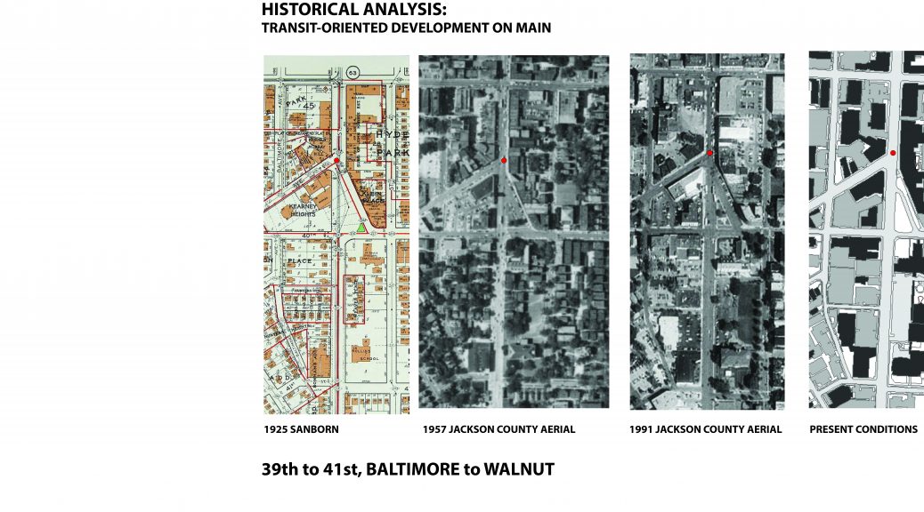
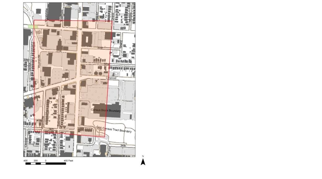
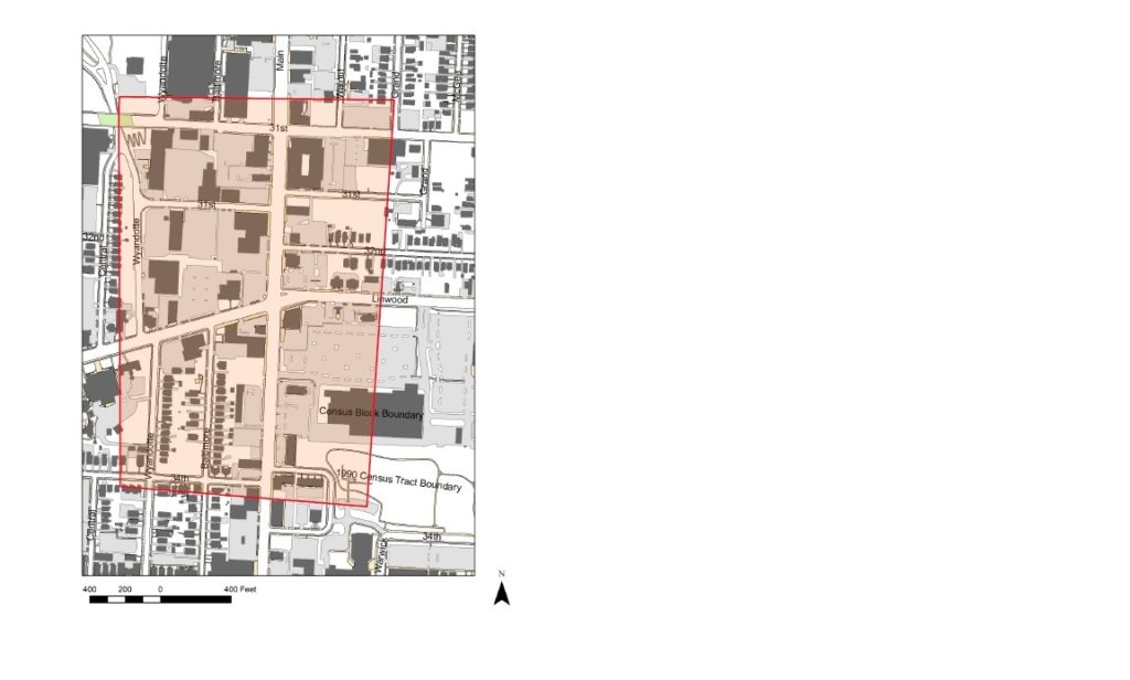
Historical analysis of sections of the Main Street corridor (39th to 41st, from Walnut to Baltimore)
Four maps, a 1925 Sanborn, 1957 and 1991 Jackson County aerials, and a modern GIS layer of present conditions, give insight into the changing dimensions of the corridor throughout time. A common scale of each map allows one to readily see the spatial changes of the built environment.
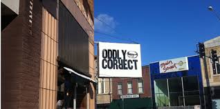
The intersection of Westport Road and Main provides an interesting analytical starting point. At this node, the built environment stayed largely intact between 1925 and 1951. The structures immediately on the corner of Westport Road and Main, now housing the Oddly Correct coffee shop, are intact from 1925.
According to the 1940 tax assessment photos, the building housed Foster’s Shoe Store, seen below.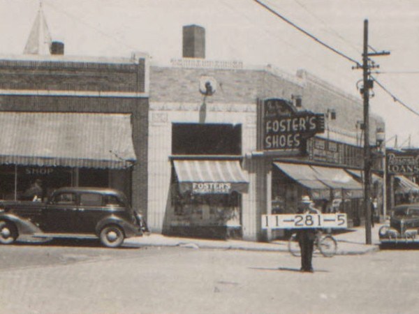
Another significant significant building at this intersection was the Hyde Park Christian Church, seen below in 1940.
.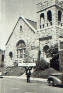
This structure was constructed in 1905, yet was demolished in the late 1950s. The church’s activity relocated to 3801 Wyandotte. A structure of a similar footprint is evident from the 1957 Jackson County aerial. However, since the building’s destruction, no new structures have been erected in its place.
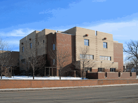
Furthermore, this stretch of the Main Street corridor is noted for other prominent demolitions. Throughout time, commercial structures that lined Main approaching 39th street have been destroyed to accommodate car-oriented uses (such as the CVS and surface parking lot at the southwest corner of Main and 39th street). Additionally, in the earlier 20th century, there was significantly more housing directly on or adjacent to Main Street. According to the 1925 Sanborn, a development known as “Weaver Place” contained 5 3-story apartment buildings. These appear to have been of the 6-plex brick typology commonly seen throughout Kansas City. Across the street, 12 2-story apartment structures lined 40th Street Way. These structures are evident in the 1957 Jackson County aerial, yet were demolished before the 1991 aerial. Presently, 40th Street Way is a one-way street with relatively little activity. Commercial uses and surface parking flank the formerly residential district on the north and south sides. Weaver Place appears to have been destroyed as St. Paul’s Episcopal Church expanded its institutional footprint in ensuing decades. This expansion included destroying the Rollins School, originally constructed in 1904.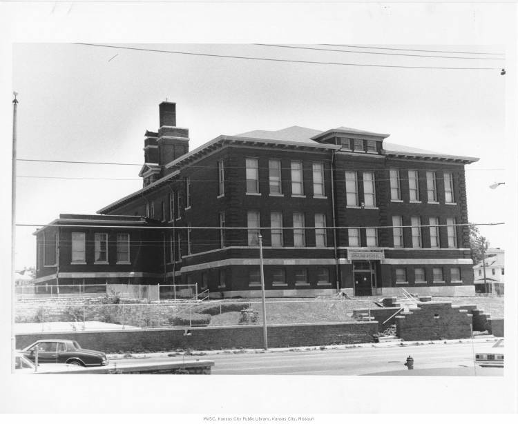
St. Paul’s Episcopal Day School erected a new structure on the site of the former Rollins building.
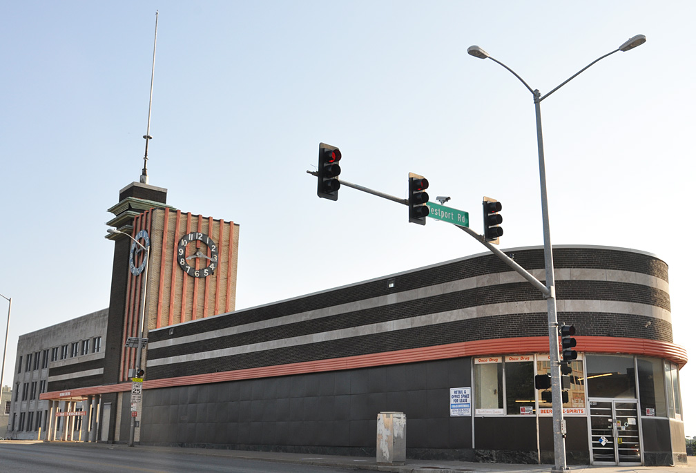
Another culturally significant change along the corridor involves the iconic Katz Drug Store at the corner of Westport Road and Main. Seen below in 1940, Katz’s personifies an Art Deco charm.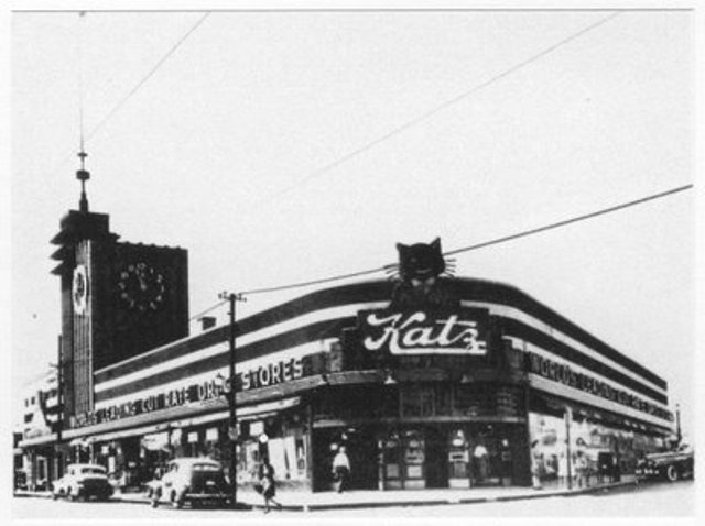
An Osco pharmacy most recently inhabited this structure. The structure has been largely vacant since 2006, however. Recently, art pop-ups have given new life to the vacant building.
Undeniably, this stretch of Main has experienced significant change throughout the decades. The preservation and adaptive reuse of the buildings that survived, however, has contributed to the charms of this Midtown area.
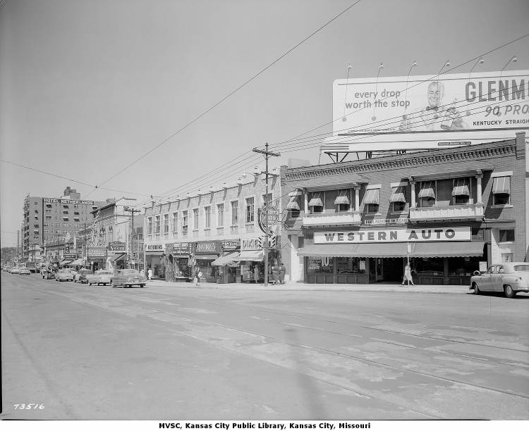
Main Street in 1952, below:
Similar extent more recently: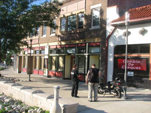
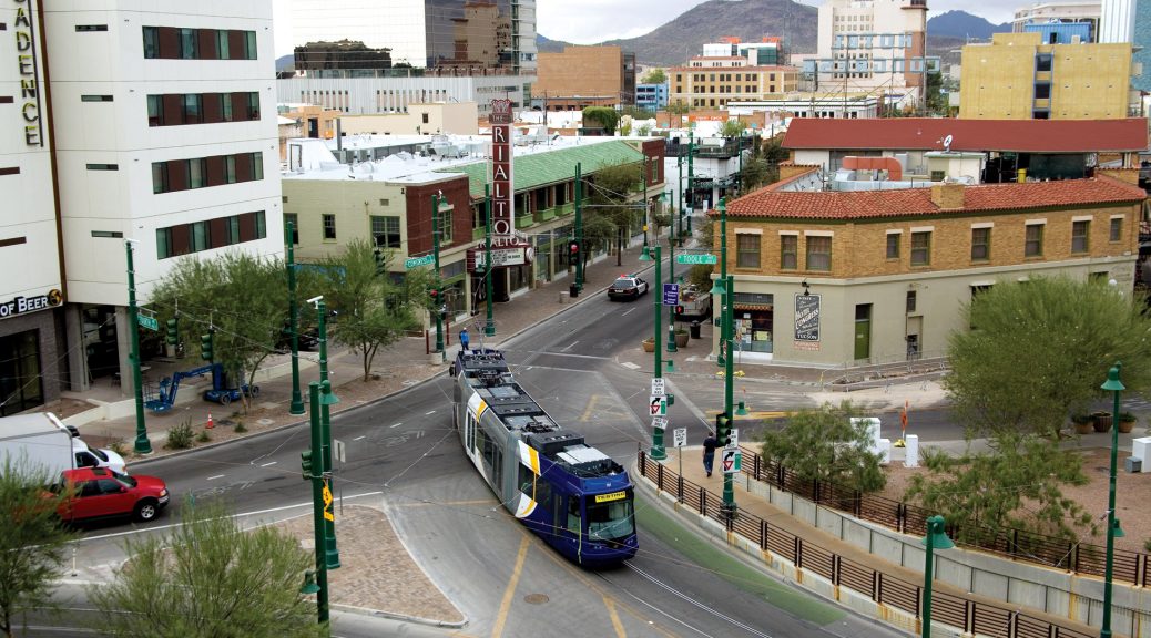
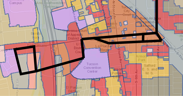
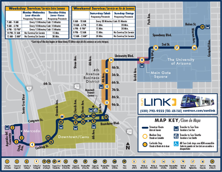
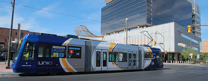 The Sun Link Streetcar system opened in July 25th 2014. It has 23 Stations (17 per direction) with daily ridership around 4,000 (Arizona Daily Star). The length of the line is 3.9 miles, servicing the University of Arizona, Downtown and Mercado. The estimate from the city was 3,600 weekday riders, it exceeded expectations.