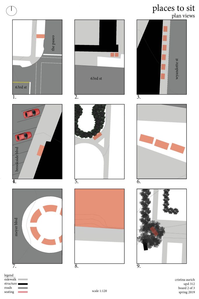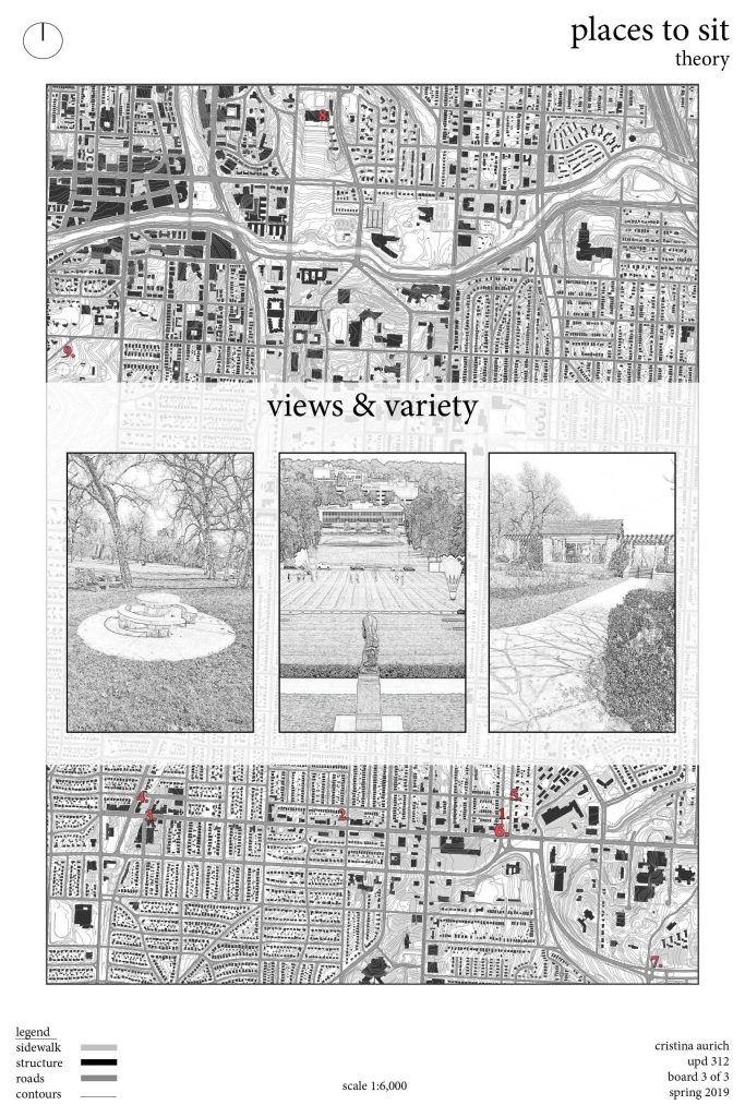
Category Archives: Elements

Elements of the Public Realm: Parking Garages

I looked at parking garages and how they interacted with the public realm within the Valentine neighborhood and Midtown. There were many examples of very bad or ugly forms and few examples of what I would consider good form. Let’s define my criteria, first if a parking garage is a stand-alone structure (meaning it doesn’t fill the same space as the structure it services) it is automatically bad form in my book. This is really the only criteria because the land use is the first most important piece in urban planning and city design. A stand-alone parking garage means that space is only ever used for parking, when it could be used for housing, commercial, and anything else. As long as we rely primarily on cars as our mode of transportation we are going to need garages, but they should interact with the public realm positively, or more likely, as little as possible. I think the Congress Lofts built in parking garage plays this role nicely as it has minimal public realm interaction and is integrated into the same structure its servicing.

3D Valentine Model

For my elements of the public realm assignment, I did not have an element. Rather, I was assigned to create a 3D model of the neighborhood.

Through viewing the model, it is far easier to understand the area’s form and contours. As you can see, the elevations are not very dramatic, and Valentine is a pretty flat area, with the exception of the dramatic incline in the center-left portion of the model.

Contours relates most to Ian McHarg’s theories in “Design with Nature” about beginning new city designs with what is already there, and to not disturb the natural benefits to what was given to a site. Often, developers may disturb the land so much that its original contours are not recognizable, and that damages nearby ecosystems (soil erosion, water cycle disruption).

This model could be used as language in community engagement, to show how disruptive KCLife’s 71′ plan has been for north Valentine; the lack of buildings are represented better in this model than they are in a figure ground.

Elements of the Public Realm: Lighting

Lighting is necessary to visually experience and interpret our surroundings. Consideration must be given to the position of the sun to plan for lighting needs at all times of day.

Lighting elements should be contribute to a well-developed streetscape, even during daytime. Ornate lighting, like the above photo from Chesterfield, can establish a sense of place. An appearance resembling historic lighting poles and genuinely historic lighting helps pedestrians be immersed in the composite of the many elements of the public realm.

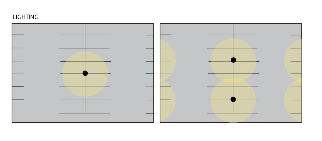
The Valentine neighborhood lacks historic lighting, with pole-mounted LED cobra lights being the most common lighting used for streets and sidewalks. These lights are directly over streets, leaving them better lit than adjacent sidewalks.

Existing Lighting in North Valentine, as depicted in the above map, is concentrated on the north side of blocks. This is likely due to the north side of structures in the Northern Hemisphere always being in shadow, requiring more light in lieu of sunlight.

The orientation of the remaining structures to face east or west provides ample natural lighting from the sun to the south, east, and west sides of the structure east.

As the sun’s position moves throughout the year, the north side of structures may be cast in longer shadows that stretch the span of the street. Ample lighting is needed on the north side of structures to establish a comfortable environment, comparable to the south facing side of the structure. The south facing side is appealing to pedestrians for the warmth, increased visibility, and intention is design given to south facing sides of a structure.

On Waverly Way

Source: Valentine Figure Ground – Spencer Norman

Waverly Way, the original name of 34th Terrace, once had a both face blocks composed of six-plexes and single family homes. It is now lined by parking lots with distant structures. The series of pictures below depict a row of six-plexes that were on the south side of the street, as documented in the 1940 Tax Assessors photos.

Source: KC 1940 District 11 Block 56 https://kc1940.org/district-no-11-map-kansas-city-jackson-county-missouri/tax-assessment-block-folder-kansas-city-mo-district-11-block-56

The consolidation of parcels has permitted development with a larger form than previously allowed by right. The block to the north and the block to the south of 34th Terrace were once composed of 37 separate parcels in total, being consolidated to just 8 parcels now. Three institutions on these 8 parcels dedicate more land area to surface lot parking than their building footprint.

Public institutions and private agencies have each expanded the area of land they own in the Valentine neighborhood, turning residential streets into under developed or completely undeveloped land. The rehabilitation of the remaining structures, which are now nearing 100 years old, would likely have exceedingly high costs to complete as well.

Source: Missouri Valley Special Collections https://kchistory.org/image/kansas-city-life-insurance-building-complex-0

North Loop Blog: Elements of the Public Realm

Board 1 of 2.
Board 2 of 2.
Photo of site detailing safety fence along the Riverfront Heritage Trail preventing people from falling off the bluff’s edge at the old 4th Street Viaduct bridge terminus near 4th & Beardsley. Coordinates: 39°6’30.4″N, 94°35’27.1″W.
Photo of screen wall obscuring an electrical substation on private property owned by Evergy near the Town of Kansas Bridge on 2nd & Main. Coordinates: 39°6’40.6″N, 94°35’1.6″W.
Photo taken from 3rd & Main of planter-bollards. They, along with the brick planters with trees in them to the right serving as seating, constrict the flow of pedestrian traffic entering and leaving this pedestrianized section of Main Street abutting City Market to the immediate left. Coordinates: 39°6’35.5″N, 94°35’0.7″W.
Photo taken at Main & Missouri of a poured concrete retaining wall separating the one-way portion of Independence Avenue between Oak and 5th & Broadway from the original street grid (as well as the original topography). The wall highlights the sheer amount of earth-moving required to ensure a semblance of adequate automobile circulation around the North Loop (let alone for the North Loop itself). The severely unactivated frontage of 529 Main across the street and the underutilized realm around the building and retaining wall create near-perfect conditions for a homeless encampment like the one obscured by overgrowth in the foreground to emerge in the intervening nooks and crannies of public space. Coordinates: 39°6’28.2″N, 94°34’58.8″W.
Photo taken at Pacific & Forest of a noise barrier separating the east-southeast portion of the Columbus Park neighborhood from Interstate 29/35. While barriers such as this one may indeed spare the neighborhood from the highway’s noise pollution, it arguably ham-fistedly legitimizes the presence of the adjacent highway by making the implicit concession that the highway indeed yield harmful health effects, but in consolation for state and federal authorities making the value judgment that its perceived economic benefits outweigh its costs to one’s physiological health, the residents are effectively being told to simply forget about it behind the wall. 1958-vintage Sanborn maps and aerial photographs taken by the U.S. Department of Agriculture in 1963 show that a pedestrian bridge used to cross the interstate from Columbus Park to the Chouteau Courts housing project that once existed along Independence Avenue to the south. Coordinates: 39°6’31.9″N, 94°34’4.9″W.
Photo taken at the pedestrian plaza nestled between 5th and Independence along Delaware St. This staircase railing is both wall and fence, and separates the brick alley in the public right-of-way to the left from the private plaza, facing Delaware in the bottom right, which is on the property of 510 Delaware. Although located in nominally private space, these elements of the public realm exist where they are in order to encourage public presence and use. Coordinates: 39°6’27.6″N, 94°35’4.2″W.
Head-on view of the same above pedestrian plaza taken from Delaware, facing west-southwest. Another double-duty planter-bollard is seen here in the foreground, while seating, shade trees, and brick pavers are used in the middleground to inculcate an inviting feeling to pedestrians, whether tenants of the loft apartments in the left of the image or not. If not for the break in the iron railing created by the staircase scaling up the sides of the wall to meet the alley in the background, one might forget the alley is itself public space. Coordinates: 39°6’27.8″N, 94°35’3.1″W.

Sidewalks: North Loop Elements

The sidewalks in the River Market area need help. River Merket is a distinct district that has a completely different feel then the rest of the city. River Market is characterized by its early 1900’s architecture, narrow streets and most importantly its brick sidewalks.

The sidewalks in River Market are important for a number of reasons. They add to the urban design ascetic of the area, they are nice to walk on and they help visitors distinguish between the districts they are walking in.

The issue is how different sidewalks materials clash in river market. There is new concreate in between plots of brick sidewalks that breaks up the feel of the area. There are also a number of older brick sidewalks that were placed horizontally while the newer sidewalks are placed vertically. This clash creates a riff in the character of the city.

My proposal is to add a gradient in the materials used. When transitioning between brick and concreate or between bricks placed at different angles, add a gentle transition between the materials. This shows that some level of care was put it to maintain the ascetic of the district and is not as harsh on the eye.

The examples of my proposed interventions above are inspired by what theme parks such as Disney World and Universal Studios do to transition between their various themed lands. It creates a more thoughtful transition between spaces and materials.

Critics may ask “why not just replaces all of the sidewalks with the same brick?” There are a few reasons for this. The majority of the brick on these sidewalks are in great condition, aside from a few spots that need some repair. There are also curb cuts that allow for accessibility, these are not possible to create with brick and need concrete to be safe. Lastly replacing all the brick is not a sustainable option. It is extremely wasteful and not cost effective. The “greenest” solution is using as much of the existing materials as possible and that is what this solution provides.

Sidewalks may not seem like an important aspect of the urban experience but the material we walk on and the look of it provides subconscious ques that we are in a different area. By making a few simple changes we can help to preserve the historic character of River Market and create an even better experience for visitors of this district.

Elements of the Public Realm

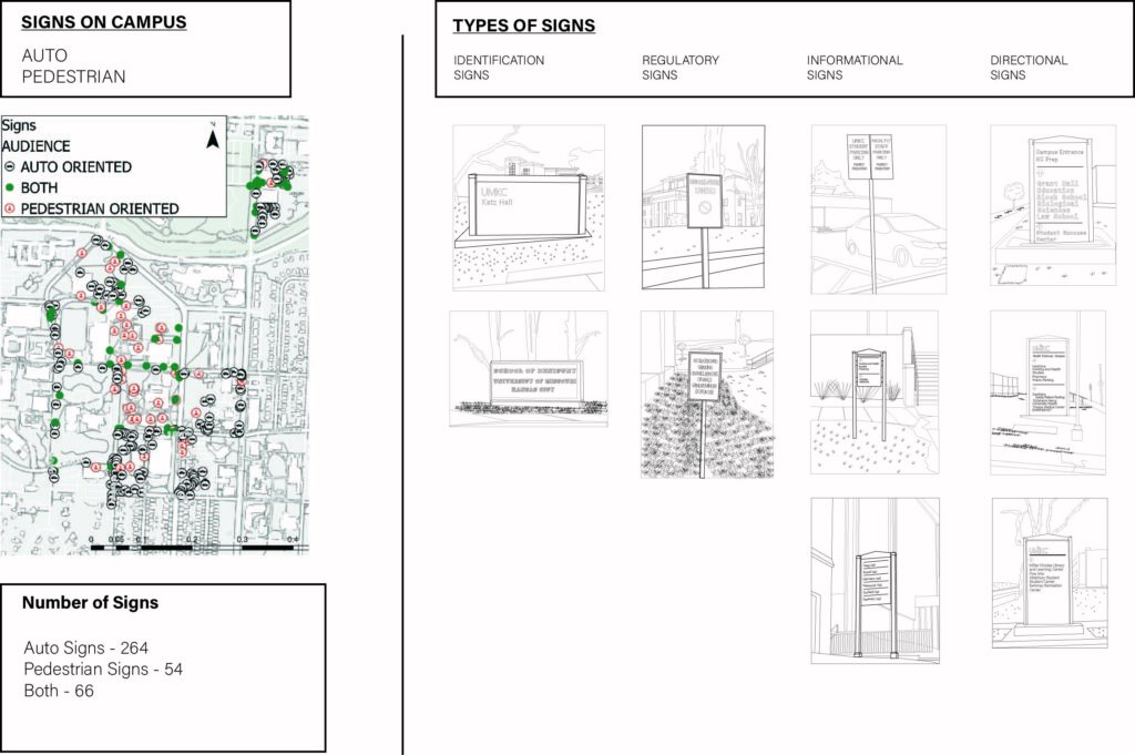
Figure 1. Number and Categories of Signs

Signs are apart of our daily lives more than we realize. We interact with them because they are used to tell us important information such as traffic speeds, parking information, directions, and the various hazards in the environment. On University of Missouri – Kansas City Volker Campus, we have a total of nearly 400 signs. Signs on campus are mostly dedicated for wayfinding, and their are four different types of wayfinding signs.

Types of Wayfinding Signs

  • Identification – They are used to tell an person that they have arrived at their destination (Examples from above: School of Dentistry, Katz Hall
  • Directional – These are often used at junction area to guide people do their destinations. (Examples from above: 50th St. and Troost Ave, Charlotte St and 24th Terrace, Rockhill Rd)
  • Information – These are used to display broad useful information about a facility. (Examples from above: (Pedestrian signs, parking signs)
  • Regulatory – These set specific boundaries for a facility. (Examples from above: (No smoking, no skateboarding)
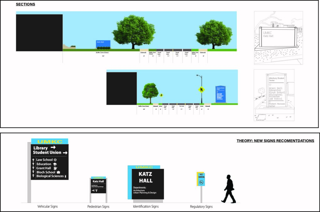
Figure 2. New Sign Recommendations

Even though we use signs regularly, UMKC falls short on using signs to more effectively communicate with visitors and students especially those who may not be as familiar with campus and those who require special accommodations. As examples, I have chosen a identification and directional sign located on campus. The first street sections shows how are current identification signs are displayed, and we have blue signs that have the name of the hall written in white located in the top corner. The second sections shows are directional signs which are tall blue signs that display names of halls with arrows pointing in their general directional, and more important facilities on top in a slightly increased font size with arrows pointing in their general direction.

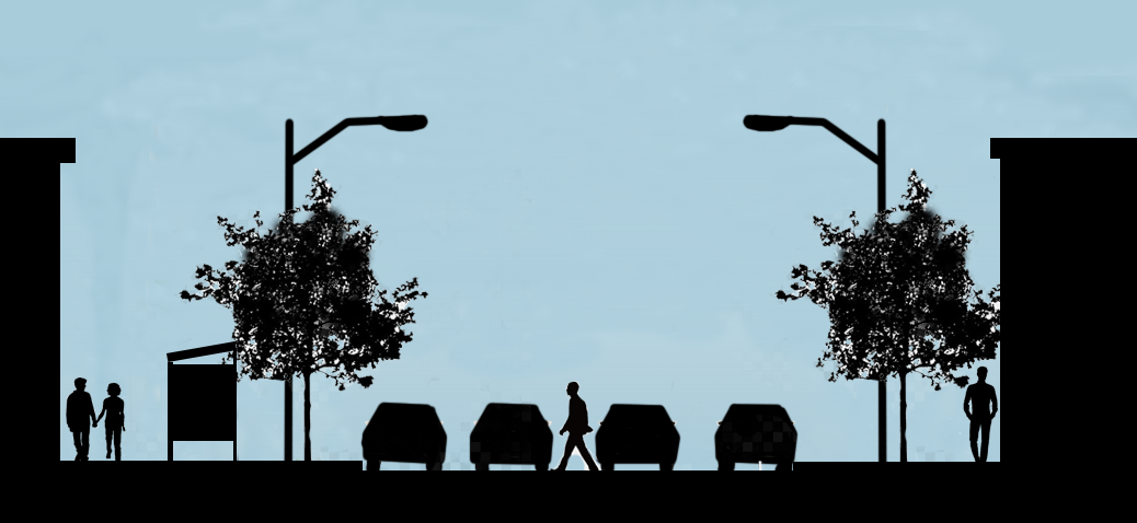
I have laid out four new signs that can be used to replace the signs that exist on campus. The directional signs which are primarily used for vehicles should have symbols that have identity the use of the building, and the top of the sign should lead visitors and students to the most utilized buildings on campus such as the library or student union. Pedestrian signs are information signs that inform pedestrians of what the particular building has inside such as various departments, and we should be aware of the types of amenities located within such as bathrooms, and elevators. Our identification signs should serve the same purpose by informing drivers and pedestrians of the departments located within, and possibly including an international symbol for those fields. Finally, I think our regulatory signs should be replicate the schools spirit, and any visitor or student should be able to recognize these signs instead of being apart of the background.
What makes an effective crosswalk?

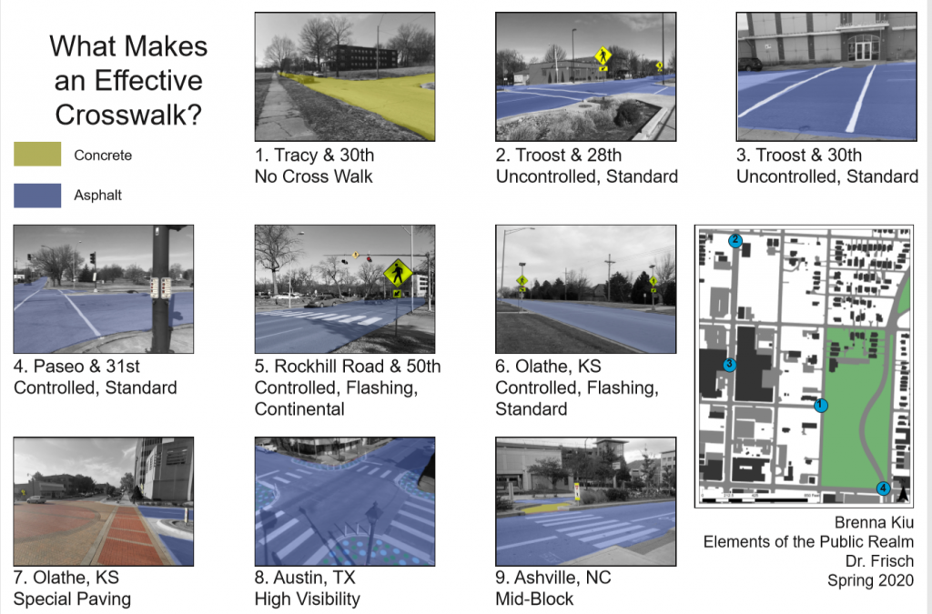
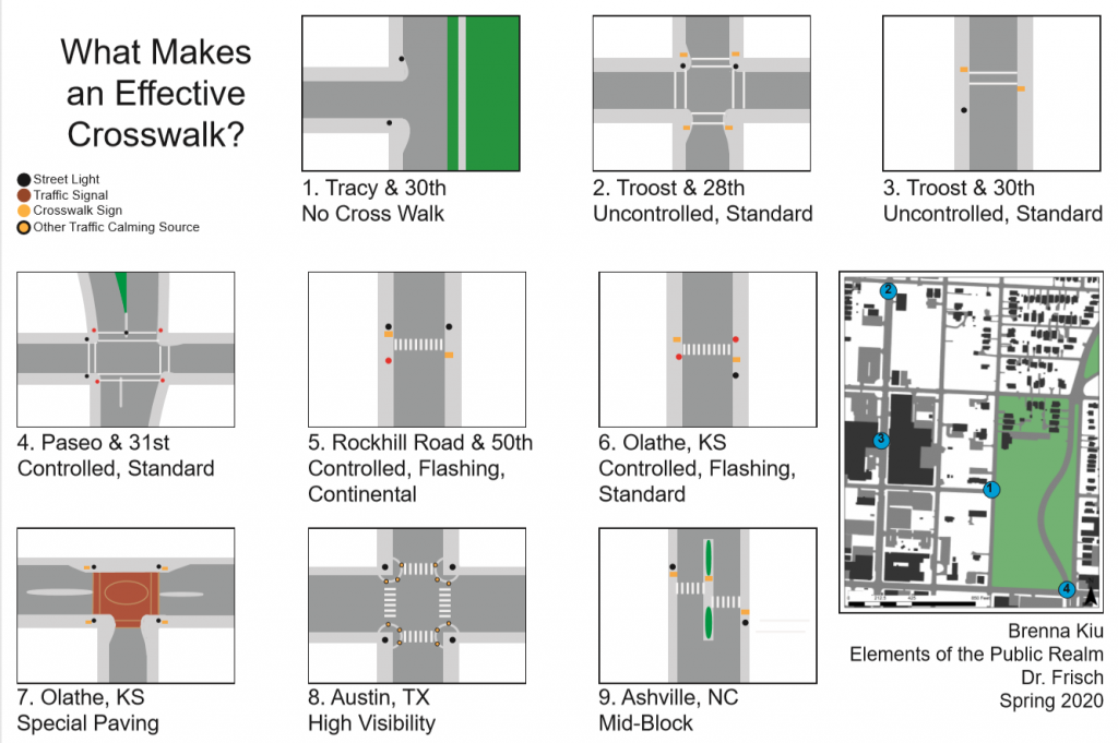
There are several different types of crosswalks which all have different psychological effects on both the pedestrian and the driver. It is my belief that the most effective crosswalks are the ones which change the monotony of driving. Many crosswalks are uncontrolled in our study area, meaning there are no traffic lights which signal to a driver that there is a pedestrian crossing. Streets like Troost and Paseo are difficult to cross and there are few, if any, crosswalks which lead to the park.

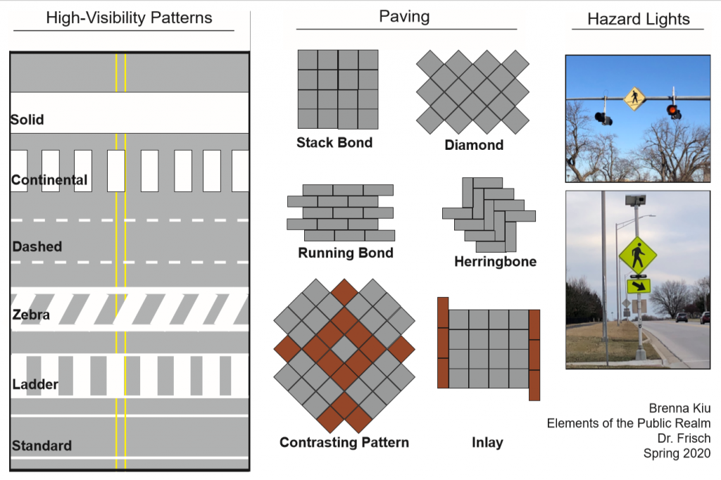
In the above image we can see the different kinds of features around a crosswalk. Some have flashing hazard lights, some are lit by streetlights in order to make the pedestrian visible during evening hours. Others are simply striped with a pedestrian crossing sign.

I believe the striping patterns are effective at telling pedestrians where to cross, but they are not great at getting drivers to slow down. Drivers are too accustomed to seeing striping on the roads, so it gives no sign that there could be anything special happening at a given intersection. Paving, however, does signal to the driver that this intersection is special. A change in paving gives the driver a change in mindset. Something different about the surface they are driving on lets them know that this is not just a street. Hazard lights can act in the same way. The lights on Rockhill Road are constantly flashing 24/7. Therefore, they cease to mean anything; they give no information to a driver. They flash whether or not there is a pedestrian crossing. However, the hazard lights in Olathe along Ridgeview Road flashing only if there are pedestrians crossing at that time. These lights provide new information to drivers which tells them to slow down.

Parking in the Public Realm

In Kansas City, there seems to be a wide variety of choices when it comes to where to park your car; however, not all parking is created equal. When observing the different types of parking around our study area and the KC Metro, one question came to mind: what makes good parking?

The photos above demonstrate qualities that make up good parking. The implementation of curb extensions or bump-outs create buffers between the roadway and pedestrians traveling on the sidewalks. These bump-outs provide protection for those on the sidewalk in the event a driver loses control of their car and drives over the curb. Bump-outs help to make roads more narrow, ideally making drivers more aware of their surroundings and pedestrians that may be walking nearby.

The middle photo shows a parking-protected sidewalk for pedestrians traveling to and from the Sunfresh grocery store located in the Linwood Shopping Center at Linwood Blvd. and Prospect in Kansas City. This protected sidewalk allows those traveling by foot from nearby transit stops to walk through the parking lot without fearing their safety by the potential of erratic drivers in the wide-open parking lot.
The photo on the right features planters with street trees that not only create shade for parked cars and pedestrians on the sidewalk, but also provide protection for those on the sidewalk. The parking provides a buffer between the lane of traffic and people on the street.

The bottom photo is located in the Brookside Shopping Center along 63rd street in Kansas City, Missouri. This parking lot is located behind the shops in Brookside, as not to take away from the storefronts and promote pedestrian traffic around the area. This area features many sidewalks and pedestrian crossings, creating an inviting atmosphere for those traveling by foot.

One of the Many Scottish Rite Temple Parking Lots

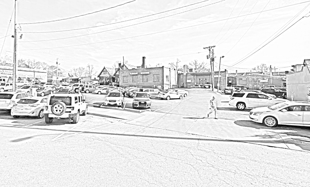
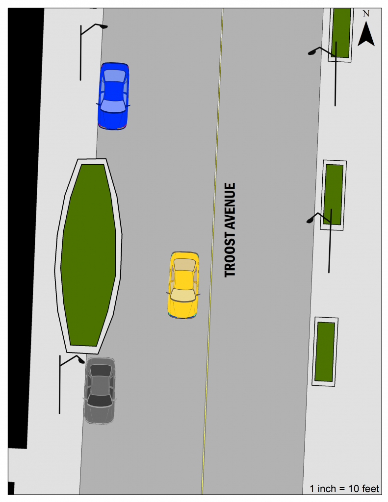
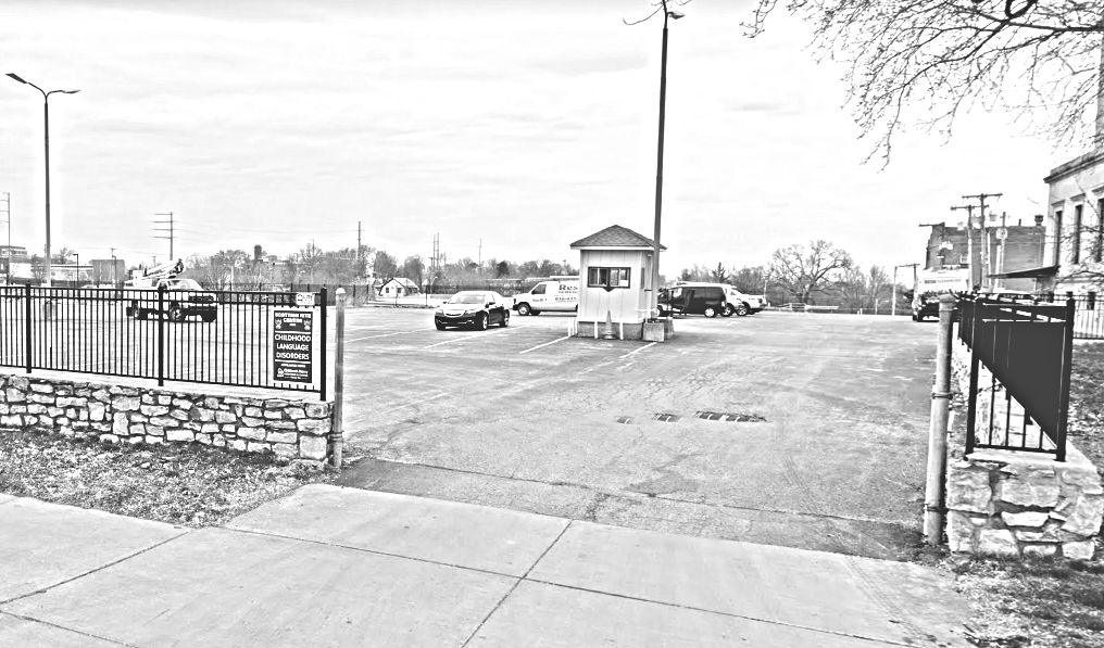
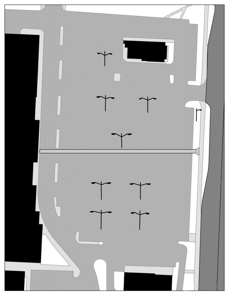
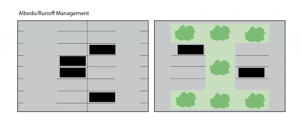
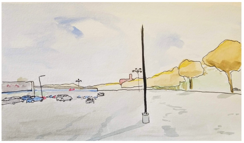
The Scottish Rite Temple parking lots are examples of poor parking choices in the Kansas City area. These lots are simply slabs of asphalt with little to no direction for cars or pedestrians walking to and from the temple. This lack of direction may create a dangerous situation for both drivers and pedestrians. The openness of the lot creates an uninviting atmosphere for anyone who may have to walk through the lot.

Diagram of Scottish Rite Parking

In addition to pedestrian traffic and protection, parking should also have adequate lighting so that both people in cars and on foot are seen and the area is well illuminated. Without proper lighting, parking lots feel dangerous and uninviting to anyone who may have to exit their car. In addition to the lights on the buildings, the parking lot for the Linwood Shopping center is well lit for both pedestrians and drivers, making this lot feel safe and helping people be seen by those in cars.

Lighting in the Linwood Shopping Center

Signs in Urban & Suburban Contexts

Signs serve two main purposes in cities; way-finding signs direct drivers and pedestrians through space, while commercial signs alert potential customers to business locations and retail opportunities. Each of these can appear in different forms depending on where they are located along the urban-rural transect.

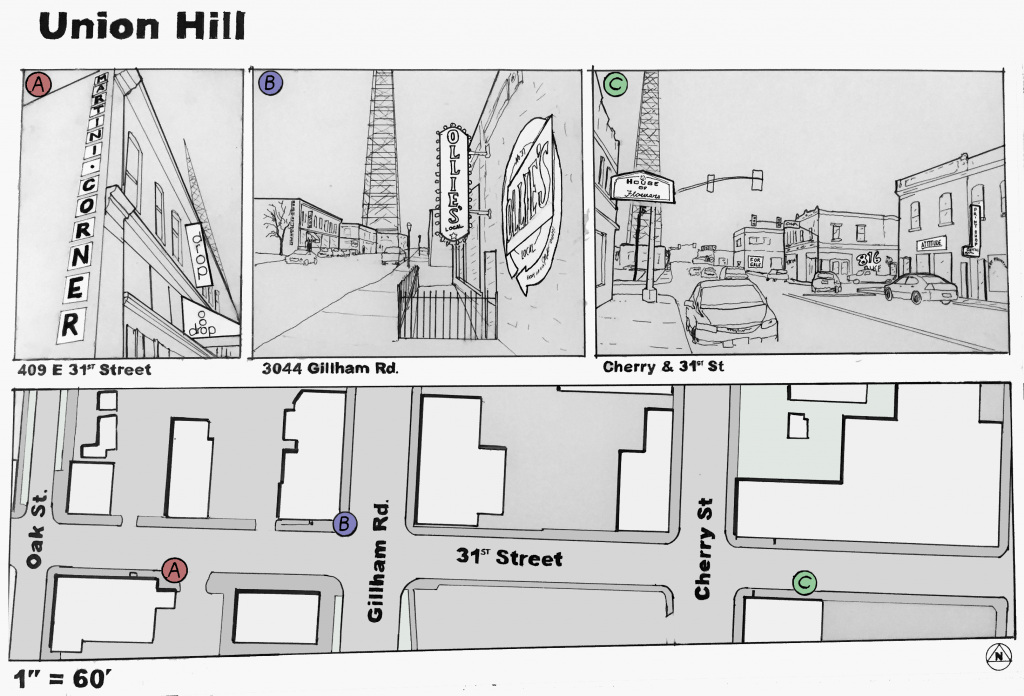
I was interested in comparing the function of commercial signage in early suburbs, as found near 63rd Street & Troost Avenue, with older-growth corridors such as 31st Street at Union Hill.

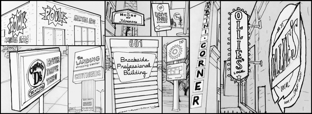
At Union Hill, as in many urban contexts, signs are found attached to the buildings that house the businesses which they are advertising. Some extend out from the building facade, such as the House of Flowers sign; while others are painted directly onto walls, such as the Martini Corner sign. The same form works for a variety of businesses, as seen above with flower shops, print shops, and restaurants all having similar sign forms.

Urban areas feature a large variety in signage. The form of signs in these areas is shared by both local businesses and national chains.

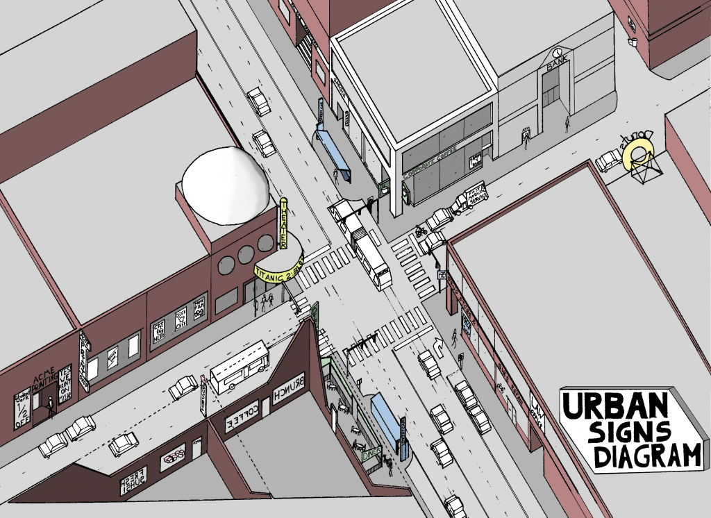
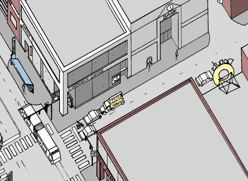
One may also find non-permanent signage in these contexts. These may be sandwich-boards in the street-furniture zone of the sidewalk or banners and chalk-painting across large windows. The most dense of urban areas may also have mobile signs that travel the area on modified box trucks.

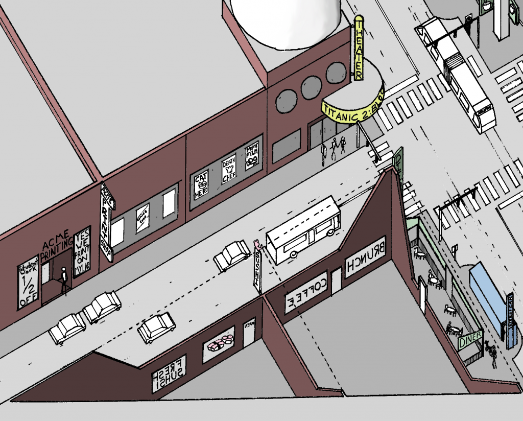
Note the signs extending from facades, mobile signs, transit-stop signs, and larger roof-top signs.

The signs which extend out from the building create a rhythm as one looks down the street and are scaled to the pedestrian eye. Generally a pedestrian will be able to see and comprehend a sign in this context from a block in either direction, a distance which many would consider easily walk-able.

In many cases, urban signs are most easily read by those travelling at slower speeds, in particular cyclists and pedestrians. Slow-moving automobile traffic may be able to comprehend the signs, but drivers travelling faster than 30 mph will have more difficulty taking note of these advertisements.

More signs extending from facade and temporary signs painted in windows. Marquees and cafe awnings can also function as signs.

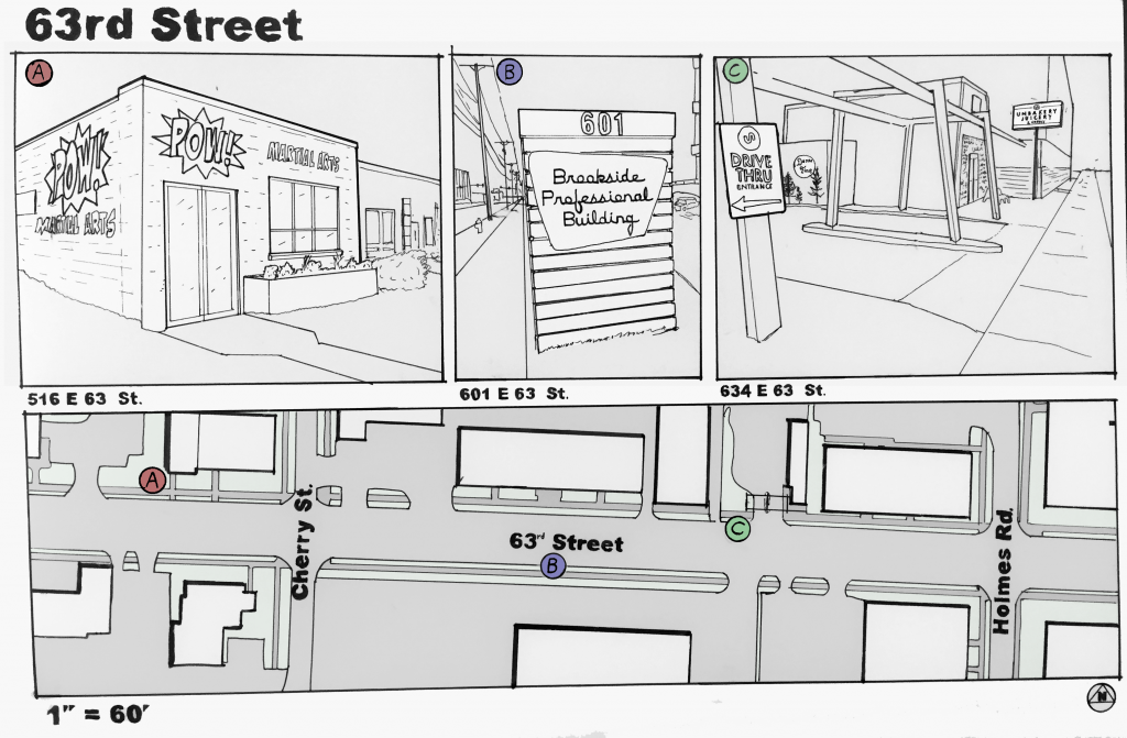
Early suburban areas feature a unique mix of signage. The area of West 63rd Street is an example of an interesting transitional period in the form of signs.

Along the 63rd Street corridor many signs retain a pedestrian scale in size but their placement, relative to the buildings they reference, is beginning to show an auto-era character.

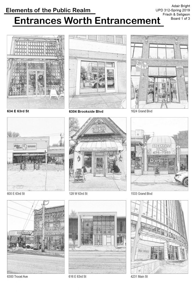
The signs noted above exemplify this mix. The POW! Martial Arts studio sign is painted directly onto the building’s facade, similar to the Ollie’s sign at Union Hill. The Brookside Professional Building sign is beginning to be out-of-scale with the pedestrian experience. It is taller than the average person and the prominent display of the street number seems designed to attract the attention of a driver who is looking for this address specifically. However, removed from its wooden stand in the median, the metal plate of the sign would not be out of place attached to the side of a building. The signs for 634 E. 63rd St. feature the hallmarks of auto-era signage. One sign in the set directs cars towards a drive-thru, while the other is a large rectangle atop a tall pole. The height and size of this sign is easily read by passing motorists but it towers over pedestrians.

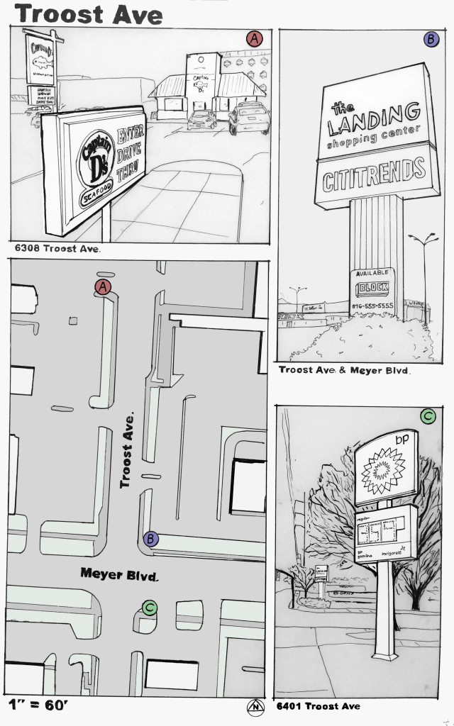
Interestingly, just a few blocks away, at Troost Ave. and Meyer Blvd., the form of signage changes dramatically. Here, almost all signs are directly scaled to automobile traffic and ignore the pedestrian experience.


Pole-signs dominate many suburban landscapes with their height and garish colors. Motorists are surely enticed by these behemoths.

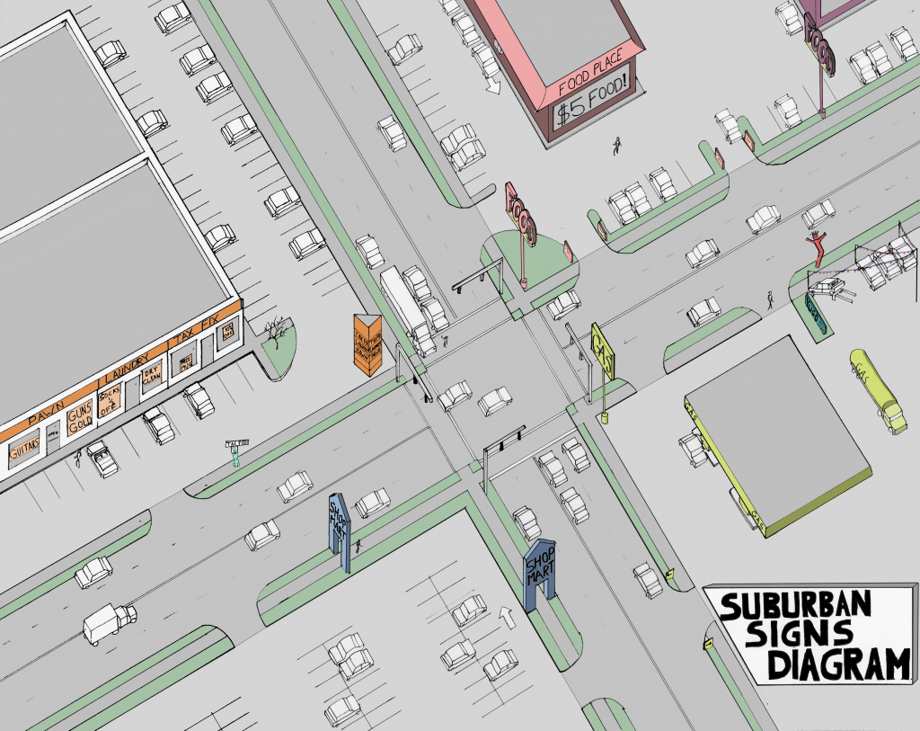
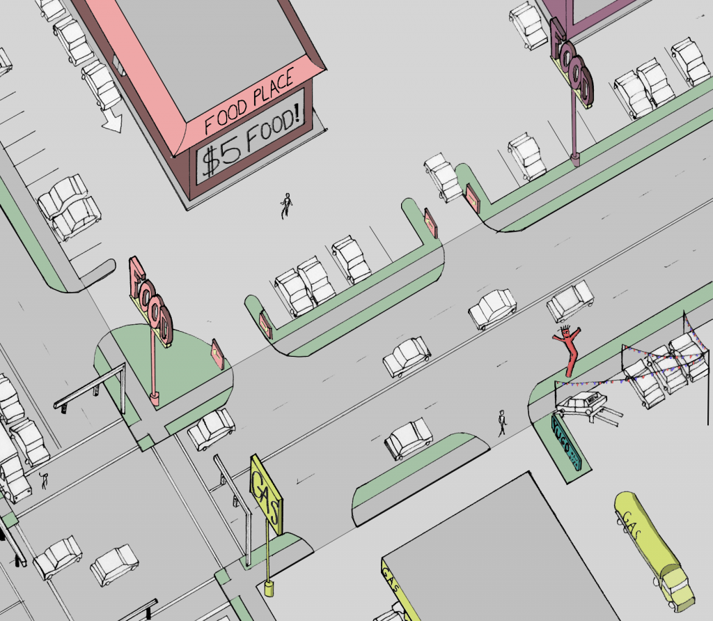
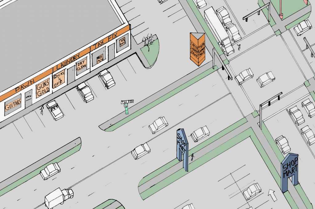
Signs in an auto-centric area often take the form of large symbols atop tall poles. Frequently these signs are a great distance from the buildings which they reference. These are often paired with smaller signs at the entrance to parking areas. The tall signs grab the attention of passing motorists through their large symbol and often garish coloring. Once a motorist has been attracted by the pole sign, the matching way-finding signs direct the driver from the street into a parking lot. This form is very often associated with fast-food restaurants, gas stations, and other franchised brands with nation-wide reputations. The fact that these signs appear in the same form around the country contributes to the suburban reputation for bland sameness.

Pole-signs are often paired with small way-finding signs at parking entrances. Car lots are notorious for their attention-grabbing variety in signage.

In an area where the rhythm of tall pole-signs has become commonplace; some businesses have resorted to outlandish variations in signage. Car sales lots and tax-assistance businesses have become notorious for their attempts to grab the attention of speeding motorists.

Strip malls often have large, boxy signs which feature a tenant list. Box stores are often hundreds of feet away from their road-side pole signs.

The overall effect of the signage in the early-suburb transect is one of overwhelming size and color. The pedestrian experienced is ignored in favor of attracting those travelling by car. The proliferation of national chains, and their associated sign-patterns, give suburban areas an interchangeability that harm any place-making efforts.