Introduction
The historical development of Kansas City, Missouri can be framed by the Missouri and Blue rivers and their watersheds. Within Kansas City, this has created a street network of long, prominent North-South main streets and shorter, mostly numbered, East-West connector and corridor streets. The study area that I am working is framed by the 63rd Street corridor and Meyer Blvd from the south, and the north-south streets of Rockhill Rd and Paseo Blvd. At the center of this study area are important intersections and the New Landing Mall, built in 1960, at the corner of 63rd and Troost. While visiting the site and exploring it, I have identified multiple positive qualities about the area as well as opportunities for improvement. The purpose of identifying these traits and first impressions of the site is to gain a coherent understanding of what makes the landing mall and its surrounding areas successful as spaces and places; moreover, the upgrades and improvements needed to make it an efficient, sustainable, urban form.
Impressions
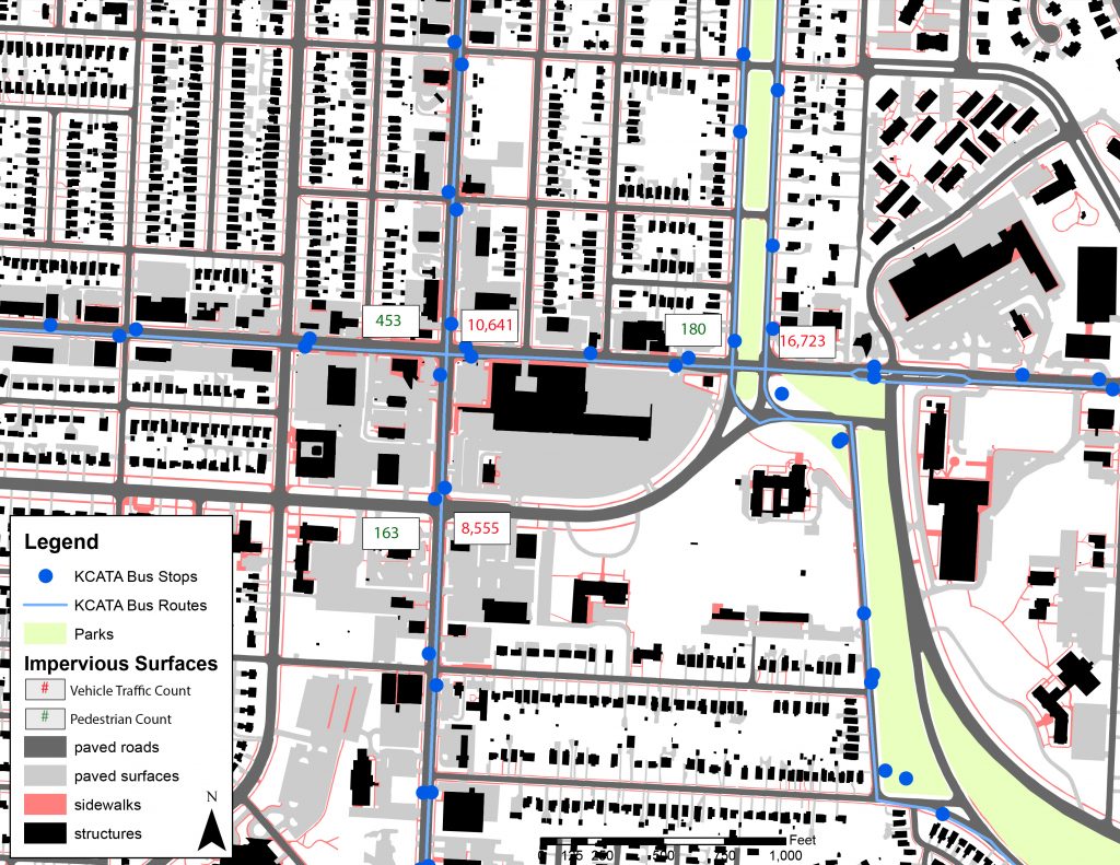
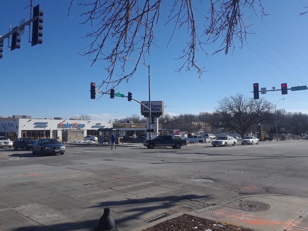
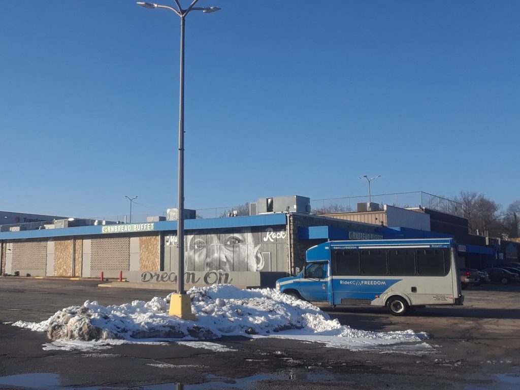
The first and most glaring part of the site is the public transit connectivity and street layout of the surrounding area. There are two major bus lines serviced by the Kansas City Area Transportation Authority (KCATA), the Troost MAX (Metro Area Express) and the 63 bus line, as well, to the east the 85 bus line that runs along Paseo Blvd. These two lines intersect at 63rd St and Troost Ave creating a major transfer point at this intersection. This hub of transportation shows not only the existing level of connectivity to the area but also the potential for the site to increase in connectivity and mobility. The street layout surrounding the site is fascinating in the way that it disrupts the existing and historical street pattern. This is due mostly to the convergence of two boulevards, the Paseo (MLK Jr.) and Meyer. In Kansas City, when two boulevards meet, it is a special event that requires special attention, and for this mall to be at the center of such a moment is quite significant. However, the mall and its parking lot has limited the number of connections through the site and instead has created termination points. This, in turn, limits the connectivity of through streets.
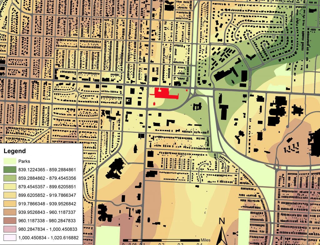
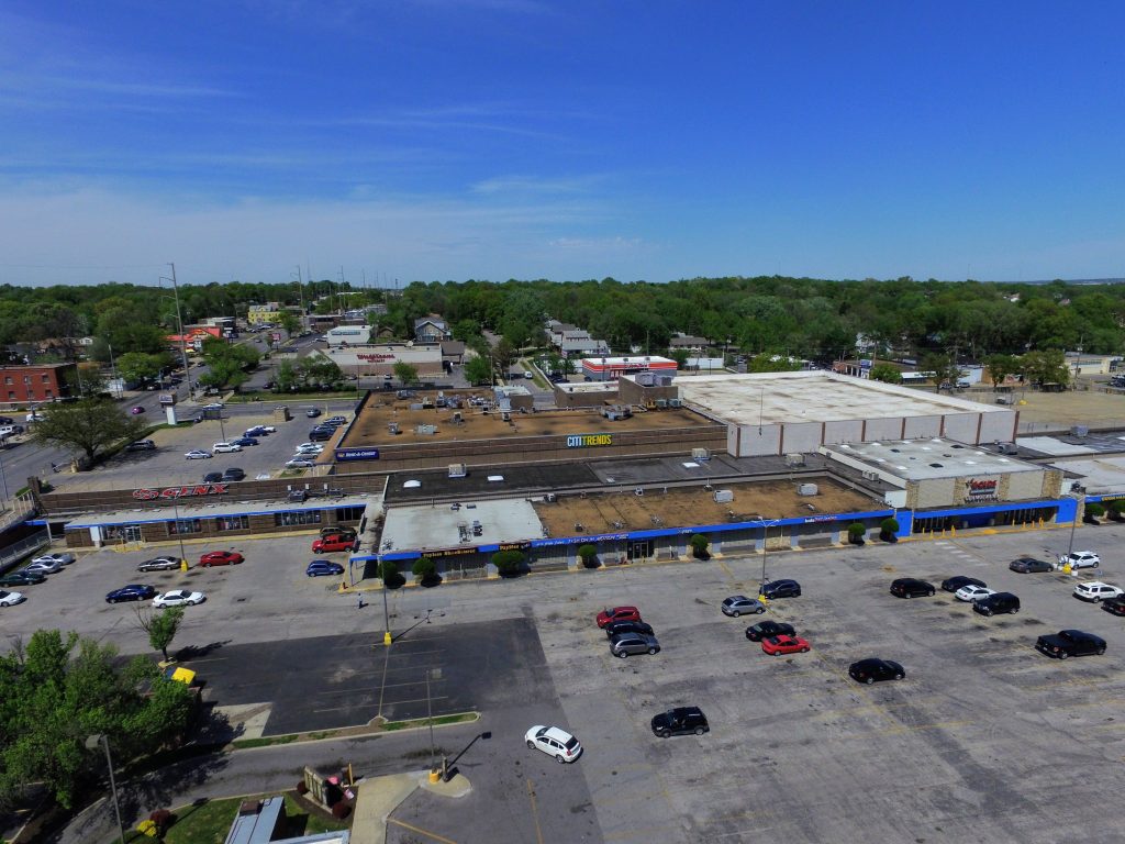
The mall takes its name mostly from its positioning topographically. The mall is situated at one of the lower points of the city due to the proximity to town fork creek, whose terminus is to the east of the site. This topographical vantage point at the bottom of a valley creates an interesting design opportunity and has already created great views out from the mall towards buildings like the Hogan Preparatory Academy and the Convent of Christ the King. The current design of the mall negates this blessing for multiple reasons including the swath of pavement and impervious surfaces with no permeable surface to counteract the effects. As well, while standing at the corner of 63rd and Troost, it is difficult to tell what lies below, with little design guiding patrons to the lower part of the mall.
While walking around the site and the mall, while also holding a general idea about the demographics of the specific area, it becomes apparent the main patrons of the mall and surrounding businesses. Without knowledge of past customers, the current customers seem to be low to moderate income persons. The importance of this observation is that this creates a level of sensitivity during the redevelopment and redesign of the mall; so that, the asset that this mall has become stays an asset. Also, this mall does have an already established customer base that can be relied upon immediately after redevelopment.
Conclusion
The New Landing Mall is located at multiple decision points and intersections that are important to the connectivity of the Kansas City, MO transportation system; however, it puts the automobile over the pedestrian and lowers the connectivity of the shopping center with the surrounding neighborhoods. The boulevards coincide with the beauty of looking up out of a valley and the topography of the surrounding land. The metaphor that describes this area is one not of the top of a mountain, but as the land below. As Dr. Martin Luther King Jr. said in his speech, I’ve Been to the Mountaintop: “And he’s allowed me to go to the mountain. And I’ve looked over, and I’ve seen the promised land! I may not get there with you, but I want you to know tonight that we as a people will get to the promised land.” For this site is where the city comes together.