Tag Archives: Elements of the Public Realm

Elements of the Public Realm – Parking in the North Loop

“The public realm, which includes streetscapes and public spaces, is the setting for street life and community activities. Public realm elements, including pavement, street furnishings, and public art, should reflect the community identity, evoke civic pride, support daily activities, and foster civic life in the community.” (Fairfax County Board of Supervisors, et. al., 2018, Volume II, Chapter 5, 5A)

An element of the public realm is something that is foundational to place, and which can be translated to several other places. It can make or break the hospitality of that place. It can be implemented in a variety of different ways. Some examples of elements of the public realm include street furniture, lighting, paths and sidewalks, walls, or entrances.

One thing people may not think of as an element, however, is parking. However, it is necessary, especially in this day and age, to consider it and how it affects our ability to place-make. Accomplished urban designers and theorists have already written about the different types of parking and their implications. One among them, Christopher Alexander, developed a theory of auto parking which largely focuses on reigning in the runaway parking development that began in the 20th century and continues today.

Alexander’s criteria for parking mainly concern making parking lots small: “make parking lots small, serving no more than five to seven cars…”, reducing the percentage of parking in a given area: “do not allow more than nine per cent of the land in any given area to be used for parking…”, and shielding that parking from view: “put all large parking lots, or parking garages, behind some kind of natural wall, so that the cars and parking structures cannot be seen from outside.” (Alexander et al., 1977).

A small lot type at 3rd Street and Broadway Blvd.

These and more of Alexander’s theory went into my considerations for parking in the North Loop area of Kansas City, Missouri’s downtown. Developing my own theory, though, I developed six different core types of this element for study. They are:

  • Street parking
  • Angle parking
  • Parking garages
  • Parking lots
  • Micromobility parking
  • Guerilla/informal parking

Street parking is one of the older, more common, and more intuitive forms of parking. One simply drives to their destination, stops their vehicle on the edge of the street, and leaves it on foot. There are certain advantages to this form of parking. It is relatively unobtrusive to street design, at most requiring slightly more right of way width for the street. It allows for direct travel to a destination, but only if there is unoccupied parking space nearby. In a city or region where people heavily depend on cars for travel, this form of parking can run out quickly. It can have people circling blocks, adding to air pollution and increasing the likelihood of collisions.

Harrison Street & Missouri Avenue – looking west on Missouri.

The location I chose to demonstrate this type is in the Columbus Park neighborhood, at Harrison Street and Missouri Avenue – looking west on Missouri. This area is an historic development with a mix of single-family homes, small apartments, and neighborhood commercial. Parked cars are rarely a nuisance here and finding parking is usually not difficult.

Another form of street parking is angle parking, although this type can also be seen in surface lots. Historically, these have been “head-in” spaces where cars pull forward into the space. As design standards have changed, however, back-in angle parking has started to become more popular. The advantage to this specific type of parking is its relationship to safety for cyclists and pedestrians. Instead of backing into blindly into traffic and hitting cyclists (as in the case of head-in angle parking) drivers now have better visibility when leaving the space.

“Dozens of cities across the country have solved the problem simply reversing the angles. Cars now pull just past the parking space and then back into it.  It is like parallel parking, but much easier.  To pull out of the space, motorists look left for approaching traffic and then pull forward.” (BikeWalkKC).

The example of angle parking below, at 401 Deleware Street, looking south, shows just this. Cars proceed one way down Deleware Street, then back in to angle parking spaces. This is especially important for deleware, considering cars share that stretch of it with the streetcar. This design helps prevent collisions.

401 Delaware Street – looking south on Delaware.

Parking Garages seem to solve some of the issues of street parking too. They allow for denser concentration of parked cars, meaning people may be able to access their destination relatively close to where they park, while maintaining the urban environment. However, when not controlled, they can become more common in an area than actual buildings for humans. Not to mention too, they are costly to build, especially when building underground. Here are some estimates for reference:

  • A surface lot is $1,500-$10,000 per space (economical).
  • An above ground garage is $25,000-$35,000 per space (balanced).
  • An underground garage is $35,000-$50,000 per space (expensive from excavation).

(Dcparkinglot, 2024).

MARC Garage (left), former Hilton Inn Garage (bottom right), and State Street Bank and Trust Garage (top right) – 7th and Washington Streets (as viewed from 5th and Washington – looking south).

The parking garages in the pictures above consist of the MARC garage to the left, the former Hilton Inn garage on the bottom right, and the State Street Bank and Trust garage in the top right. These all cluster around 7th and Washington Streets. This area is relatively dead, even during large events downtown. Partly, this is due to vacancy (the Hilton Inn was closed and demolished in 2002 and the State Street Bank building has sat vacant for some time too). But I have to imagine that even when these were operational, the area was not much more invigorated. Parking does not directly precipitate human activity (except perhaps road rage over a stolen space). It must be carefully crafted to invite a means for people to get to their destination without destroying the place those same people want to arrive at. To quote Jeff Speck:

“the twin gods of Smooth Traffic and Ample Parking—have turned our downtowns into places that are easy to get to but not worth arriving at.” (Speck et al., 2022).

In my study of North Loop parking, I used Kansas City Parcel Viewer to get an estimate of how much of the area was surface lots. I paired this with a study of the highway surface area. The results were as follows:

  • The study area measured in at around 11.5 million feet2
  • Parking lots took up around 1.2 million feet2
  • The highway (or MODOT right of way) equaled approximately 4.3 million feet2

Converting these to percentages, surface parking lots alone took up about 10% of the land area, while highways took up about 30%. These numbers don’t account for parking garages, however, nor do they fully count the highway’s area, because they can’t capture landscaping on either side of the highway lanes. Accounting for these errors, we count intuit that between these twin gods (smooth traffic and ample parking) they account for nearly 50% of the study area.

Parking lots share some of the same issues as garages, but many of them are inverse. While cheaper to build, they can take up far more surface area than garages past a certain number of spaces.

The area chosen to showcase this type is depicted below and consists of four parking lots on all corners of 7th and Main Streets. The photo was taken from the top of the Flashcube Apartments facing north/northeast. The pattern of lots actually continues out in several directions from these, creating vast swaths of underutilized, inhospitable land. This paired with the freeway (the other twin god) makes for an ocean of disconnectivity between the CBD and the River Market neighborhood.

Parking lots on corners of 7th and Main Streets as viewed from the rooftop of Flashcube Apartments (looking north/northeast).

Micromobility parking, while perhaps not conventional, is still a form of parking, and can be a way to mitigate some of the issues with parking for automobiles. Micromobility refers to bicycles, scooters, and the like, and parking for them is much the same as parking for cars, only it takes up more less space.

5th and Delaware Streets – looking west on 5th.

As shown above, this area of 5th Street near the intersection with Deleware is reserved for parking scooters and bikes. Racks are included, along with flexible delineators and street paint. This mitigates the issue of scooters and bikeshares often being left strewn haphazardly on sidewalks and streets, while also helping to slow traffic by reducing the width of the right of way for part of the street. This issue of haphazard placement is part of another form of parking I’ve termed “Guerilla Parking”

Guerilla Parking (or informal parking) is what happens when there is nowhere (or nowhere convenient) to park legitimately. In the case of the scooter shown below at the corner of 6th and Washington Streets, there were likely no other better options for the individual who was riding it.

Corner of 6th and Washington Streets – looking north.

Guerilla parking can come in many different shapes an sizes, though. Below is a picture of the parking for the Chiefs’ victory parade in 2024 taken at the corner of 26th and Jefferson Streets, looking south. This is by far an extreme case, but it just goes to show that parking will never be able to accommodate everyone if everyone must drive a car to get where they need to go.

Chiefs Parade Parking, 2024. Photo taken from 26th and Jefferson Streets, looking South.

Other more common forms of Guerilla parking including parking payment delinquency or parking in fire lanes or other restricted areas. There are several strategies we might utilize to address these issues. One initial strategy might be to better enforce the rules we’ve created surrounding illegal or delinquent parking. We might make it more convenient to pay for parking with technology. And, from a more long-range perspective, we should be reducing our dependency on automobile transportation in favor of multi-modal accommodations like transit and micromobility. We should also be infilling our downtowns to make them more walkable, and, as we build out, doing so more incrementally and more densely.

Intervening in the study area, I chose to address the egregious surface lots near Flashcube Apartments at 7th and Main streets. Applying Alexander’s Small Lot theory, I simulated building massing on one of the lots, leaving a fraction of the lot for parking. This area of the lot, a row of spaces along the building edge of Flashcube, would allow for residents, workers, and visitors to still park if need be, but regular parking could be redirected elsewhere, such as underneath Flashcube where there exists an underground garage. Transit could also be fortified to reduce the need for parking. There is a streetcar stop just outside the building. Garden walls should be paired with trees and other plantings to mask the lot from view and soften the area.

Existing Context, 7th and Main Streets.
Plan View – Reprogramming of parking lot at 701 Main Street.
Axonometric – Reprogramming of parking lot at 701 Main Street.

There exist several other opportunities for reducing or changing parking in the North Loop. Parking is a necessary amenity, and can indirectly facilitate human interaction and economic growth in an area, but its implementation should be measured and planners should be firm in limiting its use.

Citations:

Alexander, C., Ishikawa, S., & Silverstein, M. (2010). A pattern language: Towns, buildings, construction. Oxford Univ. Pr.

BikeWalkKC. (n.d.). Angle Parking. https://bikewalkkc.org/advocacy/planning/angleparking/

Dcparkinglot. (2024, August 20). Cost of building a parking garage. D & C Parking Lot Maintenance. https://dcplm.com/blog/cost-of-building-a-parking-garage/

Fairfax County Board of Supervisors, Fairfax County Planning Commission. (2018). Bailey’s Crossroads & Seven Corners Urban Design Guidelines (Volume II/Chapter5/5A Streetscape Concept). Fairfax County Office of Community Revitalization (OCR). https://www.fcrevite.org/sites/default/files/Assets/Documents/Baileys-Crossroads-Seven-Corners/Vol2-BC7C-Chapter5-Sept20-2018-AC_A-1a.pdf

Speck, J., & Sadik-Khan, J. (2022). Walkable City: How downtown can save america, one step at a time. MCD/Picador/Farrar, Straus and Giroux.


Parking in the Public Realm

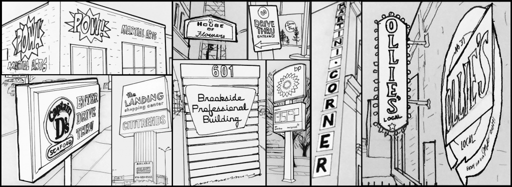
In Kansas City, there seems to be a wide variety of choices when it comes to where to park your car; however, not all parking is created equal. When observing the different types of parking around our study area and the KC Metro, one question came to mind: what makes good parking?

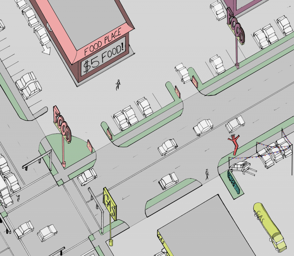
The photos above demonstrate qualities that make up good parking. The implementation of curb extensions or bump-outs create buffers between the roadway and pedestrians traveling on the sidewalks. These bump-outs provide protection for those on the sidewalk in the event a driver loses control of their car and drives over the curb. Bump-outs help to make roads more narrow, ideally making drivers more aware of their surroundings and pedestrians that may be walking nearby.

The middle photo shows a parking-protected sidewalk for pedestrians traveling to and from the Sunfresh grocery store located in the Linwood Shopping Center at Linwood Blvd. and Prospect in Kansas City. This protected sidewalk allows those traveling by foot from nearby transit stops to walk through the parking lot without fearing their safety by the potential of erratic drivers in the wide-open parking lot.

The photo on the right features planters with street trees that not only create shade for parked cars and pedestrians on the sidewalk, but also provide protection for those on the sidewalk. The parking provides a buffer between the lane of traffic and people on the street.

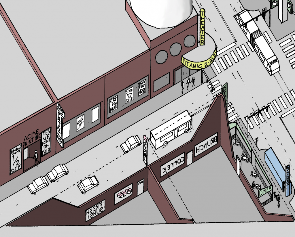
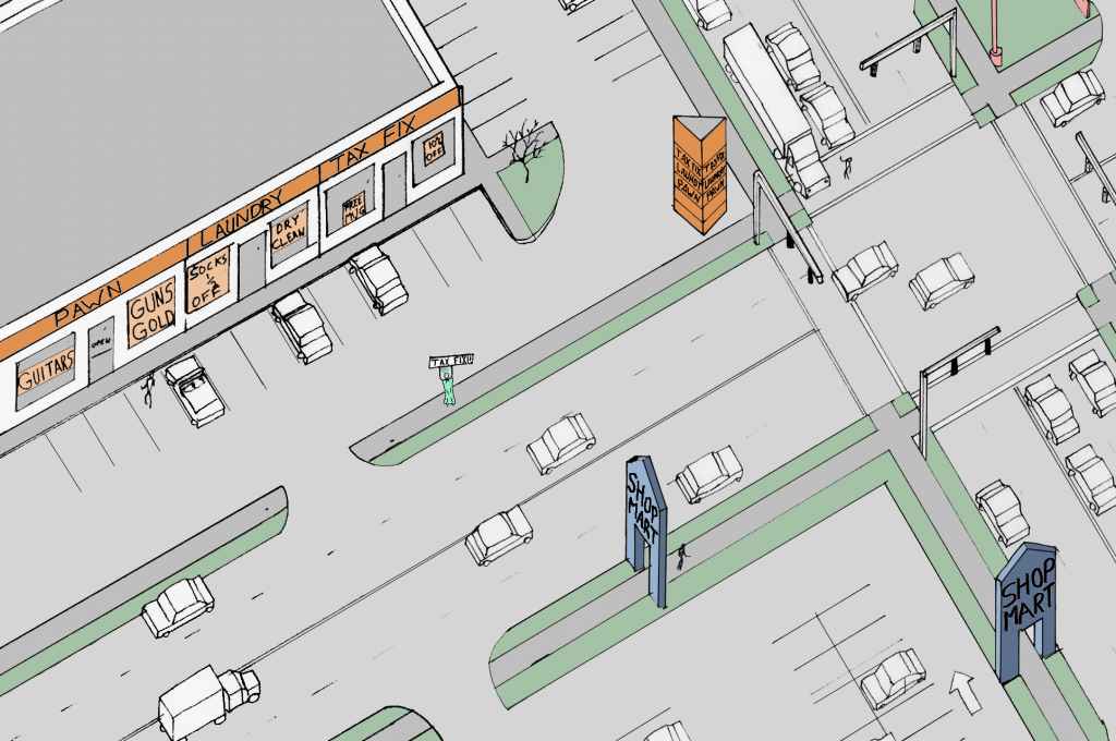
The bottom photo is located in the Brookside Shopping Center along 63rd street in Kansas City, Missouri. This parking lot is located behind the shops in Brookside, as not to take away from the storefronts and promote pedestrian traffic around the area. This area features many sidewalks and pedestrian crossings, creating an inviting atmosphere for those traveling by foot.

One of the Many Scottish Rite Temple Parking Lots

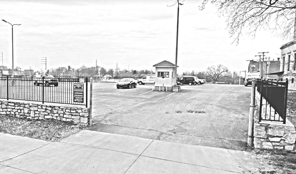
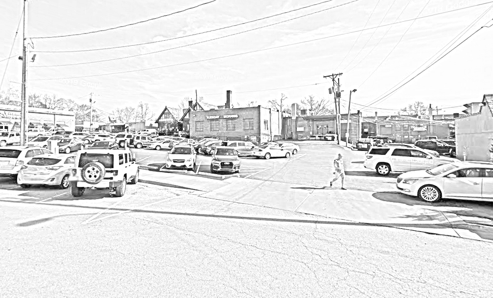
The Scottish Rite Temple parking lots are examples of poor parking choices in the Kansas City area. These lots are simply slabs of asphalt with little to no direction for cars or pedestrians walking to and from the temple. This lack of direction may create a dangerous situation for both drivers and pedestrians. The openness of the lot creates an uninviting atmosphere for anyone who may have to walk through the lot.

Diagram of Scottish Rite Parking

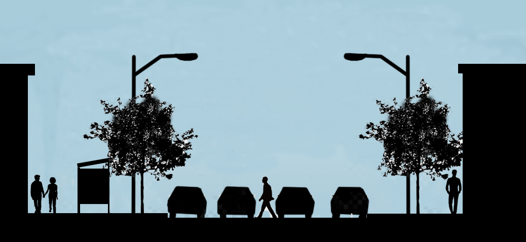
In addition to pedestrian traffic and protection, parking should also have adequate lighting so that both people in cars and on foot are seen and the area is well illuminated. Without proper lighting, parking lots feel dangerous and uninviting to anyone who may have to exit their car. In addition to the lights on the buildings, the parking lot for the Linwood Shopping center is well lit for both pedestrians and drivers, making this lot feel safe and helping people be seen by those in cars.

Lighting in the Linwood Shopping Center

Signs in Urban & Suburban Contexts

Signs serve two main purposes in cities; way-finding signs direct drivers and pedestrians through space, while commercial signs alert potential customers to business locations and retail opportunities. Each of these can appear in different forms depending on where they are located along the urban-rural transect.

I was interested in comparing the function of commercial signage in early suburbs, as found near 63rd Street & Troost Avenue, with older-growth corridors such as 31st Street at Union Hill.

At Union Hill, as in many urban contexts, signs are found attached to the buildings that house the businesses which they are advertising. Some extend out from the building facade, such as the House of Flowers sign; while others are painted directly onto walls, such as the Martini Corner sign. The same form works for a variety of businesses, as seen above with flower shops, print shops, and restaurants all having similar sign forms.

Urban areas feature a large variety in signage. The form of signs in these areas is shared by both local businesses and national chains.

One may also find non-permanent signage in these contexts. These may be sandwich-boards in the street-furniture zone of the sidewalk or banners and chalk-painting across large windows. The most dense of urban areas may also have mobile signs that travel the area on modified box trucks.

Note the signs extending from facades, mobile signs, transit-stop signs, and larger roof-top signs.

The signs which extend out from the building create a rhythm as one looks down the street and are scaled to the pedestrian eye. Generally a pedestrian will be able to see and comprehend a sign in this context from a block in either direction, a distance which many would consider easily walk-able.

In many cases, urban signs are most easily read by those travelling at slower speeds, in particular cyclists and pedestrians. Slow-moving automobile traffic may be able to comprehend the signs, but drivers travelling faster than 30 mph will have more difficulty taking note of these advertisements.

More signs extending from facade and temporary signs painted in windows. Marquees and cafe awnings can also function as signs.

Early suburban areas feature a unique mix of signage. The area of West 63rd Street is an example of an interesting transitional period in the form of signs.

Along the 63rd Street corridor many signs retain a pedestrian scale in size but their placement, relative to the buildings they reference, is beginning to show an auto-era character.

The signs noted above exemplify this mix. The POW! Martial Arts studio sign is painted directly onto the building’s facade, similar to the Ollie’s sign at Union Hill. The Brookside Professional Building sign is beginning to be out-of-scale with the pedestrian experience. It is taller than the average person and the prominent display of the street number seems designed to attract the attention of a driver who is looking for this address specifically. However, removed from its wooden stand in the median, the metal plate of the sign would not be out of place attached to the side of a building. The signs for 634 E. 63rd St. feature the hallmarks of auto-era signage. One sign in the set directs cars towards a drive-thru, while the other is a large rectangle atop a tall pole. The height and size of this sign is easily read by passing motorists but it towers over pedestrians.

Interestingly, just a few blocks away, at Troost Ave. and Meyer Blvd., the form of signage changes dramatically. Here, almost all signs are directly scaled to automobile traffic and ignore the pedestrian experience.


Pole-signs dominate many suburban landscapes with their height and garish colors. Motorists are surely enticed by these behemoths.

Signs in an auto-centric area often take the form of large symbols atop tall poles. Frequently these signs are a great distance from the buildings which they reference. These are often paired with smaller signs at the entrance to parking areas. The tall signs grab the attention of passing motorists through their large symbol and often garish coloring. Once a motorist has been attracted by the pole sign, the matching way-finding signs direct the driver from the street into a parking lot. This form is very often associated with fast-food restaurants, gas stations, and other franchised brands with nation-wide reputations. The fact that these signs appear in the same form around the country contributes to the suburban reputation for bland sameness.

Pole-signs are often paired with small way-finding signs at parking entrances. Car lots are notorious for their attention-grabbing variety in signage.

In an area where the rhythm of tall pole-signs has become commonplace; some businesses have resorted to outlandish variations in signage. Car sales lots and tax-assistance businesses have become notorious for their attempts to grab the attention of speeding motorists.

Strip malls often have large, boxy signs which feature a tenant list. Box stores are often hundreds of feet away from their road-side pole signs.

The overall effect of the signage in the early-suburb transect is one of overwhelming size and color. The pedestrian experienced is ignored in favor of attracting those travelling by car. The proliferation of national chains, and their associated sign-patterns, give suburban areas an interchangeability that harm any place-making efforts.