Structures play an important role throughout the Kansas City Parks and Boulevards System. In many ways, they act as place markers for various parks throughout the city. In this analysis, park structures were systematically divided into three categories: monumental structures, interaction structures, and shelter structures. Figure 1 illustrates examples of each structure contextually within Kansas City.
Figure 1: Context Diagram
STRUCTURES AS MONUMENTS
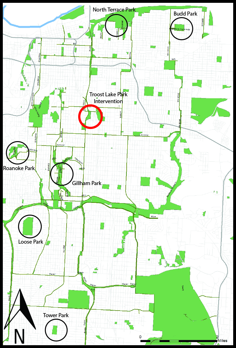
Monumental structures are found in various parks in Kansas City, and serve different purposes based on their contextual location. In Minor Park, the Old Red Bridge is a retired automobile bridge that has since been converted to a pedestrian bridge, and links a trail running through the park. At North Terrace Park, in the Historic Northeast, The Colonnade is oriented in such a way that it offers views to the northeastern part of Kansas City, as well as the Missouri River
Old Red Bridge – Minor ParkRose Garden Pergolas – Loose ParkNorth Terrace Park Colonnade – Kessler Park
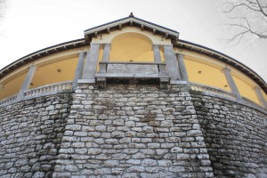
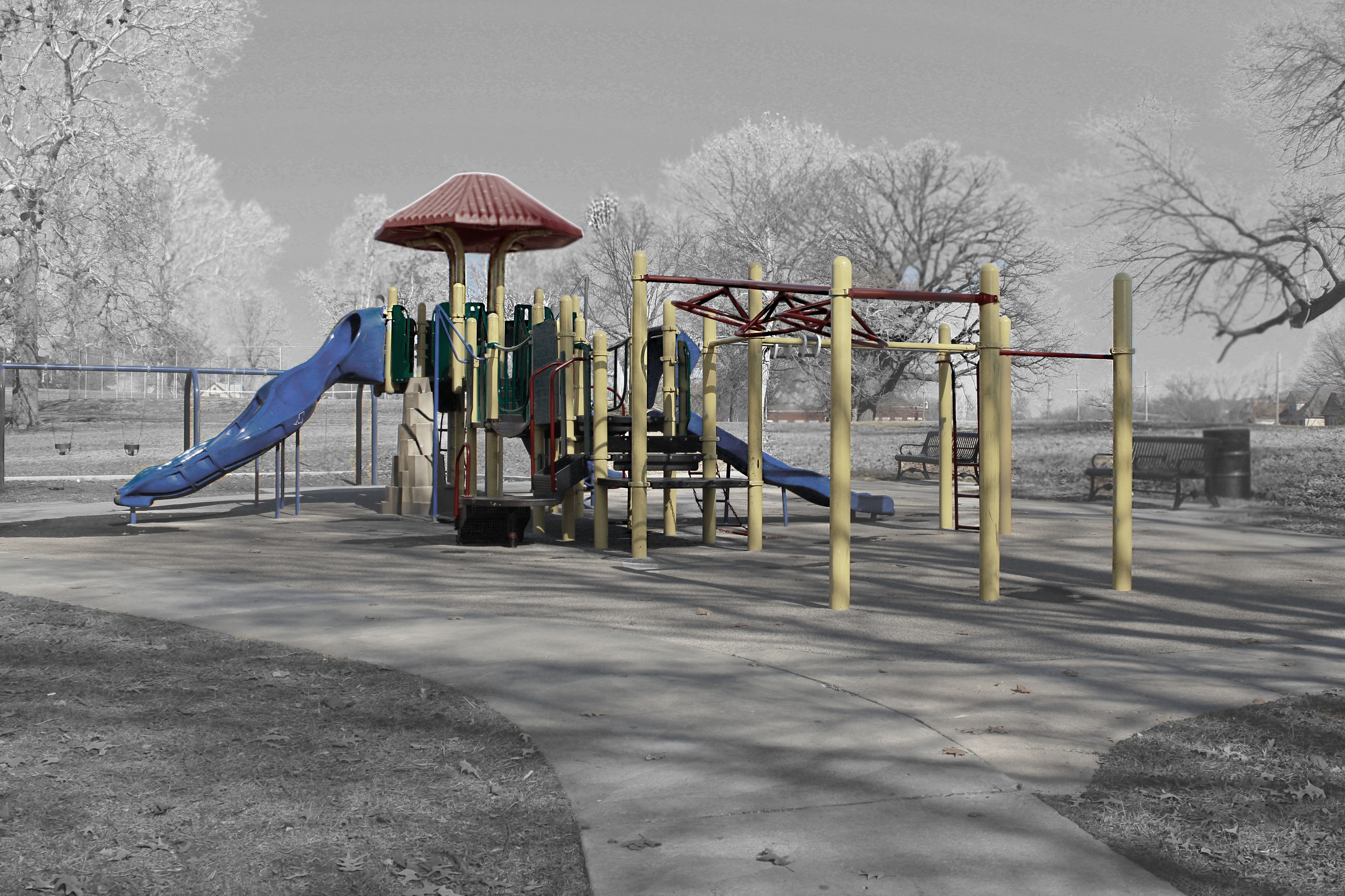
INTERACTIVE STRUCTURES
Interactive structures are some of the most common among Kansas City’s parks. Their most common forms are playground, but other include swimming pools, baseball diamonds, or even community centers. They have similar characteristics as far as their location, as they are most frequently found in smaller neighborhood parks, within walking distance to adjacent neighborhoods.
Roanoke Park playgroundGillham Park playgroundBudd Park playground
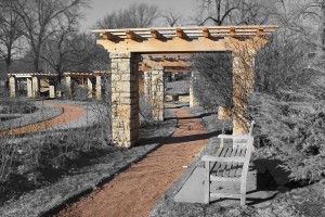
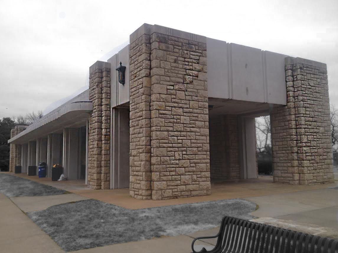
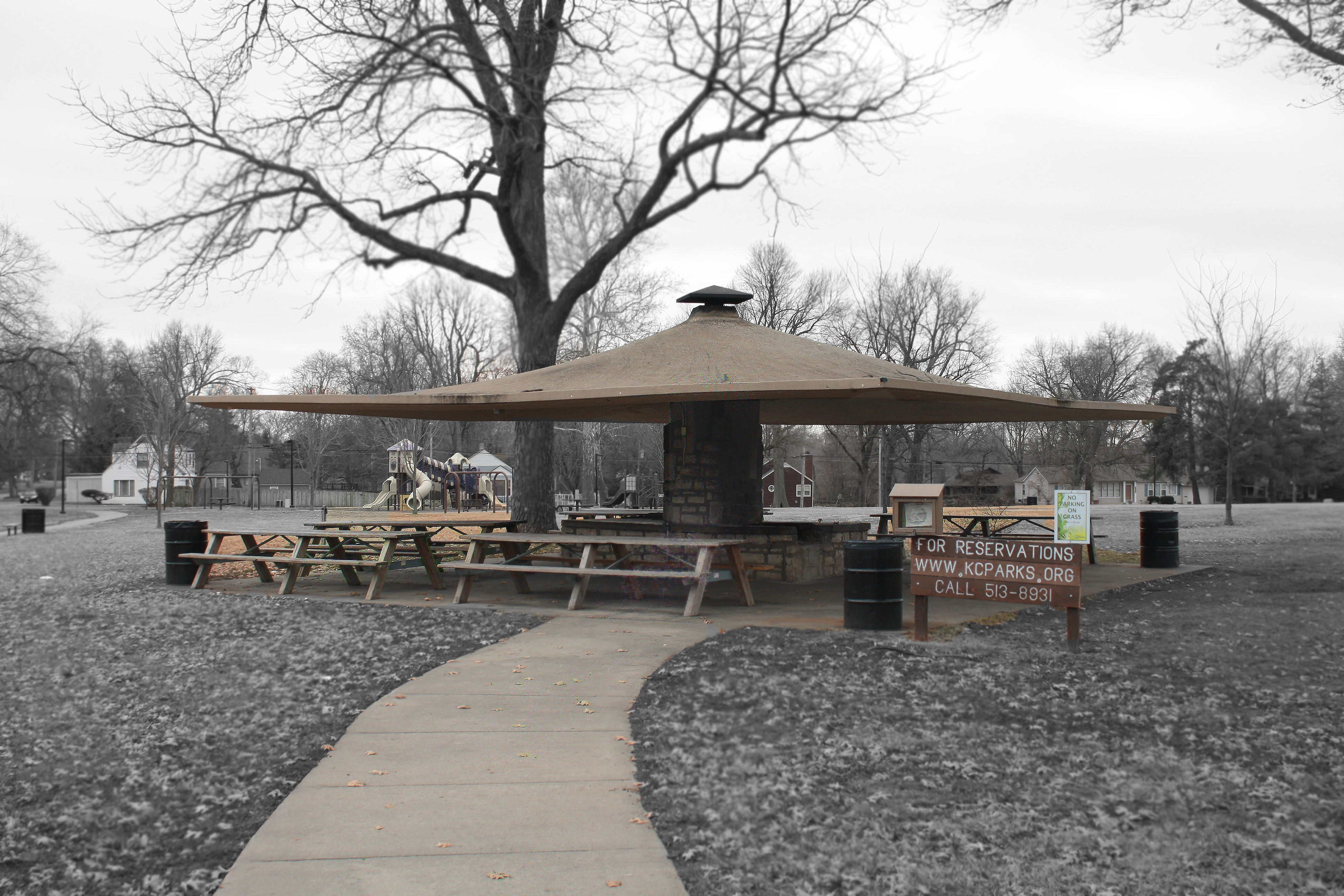
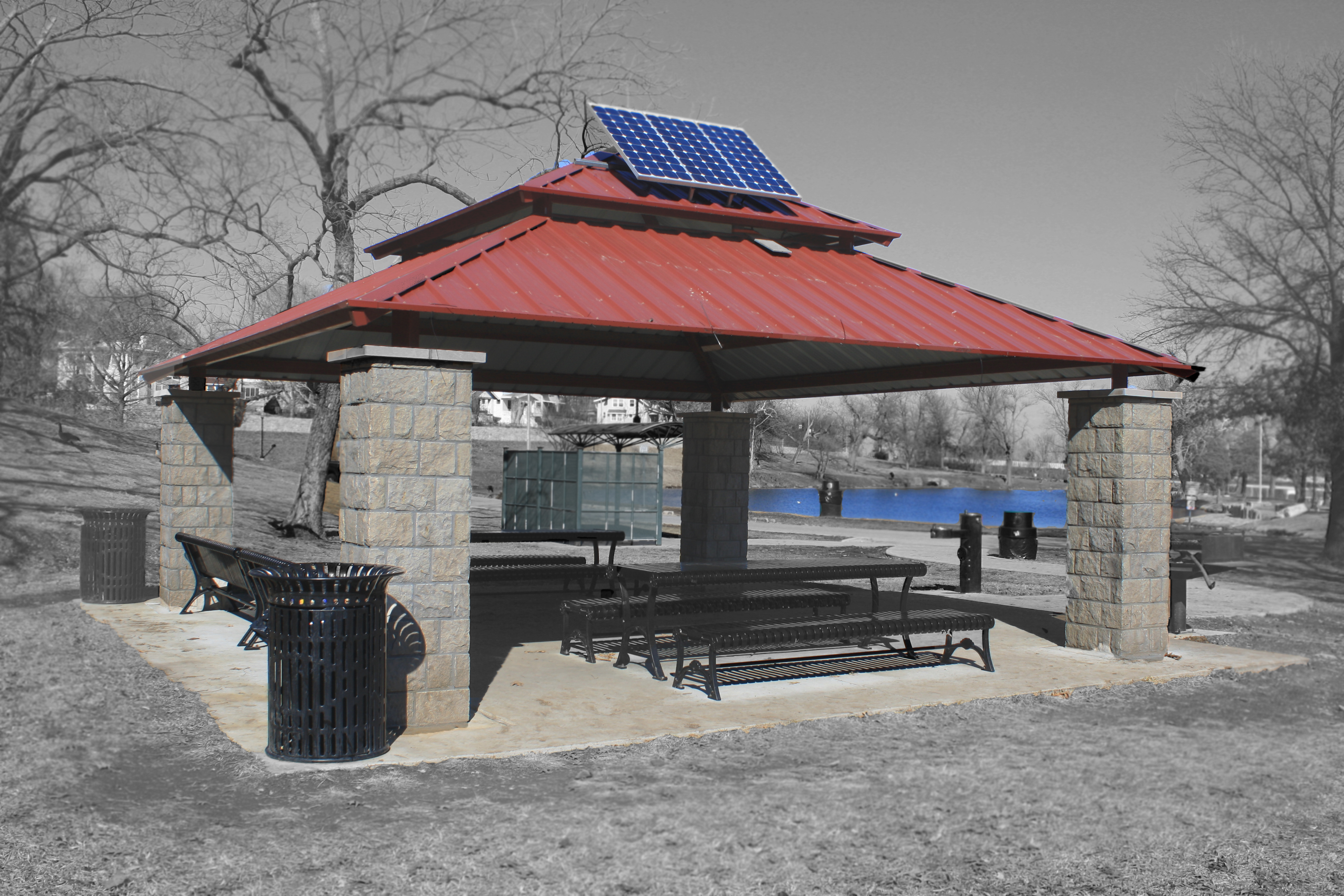
STRUCTURES AS SHELTER
Shelter structures are frequently found in various Kansas City parks as well. More specifically, neighborhood parks. In fact, during this analysis, shelter structures were most commonly found in parks paired with playgrounds, swimming pools, or other interactive structure. Note the varying types of architecture found is different parts of the city as well. The shelters found in both Loose Park and Tower Park, although slightly different, both feature very monolithic characteristics, made completely from concrete and limestone. The shelter found alongside Troost Lake Park, however, is slightly more contemporary, featuring a metal roof and solar panel, supported by limestone pillars.
Loose Park ShelterTower Park ShelterTroost Lake Shelter
A STRUCTURAL INTERVENTION
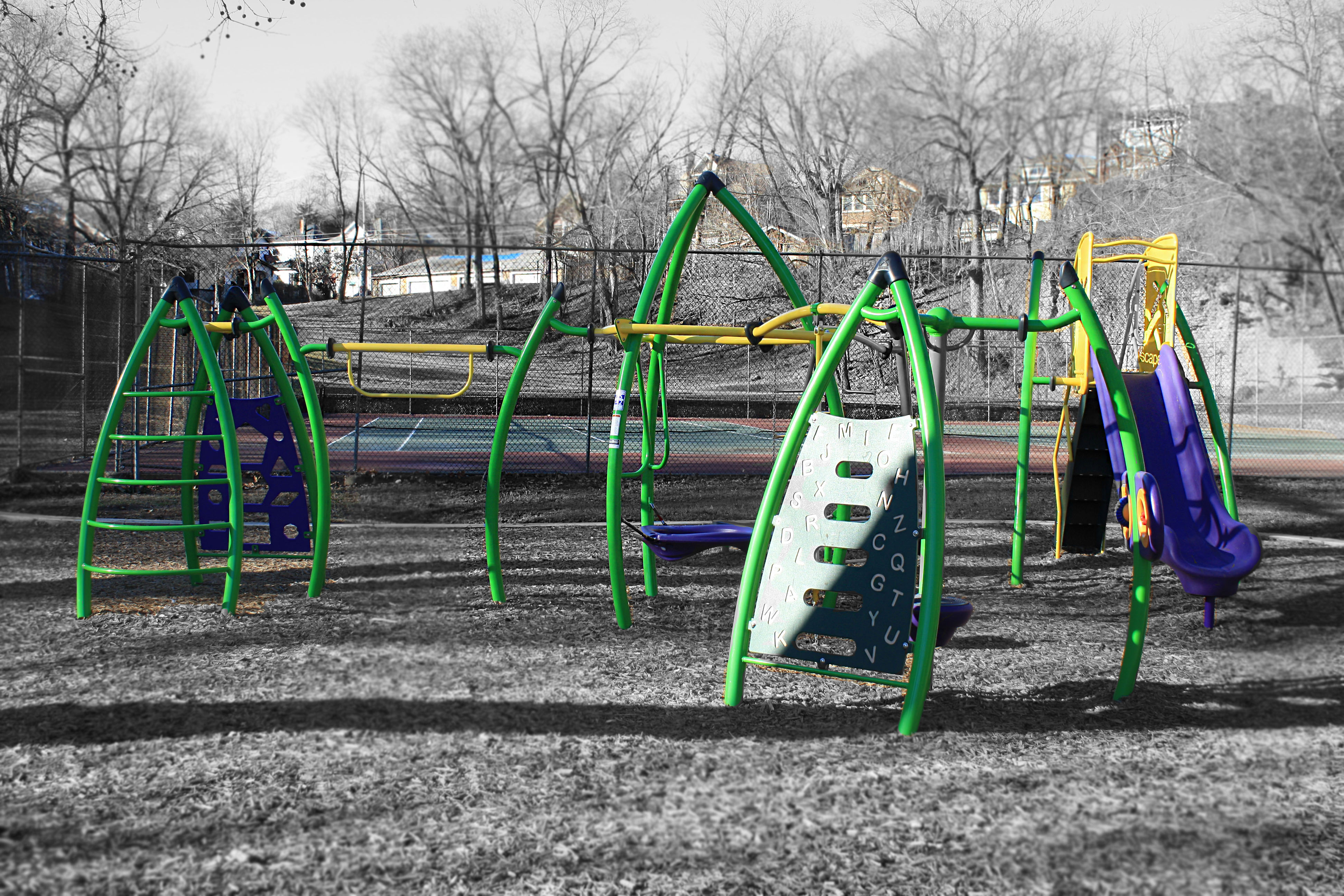
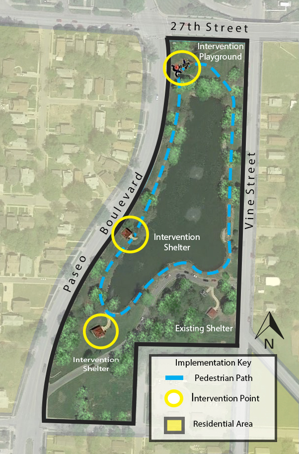
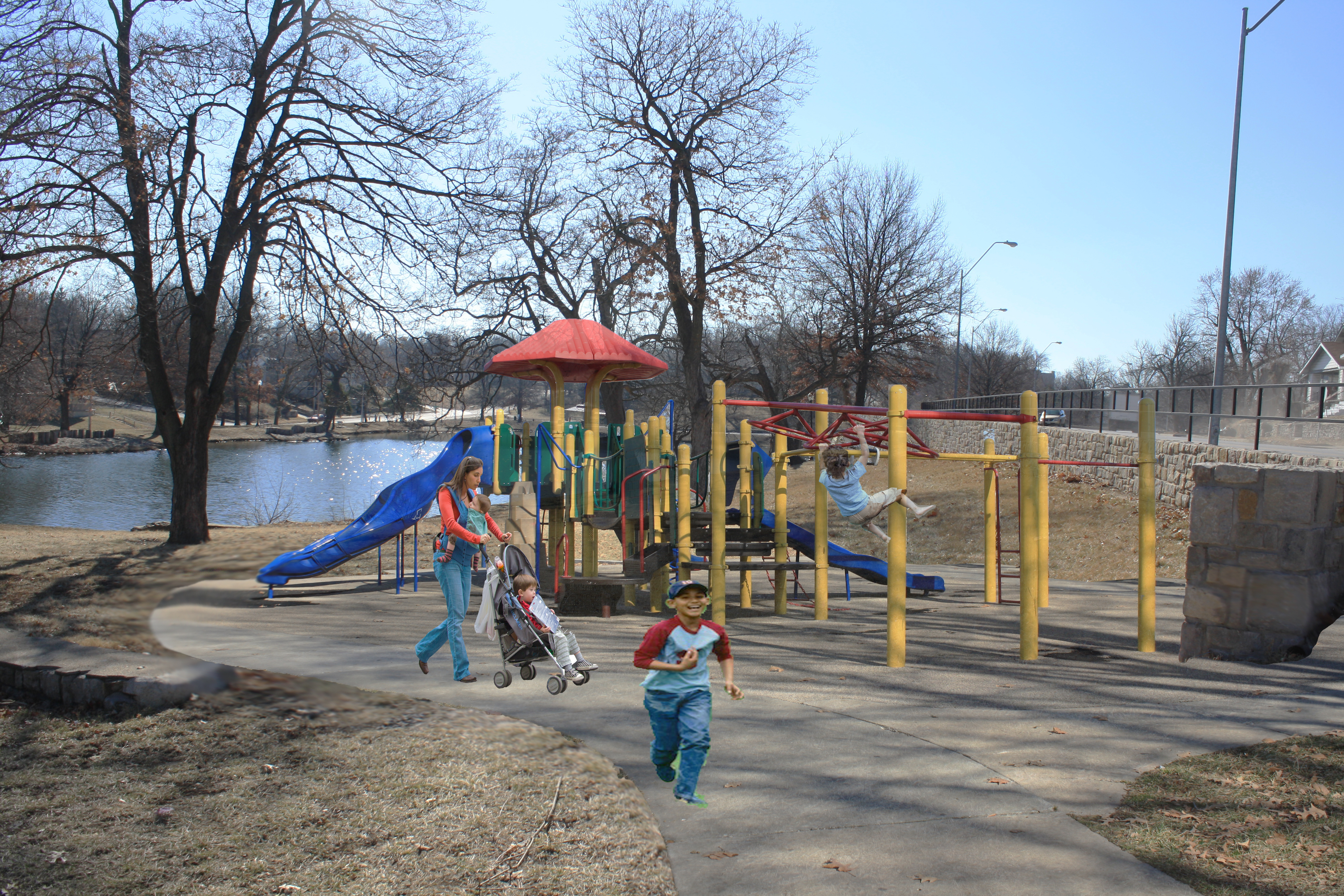
One thing that popped up several times during this analysis was the amount of disparities between park quality, whether based on location, state of upkeep, or just the presence of pedestrian amenities. Looking at several precedent studies on parks, something that was emphasized was the importance of neighborhood parks. Applying this to Kansas City’s parks system, I noticed a lack of quality neighborhood park space, specifically in the neighborhoods in eastern Kansas City. Troost Lake Park is located on 27th Street, between Paseo Boulevard and Vine Street. The lake itself is frequently used for fishing by surrounding residents, and single shelter at the corner of Vine Street and Troost Lake Drive is utilized almost year round, weather permitting. Aside from those, this neighborhood park lacks any sort of structure that can be found in similar neighborhood parks around the city. To counter this, I have proposed to add two additional shelter structures along the western portion of the park, as well as an interactive playground structure to the northwest. Also, because the lake is often fished by residents, I have also chosen to tie all of these elements together with a paved trail, running the perimeter of the entire park. Together, these elements promote increased usage among residents of all ages, and will re-activate Troost Lake Park as the neighborhood park it was intended to be.
Intervention Diagram of Troost LakeInteractive Structure – 27th and PaseoShelter Intervention – Western Troost Lake
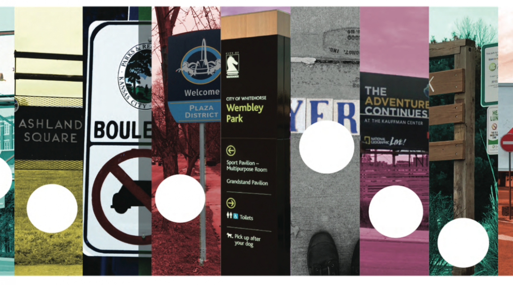
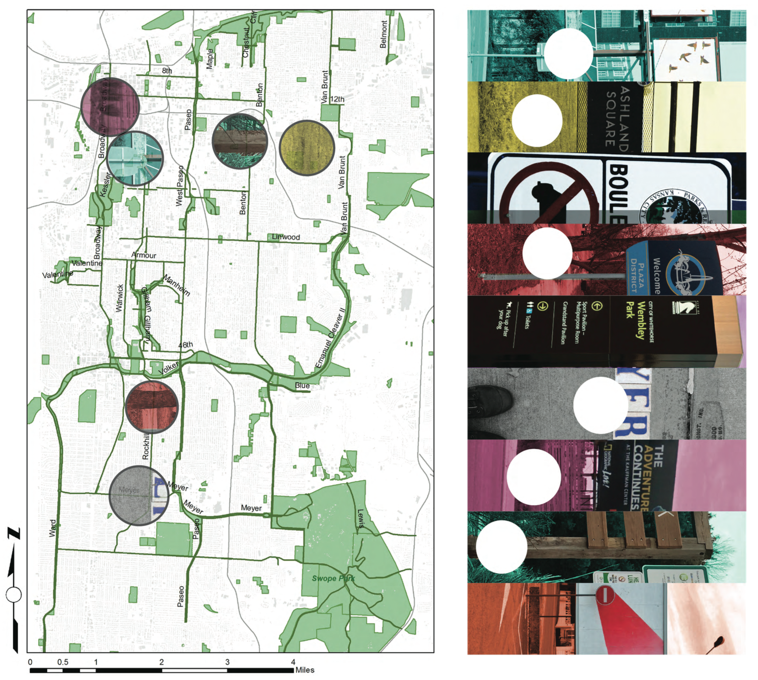
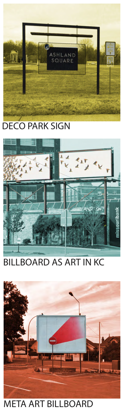
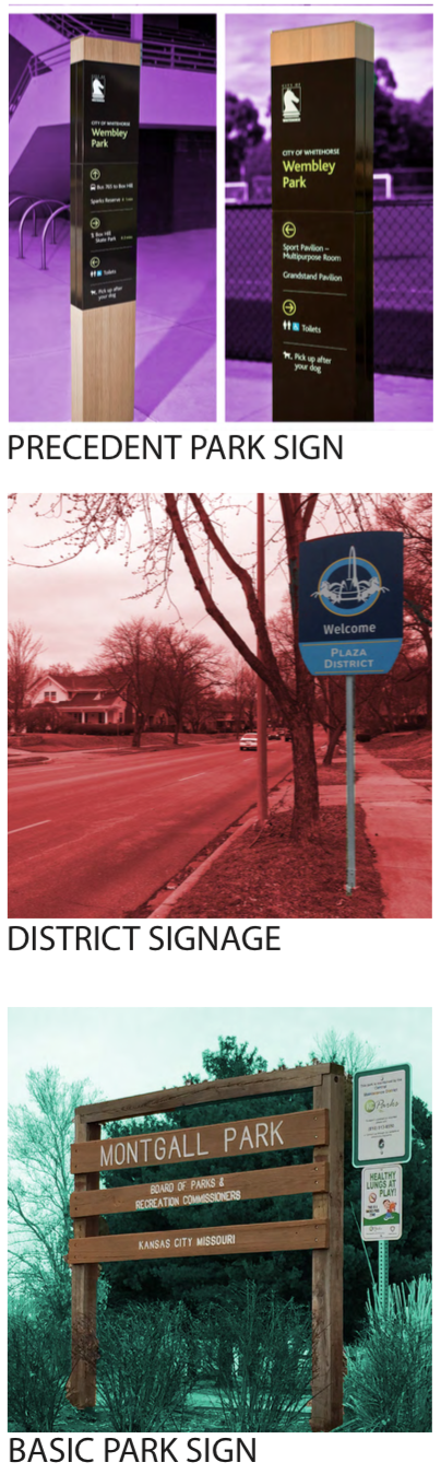
This map shows the relative locations of different kinds of signage that line the parks and boulevards system in Kansas City.
PRECEDENTS OF SIGNAGE ON PARKS & BOULEVARDS
There are a wide array of different kinds of signs in KC. I took as many examples that are representative of the different aspects of this design element.
IMPLEMENTATION
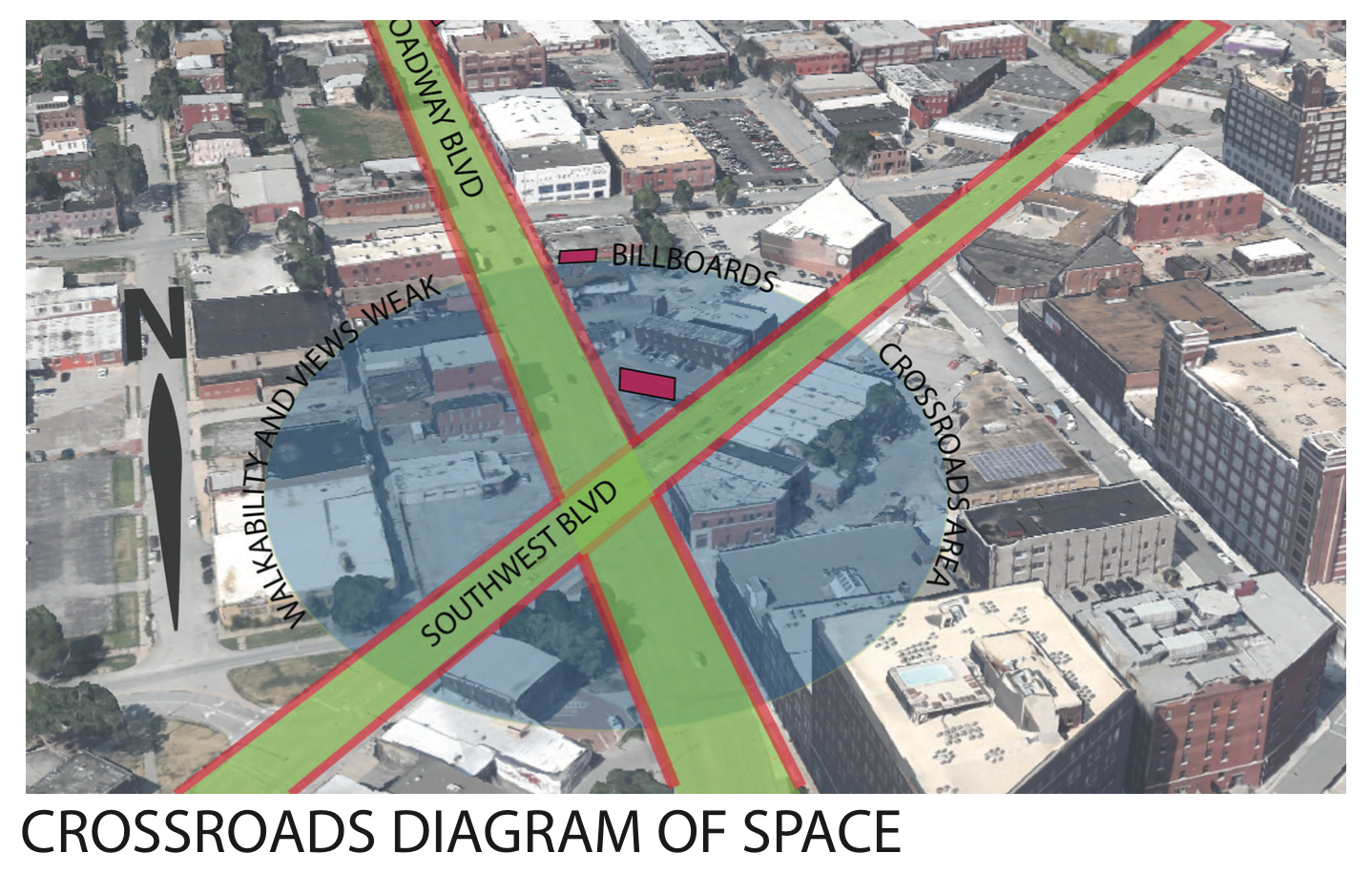
When diagraming the intersection of two famous boulevards in KC I noticed the importance of the crossing. As Broadway and Southwest Boulevard meet, there is an opportunity for a walkable route that could connect people throughout the crossroads. Currently, the billboards create a very impersonal scale for the pedestrian and also are an inherent negative externality to the passerby.
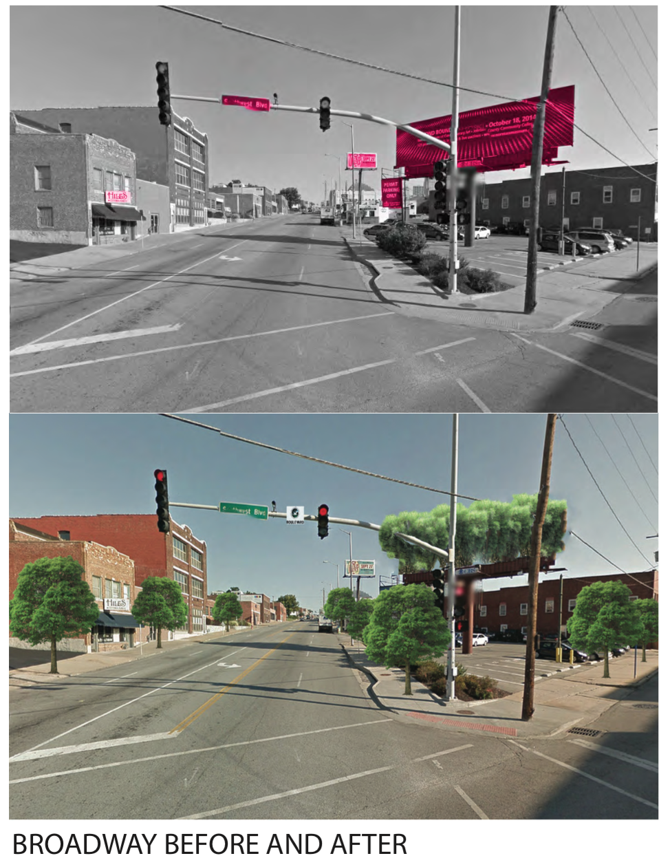
By implementing vegetation along the streets and restoring the streets to exemplify their namesake, the intersection takes upon an entirely different feeling. I also envisioned having a elevated garden green area where the billboard platform currently resides.
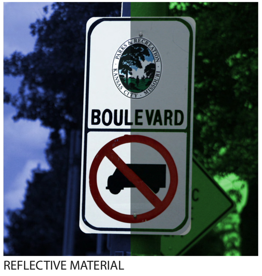
By increasing the brightness and adding a reflective material to new boulevard street signs, the information becomes much more readable.
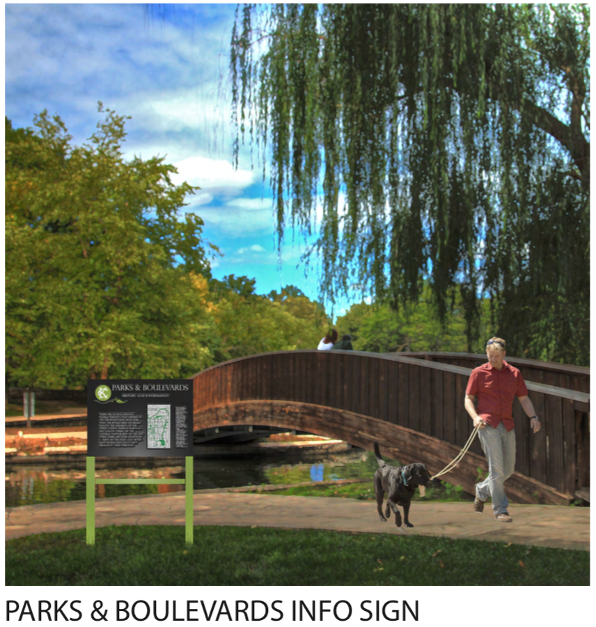
One of the things that I noticed through analysis and study of the Parks system is the lack of a design language. There also is a surprising lack of information and history that is shared in the public physical realm. I, in turn, envisioned a coherent and consistent park sign that could carry information, context, and history of the parks and boulevard system. People want to know about Kessler, and how the parkways and boulevards follow the topography, interconnecting the park “knuckles” dispersed around the city.
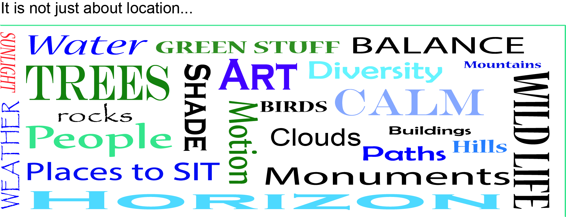
Most of us are fortunate to experience the world around us visually. There is an amazing and unfathomable amount of pictorial information bombarding us from all directions every moment of our waking lives. If we were to only sit and process everything we see we would do little else with our lives. We have become extremely good at blocking out the majority of what we see so that we can get on with our busy little lives- so much so in fact that when asked to consider the elements of a city Elements such as sidewalks, bus stops, benches, streetlights and signs are all tangible elements that we encounter daily but when it comes down to it, it is hard to immediately recall details about them. They are common but that is not to say that they are simple. These elements of our urban life are the complex and intricate fabric in which we stich in the experiences of our lives.
Another element of this public fabric and by far the largest of them, are views. A view is not a single entity that stands alone like a street lamp, but a view incorporates a wide range of other elements including something like a street lamp. Views are made up of many physical parts but are themselves intangible. Unlike a sidewalk, a bench or a bus stop, views don’t have a physical use. You cannot lean against one or ride your bike on one- its function in daily society is considerably more abstract but I would argue, no less important in the design, function and use of a city.
The Parks and Boulevards system of Kansas City is organized around the existing views of the city and is orchestrated to create additional views along its paths. These views serve many different purposes within the system and fall into two basic categories: moving views and staying views. Moving views are deliberately designed to transition you through a space and into another or are orchestrated to be viewed while moving through the boulevards. Staying views are what you find at your destination. Both of these categories house several different types under their roofs and I have probably only begun to touch on what they are but as I observed in the Parks and Boulevards system these are most common.
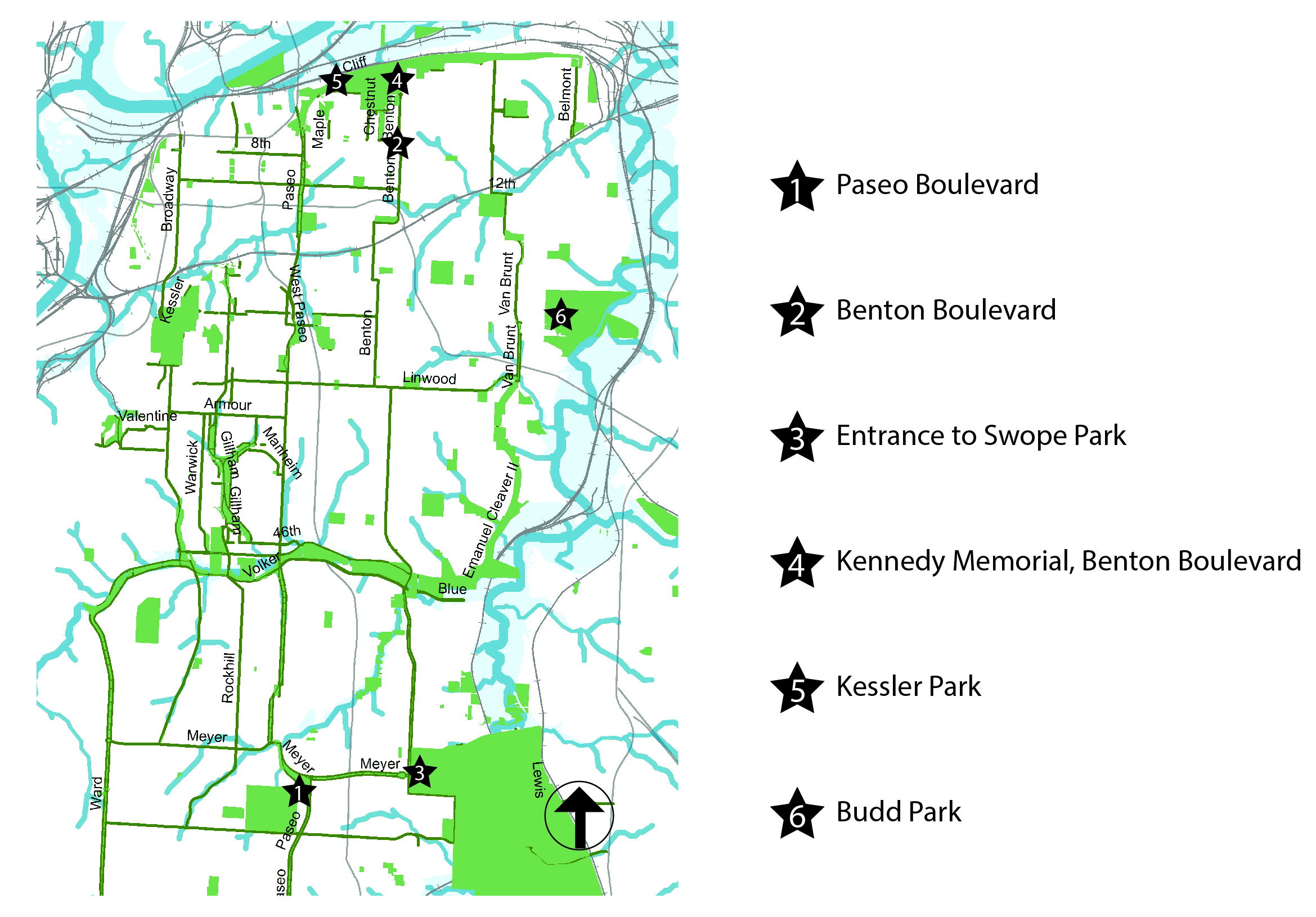
Transitional Perspective Views: These are designed to draw you along a path towards a destination. As in the first image in the series below on Troost, we don’t see where we are going exactly but we are compelled to go and see what is around the corner anyway. These invite you to follow along but to also enjoy the ride. The second image and diagram represent a more direct path to a destination, you can just barely see the Kennedy memorial at the end of the street but you can’t quite make it out. The entire length of Benton Boulevard heading north after Independence Boulevard leads up to this destination.
Moving Views of the Boulevards
Memorial or Termination View: The third diagram and example above are of the Kennedy Memorial at eh end of Benton Boulevard heading north. This type of view is also a perspective view but it has the grandiosity of a memorial or a significant structure or view that is clearly observable as you approach it. You know without a doubt that you have arrived at the intended destination and that it is important in some way.
Processional View: A series of memorials or structures that are interesting in themselves but that also serve to lead you on to your final destination as is seen in the 4th diagram and example of the memorials and water features that lead to the gates of Swope Park.
Iconic View: It is that skyline view that you see printed on the Kansas City version of the Starbucks mug. You know it. It is your city in icon form. These are the views that are representative of where you live, generally having to do with a skyline. I have put these under moving views because this is how they are presented most often but they are also an extremely common element of the staying views as well.
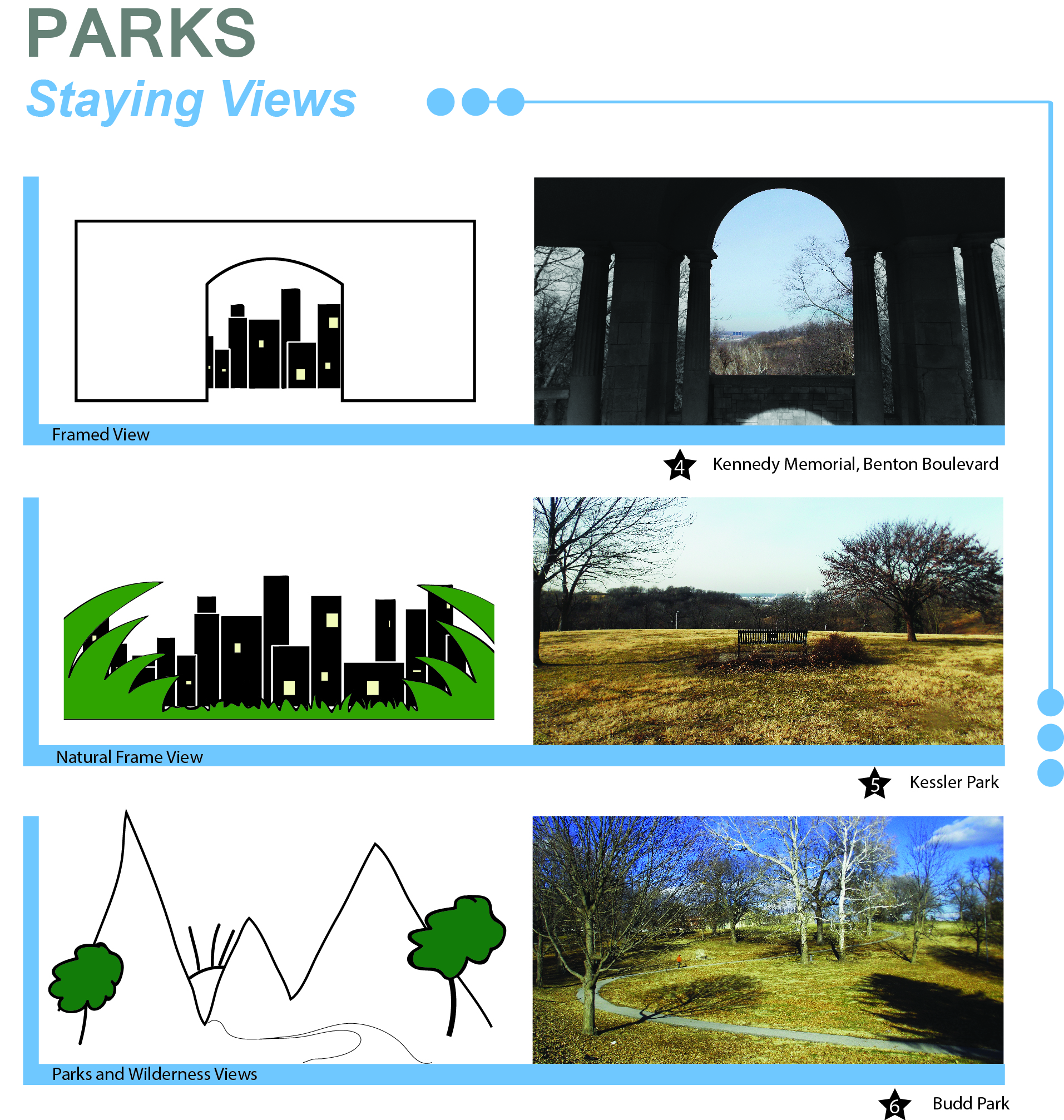
Staying Views of KC Parks and Boulevards
Framed View: An obviously manmade structure designed to direct the viewer to see a particular view. Generally seen if the viewer is standing in one particular location.
Naturally Framed View: Like the Framed View it is designed to direct the viewer to see a particular view but it is done so with natural elements.
Park or Wilderness View: This is a view that appears to have very little interference from manmade elements.
All of these types of views include elements themselves that make them views. A view is not the perception of a single entity but many harmonizing elements that come together in a particular place. The most crucial of these elements are natural elements like rivers and valleys always poised and contrasting against the horizon. If these are mixed with manmade structures you suddenly have an urban view and landscape. You would never consider a single rock a “view” but add to that rock plant life, set it near a stream, a backdrop of a mountain or a city scape breaking out of the horizon at sunset and bobs your uncle, you have a VIEW!
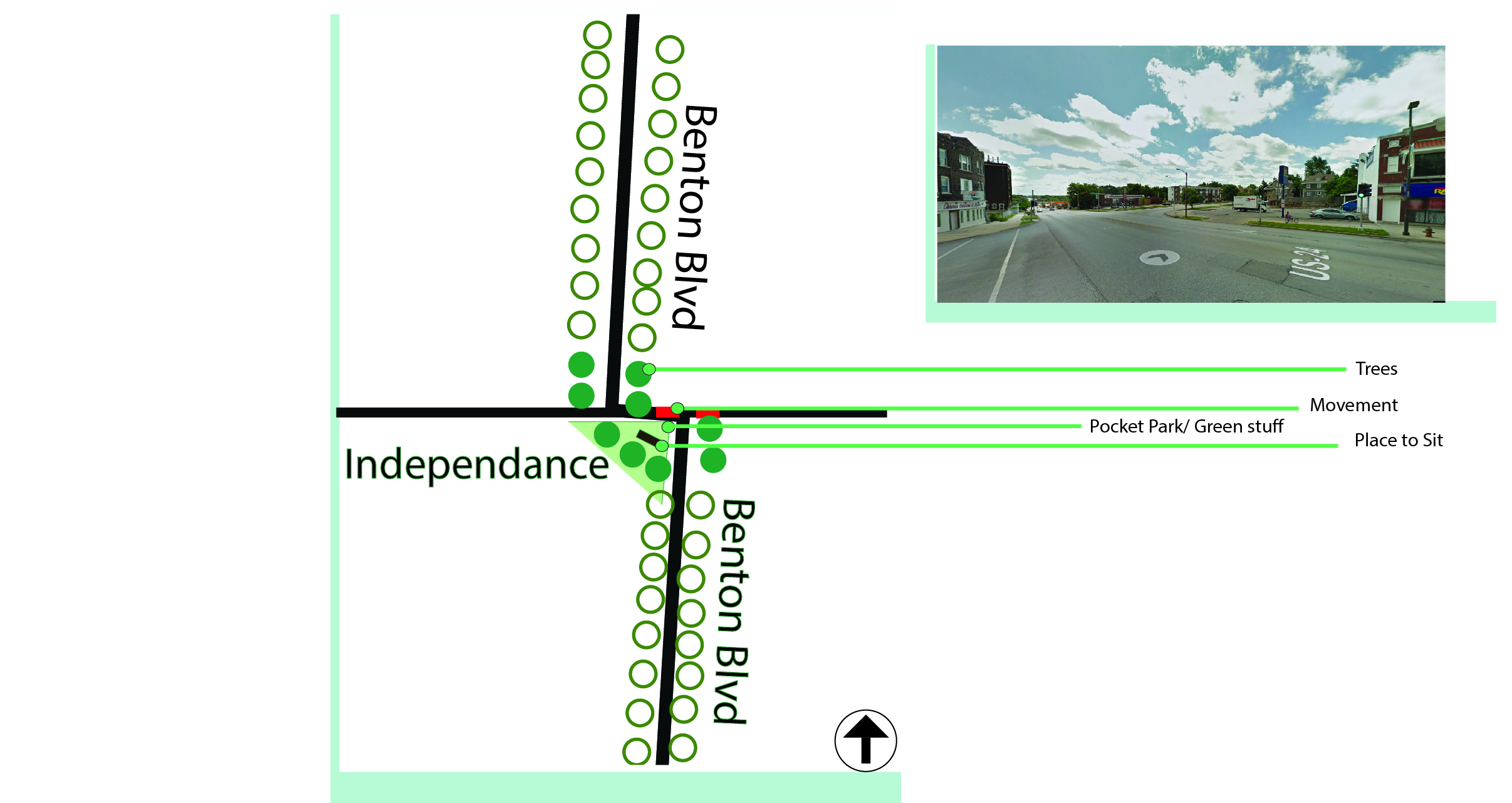
By manipulating these physical elements a view can be changed, ruined or improved. With this in mind I selected a section of the Parks and Boulevards system that could benefit from intervention of this type- A small section of the system where Benton Boulevard crosses Independence Boulevard. The P & B (Parks and Boulevards) system was originally designed around the idea of leisure drives through the city. This was conceived of during a time when cars were all the rage, back before society decided they were necessary, and people enjoyed driving and did it for fun. P & B was designed with luxury in mind so as you drifted through the slow river like boulevards at a whopping 20 mph you would be able to take in the sites of memorials, lakes, parks and natural and iconic views of Kansas City. At my intervention site where Benton Boulevard crosses Independence Boulevard it is clear that something has been lost over time. The continuity of the boulevard system temporarily breaks down in this place. On Benton heading either direction you experience big old trees, nice houses and lawns that make you forget you are in a city driving along a road that gently pulls you along through the corridor… and then you hit Independence Boulevard and suddenly you are in a city again- and not a very pleasant part of one either. Buildings are in disarray and many have been torn down and spaces left vacant or turned into a sea of parking lots. This can easily be changed and corrected by adding in a few simple elements of view.
Elements of a View Hanalei, Kauai, Hawaii
My vision for this section of the system is to add a monumental pocket park at the intersection of independence boulevard and Benton that would be viewed as you approached Independence heading south on Benton.
Intervention site
The addition of more trees, preferably older trees, would immediately begin to stitch the broken seams of this intersection back together. With the Kennedy memorial at the north end of Benton and a new memorial park at the south end, that particular stretch of boulevard would be nicely book ended and would add to the value and theme of the overall system. Planting older trees along Independence Boulevard in between the two Benton’s would bridge the gap there and help with the overall feel of connectedness of the boulevards and continue the slow easy river feel of the boulevards through the city.
Before planning the placement of a park, plaza or street in a neighborhood, the relation between all 3 elements, plus surrounding architecture, should be taken into consideration. The observations of 20th century activists and journalists on urban studies, such as Jane Jacobs and William H. Whyte, can be used as guides for modern designers, as insight from the past is often the foundation of new concepts. And although ideologies, technologies and living standards have changed over time, some things remain more constant than others – including the basic human need to enjoy outdoor spaces. Whether socializing in groups, in pairs, or singularly watching interactions take place around one’s self, people like to feel safe and comfortable while engaging in these activities.
Image 1. Street plan of Fifth Avenue (along Central Park), New York
“Knowing street sizes alone and what is in them is a major step in determining what is possible.” – H.B. Jacobs
H.B. Jacobs’s comparisons of ‘great streets’ in the U.S. to examples in European cities show similarities and differences in how various planners think, and in their ideas of what a successful street is comprised of, when juxtaposed with parks and buildings. On the Ringstrasse in Vienna, Austria, the positioning of trees and pathways on the border of a park created a natural extension to the park, much in the way that strategically placed benches and low walls give visual access to pedestrians passing New York City’s Central Park on Fifth Avenue. Both designs used elements that complimented the areas’ surroundings to attract visitors.
“The main problem of neighborhood park planning boils down to the problem of nurturing diversified neighborhoods capable of using and supporting parks.” – Jane Jacobs
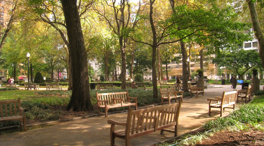
A common misconception about parks is that they are placed in neighborhoods to ‘save’ them, in a sense; parks are expected to be elements that keep communities alive and anchored. Activist Jane Jacobs wholeheartedly disagreed with that notion. In ‘The Death and Life of Great American Cities’, she argues that the opposite is actually true: people are the ones who add life and interest to parks. The types of people that frequent parks, and their patterns of use, are the main factors that give parks either a positive or negative vibration and aesthetic. In other words, parks don’t support people. People support parks! Rittenhouse Square in Philadelphia, Pennsylvania shines as an example of a successful park, because the neighborhood surrounding it is filled with people of diverse lifestyles. Mothers and children, working people, students, etc. frequent the park at different time periods; the varying demographic groups filter in and out of the park in cycles, creating a balance of use.
In stark contrast, Philadelphia’s Washington Square had to be closed and redesigned in the 1950s, because the amount of crime had become unmanageable for the police. This degeneration of the park was caused by the lack of regular visitors; Washington Square was surrounded by office buildings, whose inhabitants were workers with (more or less) the same daily schedules. Thus, the variety and frequency in visits to the park were virtually non-existent, and eventually, vagrants made themselves comfortable there. Jane Jacobs made an interesting point when she stated that the park was not ‘taken away’ from other users by the homeless, but rather they discovered an abandoned park, and made use of it.
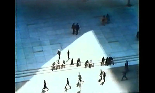
Image 3. Still from William Whyte’s “The Social Life of Small Urban Spaces”
“People tend to sit most where there are places to sit.” – William H. Whyte
The Street Life Project was a study conducted by sociologist William H. Whyte, to analyze how people utilize urban space. With the help of designers, planners and students, he filmed the activity of parks and plazas around New York City, and developed surprisingly simple conclusions based on the patterns he found, which was documented in his film “The Social Life of Small Urban Spaces”. The purpose of the observations was to answer a key question: What attracted people to plazas/parks? Although William Whyte believed that the location of a space was a prerequisite for success, he knew that an ideal location was not a guarantee that the space would thrive.
The activity seen at the study sites showed definite patterns in every day social interaction. People on their lunch breaks were the main focus on some plazas; factors such as sun angles, views and personal comfort guided every movement. William Whyte noticed that women were more discriminating than men when choosing where to settle in a plaza, and so it was safe to assume that a space with a higher ratio of women to men was probably well-managed. All of the spaces studied were located on major avenues or ‘attractive side streets’, and where there were ledges or steps near the sidewalk, men usually sat closest to the outer borders, while women gravitated towards spaces that were further back.
Out of all the positive aspects that were recognized in New York City’s parks and plazas, one feature bore the most significance. Of course, basking in the sunlight re-energized and uplifted the peoples’ spirits, splashing in water features relieved the stress of their morning work schedules, and stopping for lunch at food carts quelled their momentary hunger. But… if there was no place to sit and enjoy these amenities, would they be as popular? It is highly improbable! Seating was discovered to be the feature that attracted the most people to parks and plazas. Unconventional seating, like low walls, stairs and even sculptures, were used just as much (if not more so) as chairs and benches.
It is evident that the problems that arise when planning neighborhoods is rooted in the practice of separating a single element to plan, then trying to plan all other elements around it. All components of a neighborhood system reflect and depend on each other, as seen with parks, plazas and streets; when one part experiences trouble, there is always at least one other link that is affected as well. Conversely, one thriving element will positively effect another, which will eventually bring favorable results to the community as a whole, in one way or another.
Sources:
1. “A Compendium of Streets: Streets That Teach”. H.B. Jacobs
It’s not as simple as installing nice park benches (though that’s part of it)
In last week’s posts, my studiomates and I — having just been “introduced” to the system earlier in the week — posted our “first impressions” of Kansas City’s fabled Parks and Boulevards system, the focus of this semester’s design studio.
As was pointed out in those posts, half of us are from here and have been in contact with the system at least on and off all our lives: we weren’t posting our “first” impressions, more our understanding of the system based on a couple decades of experience.
But regardless of whether we were native Kansas Citians or not, a certain theme appeared in most of our posts last week. We each generally focused on a particular part of the system — usually, a specific park we had visited recently or were familiar with. The sites we were studying were different, our perspectives were different — and yet a theme emerged: that Kansas City’s parks and boulevards aren’t living up to their potential.
It was a sobering conclusion: that one of our city’s most distinguishing physical features isn’t fulfilling its function (and this finding was compounded by the realization that we each found the same thing). Parks are meant to have people in them, right? Yet, there were few — sometimes no — people in any of our studied parks. Boulevards, a somewhat trickier feature to study and measure the success of, certainly were driven on, we found — but we also saw that a whole other dimension of amenities offered by boulevards beyond their attractive landscaping — including shelters, monuments, open areas for sports — seemed to have been lost on Kansas Citians.
So what’s the problem? There was some chatter among us that, well, maybe it was the weather — we had initially visited our parks on a chilly January day, after all. But then some of us got back out on an unseasonably warm day later in the week and essentially saw the same. Maybe it was the time of day, or the fact we surveyed mostly on weekdays — even the best park’s going to have some ebb and flow. But over the last week, we’ve gotten out at various times of day, and even over the weekend, only to find most parks mostly empty. (And anyway, some of us were basing our judgement on years of observation and experience of these parks.)
No, for these underused parks, it seems there has to be some environmental characteristic of them — or possibly of the city around them — that was keeping people away.
The status quo of KC’s parks? Well-maintained, spacious, but empty? (Mill Creek Park at lunchtime, 1/26/2015.)
A Kansas City Specific Problem?
Of course, we can all picture well-used parks. My mind jumps to parks I’ve experienced while visiting bigger cities — Chicago, Montreal, and recently in Buenos Aires. As a Kansas Citian, some of these places were striking in how busy they were: so many people, young and old, doing all kinds of things — playing on swingset, throwing a frisbee, jogging, sitting, or just walking through.
Obviously, there are examples of well-used parks here. Everyone’s been to Loose Park. Mill Creek Park, with it’s horse fountain in the shadow of the ever-popular Plaza, is busy on balmy weekends and even weekday lunchtimes. A certain part of Gillham Park gets packed on a nice weekend day. Penn Valley and Swope Parks will usually have some kind of traffic on the weekends, regardless of weather (though these are regional parks, and I’m concerned here with smaller, more “neighborhood-oriented” parks).
But those are really just a handful. The Kansas City Parks and Boulevards System comprises “12,000 acres of parkland including 220 parks,” according to the parks department (2014). (That’s about 26 acres per 1,000 residents, which is about the median for US cities of our size [Trust for Public Land, 2011].)
Kansas Citians do seem to care about their parks system as a whole. In 2012, residents passed a sales tax dedicated to the maintenance and expansion of their parks system — this funding had previously just come from the property taxes funneled through the City’s General Fund.
So it’s not lack of interest that keeps so many KC parks empty. It’s not oversupply of park. And it’s not their condition — most parks here are very well kept. So, in short, it doesn’t appear to be something about the city, its residents, or the parks system as a whole that’s responsible.
Meanwhile, let’s keep in mind that even in cities with really great parks — Central Park, Millennium Park — there are always forgotten, empty parks.
So then, it’s not necessarily a Kansas City-specific issue — all cities can struggle to fill their parks.
That raises the question, then — what is it that makes a great park? Can we identify particular elements of urban and park design that lead to a busy park?
What makes a great park (or boulevard)?: The Jacobs/Whyte Formula
Luckily for us, we can turn no further than to the great Jane Jacobs for some answers. She devotes a chapter of her seminal Death and Life of Great American Cities (1961)to “neighborhood parks” (so, again, not regional attractions like Swope or Penn Valley).
Actually, though, Jacobs may not be the most prominent figure in the study of parks in the US — William Whyte, founder of the discipline of urban psychology, put together a widely respected analysis of parks in New York City that was turned into a film, as well as a chapter of his 1988 City: Rediscovering the Center (1996, 483).
Combine Jacobs and Whyte’s work and you end up with a powerful rubric for analysis a city’s parks.
Jacobs: “Diversity”
Jane Jacobs was all about upending conventional thinking about cities and urban planning of her era. In the Death and Life chapter entitled “The uses of neighborhood parks”– well, she might as well have stopped writing after the first two sentences:
Conventionally, neighborhood parks or parklike open spaces are considered boons conferred on the deprived populations of cities. Let us turn this though around, and consider city parks deprived places that need the boon of life and appreciation conferred on them. (1961)
Walk-off homerun, right there.
Basically, Jacobs says that parks are often created to become site of diverse activity with a diverse group of residents. Yet, she argues, what makes a park successful in this way is diverse activity already happening in the area. A vibrant, successful park, in other words, comes from a vibrant, successful neighborhood — not the other way around.
Jacobs uses a set of very similar parks around downtown Philadelphia for a sort of experiment to test this hypothesis. She explains:
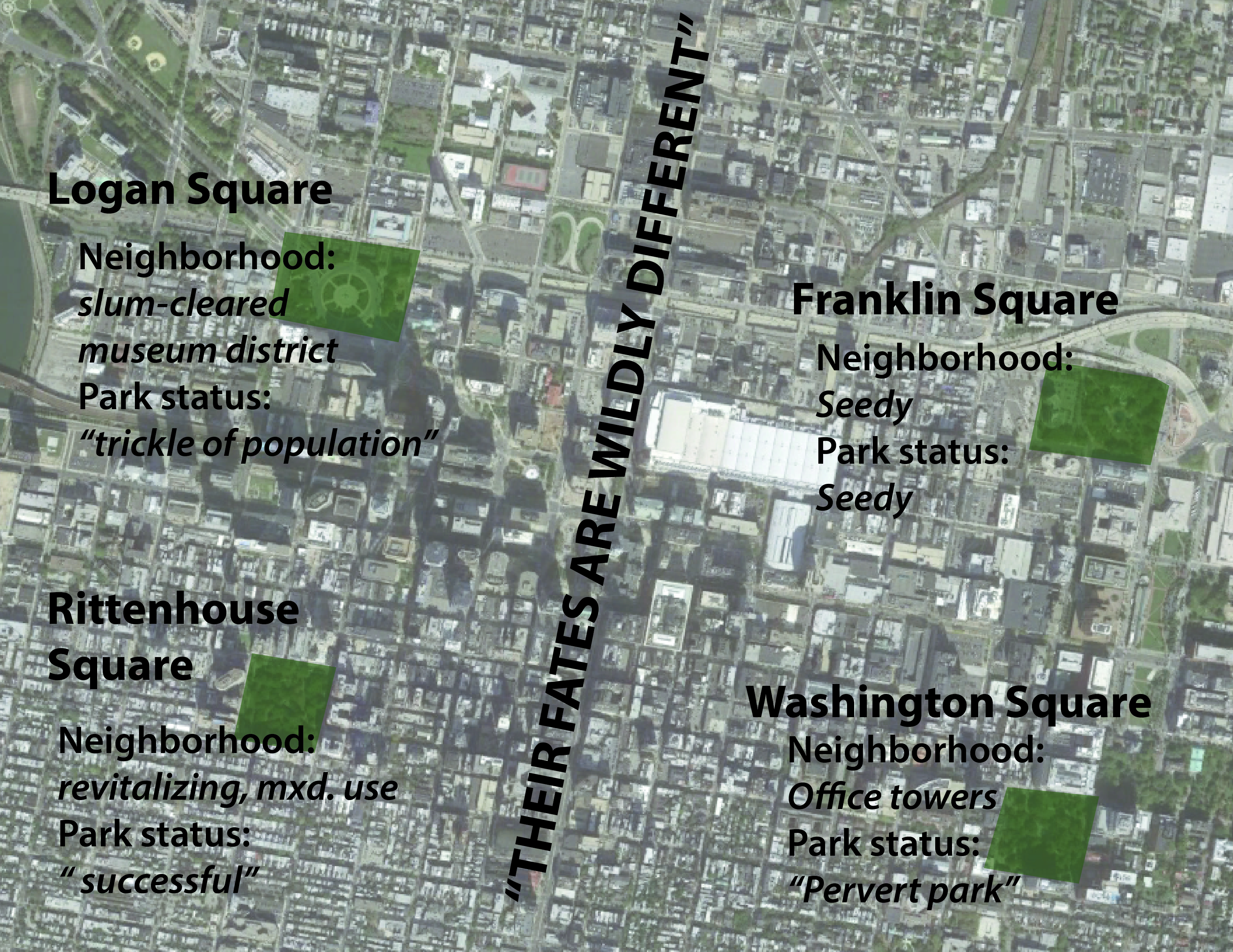
Philadelphia affords almost a controlled experiment on this point. When [William] Penn laid out the city, he placed at its center the square now occupied by City Hall, and at equal distances from this center he place four residential squares. What has become of these four, all the same age, the same size, the same original use, and as nearly the same in presumed advantages of location as they could be made?
Their fates are wildy different. (1961 p?)
The four squares, basically copies of each other, turned out differently based on the conditions in the neighborhoods immediately surrounding them. The figure below summarizes her findings:
The results of Jacobs’ experiment. Squares of the same size, age, and of similar design are strongly effected by their surrounding neighborhoods. Map source: Google StreetView
Jacobs essentially says that a park — after all, a relatively passive place — will mirror its surroundings.
And key to the continued success of a park is not only the quality of the neighborhood around it — whether it’s a “good” or “bad” place — but it’s also diversity of uses in the surrounding neighborhood that’s important too.
As Jacobs describes 1950-60’s Downtown Philadelphia, the areas around Rittenhouse Square and Washington Square are prominent, busy district — the latter is home to high-profile commercial office towers. The difference between the two is the degree of diversity in activity. Rittenhouse Square has around it, not only residences but “an art club with restaurant and galleries, a music school, and Army office building, an apartment house, a club, an old apothecary shop, a Navy office building… (1961 p?)” The list goes on.
What does this mean for the park? “This mixture of uses of buildings directly produces for the park a mixture of users who enter and leave the park at different times.”
And Washington Square? “Its rim is dominated by huge office buildings, and both its rim and its immediate hinterland lack any equivalent to the diversity of Rittenhouse Square — services, restaurants, cultural facilities. (1961 )” Consequently, the only significant population who would use the park are office workers from the surrounding buildings, describes Jacobs, and they are only free at lunchtime. And the relative “vacuum” of space that is created is filled by undesirable characters who end up scaring a lot of the office workers off altogether. This park, now known as Washington Square Park, shares some eerie similarities with Kansas City’s park of the same name near Crown Center.
“Design:” Whyte (and Jacobs, too)
I was prepared to set Death and Life down and begin work on my final project right then, after reading the results of Jacobs’ Philadelphia experiment: the “diversity” explanation seemed so spot on.
And there’s nothing to suggest that Jacobs was anything but spot on there. But even she added some detail to what makes a great park — this time, focusing on the specific design elements of a park. After all, the most vibrant neighborhood around just a plot of mowed grass probably wouldn’t make for the best park.
Jacobs defines four elements integral to the success of a neighborhood park:
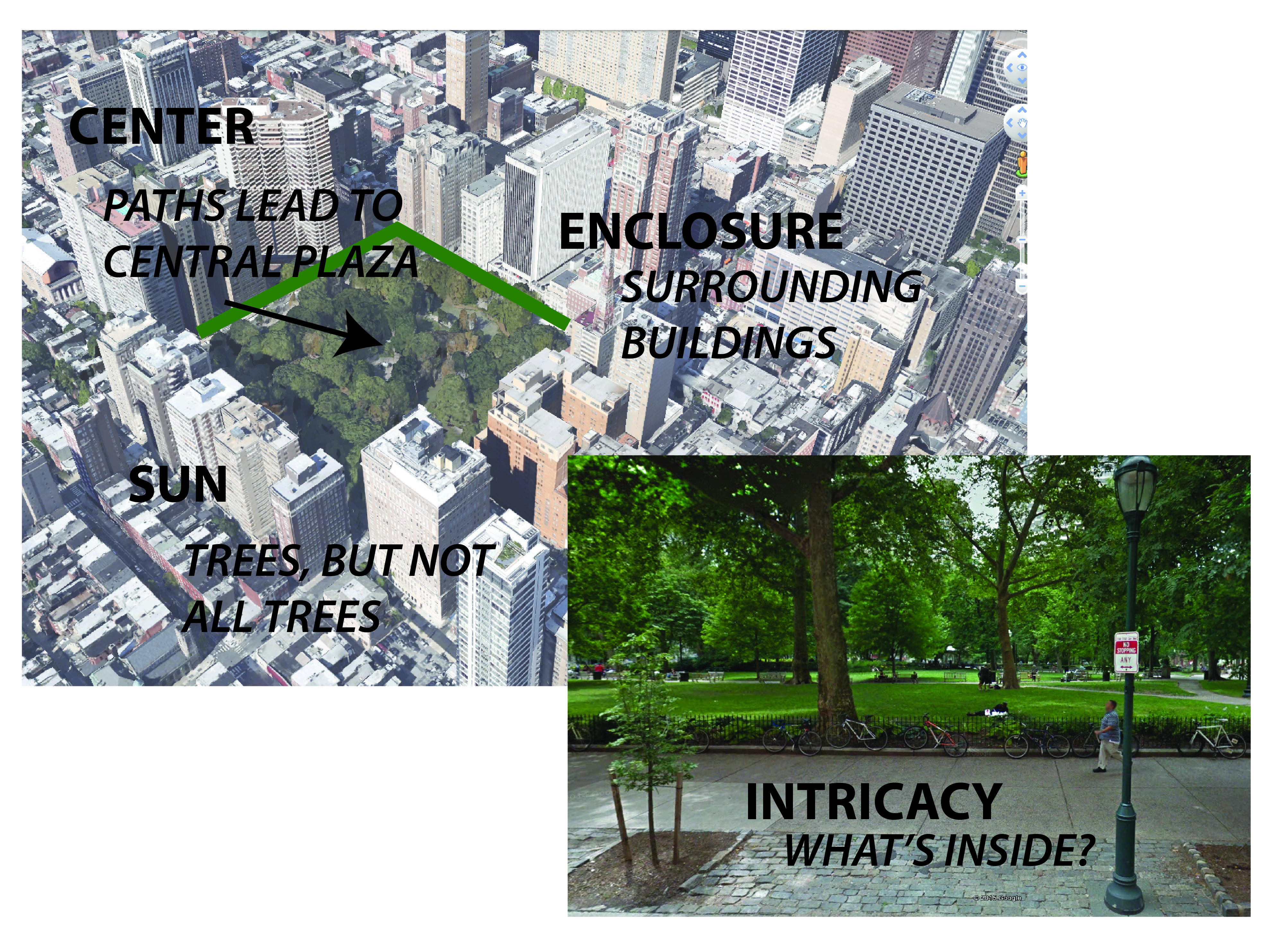
1. Intricacy: A complex, interesting plan. “[C]hange in the rise of ground, groupings of trees, openings leading to various focal points… (1961)”
2. Centering: A well-defined center point, something that pulls people into and/or through the park. Jacobs criticized “[l]ong, strip parks” especially for generally lacking a center, which she says leads to confusion among park users as to where they should go.
3. Sun: A balance of sun and shade. Too much open space exposed to the sun without trees for shade is bad; so is a giant, chilly shadow cast by a building.
4. Enclosure: Usually by surrounding buildings, making a “definite shape out of the space, so that it appears as an important event in the city scene… (1961 )”
Rittenhouse Square embodies these four characteristics.
Jacobs’ four criteria for good neighborhood parks as seen at today’s Rittenhouse Square. Map/photo source: Google Earth/StreetView
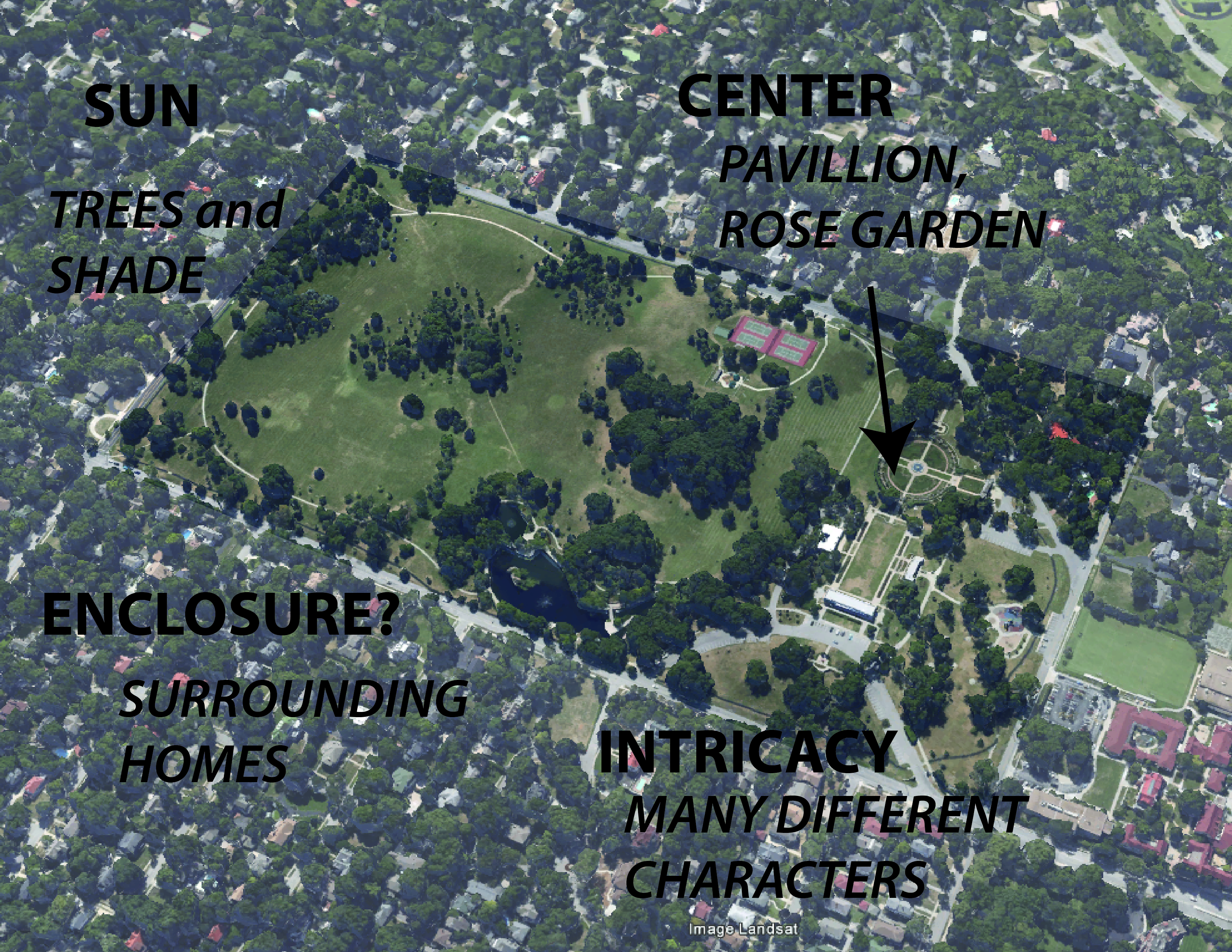
A mixture of two or three of these criteria could be attributed to Kansas City’s best parks (most are probably going to lack strong “enclosure,” though, due to our low density). Loose Park has intricacy, centering, and a good mixture of sun and shade (and some enclosure). Gillham Park has intricacy, sun, and even enclosure. (Penn Valley and Swope Park, while popular, aren’t exactly neighborhood parks, so it’s unsurprising they defy Jacobs’ standards, lacking centers and enclosure and just being somewhat chaotically organized.)
Jacobs’ criteria applied to Kansas City’s Loose Park, possibly explaining the park’s success. Map source: Google Earth.
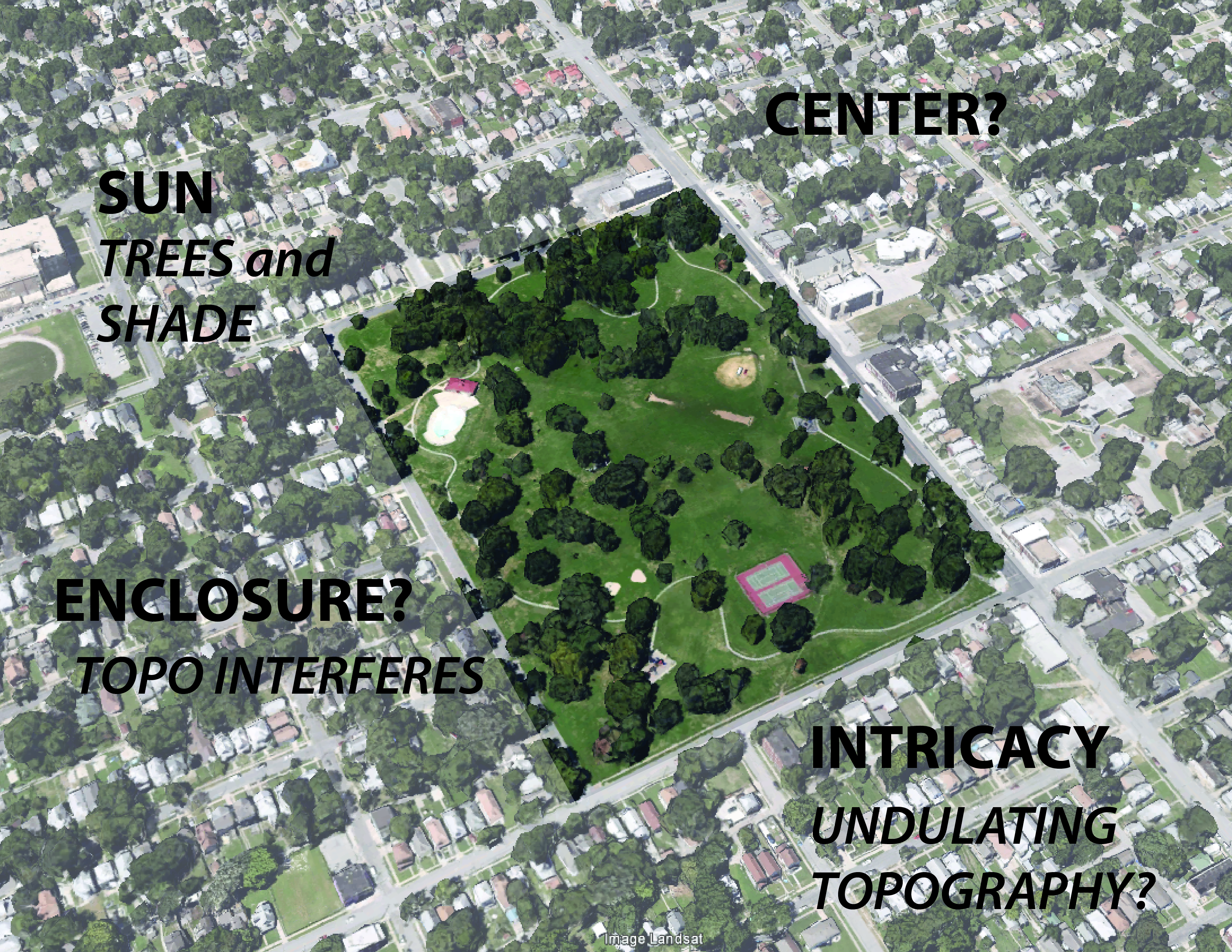
Most parks in KC, though, are missing most of these elements. Many parks, lacking intricacy, can be taken in with a single glance, usually consisting of an open, uninspiring lawn, with maybe a path or playground on the edge. An that focus of elements on the edge — probably to be near parking — leads to a lack of centering of anything (except the lawn?). Addressing the sun may be what Kansas City’s parks do best, but even some parks lack trees or shelters at all. Very few parks here are enclosed, and many just melt into their surroundings, never declaring themselves as a distinct destination; some parks are defined by a line of distant trees along their back edge, but that effect is actually somewhat unsettling (what’s lurking there?).
Jacobs’ criteria applied at Budd Park. Sun is addressed, some intricacy could be attributed to the undulating topography, but other element are problematic. Sense of enclosure (definition of park boundaries) is defeated by the rolling terrain; there’s no center or even just a main node. Map source: Google Earth.
Jacobs’ design criteria, seem, on the surface to explain the popularity (or lack thereof) of Kansas City’s parks. But really what’s that different about Loose Park and Budd Park? Is Loose’s Rose Garden and pinic pavillion enough to attract that many more people?
William Whyte’s design standards for good park space mostly affirm Jacobs’. His survey of New York City plazas in the 1970s found the most popular created visual interest (intricacy) with multiple levels, stairs, fountains, etc.; they got a good mix of sun and shade; they had centers, or at least defined nodes; and they had defined edges.
Whyte added several new findings to the understanding of park spaces, though. He and his fellow researchers, intricately mapping the flow and displacement of people in public spaces in New York City in the 1970’s, established two key patterns. First, they found that some of the most popular plazas were the most central, located closest to the largest office buildings. (This dovetails to some extent with Jacobs’ “diversity” argument.) Whyte qualified this, though: “Our initial study made clear that while location is a prerequisite for success, it no way assures it. Some of the worst plazas are in the best spots…. (486)”
The absolute defining factor, though, was the amount of sittable space in a plaza: “People tend to sit most where there are places to sit (487).”
And, in fact, more so than really any parks in Kansas City, two of the city’s most popular parks — Loose and Mill Creek Parks — or rather, the most popular parts of these parks are both centrally located in the city (near the busy Plaza) and they offer plenty of places to sit. At Loose Park, there’s the pavilion, the Rose Garden, each with plenty of benches; at Mill Creek Park, benches surround the iconic fountain at the south end of the park, and plenty of people just take a seat on the fountain’s generous rim. Many people walk to these parks — though most probably still drive.
But if all of this is the formula for good parks in Kansas City, the city soon starts to complicate things by introducing another element to its parks system: boulevards.
Boulevards
Jacobs’ and Whyte’s rubric might not, at first look, seem to be applicable to the spaces created by Kansas City’s numerous boulevards and parkways. (How can you even define a center/node for a street?)
Actually, though, Kansas City’s boulevards do meet many of the design criteria defined by Jacobs: To some degree, they create enclosure and intricacy, and manage sunlight well.
What they usually lack is the surrounding diversity of uses that Jacobs claims made Rittenhouse Square work so well: KC’s boulevards, after all, run through chiefly residential areas.
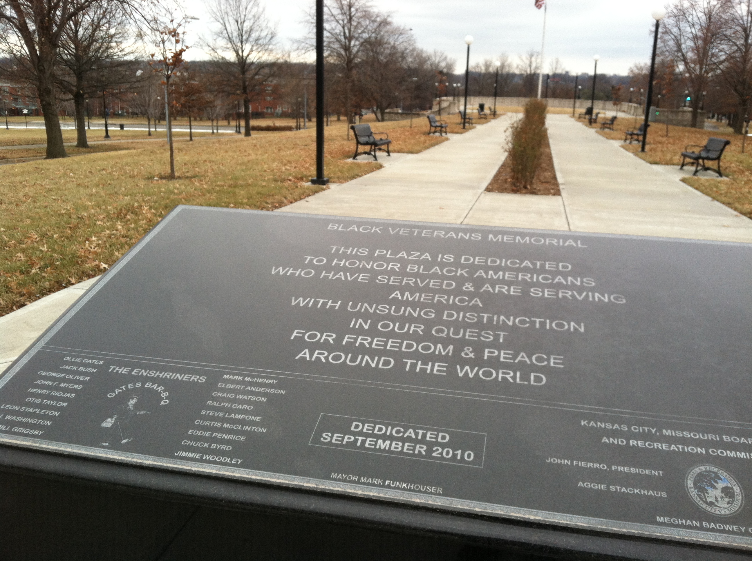
Meanwhile, Kansas City’s boulevards do not generally offer a place to gather, or just to be in. There are no places to sit. (Rare exception: The Black Veterans Memorial, in the median of Paseo near 9th St. Problem: lack of surrounding diversity of use.) Boulevards are places to drive or walk through, moving from an A elsewhere to a B still somewhere else.
Another notable “Jacobs” involved in planning research, HB Jacobs, provides a possible alternative for Kansas City’s boulevards. Jacobs wrote a compendium of great streets from around the world, aptly entitled Great Streets (1995).
Unter den Linden, Berlin. Source: Google StreetView.
One example he illustrates, that of Unter den Linden, a boulevard in central Berlin, checks all the boxes in the Jacobs/Whyte rubric: a diversity of uses is evident in the mixed-use building on the left in the photo above; expand the photo, and you’ll see that benches line the edges of the central median; meanwhile, the boulevard’s central location in the city probably helps make it successful. ( Jacobs adds: “The lindens are uniformly, 8 meters apart; the smell is beautiful, a reason to go there (148).”)
Ward Parkway, the median of which looks about as wide as Unter den Linden’s, will never look much like this photo otherwise.
What it — along with Paseo, Broadway, Benton — could become that is like the Unter den Linden above, is more of a place for people. That doesn’t mean tearing up all the grass in the median and verge for gravel pathways — but it could mean adopting some of the design elements I’ve already discussed. How about benches placed in the medians at major intersections with other streets? It would be a start. And where our boulevards do, in fact, mix with diversity of use — like, along much of Broadway Boulevard — sidewalk seating for likes of restaurants and cafés is not only doable, it seems imperative to attracting people to simply be in the street. The real challenge: Turning these lessons into action in KC
In truth, a lot of what Jacobs and Whyte discuss seems to not be applicable to Kansas City. We’re not Philadelphia or New York. Few of our parks are the squares discussed by Jacobs or the plazas surveyed by Whyte. We could never live up the sketches of European boulevards in HB Jacobs’ Great Streets.
Yes, our parks (and boulevards) are somewhat different creatures.
But the theme common to the great examples of planning/urban design I’ve shared here is that those spaces are made for people to be in. And the reasons they attract people — a center node, plentiful seating, well-defined edges, etc. — still seem to ring true.
That implies many of Kansas City’s parks — which lack these elements — could use a redesign.
The most elaborate overhaul of our city’s parks wouldn’t matter, though, if we didn’t a better job of putting parks where people are. But then, remember — parks mirror their surroundings: safe, vibrant parks will only exist in safe, vibrant neighborhoods.
And if that’s accurate — well, we have a lot of work to do in Kansas City, and parks really become the least of our worries.
References
Jacobs, HB. 1995. Great Streets. Cambridge, MA: MIT Press.
Jacobs, J. (1961). Death and Life of Great American Cities. New York:Random House.
KCMO Parks & Recreation Dept. (2014) “About KC Parks.” KCParks.org. From http://kcparks.org/about-kcpr/
Trust for Public Land (2011). 2011 City Park Facts. PDF. From https://www.tpl.org/sites/default/files/cloud.tpl.org/pubs/ccpe-city-park-facts-2011.pdf.
Whyte, William H. “The Design of Spaces” as reprinted n LeGates and Stout’s (1996) City Reader, NY: Routledge.
Last summer I had the opportunity to travel to California for several weeks. My sister and I spent time driving up and down the coast of central California exploring the landscape and more than anything — attempting to feel the environment. We decided that we would like to go to San Francisco for a couple of days before we had to return to home, so we booked an AirBnB in a reasonable part of town and took a bus out to the city. My family and I had traveled to San Francisco twice before and both times were entertaining, yet this time was different.
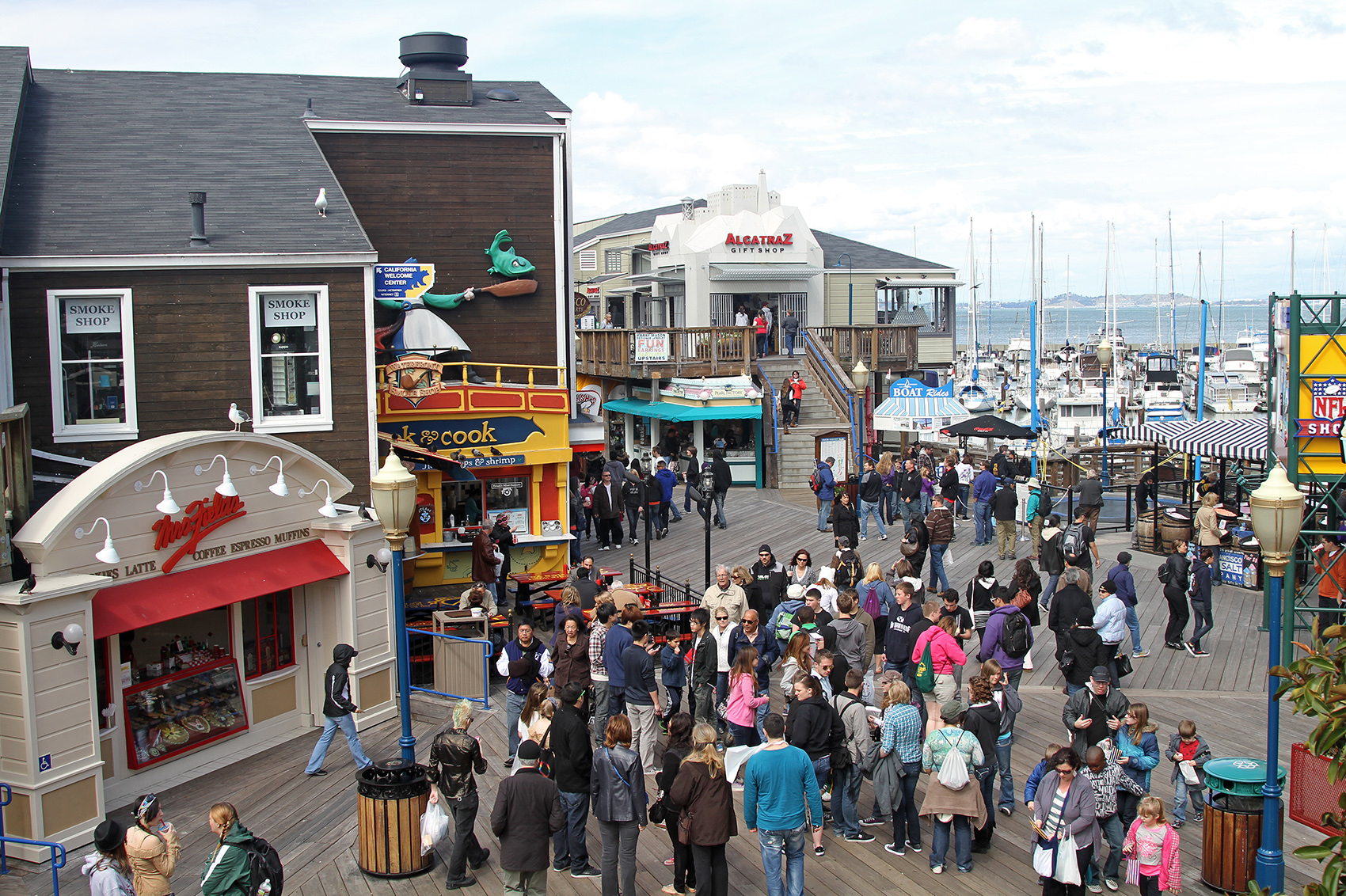
In the past we had drove to each landmark in the city and done the pre ordained activity. Yet on this trip we skipped the Pier, Chinatown, and the stone fortress island of Alcatraz and focused on what it meant to be an active member of the city. Our host at our room share informed us of activities and areas to check out that you wont find in any tour guide pamphlet and my sister and I set out on our journey. As we walked the city, we began to notice that this was not the same San Francisco that we had been to twice before. Everywhere we turned there was something different, yet something the same. The streets were the destination.
“Are we having fun yet?” Fishermans Wharf (Source: Google Image)
What makes a good park? Or bet yet, what makes a not so good park? Throughout the cities in the United States you will come across parks in almost in every shape, style, and appeal. But what makes a park so inviting for individuals, rather it be to just get away from the chaos or a nice family outing?
Many times I have traveled the city and driven past lonely, ignored parks. Different aspects go into the planning of each park for its specific purpose, so why are these parks so separated from the public. Be it the neighborhood, diversity, or behaviors that make themselves known in these beautiful parks tend to make them less appealing to individuals who are seeking comfort from them. In Jane Jacobs’ book titled “The Death and Life of Great American Cities”, she says “Too much is expected of city parks. Far from transforming any essential quality in their surroundings, far from automatically uplifting their neighborhoods, neighborhood parks themselves are directly and drastically affected by the way the neighborhood acts upon them.” Parks located around densely built environments of a city allow individuals with a space for recreation or relaxation. However, if a park is surrounded by too much open space, for example the neighborhoods on the east side of Kansas City, Missouri which contains thousands of vacant grass lots can remove the important aesthetic appeal which a park can bring to its neighborhood. “Cities are thoroughly physical places. In seeking understanding of their behavior, we get useful information by observing what occurs tangibly and physically, instead of sailing off on metaphysical fancies. (Jacobs)” What qualities make for a great park?
When planning for a park system in a major city one of the most challenging areas to plan for is for the central part of the downtown. During all the hustle and bustle that goes on in Downtown many people overlook the small city parks and plazas which are important to these busy streets. In the “Street Life Project” which is mentioned in the report “The Design of Spaces” by William H. Whyte, was a study that explains how urban space is used by people. The study found the most important aspect of urban space is how people are drawn to them (Whyte). A useful source for planning the movement of people throughout the city, especially downtown, is the compilation of examples in “Great Streets” by H. B. Jacobs. Jacobs examples of streets throughout the world can be used to implement practices that have worked for centuries in street planning. When planning the location of an urban space Whyte emphasizes that ” the space should be in the heart of downtown, close to the one hundred percent corner – preferably right on top of it.” Since most people will walk to these spaces Whyte recommends that “the effective radius of a good place is about three blocks.” The study found that “about eighty percent of users will have come from a place within that area.”
When it comes to designing an urban space within a downtown district Whyte concluded that “the elegance and purity of a complex’s design has little relationship to the usage of space around it.” The size of the space is very important, “they like well defined places, such as steps or the border of a pool. What they rarely choose is the middle of a large space. (Whyte)” It was also proven that the size of the space had no effect on the total number of people. When taking all things into account to make a better place for people to go, it is important to remember that people are what makes a space great.
“Only a genuine content of economic and social diversity, resulting in people with different schedules, has meaning to the park and the power to confer the boon of life upon it.” – Jane Jacobs
Sources:
H.B. Jacobs, A Compendium of Streets: Streets That Teach
Jane Jacobs, The Death and Life of Great American Cities, (1961)
Urban design can often play an important role in the public realm. It’s ability to influence personal behavior and its effect on social interaction are feats in and of themselves. Based on the ideas of congregation and movable chairs, American Urbanist William Whyte, is profound in the way he approaches urban space. In his documentary, The Social Life of Small Urban Spaces, Whyte examines the design of public spaces and how they influence social behaviors among their visitors. Public spaces are for people, clearly, but the ways people respond to these spaces are varied. Whyte’s dawn-til-dusk observation revealed many usage patterns, including time of day, gender ratios, and varied durations of stay. But what was it that deemed one park more successful than the other in Whyte’s study? In many instances, it was a matter of quality over quantity — meaning that the human appeal of a public park isn’t necessarily relative of its size, but rather its level of versatility. To put it lightly, if a person feels the desire to sit on the edge of the fountain, then you better make sure the fountain ledge is low enough.
William H Whyte
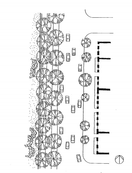
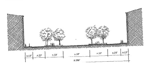
No different than some of Whyte’s thoughts, the ideas of H.B. Jacobs expressed in Great Streets reflect the influence of streetscape design on social behavior at the pedestrian scale. The use of street plans and cross sections accurately display the relationship between pedestrians and the buildings surrounding them. Different characteristics of the streetscape, including street width, the presence of vegetation, or even the placement of building entrances offer various influences on pedestrians. Although a particular street may be overly generous in width, much like Jacobs’ diagram of a Barcelona streetscape, the presence of vegetation helps break up space, and offers a sense of intimacy, despite the nearly 100 foot right-of-way. Similarly, the use of large glass panes, and strategically placed entrances offers a sense of permeability to pedestrians, and serve to keep human traffic flowing along the streets, in and out of buildings.
Jane Jacobs, in her book titled The Death and Life of Great American Cities, describes aspects of public parks that mirror many ideas of both Whyte and Jacobs. Described as volatile places, which exhibit complex behavior of extremes in popularity and unpopularity, Jacobs notes several examples of successful parks: Rittenhouse Square, Rockefeller Plaza, or even Washington Square. However, she also notes their counterparts, which she labels as city vacuums. So what is it that distinguishes a Boston Common from a city vaccuum? According to Jacobs, it seems to be the misconception of park behavior. Although examining park behavior is helpful, it is misleading to say that generalizations about human behavior can adequately explain all attributes of a single park. Therefore, it is imperative to look at park behavior relative to its location in the city. Take for example, Philadelphia, a central square, flanked on all four sides by smaller residential squares. All four the same age, yet, a drastic difference in fate — or in some cases, demise. The most successful of the four, Rittenhouse Square, is predominately influenced by its central location within a thriving neighborhood. Franklin Square, or Philadelphia’s Skid Row, is influenced not only by the groups of homeless and unemployed that gather, but also by the mix of flophouses, motels, and tattoo parlors that surround. Washington Square, a once downtown hotspot, has since transformed into the “Pervert Park”, influenced by high crime among the surrounding area. The fourth, Logan Circle, has transformed from a prime example of City Beautiful planning, to a traffic circle, which serves as nothing more than a point of interest for passing motorist.
Together, the opinions expressed in these writings suggest one thing — Urban design is an important role in the public realm. What does this mean for Kansas City and the 21st Century Parks & Boulevards? It’s simple, if we want people to use the parks we build, then we must build parks that people want to use. If we plan to revitalize this system as the transit backbone for motorists, cyclists and pedestrians alike, then we must, at the very least, consider these opinions and characteristics. Given that multiple parks and boulevards intersect at various points throughout Kansas City, it is important to realize each park independently susceptible to many factors that determine its behavior. In order to provide a consistently enjoyable experience across the parks system, all of these factors must be taken into consideration, otherwise, similar to what Jane Jacobs stated, we’re doomed to having parks where there are no people, and people where there are no parks.
Sources:
Jane Jacobs, The Death and Life of Great American Cities, (1961)
H.B. Jacobs, A Compendium of Streets: Streets That Teach
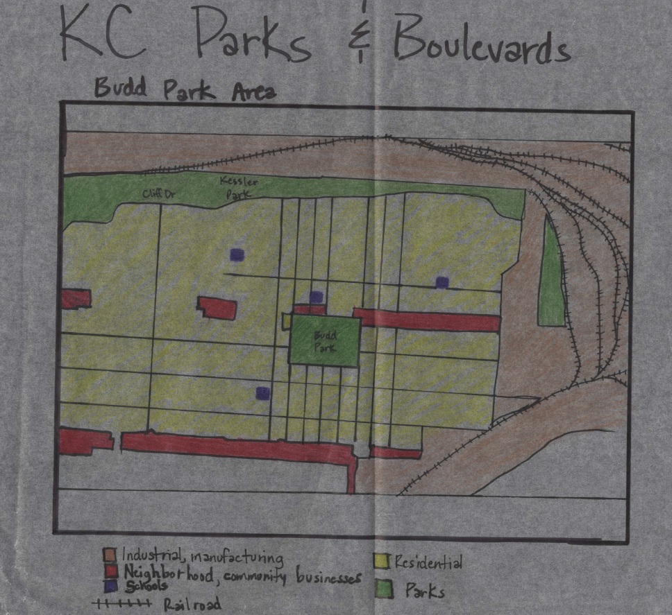
To begin my study of Kansas City’s Parks & Boulevards system, I visited a few sites within the system with my classmates from UMKC, to get the in-person understanding that an internet search cannot provide. While we only visited a few places, the system actually contains hundreds of sites. Budd Park, located in northeast Kansas City, and Troost Lake, located about 5 miles southwest of Budd Park, were the 2 locations that evoked the strongest (although almost polar opposite) reactions from me. Both are examples of historical parks whose positive and negative features can be analyzed for the purpose of creating more successful parks, and for improving the conditions of the existing parks themselves.
The first stop was Budd Park, a 26-acre expanse of land generously dotted with trees, located at St. John and Brighton Avenues. Acquired in 1890 as the second park in the Parks & Boulevards system, more recent history of the area surrounding the park has been overwhelmingly negative, due to the high crime rate. Nonetheless, the park’s atmosphere was warm and inviting upon our approach. The late afternoon sun shone brightly through the trees’ branches, casting long shadows across the grass (Image 1). Winding through the naturally uneven topography was a paved walking path which, besides two passersby, had no traffic during our short visit. We only viewed the west side of the park, but even that limited perspective of it was enough to give me the impression of ‘Welcome’.
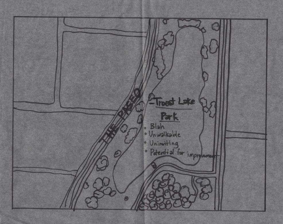
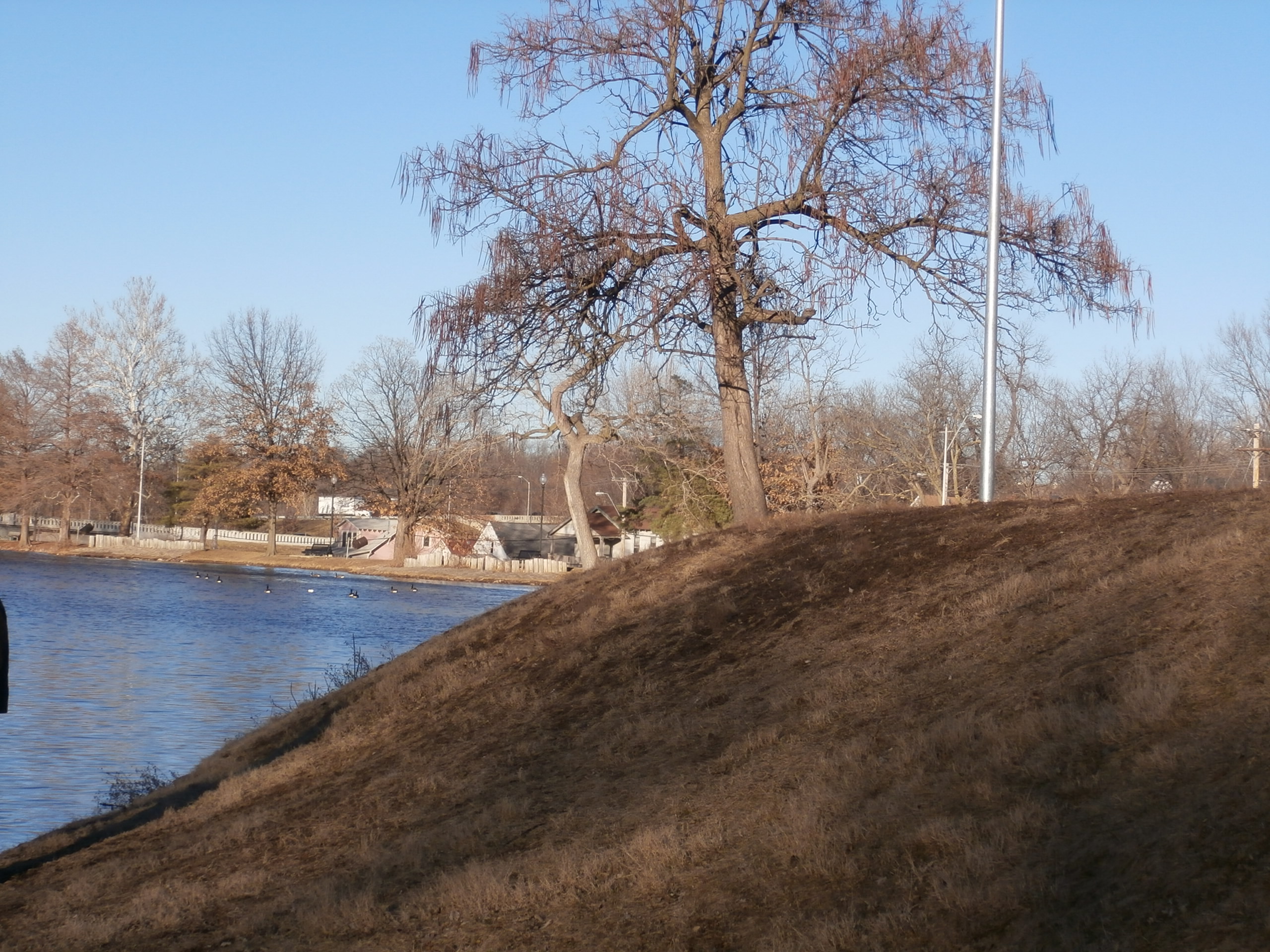
On a more somber note, our stop at Troost Lake left a less favorable impression on me, to say the least. Troost Lake was the water supply for Troost Avenue in the 1800s, and the avenue itself has a fascinating history, from a socioeconomic standpoint. But nothing fascinated me about the lake, in it’s current state. Something about the contrast between the dark blue/grey water and the muddy, patchy grass, along with the overall stillness within the site’s parameters, brought to mind words like ‘lonely’ and ‘barren’, instead of ‘calm’ and ‘peaceful’ (Image 2). To add to the feeling of isolation at the lake, just yards away from us, at a house on Vine Street, there was a lively group of people dancing away as their music played. In fact, my class made more comments about the people on Vine Street than we did about the lake!
In my opinion, the feeling of invitation I experienced at Budd Park and the feeling of emptiness at Troost Lake had a lot to do with location. Budd Park is centered in a residential neighborhood that contains 4 schools, religious centers and pockets of neighborhood businesses, all which give the community (albeit not as safe as it once was) some sense of comfort and togetherness (Diagram 1). In comparison, Troost Lake is sandwiched between the Paseo, a major north-south parkway (to the west), and Interstate 71 (to the east) (Diagram 2). Instinctively, many people feel the need to just get from their starting point to their destination when travelling along a busy street; stopping for leisure in such areas seems counterintuitive. Also, Troost Lake would benefit from the addition of a paved walking path, which would provide a safer experience for visitors. Currently, the banks of the lake are rocky and muddy, and collect litter in some spots (Image 3).
I had never given much thought to the importance of how parks and boulevards were incorporated into neighborhoods, and the enhancement that well-planned parks can add, or the depreciation that poorly- planned or -placed parks can cause. This analysis is proving that planning is a fundamental component to the development of neighborhoods/towns/cities, even on what seems to be the most inconsequential of scales.
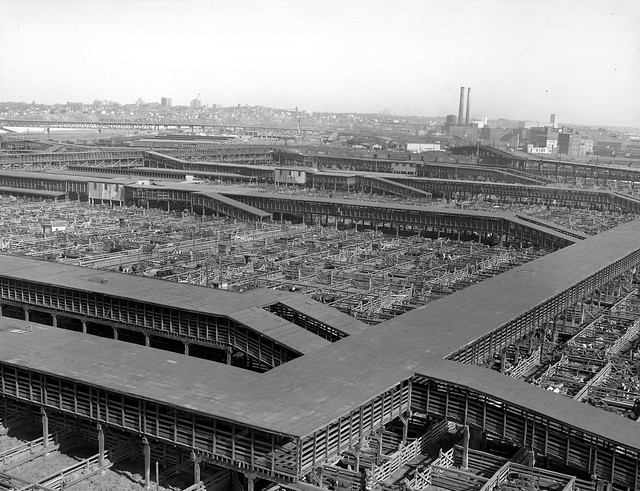
Long regarded as the ‘Paris of the Plains’, Kansas City, Missouri’s storied fountains and ornamented boulevards capture some of the elegance made famous by our European counterpart. Despite the acclaim our city receives for the beloved parks and boulevards system, such ambiance hasn’t always been the benchmark in Kansas City. Riddled with the grime and lewd behavior associated with the stockyard industry, one who found themselves in Kansas City before the turn of the century would see a much more savage environment than that of which our parks evoke today.
Kansas City, Missouri Livestock Auction: Although amassing great wealth for the region, the industry was unsightly and riddled the city with transients and crime at the turn of the century. Source: Missouri Valley Special Collections
The reincarnation of our city can be attributed not from the wealth or power of the stockyards but is the work of one man: George Kessler. Kansas City’s first landscape architect, Kessler was a jack of many trades and titles. Architect, planner, civic leader, and even lobbyist, Kessler’s early triumphs include petitioning Missouri state law to establish a city parks board and begin the issuance of municipal park bonds. Armed with the bureaucratic power and funding necessary to carry out his aesthetic desires, Kessler designed a parks and boulevards system for the city that came to consist of 2,668 acres of parks, 90 miles of landscaped city boulevards, and 38 miles of manicured park boulevards. The planning and construction of the park’s system faced an uphill battle at the time of conception, but eventually came to be beloved by citizens and envied by the rest of the nation. Today, however, Kansas City’s parks system face an entirely new set of challenges. Problems aided by decades of population decline and further fueled by the urban issues of the 21st century American city.
West facing view at 12th and Paseo Blvd. Many of the neighborhoods surrounding Kessler’s boulevards are tormented by issues of crime and depopulation. Source: Photo by Brady Brewster
Almost 120 years after completion of Kessler’s plan, the dynamics of our city has changed. Although the parks are still beloved, many citizens today choose to enjoy the parks system through the lens of their automobile rather than from personal experiences within the spaces. As population and housing demographics have changed, the effect on Kansas City’s parks and boulevards has been devastating. Many of the historic parks are now found in areas perceived as crime-ridden and impoverished. Combined with population loss of the central city of Kansas City, Missouri, the vibrancy of the urban core is much different from when Kessler set his jewels of parks in the boulevard-laced necklace of the city. Despite issues of increased automobile usage and poor utilization by residents of the city proper, Kansas Citians still champion the legacy of Kessler’s parks and call for the creation of more. Through straightforward observation, the lack of users in our parks is clear. Even in an automobile-entranced city such as Kansas City, is it really the case that users don’t want to leave their car to enjoy a system so greatly praised and useable?
Budd Park in Northeast Kansas City: Devoid of users despite it’s setting in a dense neighborhood near multiple schools.
Source: Photo by Brady Brewster
Paradoxically, two parks from Kessler’s original plan have seen a degree of developmental resurgence in the areas surrounding the parks rather than decline. Washington Square Park and Hospital Hill Park lie separated by the large scale master planned development of the Crown Center District. Union Station restricts the western boundary at Washington Square Park and the eastern boundary by Hospital Hill Park has developed into the sprawling complex of the Hospital and Academic institutions on the hill. In the changed dynamic of neighborhoods and park users in 2015 Kansas City, one wonders why even these parks lie empty at peak times of the day. With thousands of white collar and healthcare workers surrounding both parks which capture pristine views of the Kansas City skyline within just steps of their workplaces, such behavior speaks to utilization issue of Kansas City’s parks. Perhaps less people use the parks today not because they are bound to their auto or because they view the parks as dangerous but for other reasons. Looking more closely at Washington Square and Hospital Hill Parks, the issue is not with the density of residents or workers within walking distance to the parks but rather a problem of isolation and connections. A lack of accessibility via parking is especially evident at Hospital Hill Park. Combined with increased vehicular traffic in the area and lack of pedestrian connections, portions of the park that were once lively green space are now destined to mere median space dissecting two directions of traffic on Gillham Ave. Washington Square Park has the opportunity to be a showcase park for the Crossroads neighborhood, but poor connections to the street and office skyscrapers of Crown Center render the park isolated from the surrounding fabric of the area. The Link, a man made skywalk system meant for the sole purpose of connecting the Crown Center Complex to the surrounding areas, actually functions in a reverse role, creating a barrier between the park and Main St. Once served by historic streetcar lines, the reintroduction of rail to Main St. parallel to Washington Square Park will be an interesting study as to how model rail transit influences the park. In further study of Kessler’s parks and boulevards systems, I would like to examine how connections: transit, vehicular, and pedestrian influence utilization at the parks and what type of intervention needs to take place to restore these park’s to former glory. In greater focus, I would like to further explore how large scale development such as the Crown Center and Children’s Mercy Hospital developments have negatively impacted the park by neglecting such connections…..
Washington Square Park lies at the heart of a highly dense and developed mix of office, retail, and residential yet lies empty for most of the day. Connections such as The Link (pictured), lack of vehicular parking and pedestrian connections that are oddly placed relating to the surrounding fabric of the area may play a role…


