To begin my study of Kansas City’s Parks & Boulevards system, I visited a few sites within the system with my classmates from UMKC, to get the in-person understanding that an internet search cannot provide. While we only visited a few places, the system actually contains hundreds of sites. Budd Park, located in northeast Kansas City, and Troost Lake, located about 5 miles southwest of Budd Park, were the 2 locations that evoked the strongest (although almost polar opposite) reactions from me. Both are examples of historical parks whose positive and negative features can be analyzed for the purpose of creating more successful parks, and for improving the conditions of the existing parks themselves.
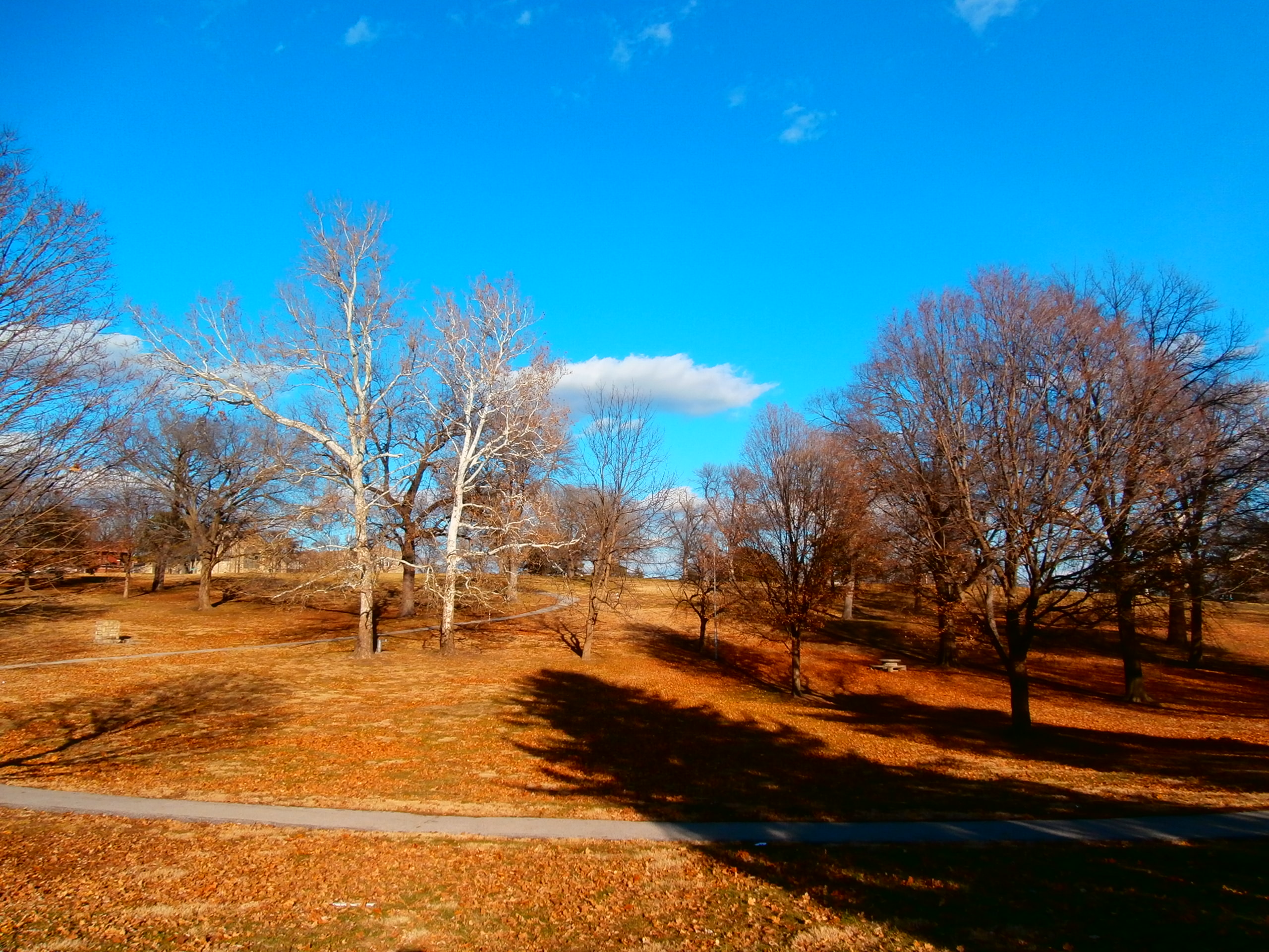
The first stop was Budd Park, a 26-acre expanse of land generously dotted with trees, located at St. John and Brighton Avenues. Acquired in 1890 as the second park in the Parks & Boulevards system, more recent history of the area surrounding the park has been overwhelmingly negative, due to the high crime rate. Nonetheless, the park’s atmosphere was warm and inviting upon our approach. The late afternoon sun shone brightly through the trees’ branches, casting long shadows across the grass (Image 1). Winding through the naturally uneven topography was a paved walking path which, besides two passersby, had no traffic during our short visit. We only viewed the west side of the park, but even that limited perspective of it was enough to give me the impression of ‘Welcome’.

On a more somber note, our stop at Troost Lake left a less favorable impression on me, to say the least. Troost Lake was the water supply for Troost Avenue in the 1800s, and the avenue itself has a fascinating history, from a socioeconomic standpoint. But nothing fascinated me about the lake, in it’s current state. Something about the contrast between the dark blue/grey water and the muddy, patchy grass, along with the overall stillness within the site’s parameters, brought to mind words like ‘lonely’ and ‘barren’, instead of ‘calm’ and ‘peaceful’ (Image 2). To add to the feeling of isolation at the lake, just yards away from us, at a house on Vine Street, there was a lively group of people dancing away as their music played. In fact, my class made more comments about the people on Vine Street than we did about the lake!
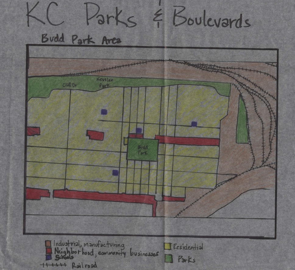
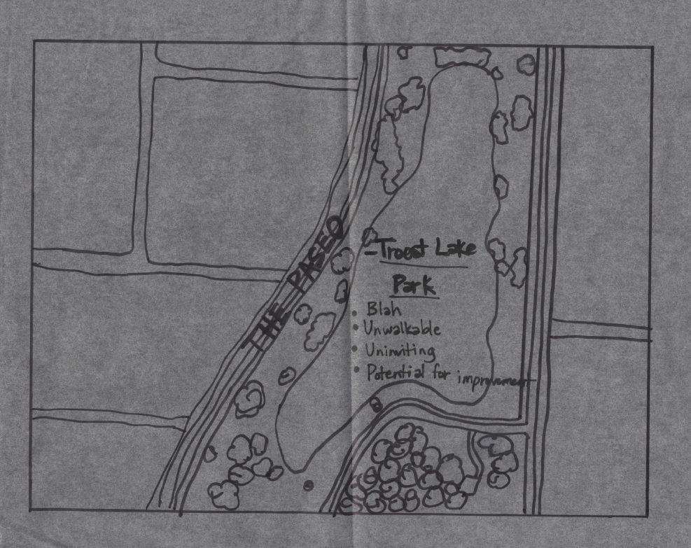
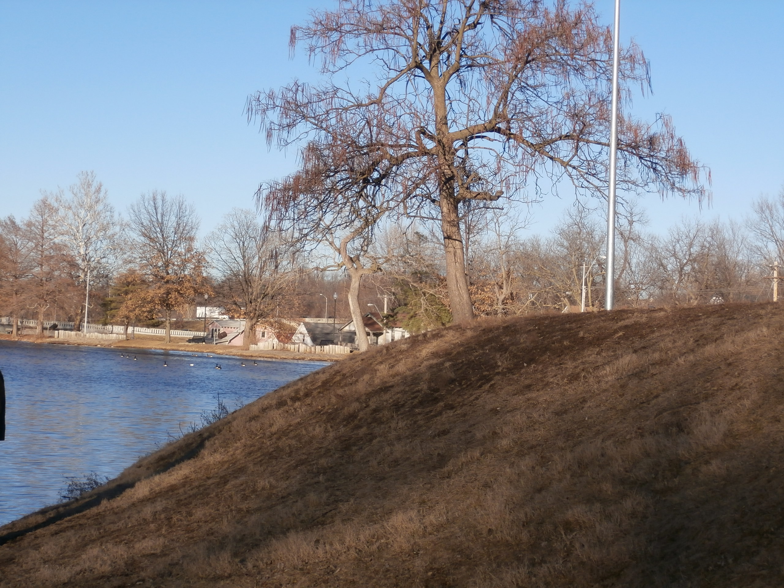
In my opinion, the feeling of invitation I experienced at Budd Park and the feeling of emptiness at Troost Lake had a lot to do with location. Budd Park is centered in a residential neighborhood that contains 4 schools, religious centers and pockets of neighborhood businesses, all which give the community (albeit not as safe as it once was) some sense of comfort and togetherness (Diagram 1). In comparison, Troost Lake is sandwiched between the Paseo, a major north-south parkway (to the west), and Interstate 71 (to the east) (Diagram 2). Instinctively, many people feel the need to just get from their starting point to their destination when travelling along a busy street; stopping for leisure in such areas seems counterintuitive. Also, Troost Lake would benefit from the addition of a paved walking path, which would provide a safer experience for visitors. Currently, the banks of the lake are rocky and muddy, and collect litter in some spots (Image 3).

This detracts from the aesthetics and accessibility, as does the steep slopes leading down to the water in some spots (Image 4)
I had never given much thought to the importance of how parks and boulevards were incorporated into neighborhoods, and the enhancement that well-planned parks can add, or the depreciation that poorly- planned or -placed parks can cause. This analysis is proving that planning is a fundamental component to the development of neighborhoods/towns/cities, even on what seems to be the most inconsequential of scales.