Tag Archives: Urban Planning

Tucson Streetcar

Tucson Sun Link Streetcar

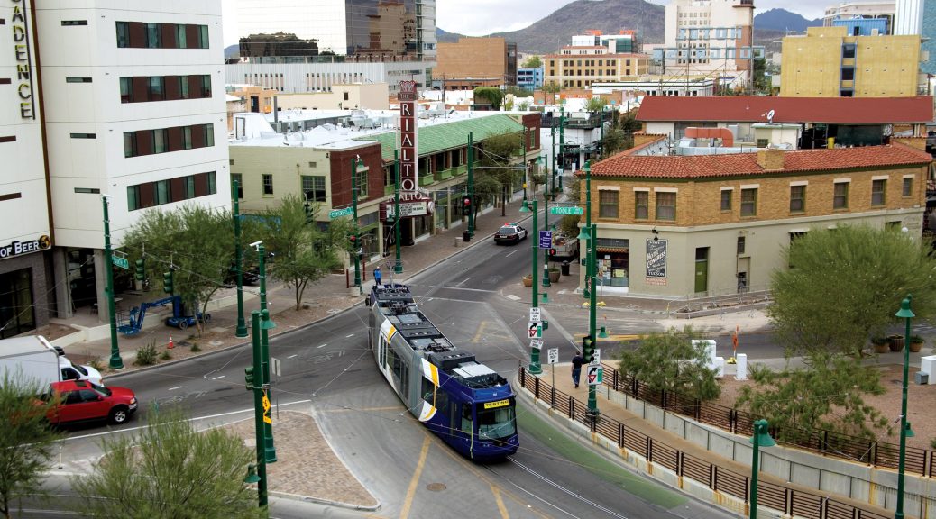
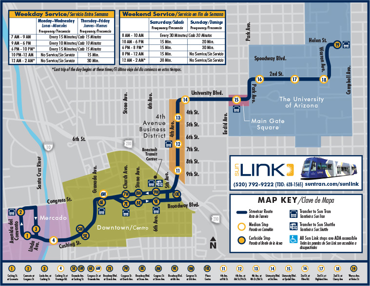
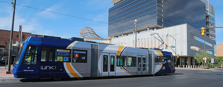
The Sun Link Streetcar system opened in July 25th 2014. It has 23 Stations (17 per direction) with daily ridership around 4,000 (Arizona Daily Star). The length of the line is 3.9 miles, servicing the University of Arizona, Downtown and Mercado.  The estimate from the city was 3,600 weekday riders, it exceeded expectations.

One-way full fare is $1.50, a day pass is $4. There is a SunGO card that works for the bus and streetcar and allows a transfer between the two vehicles.

In order to build the Sun Link System, Tucson secured a $63 million federal grant for its modern streetcar. This included the price of tearing up the existing roadway and the laying down of tracks for the streetcar. Currently, fare boxes are on course to bring in $1.2 million per year. With annual operations costs at about $4.2 million, that’s in line with cost recovery ratios for most transit systems.

Zoning Around Downtown Streetcar (MapTucson GIS)

Much of the initial ridership was due to novelty of a tram/streetcar in the downtown area. (Patrick McNamara) According to the Monthly Operations Report, in January 2017 average weekday ridership was at 2,857, which was is an increase from the January 2106 average of 2,757. Both of which are below the projections,  however in September and March ridership was at am average of 3,800 on the weekdays. This could be partially due to the large amount of University Students who utilize the streetcar. The ridership for the summer months of 2016 was also comparatively low. 

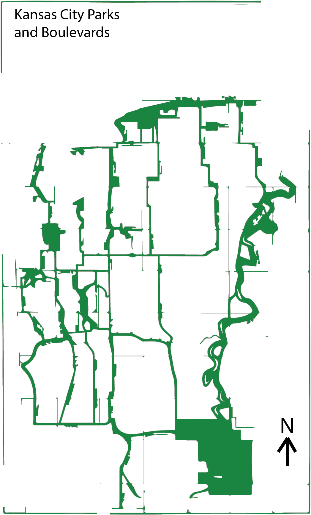
The proposed route of the extended Kansas City Streetcar, terminates at the UMKC Campus. Similarly to Tucson, the KC Streetcar could see an increase of riders during the school semester. However it is important to note that the University of Missouri – Kansas City has a total enrollment of 16,000 and the University of Arizona has a total enrollment of 43,000.
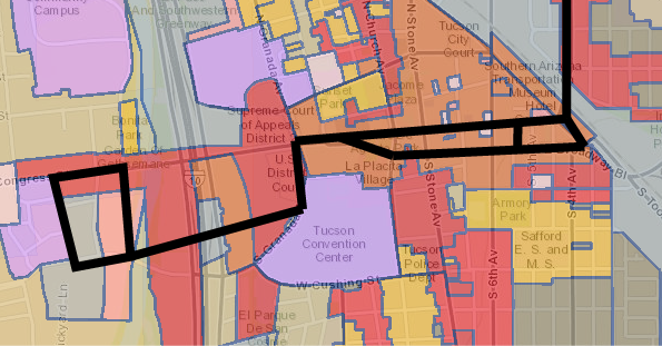
Route Maps:

Route Map for Tucson


Route Map for Kansas City.

Sources:
McNamara, Patrick”Tucson’s Streetcar Exceeds Ridership Expectations.” Tucson’s Streetcar Exceeds Ridership Expectations. Arizona Daily Star, 29 Sept. 2015. Web. 13 Mar. 2017.

O’Dell, Rob”US Grants Tucson $63M for Streetcar.” US Grants Tucson $63M for Streetcar. Arizona Daily Star, 02 July 2014. Web. 13 Mar. 2017.

“Route Map.” Sun Link – The Tucson Streetcar. Web. tucsonaz.gov

Street Furniture/Amenities

Object
Site
User

The Main Street Corridor from 30th to 51st contains several prominent examples of various street furniture and amenities. To create a taxonomy of street furniture types, I sub-categorized the elements into “seating,” “bicycle,” and “various” multi-use types. Further, I organized each ensuing board according to relationships between each element as an “object,” “site,” and “user.”

My chosen seating examples include bench seating with aggressive skateboarding and loitering deterrence (Westport Rd. and Main), a well-designed “outdoor room” (43rd and Walnut), and the gathering space/memorial at  Murray Davis Park (40th and Main).

The bicycle subheading includes the KC BCycle bike share kiosk (31st and Main), the mobius-strip bicycle racks at Capital Federal Bank (43rd and Main), and the meta-sculptural bicycle rack at 43rd and Walnut.

The “various” multi-use subheading includes the trash, recycling, and periodical containers at 39th and Main; the sculpted stone planter at 33rd and Main; and the Main Street MAX transit stop at Armour.

The underlying relationships between each element of street furniture/amenity involve “proxemic” spatial relationships.  The term proxemics, coined by anthropologist Edward T. Hall in The Hidden Dimension, describes the spectrum of distance that defines the functional space of each element.  I define each element on the proxemic spectrum between “intimate,” “”personal,” “social,” and “public.”  From this analytical starting point, the elements are further defined by their attention to accessibility, human interaction, and aesthetic continuity.  Displayed diagrammatically on the “user” board, each element comprises these themes with varying levels of success.  Overall, the elements which emphasize accessibility for differently-abled individuals, “sociopetal” (inward-facing, interactive relationships), and aesthetic continuity contribute most positively to the public realm.


Walls, Fences and Bollards

The Public realm is often defined as the space between the buildings. In this space is where people can walk, talk, meet, sit, and stay. There are certain design elements that benefit the Pedestrian experience, and some well intentioned design elements that failed. The issue of Human scale and continuity all contribute to the success or failure of an element.  I choose to study the region of Main Street from 31st to 51st, including the next closest streets, Walnut and Baltimore.

Walls

“Walls are put up in the mistaken notion that they will make a space feel safer. They make it feel isolated and gloomy.” – William Whyte

Most of the walls along Main Street fulfill the Main Street Plan’s requirement for screening a parking lot but they fail to add to the overall experience of the corridor. The purpose of these walls is ideal to help maintain a street edge and create a sense of continuity. However, because of the change in materials and scale, the walls become confusing and inconsistent.


Fences

According to the Kansas City Urban Design guidelines and the Historic preservation guidelines, fences should be low and reflect the house style. This should be done to help preserve the original historic material. However most of the fences I came into contact with were overwhelmingly utilitarian and non-compliant with the design standards.


Bollards

Bollards are used to help provide a barrier between the Pedestrian realm and the Automobile. They provide a visual and Structural deterrent and range in type and effectiveness.  The sacrificial nature of bollards allows them to stop vehicles and be easily replaced if necessary.  There are many types of bollards, permanent, movable, lighting bollards, in various shapes and sizes.

A “Drive” through the Park


A “Drive” through the Park


Illustration of the Parkways, Boulevards and Parks in Kansas City, MO
Our city was once like many other river cities of its type, dirty, pragmatic and some might even say ugly. As it expanded from the river, the gridding and subdivision of plots expanded south towards the undulating mounds of what now is Kansas City, Missouri. As man conquered new lands, there was often a manifest destiny mindset of forming our world to our whims. Yet, when George Kessler began to implement a new idea in the early 20th century, things began to change.
As a result of the City Beautiful movement, a progressive network of Parks and Boulevards was developed and constructed. These winding tree lined boulevards and parkways took full advantage of the natural topography of Kansas City. Instead of carving straight paths through the hills, the streets that Kessler help to implement curved back and forth creating a network of interlocking streets that lead the passenger through beautiful parks and vistas.

Characteristics

There are several defining characteristics that differentiate the Boulevards from Parkways. The Boulevards generally follow the gridiron of the street system whereas parkways may follow creeks or the natural topography of the city. While there are some exceptions — parts of The Paseo and Meyer – most boulevards don’t have medians in them. Parkways generally have large medians where there is space to play and back in older times, room to park. Boulevards are also very symmetrical and while parkways are sometimes symmetrical in certain areas, they are generally asymmetrical as they wind around the curves of the land.
IMG_2877
Topography of the Parkways in the Plaza


Roanoke Parkway and Park

Roanoke Parkway is disparate from the Roanoke Park. The short parkway is essentially a straight road that connects Westport Road diagonally to 47th street in the Plaza. The video shows a sped up journey one would take going north-west. There are apartment buildings that line the street on either sides and the street is lined with beautiful trees and the setbacks from the street allow a wide view when traveling by foot along the road.
Roanoke-Park-1907-web
1907 Atlas Plan of Roanoke Park
The park associated withthe Parkway is Roanoke park. Built in 1907, it is one of the oldest parks in Kansas City, Roanoke Park has an interesting shape as it tucks itself inbetween the Westport and Midtown areas.
Today Roanoke
Roanoke Park – Courtesy of Google Maps


With its beautiful trails, playgrounds, sustainable progress and a Community Center, Roanoke Park stands as a shining example of good park design. From its trails to its wide open spaces, the park offers both passive and active recreation.

Roanoke_Park_Trails
Trail Map

IMG_2849
History of the Boulevard


IMG_2857
Sustainable Development


Moving Forward

I have lived in this city for 20 years and while I have never been formally taught about Kessler’s vision with the parks and boulevards, I have spent a great deal of time enjoying their beauty. As our class took an excursion to explore some of the eastern parts of the system I realized how little of the streets and park I had actually experienced. Even on a January day, there was a great attractiveness inherent in many of the parks. The Kessler Park near Cliff Drive was quite impressive, it stands as a great example of the City Beautiful movement with its Romanesque columns and its concrete pergola.


“While parks are of inestimable value in making a city inviting to desirable residents and visitors, furnishing pleasant drives to those who can afford these luxuries, adding to the value of real estate, and promoting the general prosperity, these are matters of small consideration when compared to the imperative necessity of supplying the great mass of the people with some means of recreation to relieve the unnatural surroundings in crowded cities.” – Kessler

IMG_2807
Kessler Park Pergolas – City Beautiful Movement
The system of parks and boulevards laid a framework for Kansas City. Its good bones provide unique drives and generally pleasant experiences when getting around the city. There are areas of improvement though. How can we explore what styles Kansas City wants to represent in the future? Should we maintain the style of the City Beautiful movement or should we create our own movement as we move further into the 21st century?