There has been quite a bit of change in this part of Linwood Boulevard over the years. In 1895 it was not even a part of the city of Kansas City proper, and was still referred to as Grand Boulevard. It was acquired by the growing city of Kansas City in 1897. At the time it was mostly residential, but by 1909 the Main Street side of the block was lined with shops. A streetcar stop was also constructed at Main and Linwood in 1899. Between then and 1925 the section of street was declared to be part of Hunter Avenue. While there were plenty of shops on Main Street, the area off Main Street was all residential still- although with a few houses replaced with apartment buildings. This changed by 1950, when many commercial buildings opened along Linwood. Today, there are still many shops on both Main and Linwood, although there are a number of surprisingly empty lots given how busy the streets are. Over the years this section has played host to a number of fascinating locations. Drexel Hall, the oldest continuously-running ballroom in Kansas City, is in this location. The Pink Garter and the Jewel Box, two burlesque entertainment venues of some historical significance, were also located on this block (although the Jewel Box was moved from Troost). Milton’s Tap Room, a famous jazz establishment, was also located on this block.
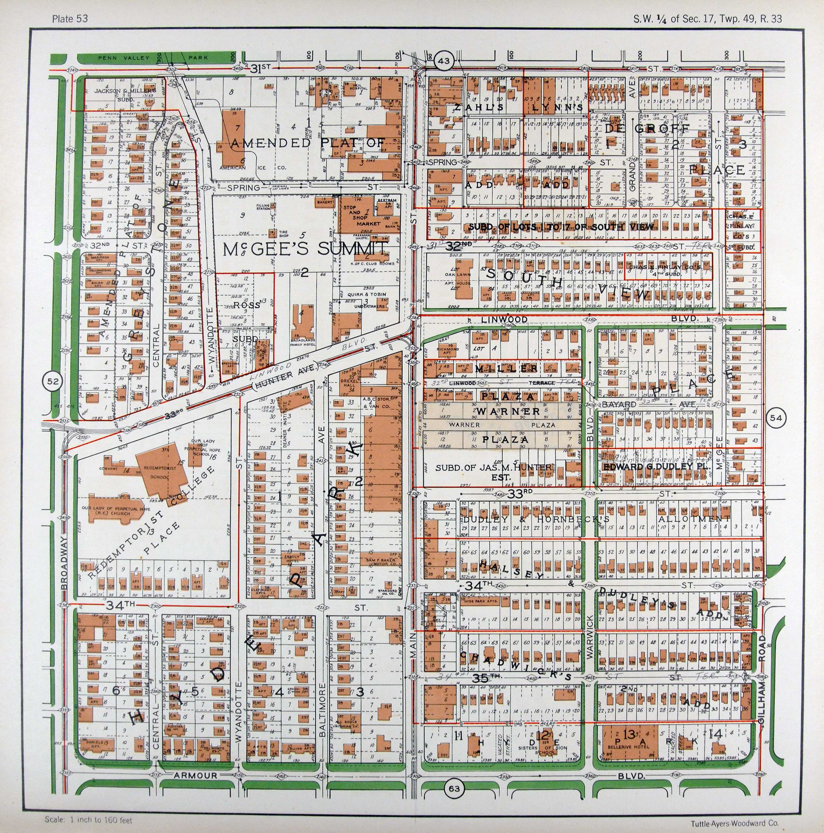
The majority of the block of Linwood from Broadway to Wyandotte has changed relatively little. The Redemptorist Catholic Church and its older buildings have taken up the large southern block since before 1895. Central Street was added on the northern block between Broadway and Wyandotte by 1909. This led to development of residences, including several apartment buildings in this area which still exist today. There are now a small college and some businesses in place of many of those residences.
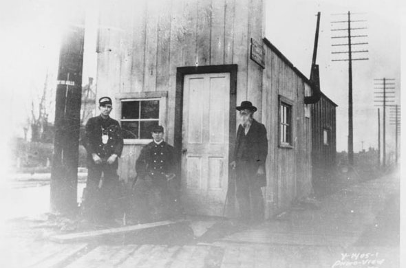
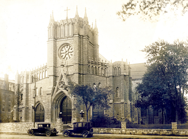
1925 Atlas Plate 53The Redemptorist Catholic Church, completed in 1920.
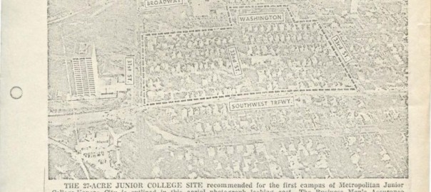
This photo was published in The Kansas City Times in February of 1968. It shows the plans for the Penn Valley campus before development began. MCC- Penn Valley open in 1969 and was the site for the first MCC campus. The campus is about the 27-acres. Before Penn Valley was built, this space was occupied with businesses and housing. MCC Penn Valley extends from 33rd St. to 31st St. and Southwest Trafficway (Summit St.) to a little past Washington St.
From researching using different maps, I notice the differences of changes among residential areas and businesses. Businesses are more likely to be torn down and rebuilt, whereas residential areas usually remain the same for years once all the space is taken.
The history of Paseo Boulevard and Wayne Avenue have changed gradually through time and Linwood Boulevard is their intersection that gives a contrast of the many changes they have encountered. For example Paseo parkway was laid out in the early 1900s by George Kessler under the direction of August Robert Meyer, first president of the Commission of Parks. It did not exist before that and Wayne Avenue was part of Vine Street and was not called that until 1909 according to the institute of Museum and Library services (1950). Sanborn Map, Kansas City, vol 4 1909-1950 [photograph]. The landmarks that surround the area have changed purposes and many have been redesigned.
In conclusion the Paseo Boulevard and Wayne Avenue area has a history of ever changing demographics from the early 1920s luxurious fashionable apartments and white residences to its current status of government assisted housing of prominent African American residents. The area of Linwood Boulevard has a diverse quantity of unique new and old buildings and the setting of the boulevard has changed considerable. Increased traffic has brought an influx of overhead signals, signs, and modern street lights. At the western end, newer commercial enterprises have replaced older residential buildings, curbside trees have been lost, and sidewalks have been extended to the curb.
A portion of Kansas City from E. 42nd Street south to E. 43rd Street and from Tracy Avenue east to Wayne Avenue, showing buildings, streets, and additions. Large numbers at edges of page refer to page with adjoin
A traffic signal at Linwood and The Paseo in 1932 and (inset) 2000.
This area has, for the most part, remained the same over the years. The two biggest landmarks in the area are a park on the north side of Linwood, and a high school on the south side. Smaller buildings around the edges of the blocks have come and gone as the years have gone by.
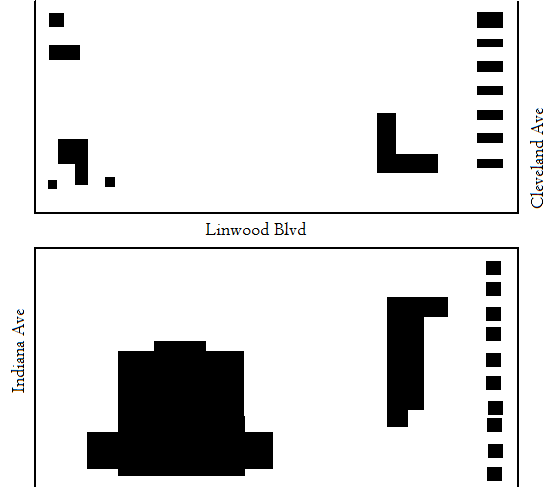
What I found most interesting about the area changing was the fact that, around 1925, when a street was added in the middle area. Monroe Avenue was extended from 31st street (where it originally ended) to Linwood Blvd. What makes this development even more interesting? The street was gone again by 1958! I thought it was fascinating that something as major as a street lasted less than forty years.
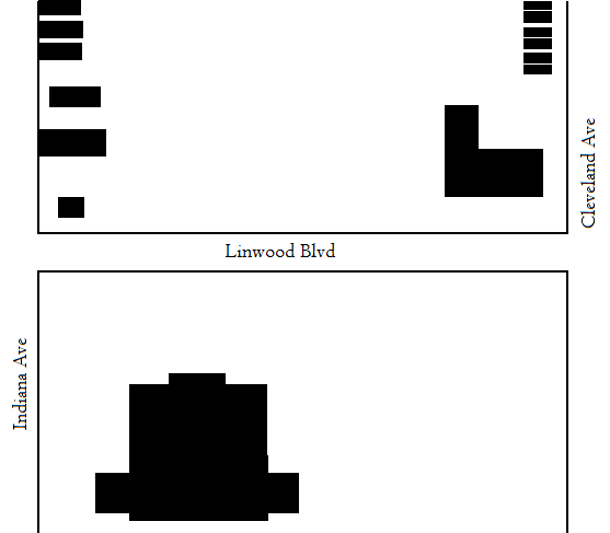
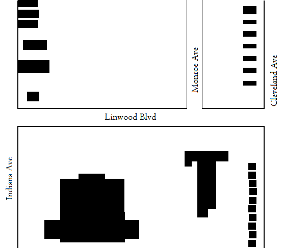
I was assigned the area between Cleveland Avenue and Myrtle Avenue.
The area is so far East that the block wasn’t available for the earliest Sanborn maps of Linwood Blvd.
By 1925, the area was still pretty devoid of any major development. 1950 saw significant growth and the addition of a church and row housing on the southern edge of Linwood between the two blocks.
The built environment has changed little since the 1950s, save the addition of a YMCA. It is currently getting renovated and until than is located in a local school nearby.
Linwood Boulevard runs east to west between Broadway Boulevard and Van Brunt Boulevard in downtown Kansas City, Missouri. I examined the development of the stretch between Michigan Avenue and Garfield Avenue from 1896 to the present using Sanborn Maps and the 1925 Atlas of Kansas City Missouri and Environs. Today these blocks have changed quite drastically compared to how they were from 1895-1950. The area between Michigan Ave. and Euclid Ave. is now the six-lane Highway 71. Looking south of Linwood Blvd., between Euclid and Garfield, there is only one building, the Emerson Manor senior facility. Taking its name from the Emerson Apartments that were present in the 1925 Sanborn Map. North of Linwood Blvd., Between Euclid Ave. and Garfield Ave. there are no buildings, but a little grassy area being used as an orchard. The orchard is maintained by The Giving Grove organization (a program of the Kansas City Community Garden). The uses of this land now are residential and for public uses. How this two-block stretch changed from a quiet, nearly empty, piece of land to being a bridge over a loud, speeding highway is eye-opening to how drastically the use of land develops over time. In 1896 Lindwood Blvd. didn’t even exist, but over time we were able to see how the indention of Lindwood Ave. decreased and was slowly replaced with grass and was eventually completely taken out. You could never imagine the drastic changes the land around you has gone through.
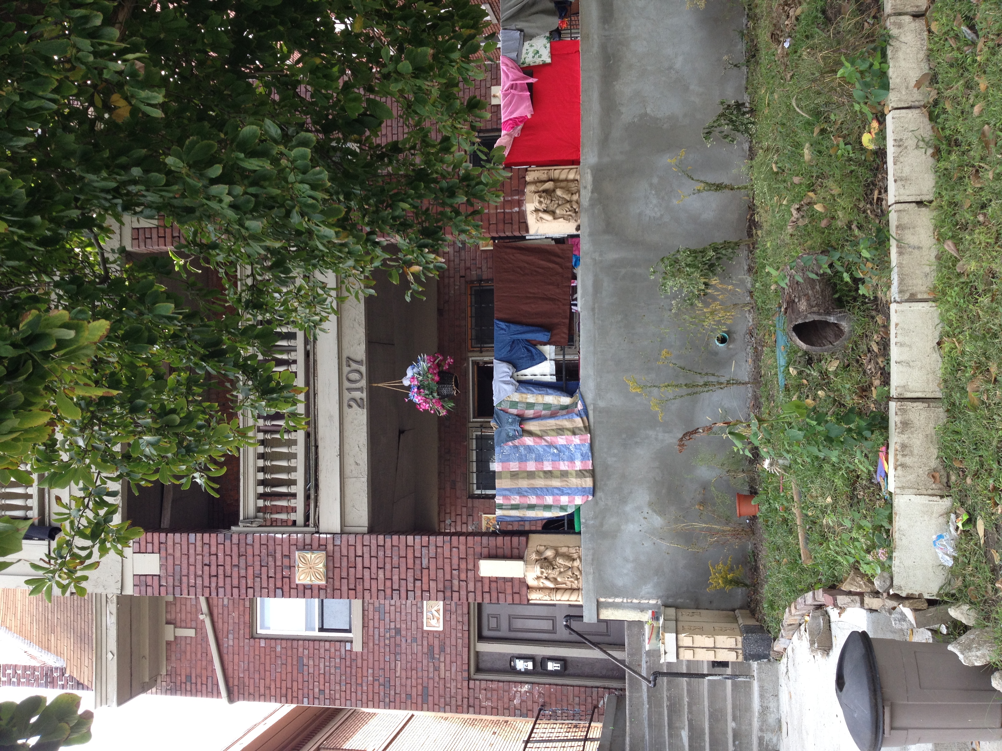
My section of Linwood was incredibly interesting to me, as my own families history was woven into the story of the street. When I first went down to the street I was disheartened by the state of the street, all overgrown with three abandoned lots; but knowing what I know now about the what the street used to hold, it’s even more disappointing. My section of Linwood used to hold the first Reform Jewish Synagogue on the street, along with the first Jewish Community Center in the city. Linwood and the surrounding streets held Kansas Cities Jewish Community during the interwar years and up until the 1960’s. My grandfather fondly recalls the many hours he spent at the old Jewish Community Center, and the Synagogue right around the corner is where he met my grandmother for the first time. This street is part of my own personal history, and I had never been there until this project took me to it!
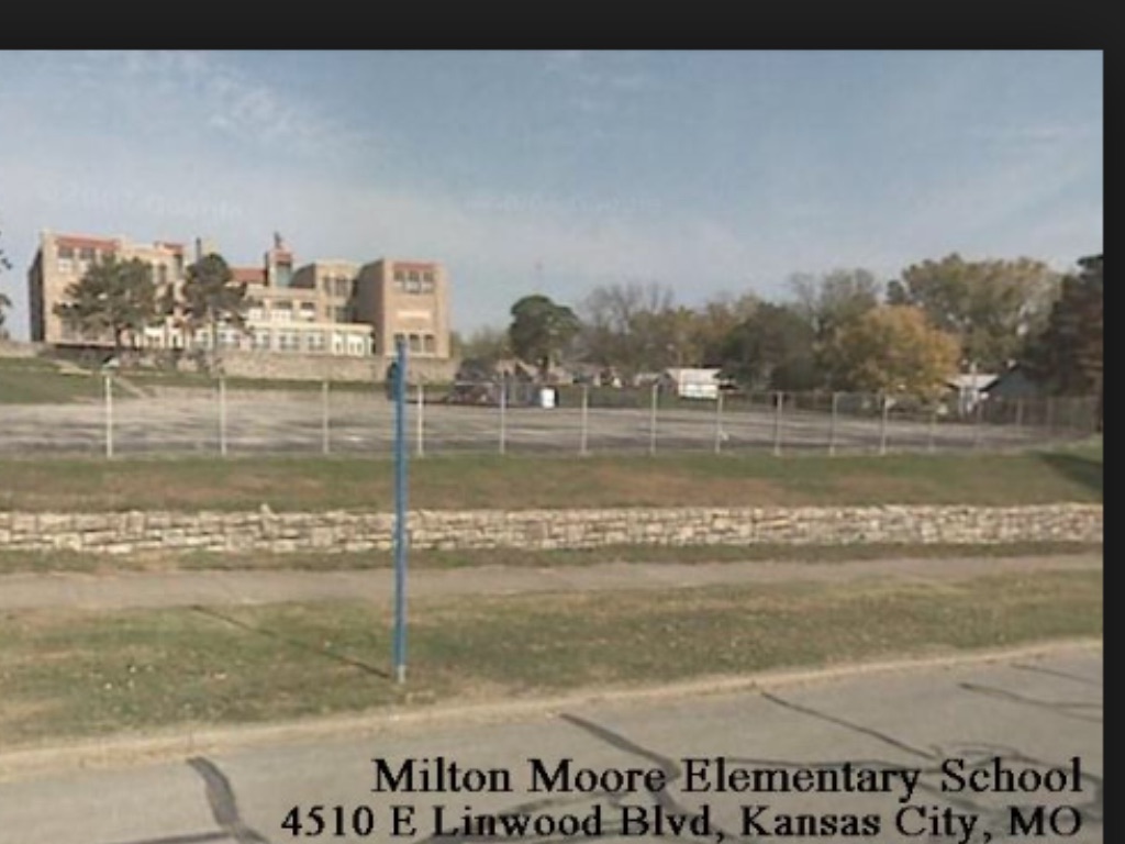
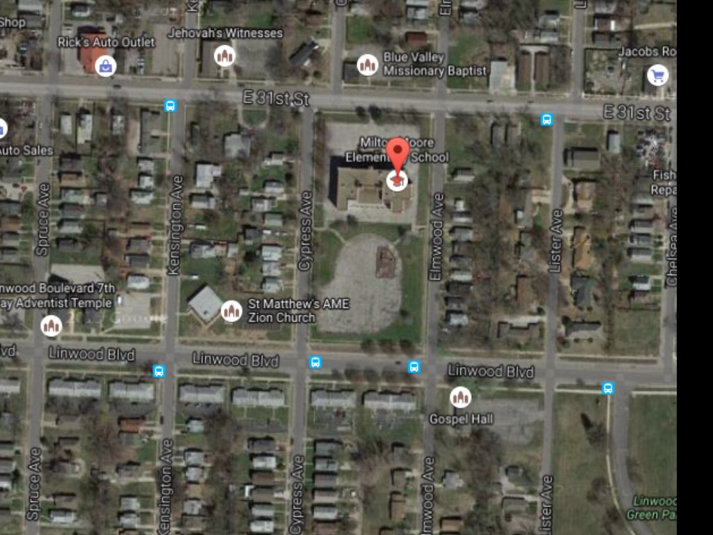
The area that I was assigned to was a little old neighborhood called Knoches Park. It was located east of The Paseo and the way I got there was by using The Metro. Getting there was a bit of a challenge because I was unfamiliar with the area. My assigned block looked like any suburban block around the Kansas City Metropolitan Area. However, when I was doing some research I found out that it looked a lot more different than it is now. The area was pretty much no man’s land prior to the 1890’s. It wasn’t around 1895 that the city limits started to expand and make it’s way past Paseo Drive. Although some housing was incorporated into the area most of the roads were unpaved and the main mode of transportation was by foot. It wasn’t until the 1920’s that paved roads started to accommodate pedestrians, horse and trollies, and a few automobiles. The area was beginning to expand with housing as the population grew around the city limits. By the 1950’s, Kansas City was beginning to sprawl outward with more roads and houses to accommodate the growing population. The automobile began to shape the suburbs and that allowed for more business districts to come into the suburbs. The area between Kensington Ave and Elmwood Ave saw mostly changes in residential development. SInce 1925, it has expanded in mostly housing. New additions since 1950 include newer homes on the south side on Linwood Blvd, a new church on the corner of Kensington Ave, and metro bus lines that run on Linwood Ave. Milton Moore highschool was built around the 1900’s right on the corner of Linwood Blvd and Elmwood Ave. It has stood there over the years with a few minor additions. The building never expanded and was eventually turned into an elementary school. It still surprises me how a small highschool at the turn of a centrury still stands today to serve elementary students in that area.
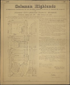
This area has largely been used for residential purposes. Back in 1896, the area was just undocumented green space and it remained that way till the early 20th century. In 1907, there was a declaration (pictured below) signed to establish the Coleman Highlands neighborhood. This brought many new homes around this segment of W. 33rd street between 1910 and 1925. By 1950, the majority of the houses present today were already built around this block. Today, this segment of W. 33rd street is a quiet, peaceful neighborhood in the heart of Kansas City.
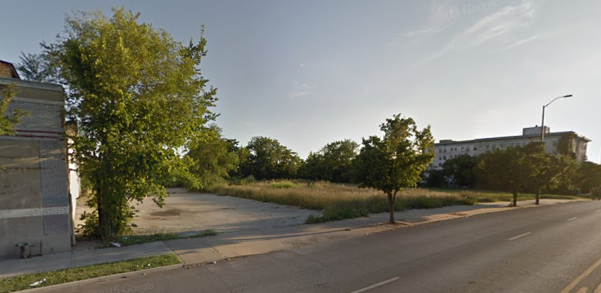
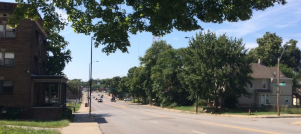
Visiting these blocks and doing research was very interesting to me. The blocks had a sense of being unfinished. Parcels of land either empty or containing a house were typically over grown and falling apart. I found that many properties that had major issues typically were owned by out of town developers or private individuals. This raised many questions for me. Although it was very rough on the edges you could see the beauty of the boulevards with wide roads lined with wide green buffers and large sidewalks. Overall its a area that I would love to see come back. It will take the right people to work on a project of this size with the right intentions.
This area began as primarily residential, before Linwood Boulevard or Gillham Plaza even existed. A home for the elderly resided on the grounds that would become the intersection of Gillham Plaza and Linwood until around 1925. Once the two streets were created, these two blocks quickly grew as a commercial area.
1925 Atlas of Linwood Boulevard
By 1950, residential spaces lining Linwood would be replaced by commercial businesses (except for one apartment building). These businesses mainly catered to car owners – there were two gas stations and two auto service business in this one area, plus an auto yard. 1950 was the height of activity on these blocks. Nowadays, the businesses still target car owners – there’s a Jiffy Lube, O’Reillys, a gas station (this lot has always been a gas station since before 1950), and a car wash – but the area seems run down. The Acme Cleaning Company building, built in 1924, is still standing but is boarded up and not being used.
To begin, Kansas City’s system of planned parks, boulevards, and infrastructure can be traced to the 1893 Plan for Parks and Boulevards. This early plan, championed by visionary urban designer George Kessler, emphasizes the need to design comprehensively, yet pursue goals incrementally. Like any organism, the city needed to be designed intelligently in order to function sensibly throughout time. The 1893 plan accounted for a series of boulevards, then outside of the city limits, to help organize urban growth moving forward. One of these east-west thoroughfares was Linwood Boulevard. There is no data of the intersections of Garfield to Park existing on Linwood Boulevard in 1895. Thus, one can assume that this artery had not yet been developed. Despite being undeveloped, the boulevard was instructed to be “60 feet wide and contain sections lined by 10-to-12-foot-wide grass strips and 5-to-6-foot-wide sidewalks.”
According to the Sanborn map of 1950, all the residential structures between Garfield and Brooklyn retained the same building footprints. Behind the buildings on the southern side of Linwood from Garfield to Brooklyn, underground gasoline tanks were installed. Also, parking lots behind residences begin to emerge on the Sanborn map. In 1963, the monument to Sanford Brown, Jr. was relocated to a masonic cemetery.
From 1950 to the present, Sanford Brown Plaza has experienced moments of deterioration and revitalization. According to the Kansas City Star in 2009, “at Sanford Brown Plaza, Linwood Boulevard and Brooklyn Avenue, both drinking fountains worked; one didn’t in 2003, about twenty new trees have been planted in recent years, with much less glass and graffiti than six years ago.” Presently, the park appears to be in good order. It is well-landscaped, with new playground equipment, functional facilities, and well-kept basketball courts and baseball diamond.
Thus, the spatial history of Garfield to Park Avenues along Linwood Boulevard is an example of idealistic beginnings that produced mixed results. Sanford Brown Plaza has bounced back to become an important anchor for the community, but the surrounding residential structures are depressing remnants of a bygone era.
Linwood Boulevard was an up and coming neighborhood in the early 20th Century. It formed in the late 1800s which a few established apartment buildings, filling vacant lots, and quickly grew as the first World War arrive. The blocks of Linwood, from Campbell to Troost began simply. In 1895, there was nothing but a few multi-family units, a Methodist Episcopal Church, and a Springfield Avenue Christian Church. Within a decade, Sanborn maps show the neighborhood found mixed-use function, and began to thrive. By 1925, the neighborhood filled with occupants such as Anthenaeum Club Building, Berkshire Arms Apartment Hotel, Cornell Apartments, LaSalle Apartment Hotel, Thornton and Minor Hospital, United States Post Office Station “E”, Wirthman Building, Isis Theatre.
After the 1950s, the neighborhood went quickly in decline. Crime rates skyrocketed, white flight took shape, and businesses fled. Today, the neighborhood looks nothing like the thriving downtown suburbia that was the idyllic dream of 1925. The small block is still mixed use, but occupied by a Family Dollar Store, a Sinclair Gas Station, empty lots, apartment homes, and the Anthenaeum, which holds historical significance for the community.
The Kansas City Missouri Parks and Boulevards system was the first plan initiated by the city that focused on future development. One of the most ambitious boulevards was the southern boulevard connecting the east side of 31st to the west side of 31st, Linwood Boulevard.
On the far east end of the boulevard is a reserved green space in the shape of a triangle: Linwood Blvd to the North, 31st to the south and Raytown Road (eventually, Van Brunt & Emanuel Clever II). The natural drainage towards Brush Creek at this point served as the natural ending point for Linwood Boulevard. In the earliest depiction of this area from 1895 (Figure 1) shows that it is not within the city limits and Linwood Boulevard did not formally stretch to there yet. In 1897 Kansas City MO annexed Westport MO, effectively lengthening Linwood Boulevard the maximum length natural features permit (referring to the natural barrier, the Blue River). Immediately following the annexation, in 1899, the Parks and Boulevard System plan officially began.
Linwood Boulevard spanned 3.43 miles ending with a natural green space Kessler describes as, “a park like effect, and an appearance differing radically from that of the ordinary residence street”. This area, at the end of Linwood, has been and continues to be nothing but a green space (Figure 2).
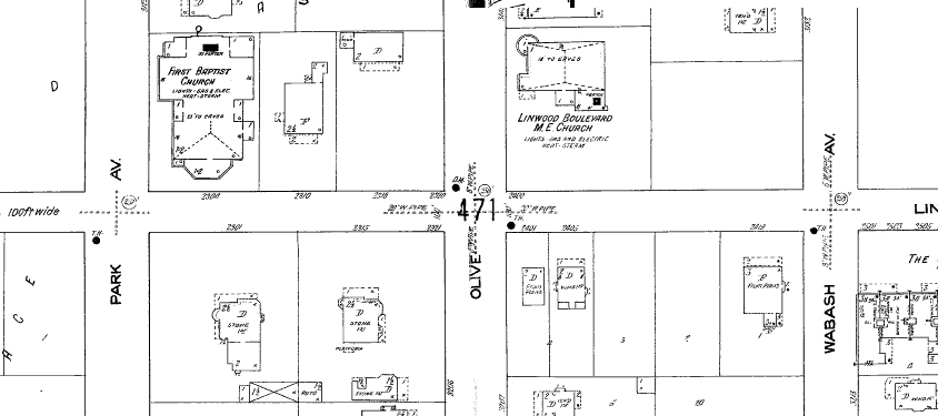
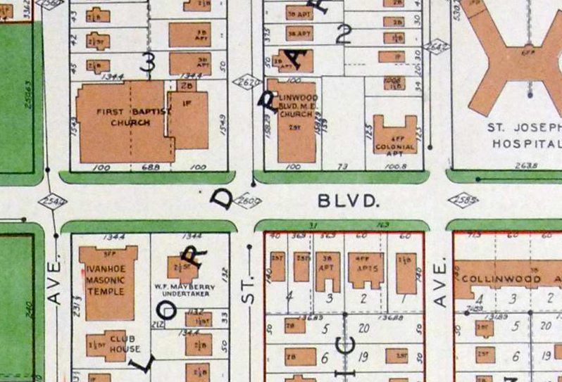
In 1909, this portion of Linwood Boulevard was starting to be settled, and two churches, First Baptist Church and Linwood Boulevard Methodist Episcopal Church, located on the north side of the street, dominated much of the landscape. At the time, the Linwood Boulevard M.E. Church was a simple chapel. There were a few residential buildings as well as empty lots.
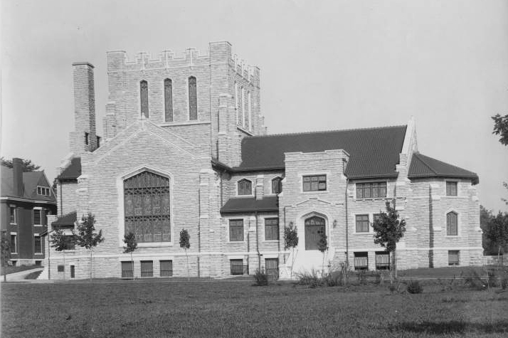
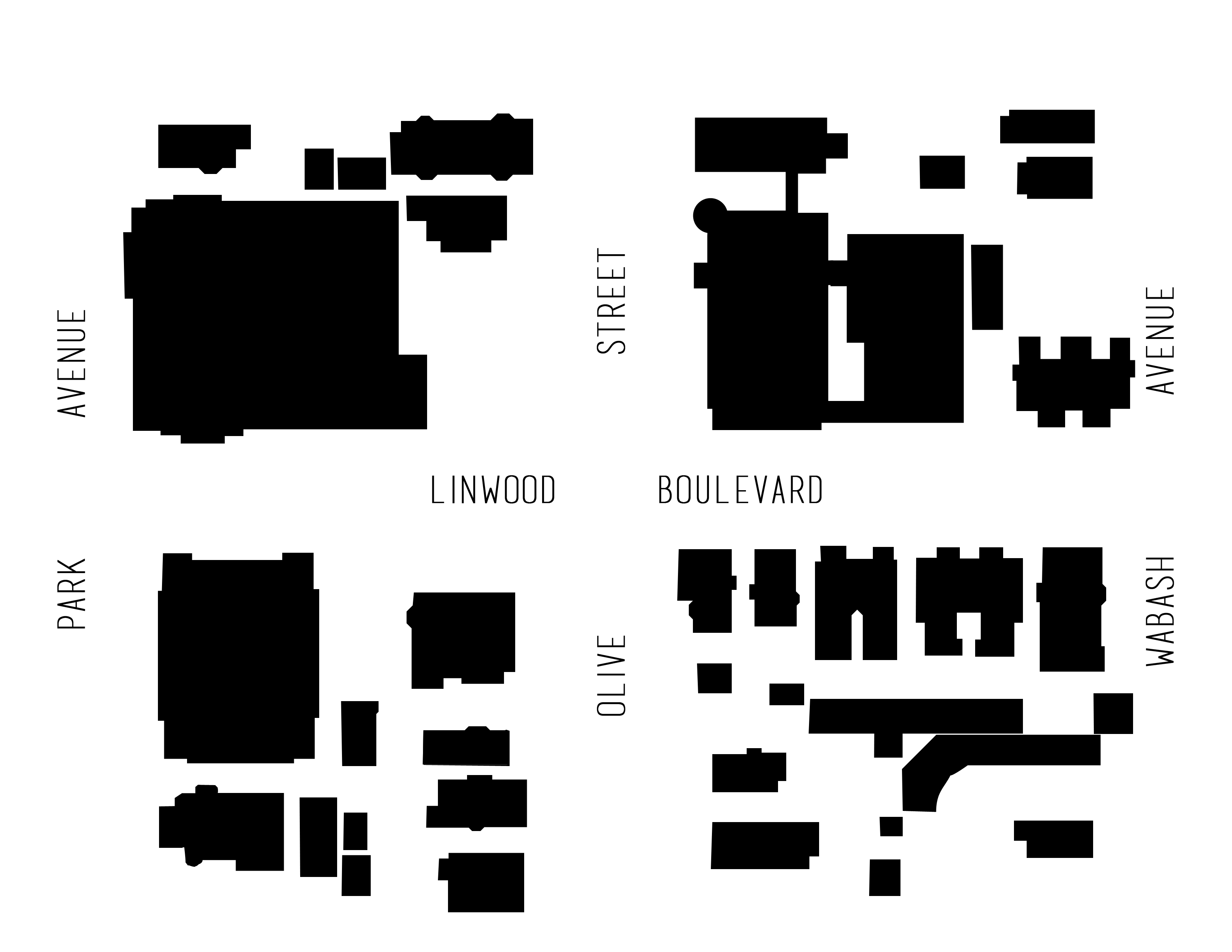
Above: 1909 Map of Linwood Boulevard, Park Ave to Wabash AveAbove: First Baptist Church, undated photograph.
Comparing the 1909 Sanborn Fire Insurance Map to the 1925 Tuttle-Ayers-Woodward-Co. Atlas you can see additional development of the existing and empty lots, including expansions of both churches and the building of the Ivanhoe Masonic Temple on the south side of the street. In its heydey, the temple housed meetings and civic activities of the largest group of Freemasons west of the Mississippi (“Golden Spade,” 1920). It’s construction from 1920 – 1922, and its $1 million price tag (Penn, 1999), was big news among the ladies and gentlemen who lived, worked, and played in Kansas City’s inner suburbs.
Above: 1925 Map of Linwood Boulevard, Park Ave to Wabash AveAbove: Postcard of Ivanhoe Masonic Temple, undated
1951 saw the heaviest density of these two blocks with all plats being built up and additions of Sunday School buildings for both churches. However, between 1951 and present day, several of the original buildings were torn down including the temple and many of the residences. After being added to the National Register of Historic Places in 1985, the Ivanhoe Masonic Temple was demolished in 1999 at a cost of $400,000 to the city plus $65,000 already spent to purchase the building (Penn, 1999). Some members of the community, including architectural historian Cydney Millstein, fought to save the building for its historic value. Others, including the Reverend Wallace Hartsfield of the Metropolitan Missionary Baptist Church across the street (formerly First Baptist Church), wanted it torn down because it had become a blight on the neighborhood. Ultimately, the city was not able to find a suitable use nor a buyer (Penn, 1999).
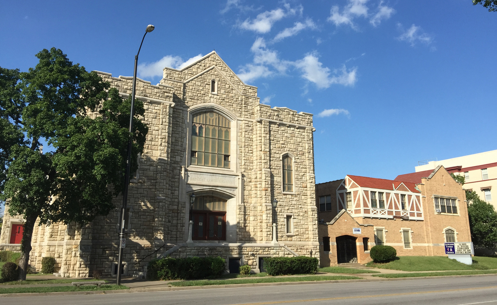
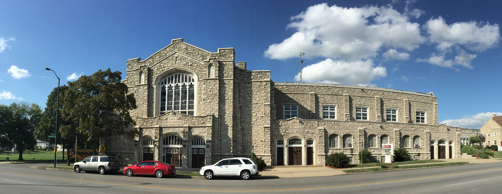
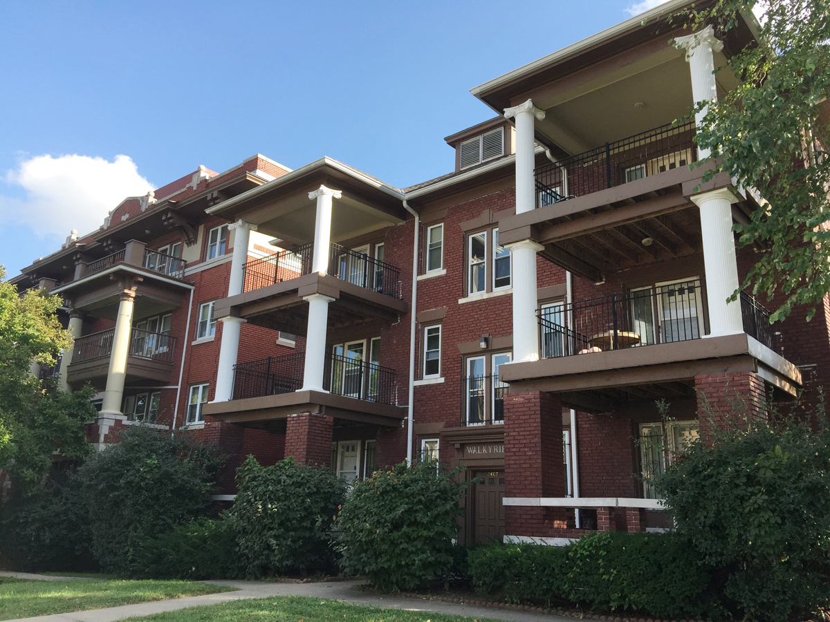
The two churches still remain on these blocks and are currently open and operating. On the south side of the street three original multi-family residences remain in use. An original building called the Colonial on the north side of Linwood and Wabash remains as well but is used for commercial space.
Linwood United Church (formerly Linwood Methodist Episcopal Church) and adjacent Sunday School building, 2015Metropolitan Missionary Baptist Church (formerly First Baptist Church), 2015Three original multi-family housing units remain on the south side of the street, 2015.The original Colonial apartment building on the north side of Linwood and Wabash, 2015
The figure ground studies below show the stark contrast in the built environment between 1951 and 2015.
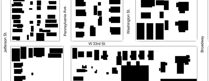
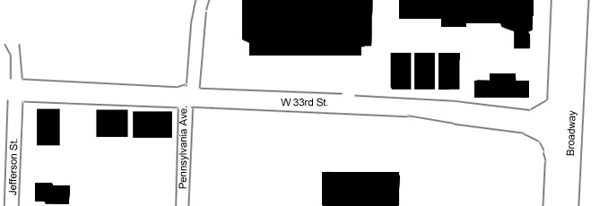
My assigned area is a portion of West 33rd Street to the beginning of Linwood Boulevard. The type of uses that currently characterize the area are primarily mixed use. There are commercial businesses on both the North and South sides of my blocks – such as Browne’s Irish Marketplace on the corner of West 33rd Street and Pennsylvania Avenue and Sheng Chinese restaurant on the corner of West 33rd Street and Broadway Boulevard – but there are also a small number of residential apartment buildings.
One major change that I observed when researching these blocks was the dramatic decrease in density that occurred in the area from 1950 to present day. In 1950, a number of residential homes lined the streets. In 2015, these homes no longer exist and have been replaced with parking lots on both the North and South sides of West 33rd Street.
A figure-ground diagram of Jefferson St. to Broadway Blvd. displaying conditions in 1950A figure-ground diagram of Jefferson St. to Broadway Blvd. displaying conditions in present day
Researching Linwood Boulevard helped me gain an overall understanding of how Cities change of Time. There were new streets built, streets widened and streets renamed. The density of my are fluctuated, buildings were built, and then destroyed, sometimes replaced by new buildings other times by bare parking lots. It seemed that there was a theme of reusing buildings with a new purpose. Some houses became places of businesses and a gas station became a tire repair store. This section Linwood seemed to be at its height in 1950, there were more residential buildings and businesses, and over the years the block slowly died down. It was interesting to see how new streets formed, new buildings were built, older buildings were re-purposed and buildings like the Seventh day Adventist Church that ceased to exist.
The most historic building on the blocks is the Kansas City Athenaeum. The Kansas City Athenaeum was formed in 1894 by joining several women’s groups together. The members of the group formed as a way for women to receive a college level education in subjects such as art, music, literature, science, and economics. The group was also very active in civic and charitable events. Their building was completed in 1914, and remains in use today.
The block tells an interesting story and I only uncovered the surface. I would like to more of the details about the buildings that cease to exist. I wonder what their stories are? Perhaps sometime I’ll have to eat at that Texas Tom’s as well.
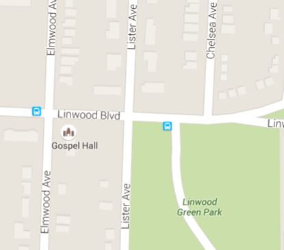
This area of Linwood Boulevard saw a considerable amount of change over the past ninety years. Not only did residences slowly rise, but the south side of Chelsea Avenue was entirely rearranged. This section of Linwood Boulevard transformed from an empty landscape to a residential area with features such as The Gospel Hall church and the Kansas City VA Medical Center which is just south of Linwood Green Park. This church, hospital, and park have created an interesting microcosm compared to it’s relatively blank state in 1925.
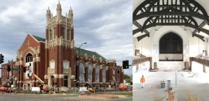
My area of Linwood is immediately to the east Highway 71. It includes the church that is currently being restored. My area has two churches and a funeral home. Google Maps shows a third church in this area, presumably it was recently demolished or moved as there is currently an empty lot with both a church parking sign and a for sale sign. The multiple churches is this two block area demonstrate why Linwood Boulevard was also known as the Boulevard of Churches.
From my research of the area, the location was previously a mix of uses. There were dwellings that included at least one boarding house. An ad in the Kansas City Star listed 8 rooms for rent to couples or gentlemen. Linwood School was also located in my two block area. The current funeral home has been at this location for many years and prior to that was owned by another funeral home.
The church currently being remodeled has been standing at this location for almost 100 years. Originally built in 1923, the church remained open until the late 1970’s. After the church’s pastor was swept away in flash floods along the Plaza, the church struggled, finally closing it’s doors. The current renovation will result in space for a congregation, multiple non-profit’s will occupy office space, and senior living apartments will be added.
The current businesses in the area and the renovation of the Presbyterian Church will help drive further development in this area and revive Linwood Boulevard and the surrounding neighborhoods.
Follow this blog as students in UMKC‘s UPD 260: History of Planning + Urban Design share their findings as they research the development and change of Kansas City’s Linwood Boulevard from the late nineteenth century through the present.