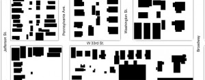
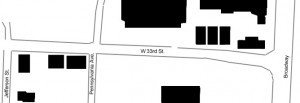
When reviewing Census records from 1950, 2000, and 2010, the population difference by race in census tract 47 – which contains the blocks from Jefferson Street to Broadway Boulevard along West 33rd Street – begins with a dramatic imbalance and displays the unevenness in Kansas City’s racial composition as the years go by.
In 1950, census tract 47 was a predominantly white area with 4,970 white residents and only 63 African-American residents. When viewing the numbers city-wide, Kansas City had 400,599 white residents within its city limits compared to only 55,682 African-American residents. To put these numbers into perspective, Kansas City in 1950 had over eighty percent of its population comprised of white residents.
In 2000, the great population divide between white residents and African-American residents at the census tract and city level is less drastic than in 1950. In census tract 47, there are 500 white residents and 202 African-American residents. At the city-wide level, Kansas City housed 254,471 white residents and 136,921 African-American residents. No longer are white residents eighty percent of the city’s population, but this data still displays a lack of evenness in racial composition.
In 2010, the population numbers of white and African-American residents remain unequal. At the census tract level, white residents held 1,915 spots in the population and African-Americans totaled 666 residents. City-wide, white population exceeded African-American population by over 100,000 people. However, the most sobering racial population numbers come from the metropolitan statistical area data. As can be seen in the data table below, at the MSA level, African-Americans were outnumbered by whites by over a million people – precisely 1,514,888 white residents and 250,563 African-American residents.
 2010: Population and racial composition numbers compiled from Census data

