I examined 62nd and Brooklyn Ave to the West of Prospect and also a little of North up until 59th Street as well. I had difficulties allocating maps for my area due to its lack of development up until 1925 (Atlas.) This was the first indication of structures in that area, but it was still documented in an Atlas and not a Sanborn Map. the area was primarily residential with single-family dwellings from what I could tell f rom the lot sizes and structures.
As the neighborhood progressed there were several new residential homes added up until 1939, and then the timeline gets a little hazy. From 1939, the last documented Sanborn map shows a decline in development and actually a staggering amount of demolition to the block on 62nd.
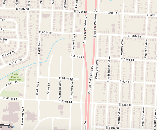
Though it wasn’t noted in my paper due to lack of evidence to support it, I’m going to mention it hear as a controversial factor to 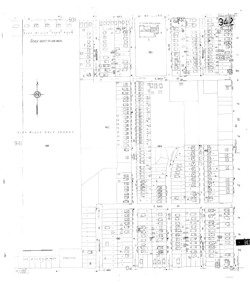 this deconstruction of the neighborhood along Prospect Ave. There is a pretty concise grid network through Kansas City and the construction of US 71 (Bruce R. Watkins Expressway), which extends North to South, cuts through this grid. In my opinion, my block suffered from this segregation and physical barrier, relocating many residents in the area.
Great summary and very interesting to see the differences in trends between blocks.