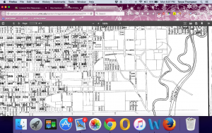
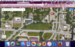
Tract 52, as identified by the United States Census Bureau, in Kansas City Missouri is approximately a 42-block radius situated on the southern side of historical Linwood Boulevard. Over the past 50 years this tract has experienced intense change.
In 1950 the population in Tract 52 exceeded 6,500 people and consisted of 99% whites and .98% African Americans (Figure 3, Table 2). Within only about 50 years the population became completely inverted. Figure 1, Table 2 shows that in 2010 the population was 87% African American and only 6% white.
The average tenant in Tract 52 could expect to pay about $46 per month for rent in 1950 (or $454.57, 2015 Dollars), about $4 above the city average (Figure 3, Table 3). The average rental price was $281 in 2000 (or $31.06, 1950 Dollars) (Figure 2, Table 3) and fell to $263 in 2010 (Figure 1, Table 3).
Approximately 54% of the residents in Tract 52 own their home in 2010(Figure 1, Table 3), in comparison to about 26% of residents in 1950 (Figure 3, Table 3).
Only 54% of Tract 52 had earned their high school diploma in 1950 (Figure 3, Table 2); that is in comparison to 77% of the 2010 population (Figure 1, Table 2).
The median household income in Kansas City, according to the Metropolitan Statistical Area, is $45,656 but only $23,047 for Tract 52.
Figure 1 – 2010
Table 1 – General Population
| Total Population: | 1221 |
| Population Density: | 4901.1 |
Table 2 – Demographics
| Race/Ethnicity: | |
| Gender: | 493 Males, 728 Females |
| Average Age: | 35.1 years old |
| Average Income: | $25,130 |
| Highest Level Education: | Considering only the 729 persons over the age of 25.
Less than high school diploma: 166 High school graduate: 563 Completed some college: 323 Earned Bachelors Degrees: 68 Earned Masters or Doctorate: 0 |
Table 3 – Housing
| # of Housing Units: | 726 |
| Occupancy Status: | Vacant: 171
Owner Occupied: 195 Tenant Occupied: 360 |
| Median Home Value: | Rental Rate: $263 Sales Price: $72,200 |
| GINI Index: | .53 |
| Median Household Income: | $23,047 |
Figure 2 – 2000
Table 1 – General Population
| Total Population: | 1483 |
| Population Density: | 5977.6 |
Table 2 – Demographics
| Race/Ethnicity: | |
| Gender: | 798 Males, 685 Females |
| Average Age: | 35.5 years old |
| Average Income: | $32,116 |
| Highest Level Education: | Considering only the 947 persons over the age of 25.
Less than high school diploma: 390 High school graduate: 557 Completed some college: 244 Earned Bachelors Degrees: 29 Earned Masters Degree: 218 Earned Doctorate Degree: 6
*Please note I am aware these numbers do not add up but these ARE the figured given by the Census Bureau. |
Table 3 – Housing
| # of Housing Units: | 641 |
| Occupancy Status: | Vacant: 131
Owner Occupied: 171 Tenant Occupied: 357 |
| Median Home Value: | Rental Rate: $281 Sales Price: $62,100 |
Figure 3 – 1950
Table 1 – General Population
| Total Population: | 6,531 |
| Population Density: | 26,323.96 |
Table 2 – Demographics
| Race/Ethnicity: | |
| Gender: | 2,869 Males, 3662 Females |
| Median Age: | 35-64 years old |
| Median Household Income: | $2,705 |
| Highest Level Education: | Considering only the 4,785 persons over the age of 25.
No education: 35 Attended Elementary & Middle School only: 1,305 Attended some high school: 3,320 High School graduate: 2,585 Completed some college: 930 Earned Bachelors Degrees or more: 350 Not reported: 160 |
Table 3 – Housing
| # of Housing Units: | 2,604 |
| Occupancy Status: | Vacant: 116
Owner Occupied: 542 Tenant Occupied: 1,946 |
| Median Home Value: | Rental Rate: $46.89 Sales Price: $6,308 |
| Homes w/o Refrigeration Systems: | 10% |
| Homes w/o Efficient Heat Source: | 5% |
| Homes w/o bathroom: | 627 |
| Median Household Income: | $2,705 |
Info Source: (Social Explorer)

