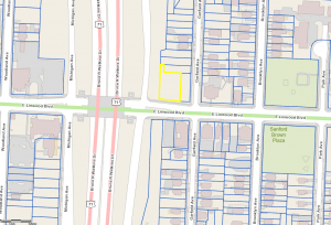
Linwood Boulevard runs east to west between Broadway Boulevard and Van Brunt Boulevard in downtown Kansas City, Missouri. I examined the development of the stretch between Michigan Avenue and Garfield Avenue from 1896 to the present using Sanborn Maps and the 1925 Atlas of Kansas City Missouri and Environs. Today these blocks have changed quite drastically compared to how they were from 1895-1950. The area between Michigan Ave. and Euclid Ave. is now the six-lane Highway 71. Looking south of Linwood Blvd., between Euclid and Garfield, there is only one building, the Emerson Manor senior facility. Taking its name from the Emerson Apartments that were present in the 1925 Sanborn Map. North of Linwood Blvd., Between Euclid Ave. and Garfield Ave. there are no buildings, but a little grassy area being used as an orchard. The orchard is maintained by The Giving Grove organization (a program of the Kansas City Community Garden). The uses of this land now are residential and for public uses. How this two-block stretch changed from a quiet, nearly empty, piece of land to being a bridge over a loud, speeding highway is eye-opening to how drastically the use of land develops over time. In 1896 Lindwood Blvd. didn’t even exist, but over time we were able to see how the indention of Lindwood Ave. decreased and was slowly replaced with grass and was eventually completely taken out. You could never imagine the drastic changes the land around you has gone through.
Interesting useless trivia, Bruce R Watkins was against the building of Highway 71 because it would divide the neighborhood. He passed away long before it was completed and named after him.