My contribution to the analysis was transportation mostly focusing on the Hospital Hill Campus and the area directly south that connects to the Volker Campus.
The transportation team was responsible for representing traffic counts, directional turning traffic, pedestrian traffic, speed limits, and bus routes.
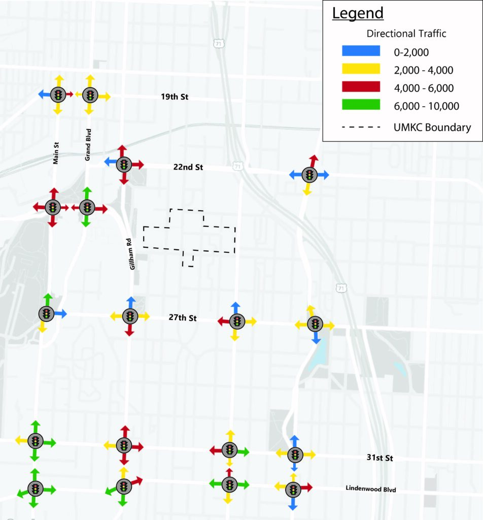
This map indicates the values of vehicles that are turning north, south, east, and west at major intersections from 19th St to Linwood Blvd. We found the majority of traffic is circling around the hospital hill campus because 31st St and Linwood Ave are carrying traffic from highway 71, and Main St is a connecting through Kansas City from Downtown to the Volker Campus. The main point of entries into Hospital Hill are south of 22nd St at Gillham Rd and Troost Ave.
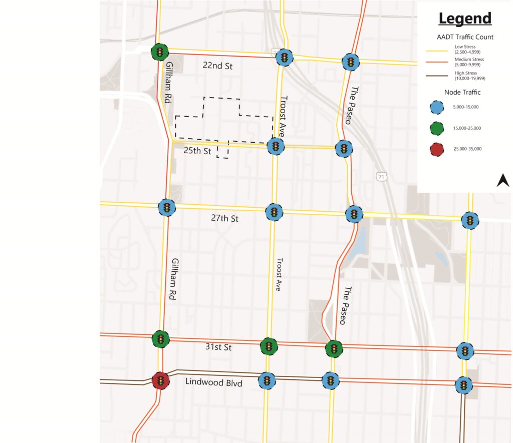
This maps represents the average daily traffic, and the total number of vehicles that entered the intersection throughout a 12 hour period. The roads that mold hospital Hill, Troost Ave and Gillham Rd, show lower than predicted stressed streets. As shown above in the directional traffic map, 31st and Linwood are the most traffic traveled streets with a stress level of 10,000 to 19,999 cars per day.
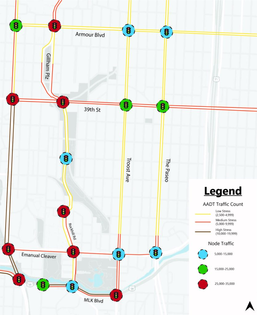
Below is the map of connecting roads between Hospital Hill and Volker Campus. The level of stress on major roads such as Troost Ave and Main St changes as you pass Emanuel Cleaver Blvd. Another east and west street, MLK Blvd, is a high stress street that connects to highway 71 located east of campus. The stress level of these streets indicates that many students commute to campus via the highway system instead of intercity roads.
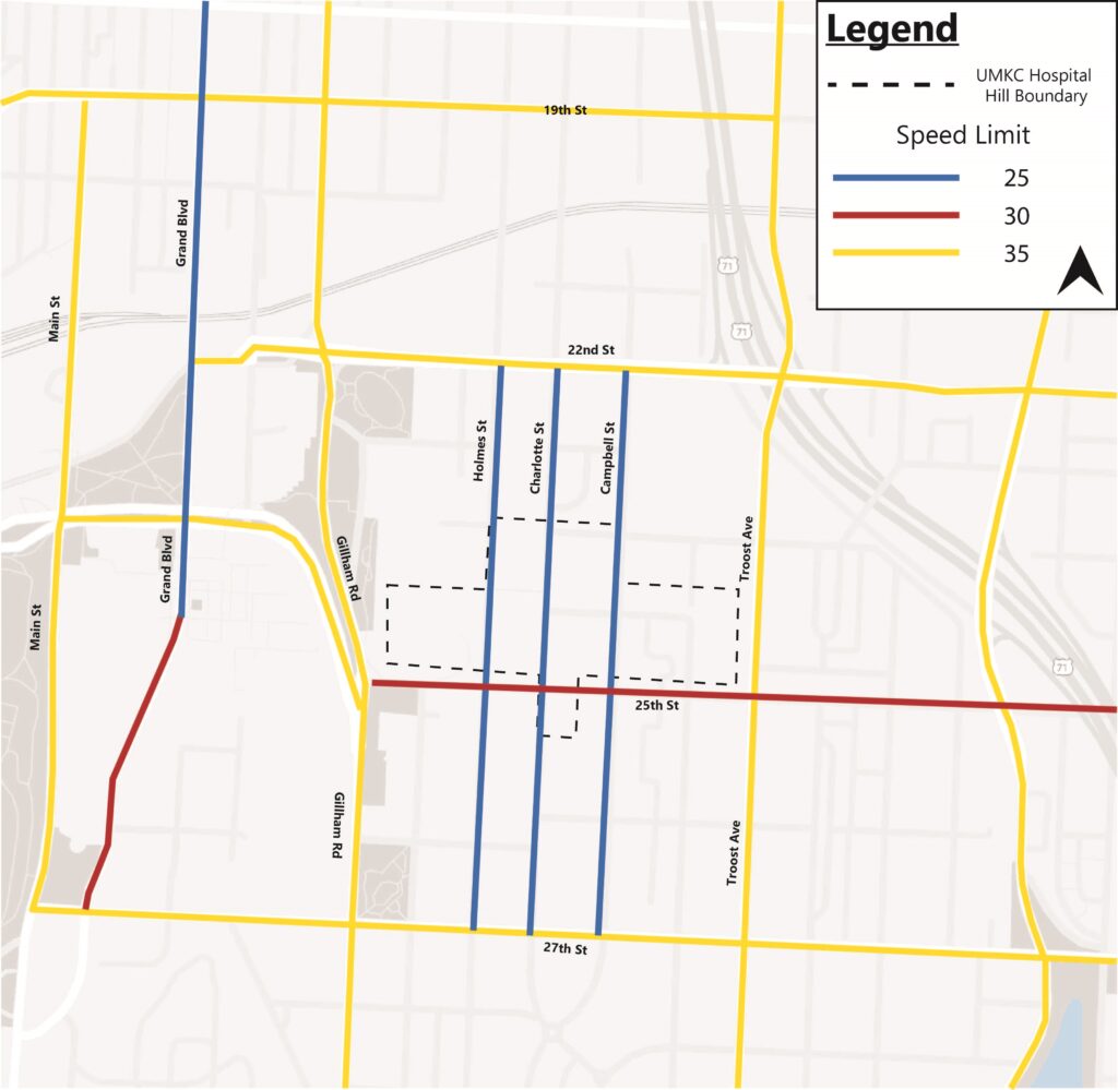
We also gathered the various speed limits around both campuses. I found that within Hospital Hill, the speed limit stays at 25 mph on Holmes St, Charlotte St, and Campbell St. The highest street that cuts through campus is 25th St where it rises to 30 mph. In addition, Grand Blvd is 25 mph because of Crown Center and it changes to 30 mph as you exit that area. All other roads in the surrounding area are 35 mph.
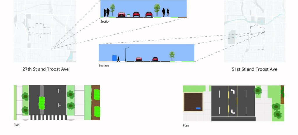
I produced sections and plan view of two different intersections of Troost Ave. The first intersection is at 27th and Troost which is directly in front of the Hospital Hill dorms, and the second is located at 51st and Troost on the bottom right corner of campus. We wanted to highlight the differences in infrastructure for pedestrians and cars. The first intersection has a median, a well defined painted area for pedestrians to cross, and on street parking to slow traffic down. The second intersection is a five lane street including a turn lane, and has a crosswalk indicated by only two white lines.