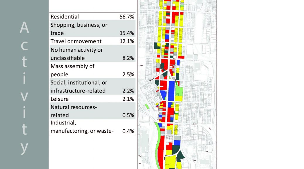
The second project of the semester consists of producing a land use survey along the Main Street corridor from the north boundary, 30th street to the southern boundary 51st street. We began by completing a lengthy survey on foot of every parcel in the corridor tracking five categories, activity, function, structure, site and ownership. To get an idea of what this means, let me explain these categories in greater detail. Activity refers to the visible activity happening on the parcel. For instance, a parcel with single family home would be listed as residential activities. Function refers to the economic activity that is occurring on the parcel. A shop or store along Main Street would be categorized as general sales or services. Structure has to do with the type of structure or building on the parcel. A church would be listed as a public assembly structure. Site is the overall physical development characteristic of the land. A parcel with a commercial or residential building would be listed as a developed site with buildings. Finally, Ownership displays whether the owner of the parcel occupies it or if it is leased out to other individuals or companies.
Once we gathered the data, we entered it into an excel spreadsheet and linked it to Arc Map GIS. Arc Map allowed us to create maps to visually show our results. Above is the Activity map that was created.