A quick look at an iconic boulevard shows the Parks system can be intensely urban
Last week was like a boot camp for planning students. We have studio three times a week, and it’s usually relatively laid back: we work on projects, get feedback from professors. (Laid back is the wrong term it’s always fast-paced and stressful
But last week, the pressure was raised a notch. In each class period, we were assigned a “quick analysis” assignment to complete in the three hours of class time. On Monday, for instance, we were assigned a demographic variable to study at the scale of Kansas City, MO. In three hours we had to produce at least one GIS map visually representing the spread of the variable, do any background research, write 600 words about what we found.
Not only is that really challenging, it’s almost impossible to do. Still, it’s impressive what you can learn about a place in two hours and fifty minutes.
While the first “quick analysis” was at the city scale, the next two — on Wednesday and Friday, respectively — dealt with the same, specific location on the city’s Parks and Boulevards system. I was assigned to look at Armour Boulevard near where it intersects with Troost Avenue — specifically between Kenwood Ave. on the west and Forest Ave. on the east. (See map below.)

On Wednesday, the assignment was to look at the history of the urban “morphology” (how streets are laid out, where buildings are, what kind of buildings they are, etc.).
Although maps do go farther back in time, we started our research in 1925 (we only had three hours, after all). Why 1925, specifically? Because an “atlas” of the city was produced for that year, showing streets, streetcar lines and building footprints.
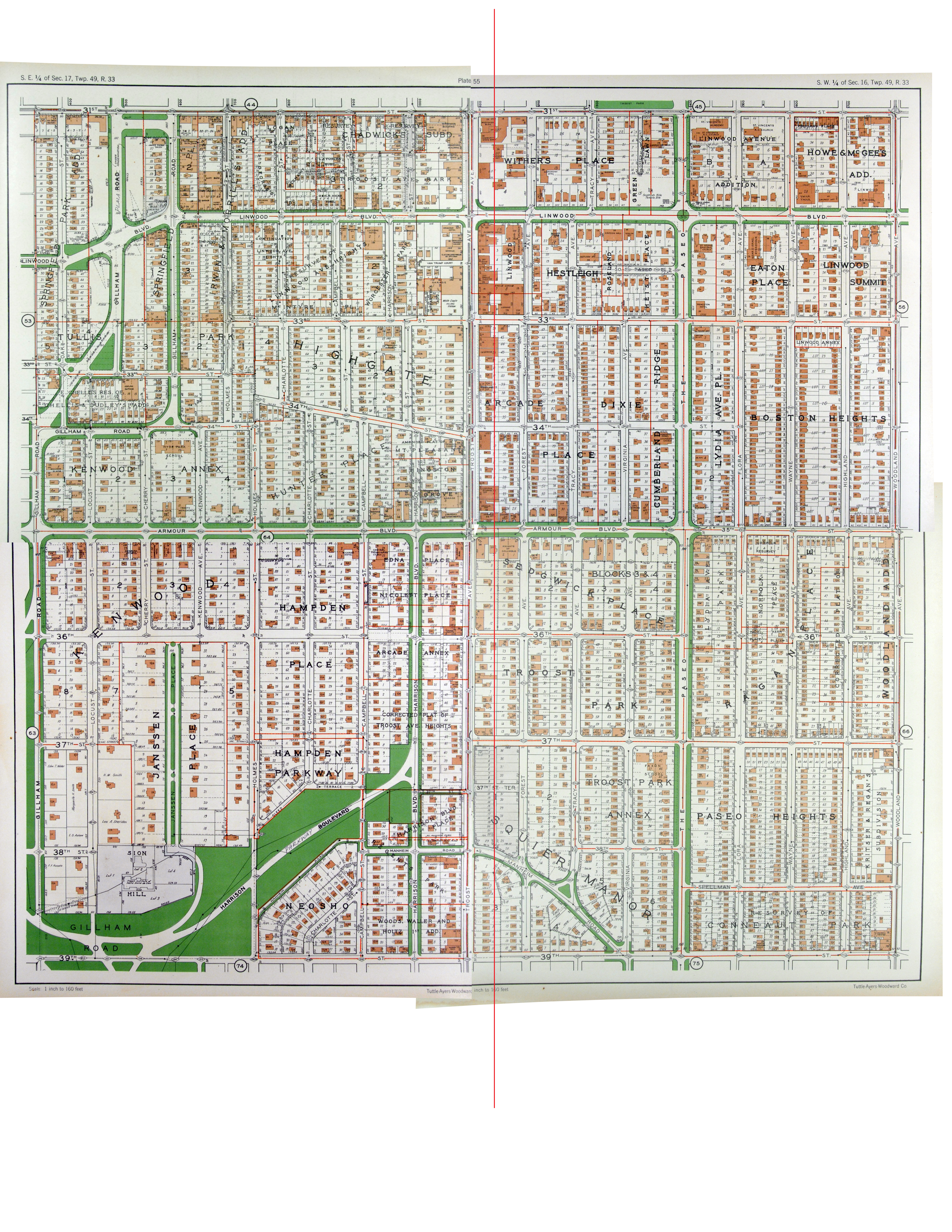
If you look closely at the map of my assigned area from 1925 (you can expand by clicking on it), you’ll notice a couple patterns. First, the area is largely filled by single-family homes. There are exceptions, though, most notably along Armour itself and Troost, where higher-intensity uses — apartment buildings, churches, and along Troost particularly, commercial spaces — are found. Another important pattern is seen in clusters of empty, undeveloped lots — this suggests the neighborhood was fairly new at the time. (And in fact, the city limits at the time would have been just a mile south near 47th Street.) The concentration of gathering places and commercial uses along Armour and Troost suggests they provided the framework for the development of the neighborhood — Armour as an attractive boulevard thoroughfare and Troost as a throroughfare and streetcar line.
1950
Not much seems to have changed by 1950, the next point on the timeline we were supposed to look. A few more lots have been filled in with structures. Several mid-rise apartment buildings, which were already numerous to west near Gillham Rd., have appeared along this stretch of Armour. The Armour Tower apartments, in a photo from around 1952, are exemplary of that kind of development.
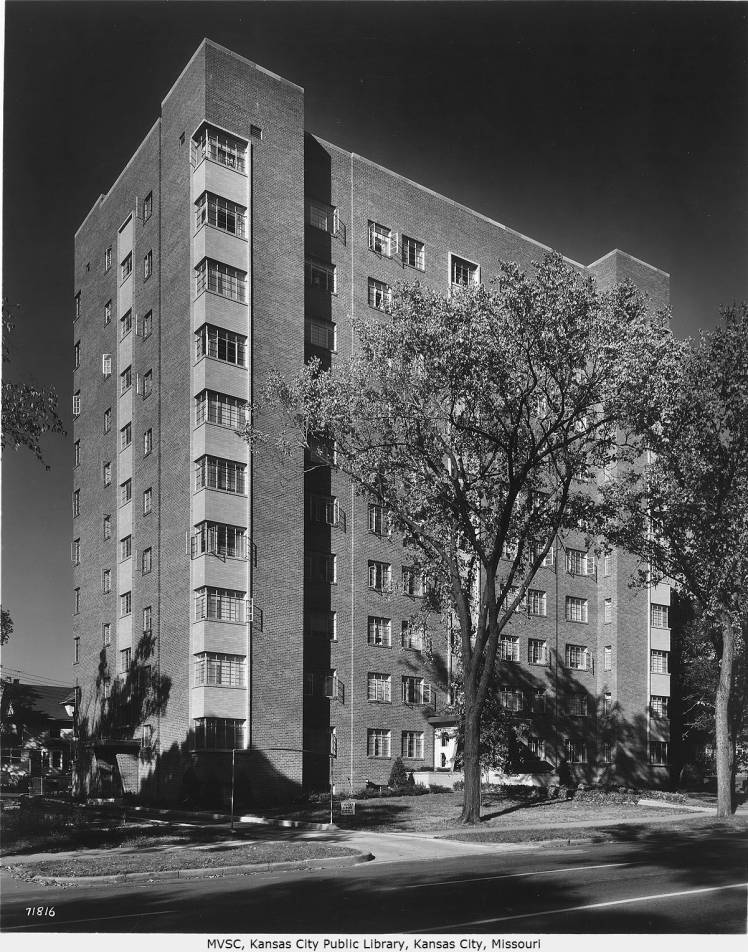
An undated photo (probably from the same period based on the style of cars) is even more telling: It shows the area was bustling and vibrant and had an urban scale.

Today
Contrast the above photo with one from today at the same spot