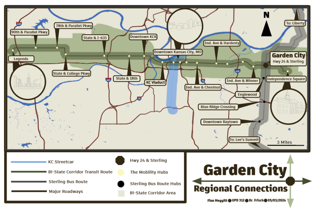
The regional connections board explains the context for the Bi-State Corridor transit network and its respective mobility hubs. The proposed corridor goes from Independence Square to West Village, or the Legends. This map also includes the proposed creation of a Bus Route from Lee’s Summit to Liberty which will connect this mobility hub to Englewood and Raytown.
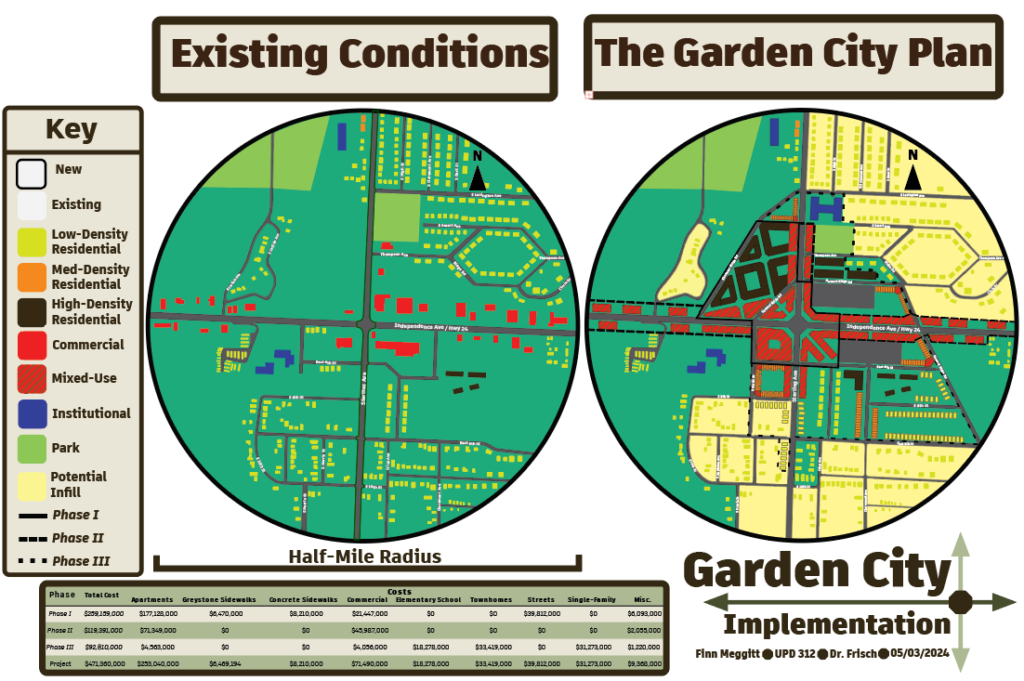
This shows what changed from the existing conditions to the development. The mobility hub currently supports an unplanned area of suburban and exurban housing in combination with commercial pads and strip malls with large front and side setbacks. The area changes into a dense core which can support transit, unlike the current existing conditions. This density will help keep out of the flood plain and create a more sustainable area which will make residents healthier.
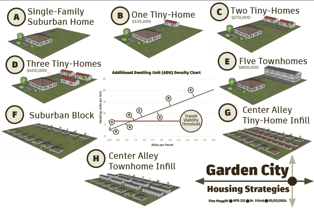
Housing board which illustrates how many ADU’s would be necessary to create the necessary density for transit in suburb and borderline exurban areas. A through E are free market solutions which allow residents to freely manage a construction project in their own backyard. F through H are solutions where the government eminent domains your backyard and turns it into housing.
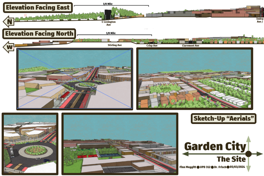
This board shows what the project looks like. You can see the greenery and more forested and lower and medium density buildings which create more private areas for families. You can also see the elementary school on this board as well as the dense core of the project area.
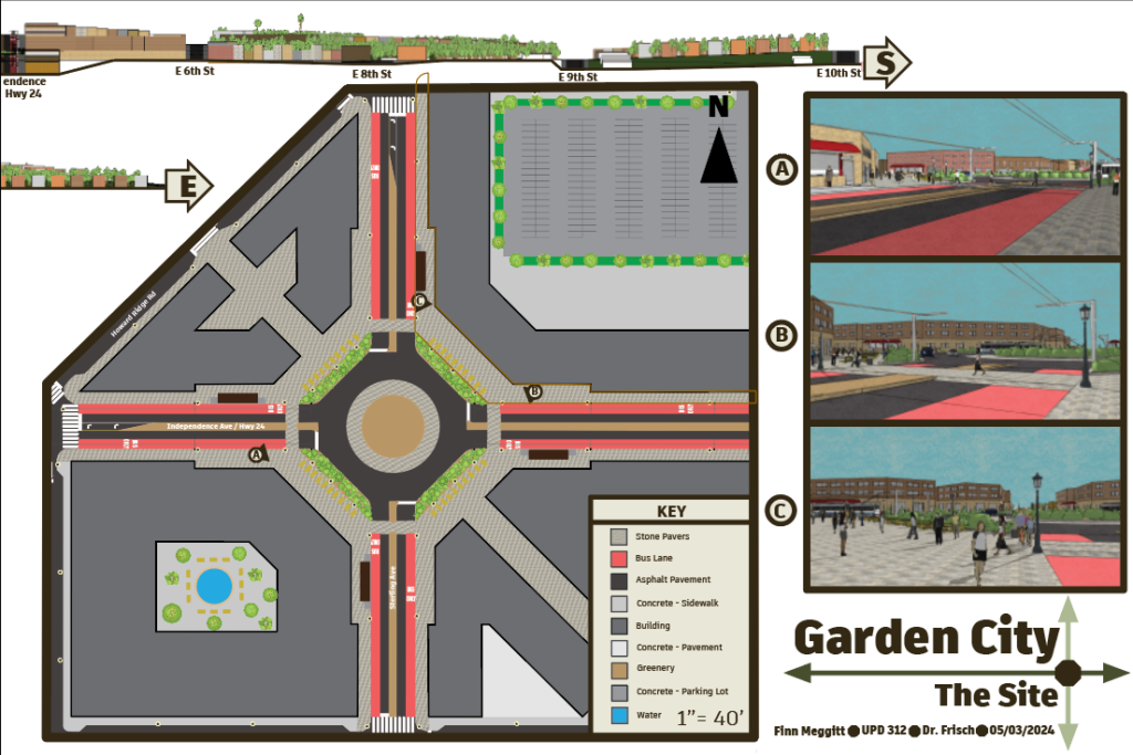
This is what the center of the mobility hub looks like, its the right board. The board shows the human scale of the mobility hub as well as the four bus stops within the mobility hub. The perspectives are labeled on the mobility hub and you can get a complete view of the center of the mobility hub. The area has bulb-outs, planters, raised crosswalks, and bus lanes.