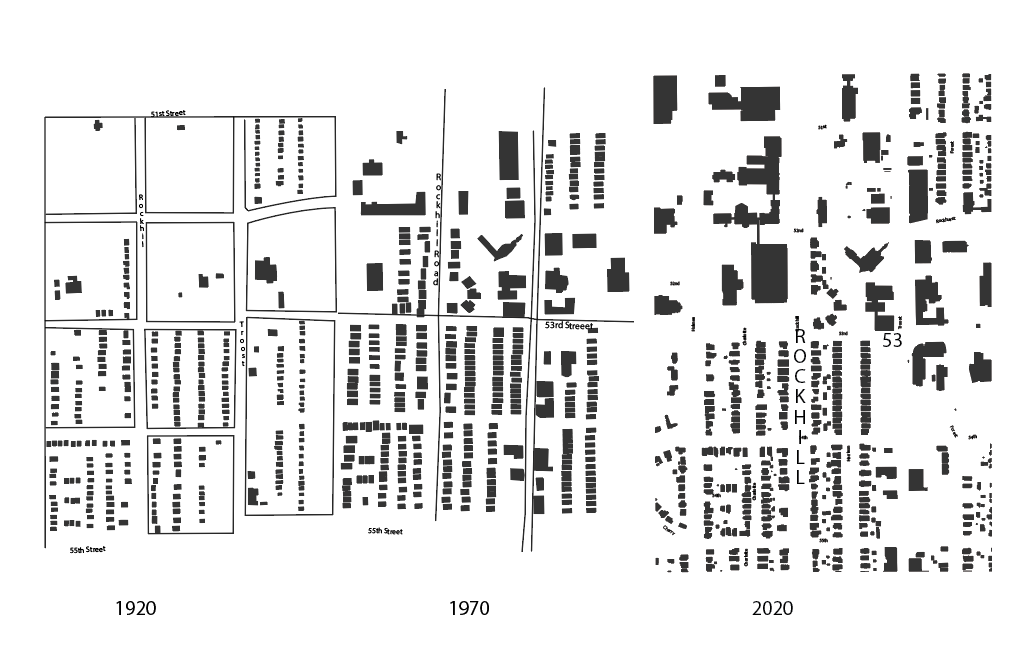
The studied area is from 51st to the North to 55th in the South. And from Holmes on the Eastside to Forest on the West. The area was mostly made up of residential living space, and that continues to this day. Although the two universities have made growth, they have also experienced set backs. The universities acquired some of the residential homes, and the community responded by feeling threatened of change in their neighborhoods. There might be something to the student ‘lifestyle’ that most neighborhood communities don’t want to put up with, as well.
We see a lot of residential growth in between 1925 and 1970. And it seems built-up fairly equally with the universities growth. We also see the commercial area on Troost gain is size. And the Church at 52nd and Troost is finally built. What stood before that, was a parish school. From 1970 to 2020, we see that some of the single-family housing is bought and razed by the school to create, a parking garage at 53rd and Rockhill. For the most part the housing is still in tact from its original placement prior to the 1925 Sanborn Maps. The biggest loss in housing seems to be the homes on the west end of Troost between 53rd and 54th. There is plans for that area to become student housing in the new Master Plan.
I think that this area was late to develop and by the time it did develop, cars had already become a popular mode of transportation. And it is worth noting that Troost used to be a streetcar road. But that could not withstand the transfer to the automobile. This transformation is furthered by the construction of not one, but multiple parking garages being built between the 1970’s and the 2020’s; there is the one mentioned at Rockhill and 53rd, but also the Rockhurst garage at Troost and 51st, and the Stowers Research Institute garage at Troost and 50th. This confederation of parking is unorganized and is exclusive to each group. It seems that the universities did not help make the area more walkable either. Even though when we think of universities there is a walkability/connectivity to the image of a campus. The progression of UMKC becoming a commuter school seems only natural. As the area was developed mostly in the context of the car, none of the single family residential has been up-zoned and roads and parking have been updated for more use. While walkways and bike paths seem out of character for this area now. And little has been done between the universities or its neighbors, even in between the city and the universities, to create walkways that work for the area.