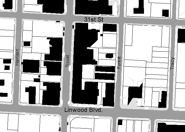
My historical analysis area includes Tracy, Forest, Troost, and Harrison streets between 31st and Linwood Blvd.
The 1885 Kansas City Sanborn maps reveal that the area is almost entirely residential. To the west, there are many open narrow lots. To the East, near Tracy there are larger open lots. Linwood blvd is called 32nd street at this point. The hall and Faxton Elementary school would be in the southeastern corner but it has not been built yet.
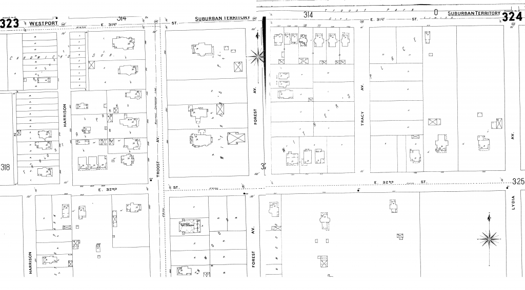
This map is from the 1925 atlas. The school has been built but according to the Atlas it is called Haddon Hall. Along 31st and Troost there is more commercial space but there is still no development north of 31st street. 32nd street was renamed Linwood Boulevard because of the implementation of the Kansas City Parks and Boulevards system.
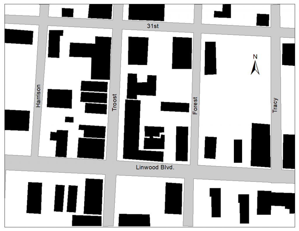
This 1991 map is from Google Earth, and the building polygons were transferred into Arc GIS. The apartments and houses along the east side of Forest Street are no longer there. Along the eastside of Troost the existing buildings were removed and new larger commercial buildings took their place. There has also been a significant increase in single family residential units along Linwood and Tracy. There has been development north of 31st street, one of those developments being a church.
This map was made on Arc GIS using the impervious surface files from KC Parcel Viewer. There is a noticeable decrease in residential units. There is a significant amount of vacant lots in this area. Almost everything south of Linwood is large paved parking lots. Between Forest and Tracy the empty parcels are vacant lots. North of 31st street the church still stands, but the other buildings were replaced with larger ones.