The area I was assigned to find the history of is Wayne Ave. (formally known as Vine St.) to The Paseo (formally known as Lydia Ave.) as well as Linwood Blvd. (formally known as 32nd St.) to 31st St.
The first map below is a block view from 1896. This is before Troost park was built as well the main landmarks in the area such as the Scottish Rite Temple on the Corner of Linwood and The Paseo.
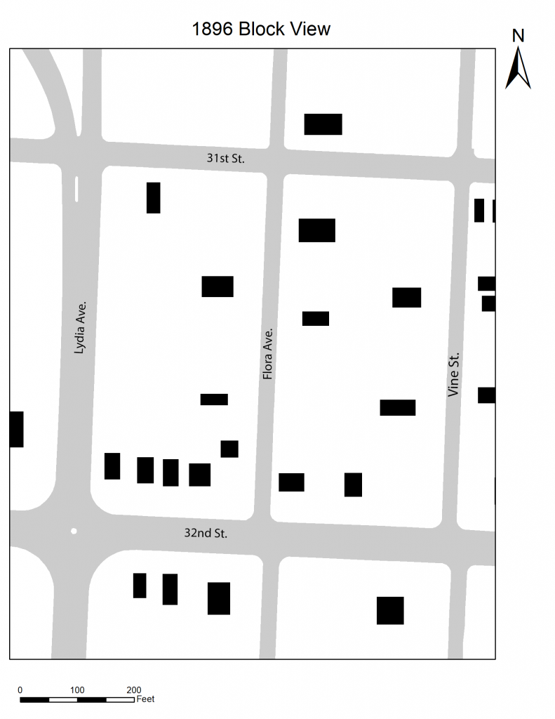
As you can see from the map above, the area is scatted residential mostly. The area in 1896 was actually considered Kansas City’s Suburbs.
The next Image shown is a Block View from 1925.
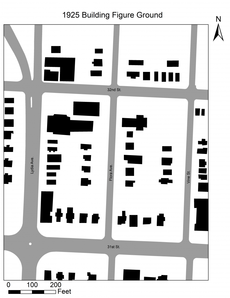
The Area is becoming more “mixed use”. An example is the addition of St. Vincent De Paul Church on the corner of Flora Ave. and 31st St. The area also has more residential structures. This being said I would assume the time around 1925 was the height of the area.
The Next Image is a Block View from 1955.
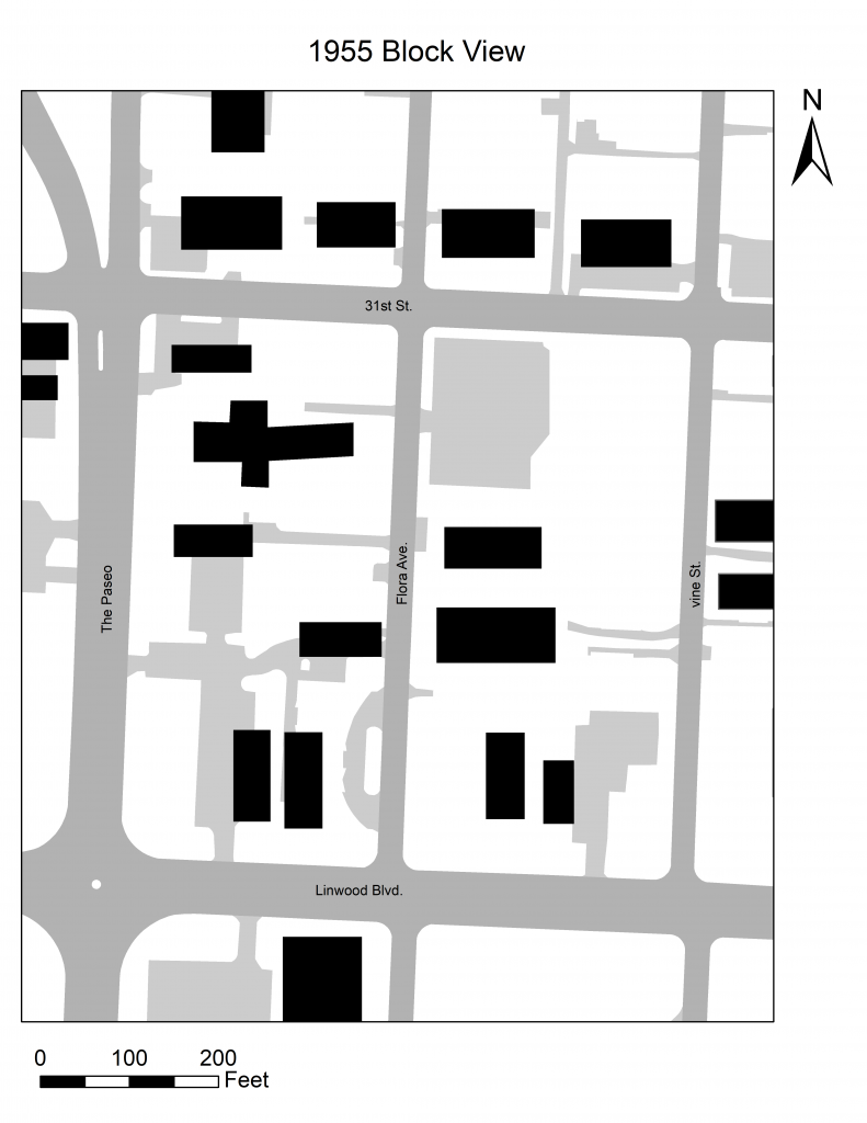
The area in 1955 has become less residential and more scattered use. There are less residences and more larger structures. The area is becoming what we know it as today.
The next image is a 1991 Block View.
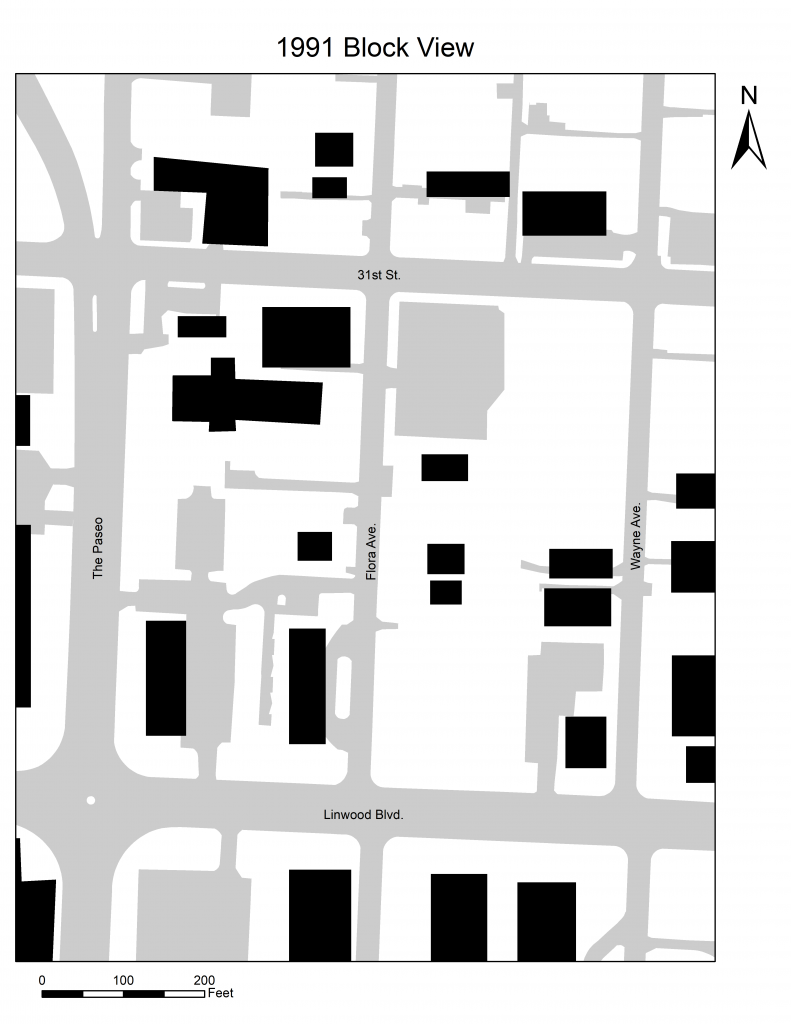
in 1991 there is removal of different structures throughout the area as well as additions to the area. By 1991 all of the street names are what we know them as today. As well as not much change to the structures.
The next Image is the Current Block View.
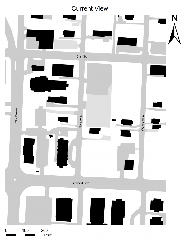
The area has pretty much stayed the same from 1991 to the current view. There are a couple structures that have been removed however no major structures have been built or been torn down.