Diagram by Tom Meyer
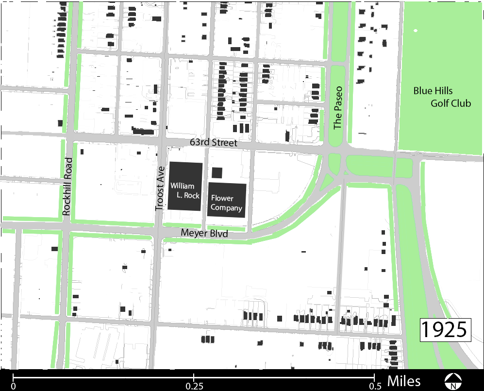
In 1909, Kansas City, Missouri annexed the land between Brush Creek and 77th street, officially bringing our study area into the fold of the rapidly expanding metropolis (City Planning & Development Dept). The intersection of 63rd and Troost Avenue was perfectly positioned in the center of this expansion to become a transportation and commercial hub for the surrounding residential area.
Troost Avenue had been graded to 63rd Street by 1883 (KC Star, 05.14.1884). A line of the interurban railway system was extended past the intersection in 1904 (KC Star, 04.15.1904). The grading of Troost Ave and the extension of the rail system led to the subdivision of the large land holdings in the area.
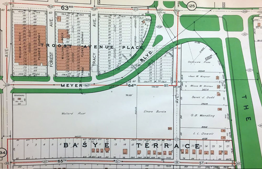
In 1888, a plat for Troost Avenue Place, on the future site of the landing, was one of the first to be filed with Jackson County (Jackson County). A single owner, the William L. Rock Flower Company, snapped up most of these lots and built two large greenhouses there (Figure 2). These greenhouses would stand until the 1940’s and remain in continuous operation by the Rock Flower Company (KC Star, 01.10.1947).
With annexation in 1909 the boulevard system was extended into the area. The Paseo, the main north-south corridor of the system, was given an intricate intersection with the newly planned east-west corridor of Meyer Boulevard.
The path of this new boulevard was graded in 1915 (KC Star, 10.27.1915) but the outbreak of the First World War, and subsequent material rationing, prevented it’s paving until the conclusion of the war in 1918 (KC Star, 10.27.18)
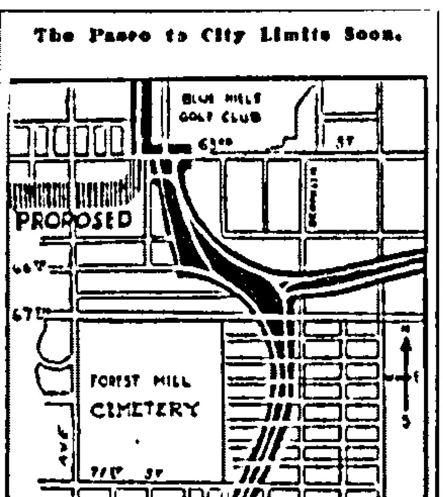
Some tracts of land along the new boulevard were not subdivided (KC Parcel Viewer). The area immediately south of Meyer Blvd. at it’s intersection with The Paseo was likely too steep for the development of small lots. Today, this area forms the grounds of the Convent of Christ the King, built in 1948, and Hogan Preparatory Academy, built in 1940. Only one lot of this area was sold from the whole, that being at the corner of Meyer Blvd and Troost Ave, which was sold to a gas station interest in 1921 (KC Star, 05.27.1921).
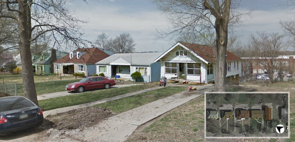
65th Street, between Troost Avenue and The Paseo, was subdivided as Basye Terrace in 1916 (Jackson County), though housing construction didn’t commence until the mid-1920’s (KC Parcel Viewer). Even then, many of the lots remained unsold for another 30 years (KC Parcel Viewer). This gap of construction is evident in the styles of home on the street. 1920’s bungalows can be seen built right alongside mid-century Cape Cod homes (Figure 4).
Once Meyer Boulevard was paved, platting and development along its corridor began in earnest. The plats for the Meyer Boulevard Heights and Hale Addition subdivisions were filed within five years of the completed roadwork (Jackson County).
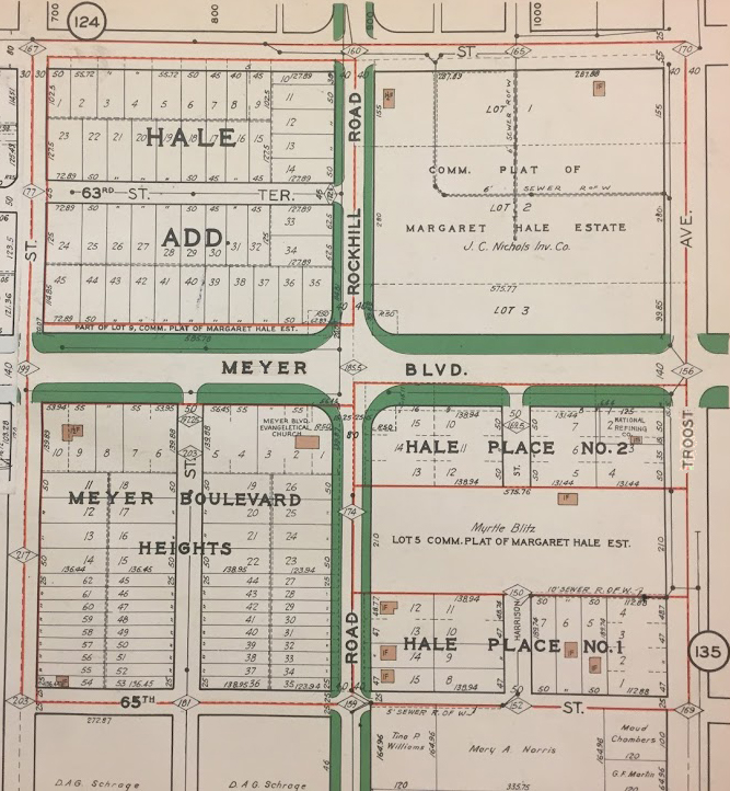
The commercial block between 63rd St. & Meyer Blvd. and Rockhill Rd. & Troost Ave. was developed by the J.C. Nichols Company (Figure 5). Many of the buildings on this block date to the mid-century as evidenced by the architectural styles of the Rockhill Plaza building and the A-Z Theatrical Supply Company. The former church and current home of the Banneker charter school is of a similar vintage. An exception to this mid-century style is the U.S. Bank building at 63rd St. and Troost Ave. which dates to the 1920’s (KC Parcel Viewer).
The J.C. Nichols company purchased the former grounds of the Rock Flower Company in 1946 and began demolition of the greenhouses and supporting structures in early 1947 (KC Star, 01.10.47). The site would remain empty for a decade until the Nichols company began development of The Landing Shopping Center (06.16.1957), which would open in 1961 (KC Star, 02.27.1961).
Today, the ample parking along with the many pad-site buildings fronting Troost Avenue show the auto-centric character of the area (Figure 1).
References
Historic Aerials. (n.d.). Retrieved February 4 , 2019 from https://www.historicaerials.com/viewer
Jackson County. Retrieved 2019, from http:// records.jacksongov.org
Kansas City Star. May 14, 1884: p8. Newsbank. Web. 4 Feb. 2019
Kansas City Star. April 15, 1904: p6. Newsbank. Web. 5 Feb. 2019
Kansas City Star. January 10, 1947: p3. Newsbank. Web. 5 Feb. 2019
Kansas City Star. October 27, 1915: p7. Newsbank. Web. 5 Feb. 2019
Kansas City Star. October 27, 1918: p8. Newsbank. Web. 8 Feb. 2019
Kansas City Star. May 27, 1921: p2. Newsbank. Web. 8 Feb. 2019
Kansas City Star. June 16, 1957: p8. Newsbank. Web. 8 Feb. 2019
Kansas City Star. February 2, 1957. MVSC. Microfilm. Shopping Centers: The Landing
Kansas City Star. March 1, 1961. MVSC. Microfilm. Shopping Centers: The Landing
KC Parcel Viewer. Retrieved 2019, from http://maps.kcmo.org/apps/parcelviewer/
Tuttle-Ayers-Woodward Co. (1925). Atlas of Kansas City Missouri and Environs. Kansas City, Environs. Kansas City, MO: Tuttle-Ayers-Woodward Co.