For this semester’s final project, we were responsible for choosing a key location along the Parks and Boulevards System, within the 1940 boundaries of Kansas City. My site is located on the southern end of Gillham Park, from Brush Creek Boulevard to Emanuel Cleaver II Boulevard, between Troost Avenue and Campbell Street. It is an important artery for residesnts in the surrounding areas, including the Hyde Park, Southmoreland, and Rockhill neighborhoods, as well as the Midtown Wesport area. Currently, however, the park itself lacks important North-South connectivity, causing a major disconnect within the Parks and Boulevards System.
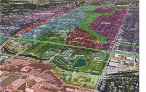
To connect this area completely to the rest of Kansas City’s system, Gillham park has been extended to connect to Emanuel Cleaver II Boulevard, ultimately linking Emanuel Cleaver, Brush Creek Boulevard and Armour Boulevard together.
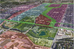
Below is the site plan for this area, which differentiates between new and existing structures. The main focus of this plan is to rid the area of the undersireable developments, including the apartment homes along Harrison and Campbell Streets, and the poor commercial variety along Troost, and redevelop this area in such a way that would reflect both the historic context of the surrounding neighborhood, as well as acknowledge the cultural presence from surrounding institutions.
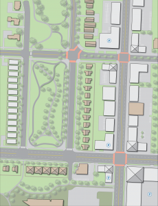
By extending Gillham Park, this plan has added an additional 156,000 square feet of space to Kansas City’s park inventory. On top of that, a proposed half mile of pathway, and addiontial 1.5 miles of bike trail would connect pedestrians nearly two miles from Emanuel Cleaver to Armour Boulevard. To support the increase in pedestrian activity, the portion of the Troost Corridor from north of Brush Creek Boulevard to Emanuel Cleaver has been redeveloped to include a healthy mix of retail, office, and residential, with a heavy focus on mixed use developments.
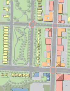
An important aspect of this design focuses on the historic context of this area as a whole. With the Rockhill and Southmoreland Neighborhood just to the west, this area is home to a number of historic charactristics, from the unique building styles and materials, all the way down to the historic stone walls that surround the majority of the adjacent homes. Using this as a means of connecting this area to the rest of Kansas City as a whole was done through the bike trail that runs from Emanuel Cleaver, north to Armour Boulevard. In researching some of the history of this area, I came across some historic photographs depicting an old wagon trail that ran through both Gillham Park and Hyde Park
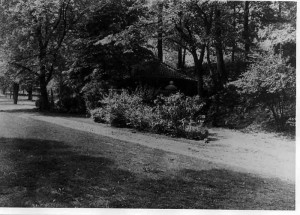
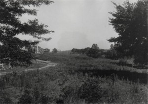
The bike trail begins at the intersection of Emanuel Cleaver and Campbell Streets, and traces the Western edge of Gillham Park and Hyde Park. The image below depicts the interaction between neighboring bike trails in the surrounding area. With the Brush Creek Trail just to the South, it acts as an East-West connector to the Trolley Track Trail, which continues into the southern portion of Kansas City
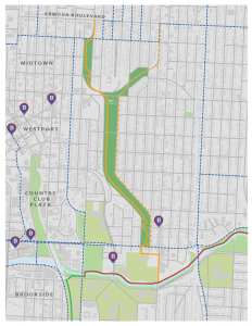
As a whole, this plan was designed to serve as a resource for the neighoring residents, to better connect them with the surrounding area. By creating this connection within the Parks and Boulevards System, this area would indefinitely experience a high influx of both residential and commercial activity. With a cultural presence on Troost from the Nelson Atkins Museum and the adjacent institutions, it would serve as a potential catalyst for future development and revitlization of the Troost Corridor.
