For the 2015 JC NicholsPrize project we were assigned to choose an area from the 1950’s boundaries of Kansas City, Missouri Parks and Boulevards system and create a new plan for the 21st Century. The location I chose is the interchange between Broadway, Southwest Trafficway, and I-35. I Chose this ocation because I wanted to try and make a feasable plan for the removal of I-35, and bring life back to the Westside neighborhood that had been blocked off by the massive wall created that is I-35.
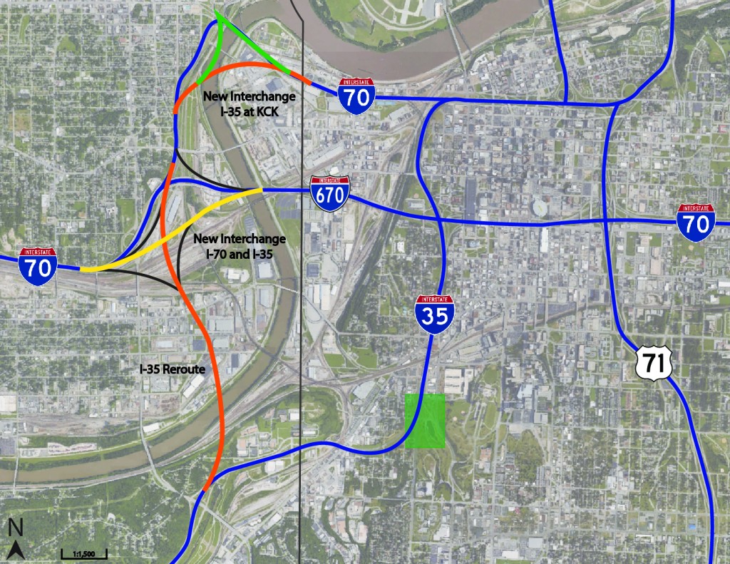
My first order of business was to find the best location to reroute I-35. Below in Image 1 I chose to connect it northwest to the interchange of I-70 and I-670. I also adding a few other minor changes with the rerutefurther north. By rerouting I-35, the Westside neighborhood is opened back up to the Crossroads Arts District and Penn Valley Park. And is allowed to infill the land with new residential housing. The estimated cost for this portion of the project is around $328,000,000.

The next phase of the plan is the transition from changing Southwest Trafficway to a Parkway, and adding infill housing to the Westside South neighborhood. The two and a half block area where the interchange was at I added a new multi-family housing neighborhood to increase the population density but still protect views by keeping the structures under 4 stories. A new loft was added next to Annies with underground parking and a statue was added to be a landmark for George Kessler. And finally the lake was raised to help control flood water, and the creek valley was raised even higher to allow a better sight angle for pedestrians and to provide a beautiful waterfall for an added element to the the lake.
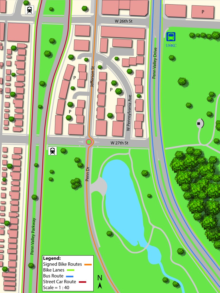
Below in Image 2 you can see the plan for the model area and where detailed changes were made. Also in Image 2 is the addition of a streetcar line running along Penn Valley Parkway, and the bus line as well as the UMKC Concervatory shuttle along Broadway with a stop at the southeast corner of 26th street. For bike lanes, the current signed bike route along Penn Dr. has been made faster and safer with the addition of Jefferson street so the riders do not have to cross the new Parkway they can ride two blocks further north and cross under the bridge. I have also added bike lanes along Broadway and Penn Valley Parkway.

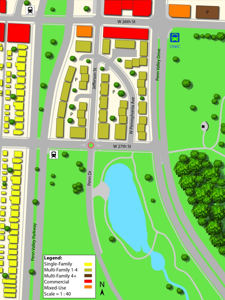
The housing in the plan would add 385,900 square feet of residential housing at an estimated cost of $31,643,800. The commercial adittions would have an increase of 53,600 square feet at an estimated cost of $4,824,000. Seen below in Image 3 is the Land-usemap showing the location of the different building types.

With the removal of I-35 the Westside neighborhood is reconnected to the Crossroads Arts District and Penn Valley Park and creates a more healthy and livable environment where walkability and all modes of transportation are welcomed.
