Walking through Prospect Avenue from 52nd Street to 54th Street today we find a mix of residencies and businesses sporadically located. The residencies have little space between them and are similar in size. However, some of the businesses have large properties or are by a vacant property. There is an auto shop, a dental clinic, a discount merchandise store, a party shop, a motel, a restaurant and a laundromat.

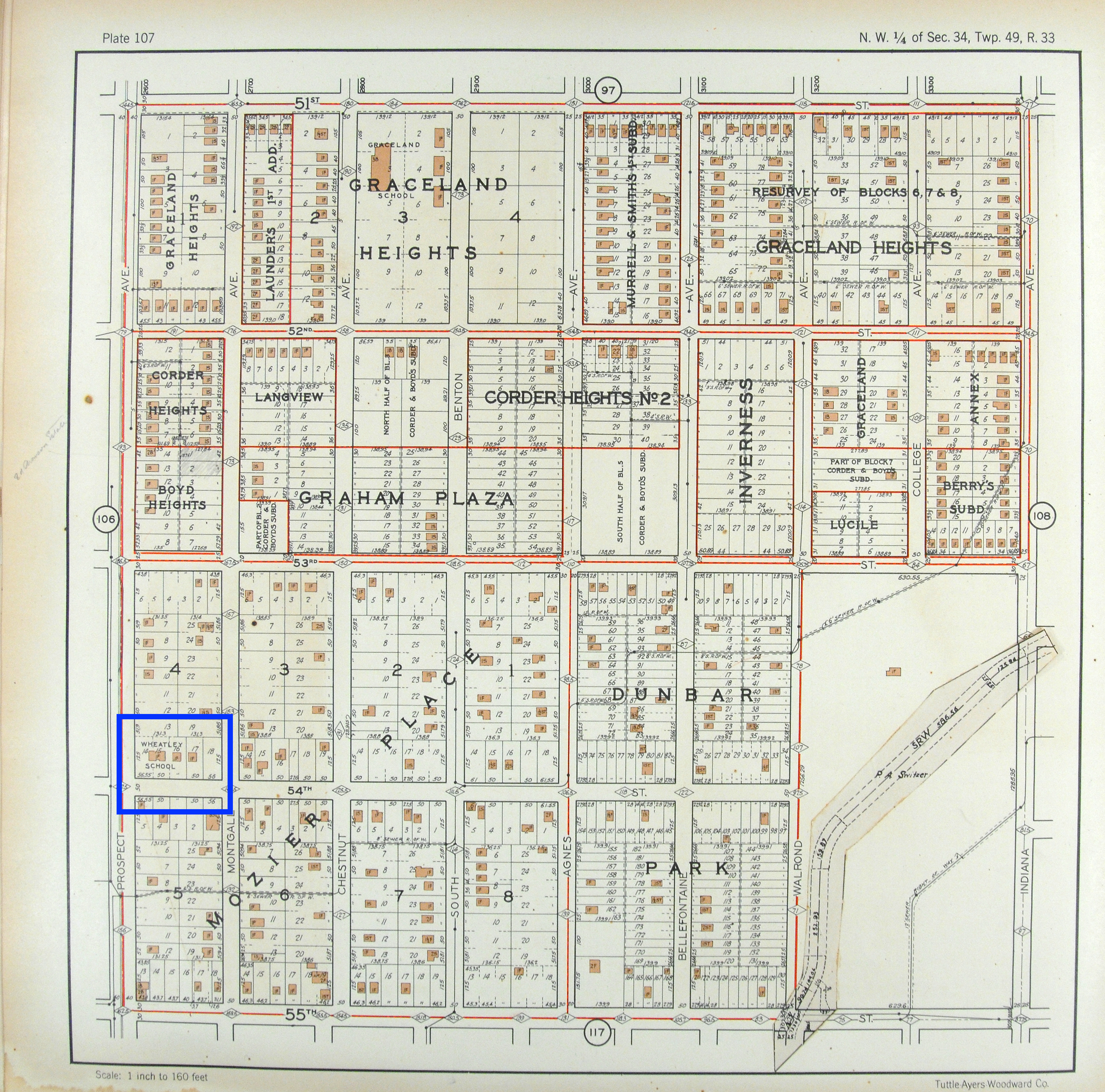
On the West side of Prospect for these blocks, the 1925 Atlas and Sanborn maps c.1950 volume 9 and volume 6, show that landlords of certain sections on these blocks, divided the area into grid-like compartments and placed buildings in the compartments. These compartmentalized sections, shared the land on the block with a landlord, Mary S Smeltzer who kept her section unbuilt and undivided. The East side of Prospect for these blocks show a similar division of land use. However, the 1925 Atlast shoes an interesting set of buildings were located Prospect and 54th Street — Wheatley School. The school was name after Phillis Wheatley and was for African Americans. The c1950 Sanborn maps show that the school moved two blocks East and in parenthesis classifies it as “colored”. It also showed that the buildings for Wheatley School by prospect were not there anymore by then.
Today, there still is a mix of compartmentalized residency buildings and unkept, empty sections of land on these blocks.