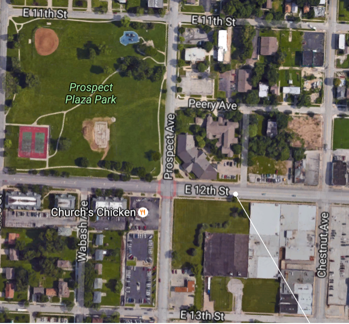
My blocks were primarily used for commercial purposes. I saw a BP gas station, a Church’s Chicken, a police gas station, a life insurance building, a car dealership, a women’s center, and Prospect Plaza Park. The area was pretty busy and the park was well-maintained. 12th St had the most traffic traveling east and west. When I did my figure-ground study, the area was not very dense, mainly because parking lots took up so much space instead of buildings.
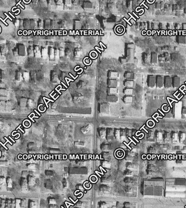
When I looked back at the historical maps of the area, I was surprised to see it had mostly been residential single-family homes, a different apartment complex (now gone), and a large Catholic Church. I asked a friend about the church and he was surprised to hear it was gone. After doing some digging, the church closed down because it didn’t have a large enough following anymore. It appears people are moving away and businesses are moving in.