The Parks and Boulevards system in Kansas City, Missouri is one of the largest systems in the world. When August Meyer and George Kessler moved to Kansas City in the middle to late nineteenth century, Kansas City was a dirty and unwelcoming place to be. Due to the success of the Stock Yards and Rail Road expansion, the population of Kansas City grew at an astonishing rate. When Meyer became the President of the Commission of Parks, he helped lead the way for the implementation of the Parks and Boulevard systems with the help of George Kessler, who was the lead designer.
When someone visits Kansas City and is shown the Parks and Boulevards system for the first time they are usually blown away by how large the system is as a whole, and how truly beautiful it is. For the everyday driver who lives in Kansas City, the system may only be viewed for the purpose of being the fastest way to commute back and forth to work or the fastest way to get from point A to point B. Most people do not appreciate its true beauty. If you asked a citizen that lives in Kansas City, what the difference between a Boulevard and a Parkway is, or when the last time they went and walked around Cliff Drive was, you may be disappointed. But what I would ask them, is to name three Boulevards that are not Broadway, Emanuel Cleaver, or Brookside.
When it comes to describing the Parks and Boulevards system amalgamation, people like myself may be surprised to learn that the system is actually comprised of Parkways, Boulevards, Avenues, Roads, and Drives. Image 1 is a great example of Kansas City’s Parks and Boulevard system. The photo, which is the Budd Park Esplanade, was taken looking west of Budd Bark in the Northeast neighborhood.
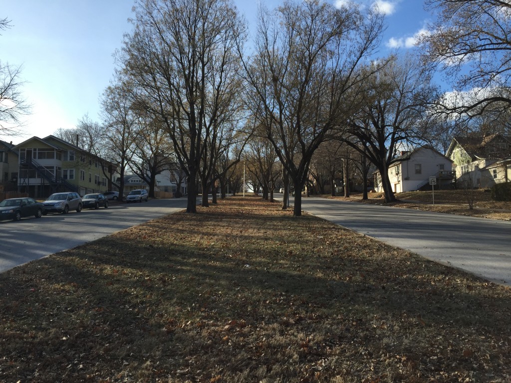 Image 1. Looking East on Budd Park Esplanade St. © BKeller
It is known for its picturesque center median and being the main entrance to Budd Park from Van Brunt Boulevard. Image 2, which is another great example of the Parks and Boulevard system, was taken looking south down Paseo just south of East 51st Street. I would like to tell you that it is one of the most magnificent Parkways is Kansas City, but I can’t, because it’s not. Neither is it a Boulevard, or an Avenue. It is just The Paseo. This is just one example of why it is so hard for someone to know what type of thoroughfare they are actually driving on.
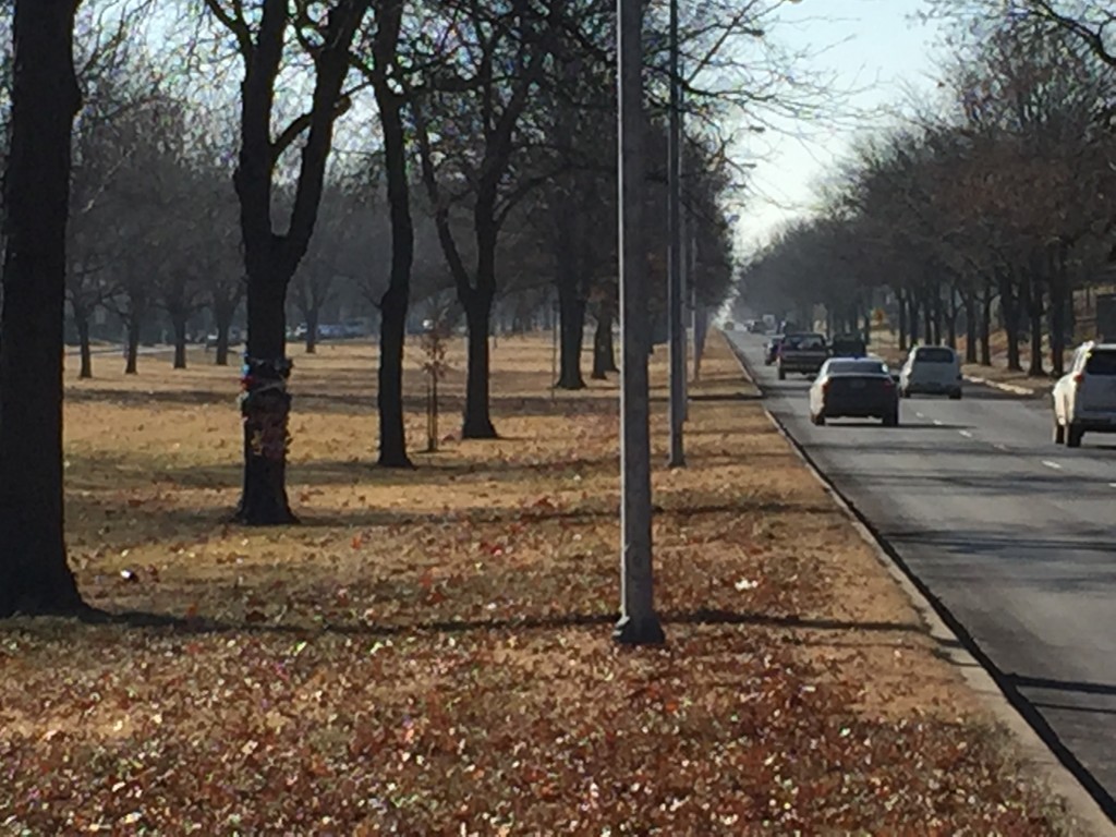 Image. 2 Looking South on The Paseo. © BKeller
According to the City of Kansas City’s Major Street Plan, a Boulevard does not have a center median. Only Parkways have center medians. And yes I understand there can be exceptions, especially when it is needed because of the geography, but this section of Paseo was obviously planned to be like this or it wouldn’t have such a wide median.
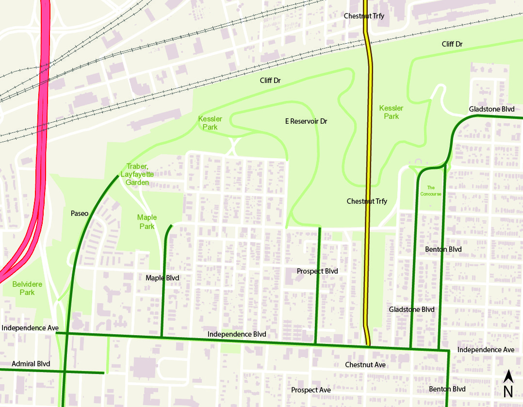 Diagram 1. Source: KCMO Parcel Viewer
Diagram 1 is a major area of the Parks and Boulevards system around Cliff Drive Park. In the diagram I have highlighted and labeled important sections of the system. But what I am interested in, is how and why some street names change along the system. A good example is Independence Avenue, as you can see from Paseo to Benton Boulevard, it is labeled Independence Boulevard, not Avenue. This is fine, and I believe it was planned to connect to the other Boulevards. Another example is Chestnut Traffic way. It shown as part of the Parks and Boulevard System from the railroad tracks down to Independence Boulevard, but why is that section of the road not changed to Chestnut Boulevard or Parkway? Then when you look at Prospect Avenue, the name is changed while apart of the system.
 Diagram 2. Source: KCMO Parcel Viewer
In the next diagram (Diagram 2), I have highlighted major parts of the Parks and Boulevard system along Brush Creek. In the diagram, I have Parkways highlighted in yellow, and boulevards highlighted in green. As you can see a couple of the streets were highlighted in both. Roanoke Parkway according to the Kansas City Major Street Plan, should not be named a Parkway because it does not have a center median. It would be better fit as a Boulevard. The other street I have double highlighted is Emanuel Cleaver II Boulevard. Image 3 shows you what Cleaver looks like just east of Troost Avenue, and it is a great example of a newer generation Boulevard.
 Image 3. Looking East on Emanuel Cleaver II Blvd ©BKeller
However Image 4 was taken looking from Clary Boulevard looking north on Cleaver. But what you see is a vegetated median which again should be labeled as a Parkway, but why isn’t it?
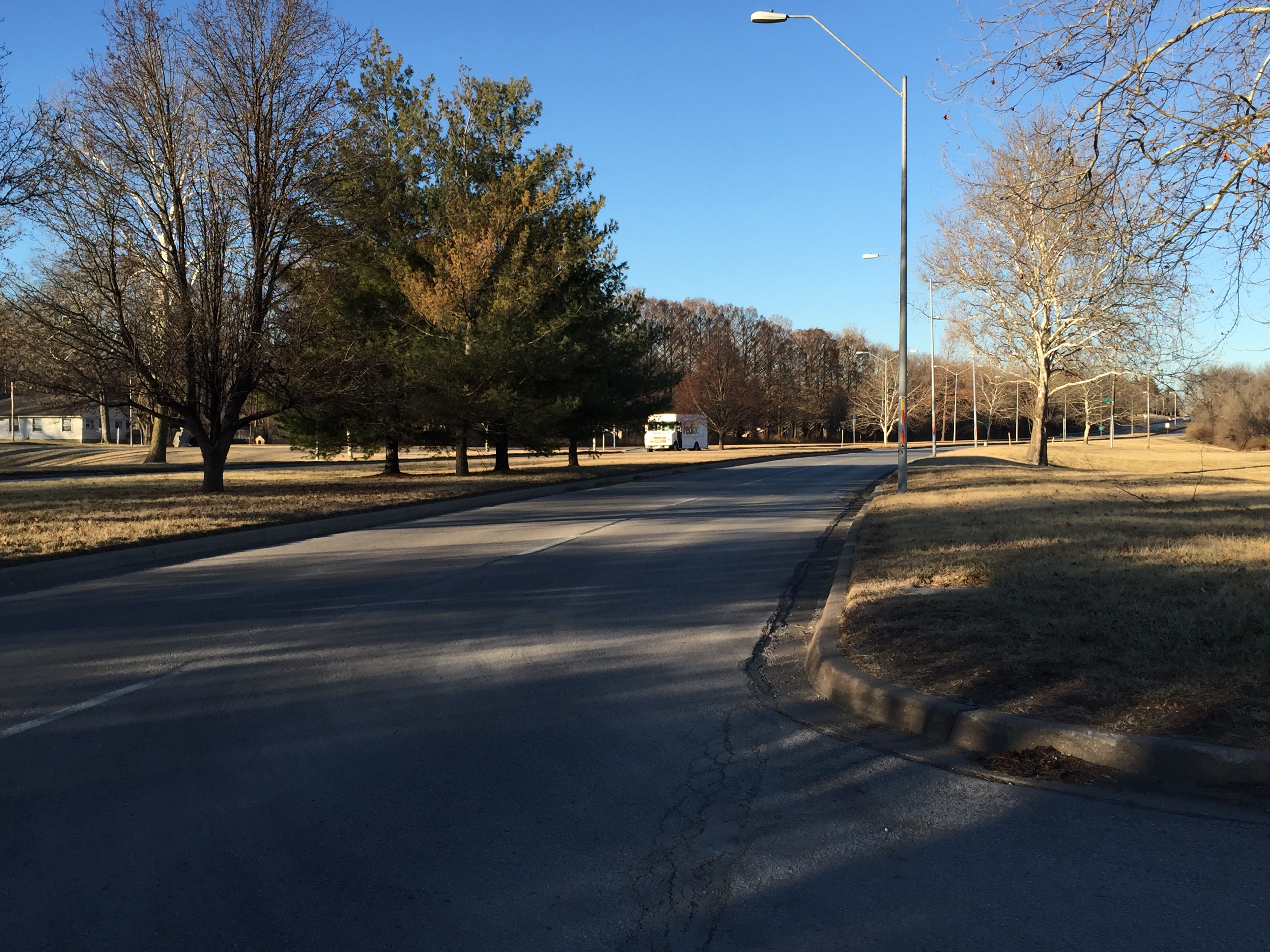 Image 4. Looking North on Emanuel Cleaver II Blvd ©BKeller
These are all great examples of how the Parks and Boulevard system can be confusing to people that would like to explore it but do not know much about it. Hopefully the City will edit the street names for everyone’s sake!
The Kansas City Missouri Major Streets Plan can be found by clicking this link then downloading the PDF: https://www.google.com/webhp?sourceid=chrome-instant&ion=1&espv=2&ie=UTF-8#q=kcmo%20major%20street%20plan