This semester, our class performed an Existing Condition Analysis for The University of Missouri Kansas City. We were asked to Conduct research for the Volker and Hospital Hill campuses. Our class had ten students, and we divided the work so that we could complete the project promptly. Today I am sharing with you what I was responsible for producing on behalf of this Existing Condition Analysis:
- You will see a GIS map displaying the amount of parking within campus borders and the surrounding campus interface on both the Volker and Hospital Hill campuses.
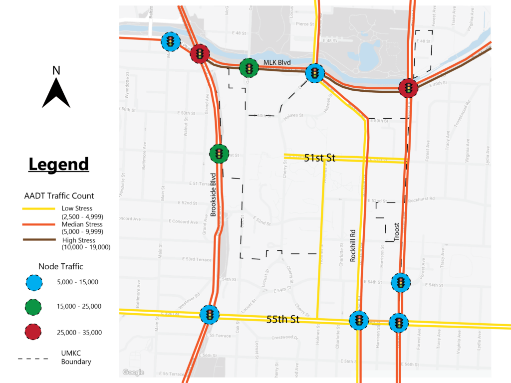
- You will see an estimated 12-hour AADT count of the roads in and around the Volker Campus.
- You will see a map displaying the traffic going through many nodes around the Volker campus.
- You will see a map showing the direction in which vehicles are turning around the Volker campus.
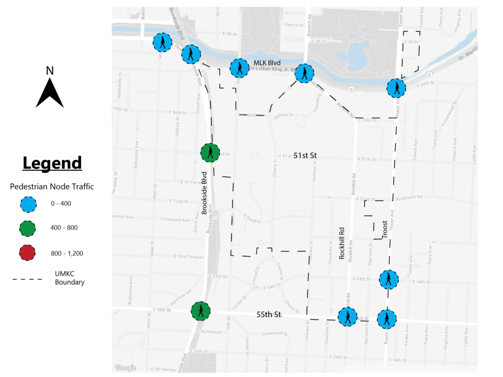
- You will see a map illustrating the amount of pedestrian traffic around the Volker campus.
- You will see a map that demonstrates the speed limits in and around the Volker campus.
The GIS map shows the amount of surface parking UMKC has on the property to accommodate the students on both campuses. I hope the campus will someday build hidden parking garages, allowing the large open lots to be utilized for developments. This type of redevelopment can only be done with improvements in the pedestrian and biking experience.
The 12-hour AADT traffic count illustration shows that the Major roads surrounding Volker Campus and Rockhill road that cut through the campus boundaries are used regularly. This tells me that most people passing by campus are everyday commuters, probably heading toward downtown or to 71 Hwy.
The directional map is good because it ensures people are heading toward downtown or highway 71. It also makes me say more confidently that the traffic turning into school is more than likely just students from Rockhill, Cherry, 51st and 54th streets.
The pedestrian node traffic graphic is informative in that more people are active in Brookside because the density is built up around these areas. For example, 51st and Brookside has a coffee shop, Pizza, Whole Foods, apartments, and a trail. In addition, 55th and Brookside also has a small walkable shopping center and a trail that cuts through that intersection.
Lastly, the speed limit map exposes a problem. Most notable is that the speed limit increases once it enters campus on Oak St. I think it should not be 35mph cutting through campus. We want to promote walkability and bike-ability in and around campus, and that would be a step in the right direction if the speed limits were to be reduced, but that is just the beginning of a long list of suggestions for the UMKC campus.
We reviewed five maps that display existing conditions; I would like your feedback on what you think these illustrations are showing. On the Volker campus, a challenge is presented when it comes to improving the campus community interface due to the number of single-family residential homes around the campus. Making a bikeable campus with mixed-use amenities that could benefit the neighbors would be something to introduce as an idea to the surrounding neighborhoods.