Introduction
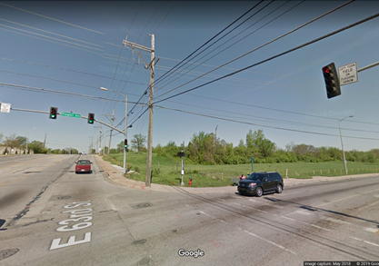
At the easternmost edge of the 63rd Street Corridor study area lies the intersection at Prospect Avenue, another major commercial corridor running north to south through the heart of KCMO. Prospect has been and is set to improve upon its distinction as a major transport thoroughfare with the addition of the Prospect MAX (http://www.kcata.org/transit-initiatives/prospect_max) similar to the bus route that runs along Troost Avenue. The specific intersection has also gone through a lot over the past two decades, but with its close proximity to many institutional land uses like hospitals, the area will not stop to grow and change. I will look at how the particular area from Euclid to Prospect has evolved since 1925 from single family detached homes to major transport and medical center.
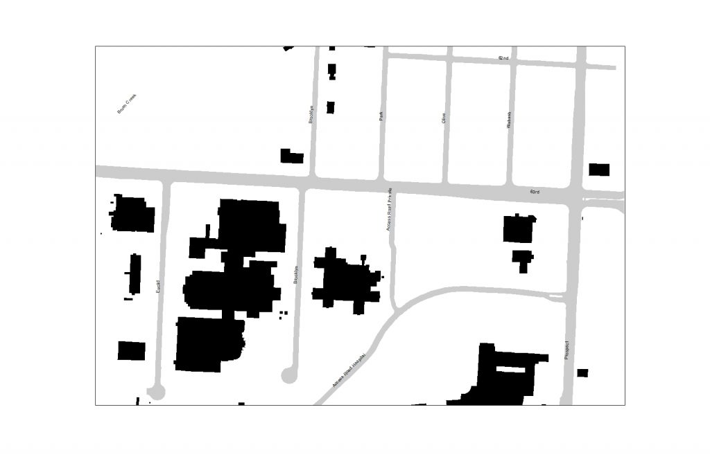
1925
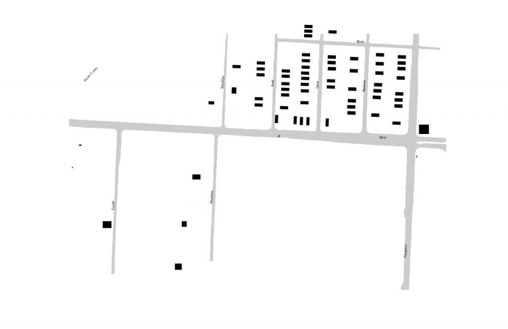
To start, I will look at how the area approximately looked 95 years ago. Figure 1 shows an image that seems almost reversed when looking at a figure-ground of the area in 2019. Most of the development for these bounds had only occurred in the southeasternmost portion of the Blue Hills neighborhood (which stretches northward to Swope Pkwy and is bounded by Paseo and Prospect). There existed only single-family detached housing on the inner streets and some commercial buildings along 63rd street and some on Prospect, including the gas station on the Northeast part of the 63rd and Prospect intersection. The large swath of what appears to be empty land to the West is the Blue Hills Golf course, which was founded in 1912 and moved in 1963. The current development and morphology of the area in 1925 saw a continuation of single family detached housing across 63rd southward, as well as more commercial buildings along 63rd and Prospect. The 1925 atlas also shows that it was JC Nichols, famous residential and commercial developer based in Kansas City, that owned the land bordering 63rd and Prospect at the Southwest corner. This ownership stretched west along 63rd to Brooklyn and South along Prospect to 65th Street. So the area was recognized as early as 1925 as an area with strong potential for development.
1963
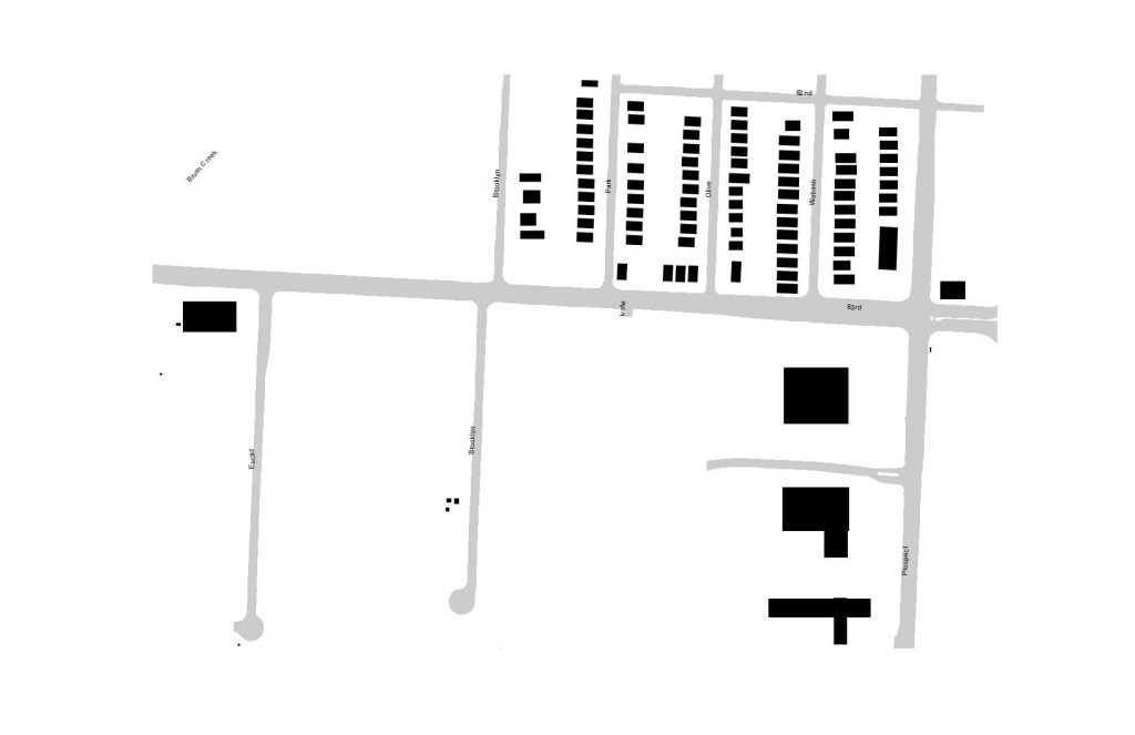
By the time the Great Depression struck most of the parcels had been filled out in the blocks shown, the rest were built in the building boom following WWII and are found mostly along Brooklyn. More commercial buildings had been built since 1925 like the one at the northwest corner of 63rd and Prospect. A couple larger buildings had sprung as well, based on typology, most likely commercial or office buildings built post- World War II. This was right around the same time that the Blue Hills Golf Club decided to move to a different location, which opened up an opportunity for development in the area. Just south of the map, what would become the Research Hospital and Medical Center had opened its 521-bed hospital at Meyer and Prospect. The hospital would become a major job center for KCMO and hopefully lead the continued development of the area.
1990
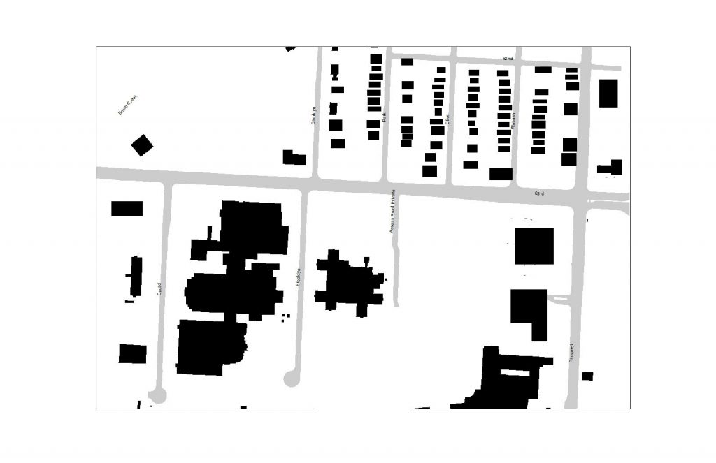
1963 showed the extent to which there would be residential development in the area, but the 1990 figure-ground shows the magnitude of the Research Hospital and Medical Center mentioned in 1963. By 1990, the area had seen development of seemingly all land uses except residential. The commercial buildings at almost all corners of 63rd and Prospect had continued to stay and as you move west down 63rd development had been rampant. This starts with a new psychiatric research center apart from the expanding hospital complex and medical center. To the west of this is the AT&T Data Center that also increases job employment in the area. At the edge of the image are two buildings that may have been commercial but today are either gone or have changed land use. The long and narrow building facing Euclid Avenue at the edge of the figure is most likely in 1990 as it is today, the Victoria arms apartments. South of where the golf course used to be and just north of 63rd by Euclid, sits a Metro Patrol Division station that was built in 1977 and was demolished in 2010.
2019
In the last 20 years, this section of the 63rd street corridor has experienced quite a change. In 2005, a 12-year long effort by the Native Sons and Daughters of Kansas City to establish a park at the burial site of Daniel Boone Morgan came to fruition. The park is 14. 64 acres and acts as a great spot for lunch as well as honoring the past (https://kcparks.org/places/daniel-morgan-boone-park/). One of the most visible changes, however, is one of much devastation that started with the area of 63rd and Prospect’s determination of blight and the subsequent Health Midwest Partnership for Change plan tax increment financing project that includes the 63rd and Prospect redevelopment area, as well as adjacent areas (Karash, 2002).
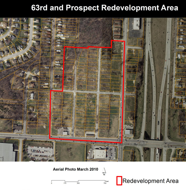
In 2003, the Community Development Corporation of Kansas City, or CDC-KC, a non-profit, made and implemented a plan for the TIF and redevelopment area along with the Land Use and Development Plan adopted for the 63rd street corridor in 2002. The plan was going to cost $103 million and included 250,000 square feet of retail space and over 300 new housing units. The CDC-KC was granted money through federal funds to buy up and demolish all of the older homes for the redevelopment project titled: Citadel Plaza. The demolition of about 140 homes all built before the 1970’s took about three years until the summer of 2006 when concerns about asbestos contamination halted the demolition (Dillon and Horsley, 2006). No asbestos inspections had taken place before the demolition of the homes, as well nothing happened to contain the asbestos. As the demolition process went on, there were also many occurrences of illegal dumping (at one point upwards of 20 truckloads). In August of 2006, the health department of Kansas City confirmed that samples of the area tested positive for asbestos, both above and below ground (Dillon, 2006). After state and federal lawsuits, the city finally reached a settlement in 2012 and clean up started in early 2014. In 2015, the cleanup was completed and in 2016, the city started, like it did in 2014, to market the area to developers and hoped for bids to redevelop the site. This included a redevelopment plan from DRAW Architecture firm.
This area of the 63rd street corridor is significant in both historical and contemporary terms. It is an important node of institutional and transportation activity. The potential for the area is through the roof as well as its impacts on the rest of the corridors (63rd Street and Prospect Avenue) as it continues to evolve.
References
Karash, Julius. “Prospects along 63rd -Development project adds $1 million in – federal funds.” Kansas City Star, 23 January 2002. Accessed 10 February 2019.
Dillon, Karen and Horsley Lynn. “Asbestos concern delays project – KC officials halt work on Citadel Plaza so that inspectors can examine health issues.” Kansas City Star, 14 June 2006. Accessed
10 February 2019.
Dillon, Karen. “Anatomy of an urban hazard – Asbestos now permeates rubble near 63rd and Prospect. City could have prevented the situation by following its own ordinances.” Kansas City Star, 8 August 2006. Accessed 10 February 2019
Horsley, Lynn. “Kansas City trying again after troubled path to development for 63rd and Prospect.” Kansas City Star, 22 September 2016. Accessed 10 February 2019