When we started this project, we picked our own proposed locations of mobility hubs within the bi-state corridor. My Area turned out to be at the intersction of Parallel Park Way and North 90th street. I started my study by analyzing the area and making a research on Demographics, housing, ways of commuting to work, and some economic analysis.Then i visited the site and took multiple photos which i will demonstrate later.
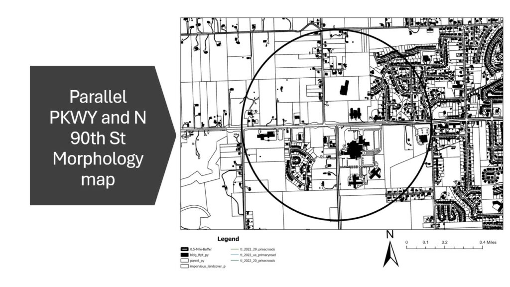
Figure 1 a morphology map of my area within half a mile radius.
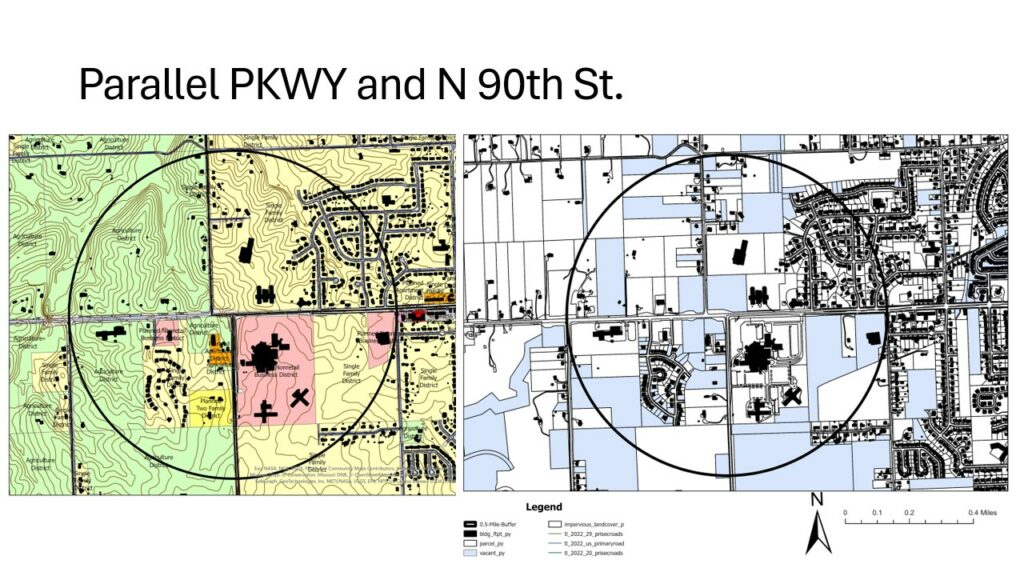
Figure 2 ( to the left,Current zoning of the area ) (to the right, morphology map with vacant parcels)
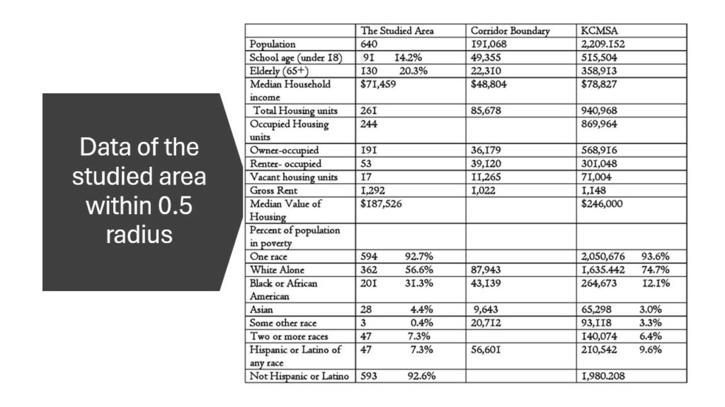
Figure 3 Data analysis for the area within half a mile radius compared with the bi-state corridor and KCMSA.
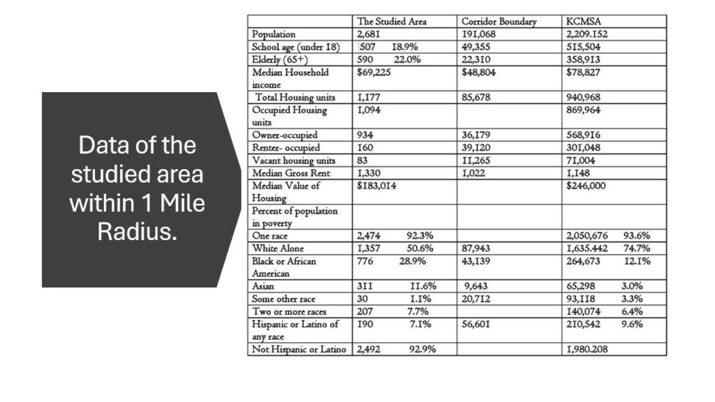
Figure 4 Data analysis for the area within half a mile radius compared with the bi-state corridor and KCMSA.
Figure 3 & 4 show how different my area is from the rest of the corridor. My area which is at the intersection of Parallel Pkwy & N90th St. in Kansas state is demographically have high numbers of white people than any other race comes in second place are the black or African American people while the rest of the corridor is much more diversified especially around KCK downtown and KCMO Area or compared to the metro area.My area has also higher number of Gross Rent compared to the Corridor or KCMSA and higher housing value.Median Income is also higher in the area than the corridor’s median income and almost close to the Metro’s median income. Housing structure there is more owner occupied than renter occupied and good amount of vacant lots compared to other dense ares in the metro or within the corridor like Downtown KCMO and Downtown Independence. The more we go West, the less density it gets how much residents there are per square mile.
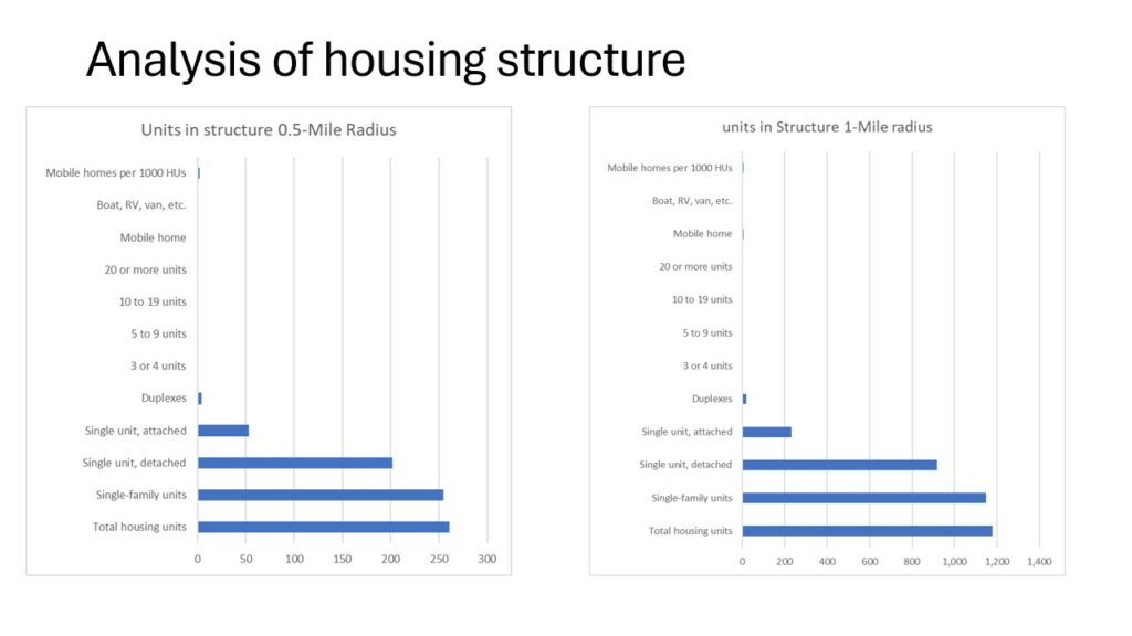
Figure 5 Housing Structure within 0.5 a mile and 1 mile.
according to figure 5 types of housing in my area whether we are looking within half a mile radius or within a mile, the most dominant type of housing structure is single-family units with single- family units detached having higher numbers than single units of attached. a few scattered duplexes and a very few mobile homes .
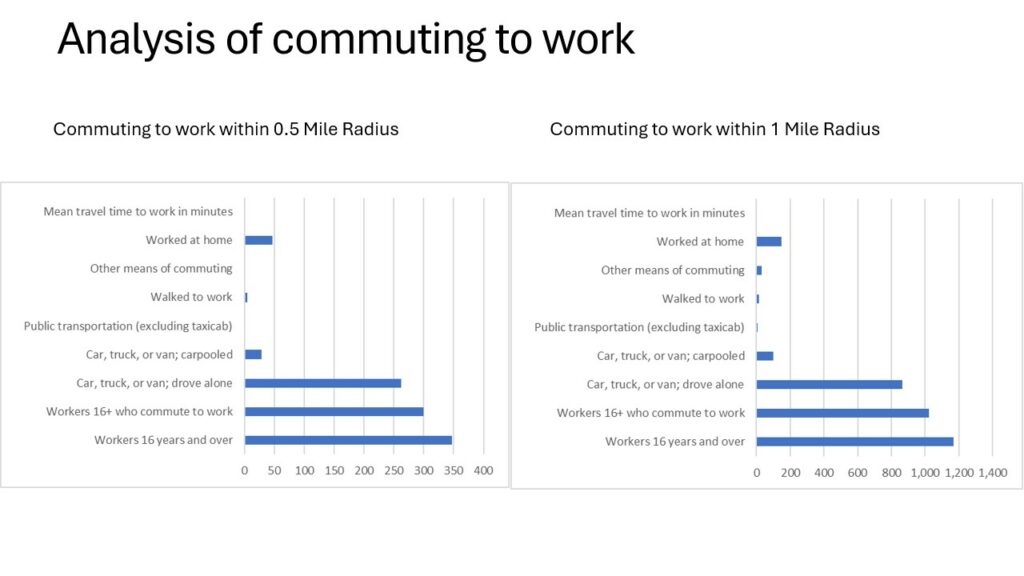
Figure 6 Analysis of commuting to work within 0.5 a mile and 1 mile.
The most common way to go to work around the specified area in KS state is by car, truck or van, so having your own vehicle. smaller number carpooled or worked from home and even very smaller number walked to work.

Figure 7 Inflow- outflow analysis
In figure 7, it shows that the number of people that worked and resided in the area are only ten with 1,433 coming from other areas and 692 of the residents of the specific area, work at other employment centers outside the studied area.
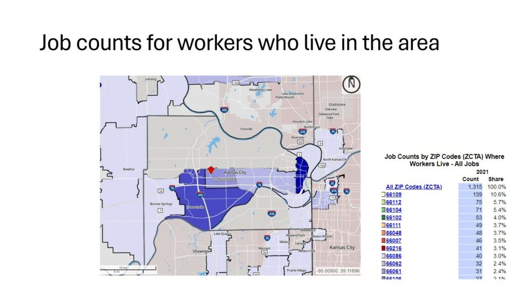
Figure 8 Job counts analysis for workers living in the assigned area
Figure 8 shows where workers who live in the specified area, where they commute to work according to zip codes.showing the highest numbers of jobs around Downtown KCK and Edwardsville.
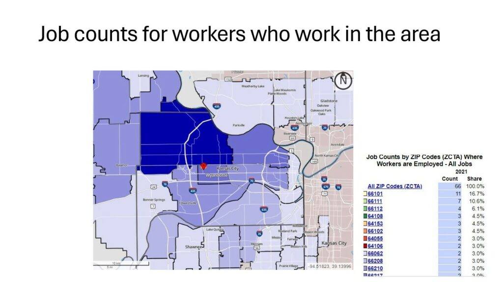
Figure 9 Job count analysis for workers working in the assigned area
Figure 9 shows where workers working in the specified area, where they live according to zip codes.showing the highest numbers of residential groups just north of the specified area at Leavenworth, Lansing, Basehor and Bethel.
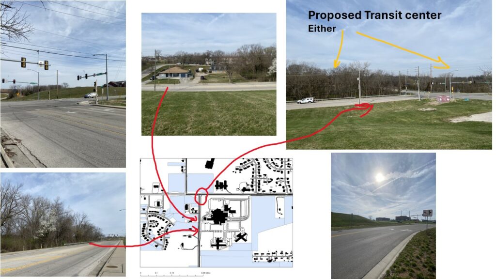
Figure 10 photos of the site.
Figure 10 is multiple photos of the site around the intersection of Parallel Pkwy and N 90th St. along with some views of both sides of 90th st.
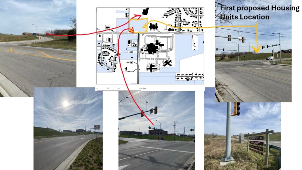
Figure 11 photos of the site.
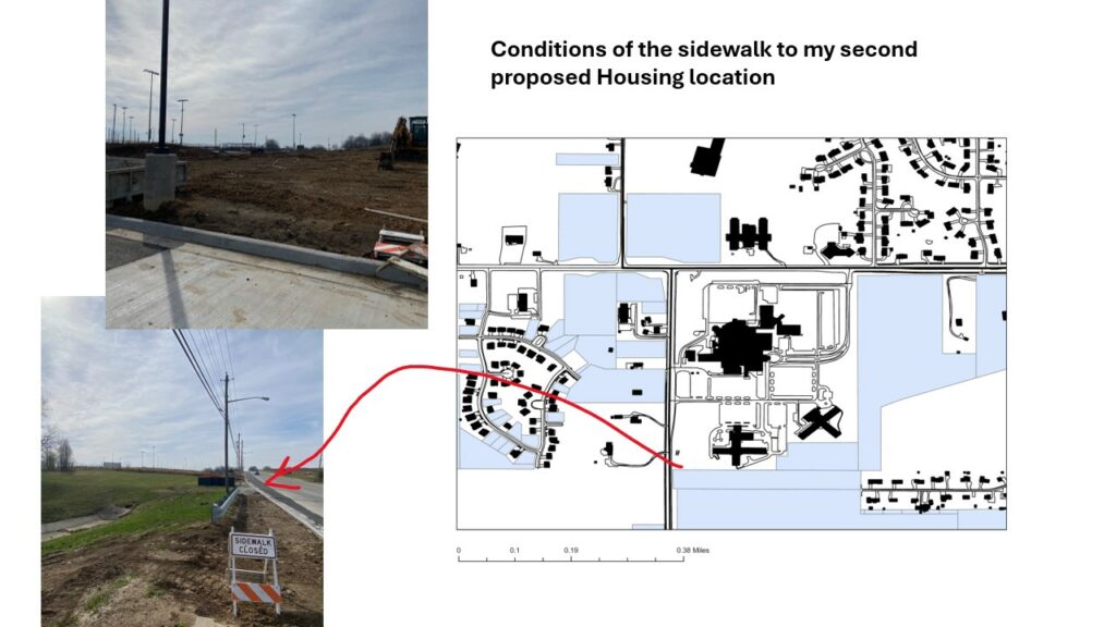
Figure 12 photos of the site
Conditions of the sidewalk around the Providence Medical Center.

Figure 13 photos of the site
more photos south of the Hospital and adjacent to the clinics in the south and then on the other side the Compass Minerals Fields.
The next steps after analyzing the area, would be to think and work on multiple ideas for development and redevelopment of the assigned areas.
References
US Census Bureau On The Map
https://onthemap.ces.census.gov/
https://mcdc.missouri.edu/applications/capsACS.html
UG Wyandotte County