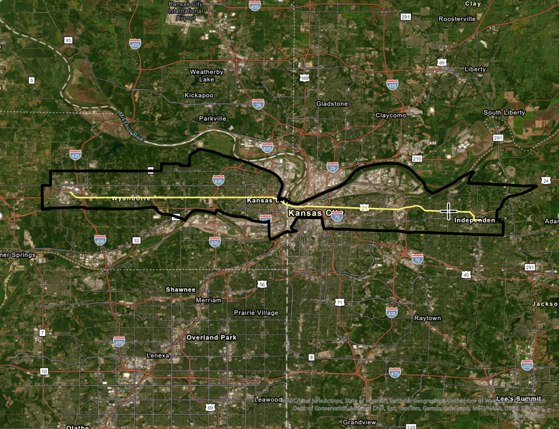
My selected mobility hub is at the intersection of Sterling and Hwy 24 (Independence Ave.). The area is suburban in character and is in an awkward spot between the older, historic Independence and the Blue River Valley.
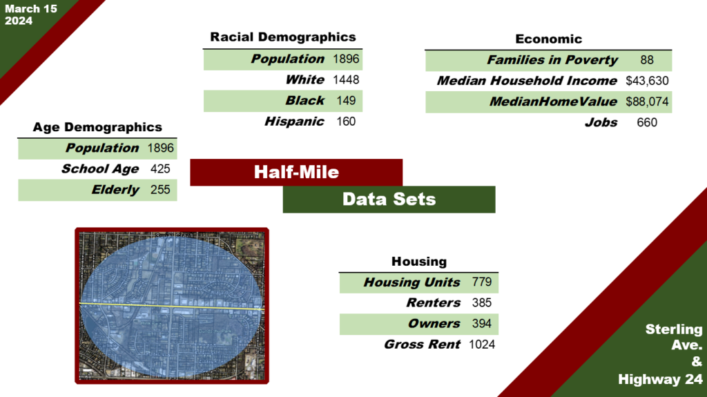

The area has a low, non-diverse population. The area is affordable with low rents allowing people with tighter budgets to live here. This aspect of affordability is important to the development of the area. The area also doesn’t have many jobs, there are 10,000 people within one-mile and only 2,700 jobs. The only change in the data between one-mile and a half-mile is that there are more people of Hispanic and Latino descent within one-mile.
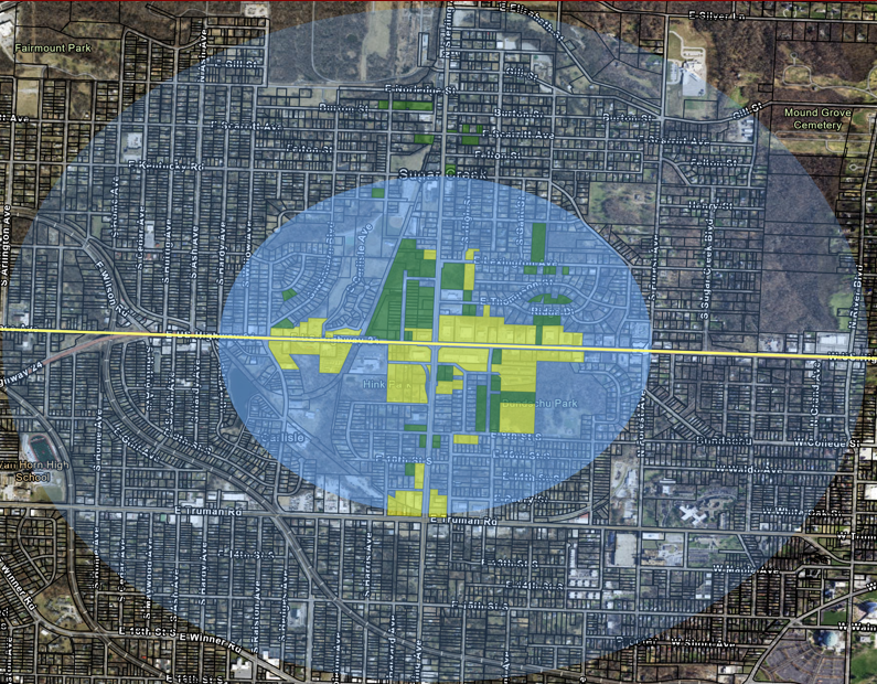
The areas in green a vacant lots that are prepared for development and the yellow are lots that are underutilized and could be redeveloped with ease. There is a lot of opportunity for redevelopment within the half-mile area.

City of Independence, City of Sugar Creek. (2006). Sample Concept for U.S. Highway 24 and Sterling. City of Independence. Retrieved 2024, from https://issuu.com/cityofindepmo/docs/us_24_highway_corridor_strategic_plan.
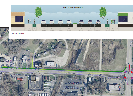
The above image is at the intersection of Hwy 24 and Sterling, my mobility hub. The area, since 2006, has been reimagined as a mixed use area that can support density. This also explains why the Four Trails Neighborhood was demolished between 2007 and 2009.
MARC, MODOT, City of Independence. (2006). Fairmount District Plan. MARC. Retrieved 2024, from chrome-extension://efaidnbmnnnibpcajpcglclefindmkaj/https://www.marc.org/sites/default/files/2022-09/PSP_Projects_2017_Independence_Fairmount_District.pdf
The MARC 2017 plan also designates this area as mixed-use and in the image above demonstrates the improvements to the intersection to facilitate the type of development they want to see. Neither the 2017 or 2006 plans have come to fruition until recent intersection improvements.
City of Sugar Creek. (2014). Four Trails Landing Replat.Jackson County Public Records. Retrieved 2024, from https://aumentumweb.jacksongov.org/RealEstate/SearchResults.aspx?pg=2
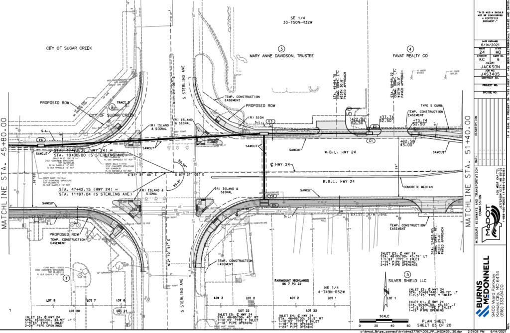
MODOT. (2021). Hwy 24 and Sterling Improvements. MARC. Retrieved 2024, from chrome-extension://efaidnbmnnnibpcajpcglclefindmkaj/https://www.modot.org/sites/default/files/documents/6.14.21%20J4S3405%20-%2024%20HWY%20-%20Sterling%20to%20River%20-%20Preliminary%20Plans.pdf
The above plan is what was mapped out in the previous MARC plan, illustrating that planning efforts have had a more significant impact in recent years. There might be energy for further development of the area.
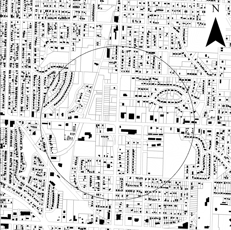
The figure ground above illustrates the amount of opportunity for the area as there is a lot of vacant land, and according to recent research, is usable and safe to develop on. Safe, developable land is less common in Sugar Creek than other jurisdictions. The plans from previous years show that the area is ready for development and that there is political will to reimagine the area completely, giving infinite leeway for how this area can be reimagined.