As my studio class continues our study of the Kansas City, Missouri Parks and Boulevard system, we recently completed a small study of the public realm. We were each assigned a different element of the public realm, and were required to seek out iconic and distinct examples to illustrate. We were then assigned to choose a site, which might improve the public realm through a better use of their element.
My assigned element of the public realm was bike lanes, crossings, and bike ways. While studying the different uses for biking along the Parks and Boulevard system, it was hard to find examples for my element because only a few such uses have been emplemented.
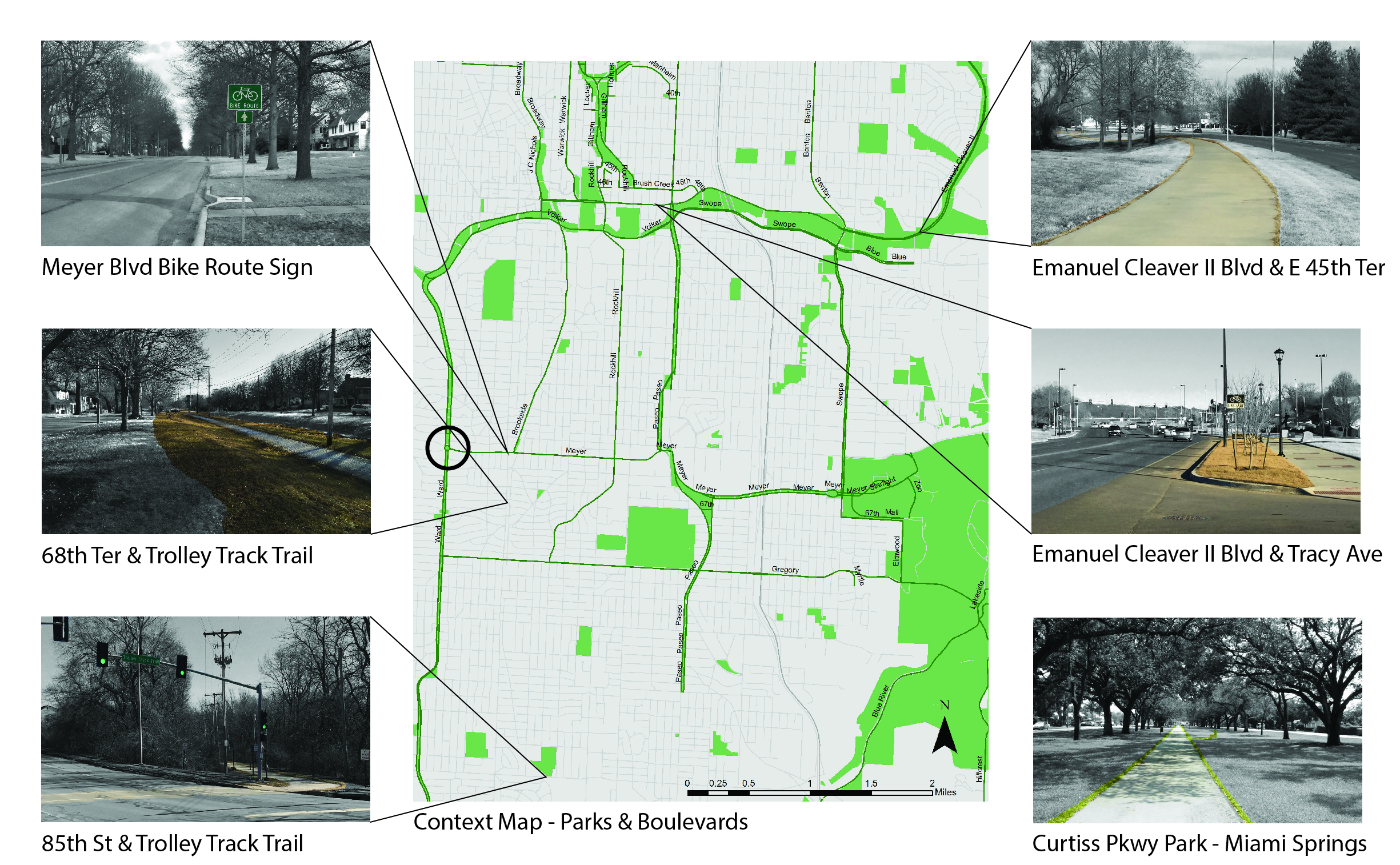
By looking at my context map, you can see that all of my examples are from 47th street down to 85th. I also added an example from Miami Springs. For my implementation, I chose the intersection of Ward Parkway and Meyer Boulevard, which is circled on the map and I will talk about later.
PRECEDENTS OF THE PUBLIC REALM


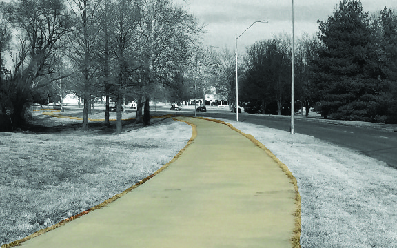

Image (1-5) ©BKeller
©Google Images
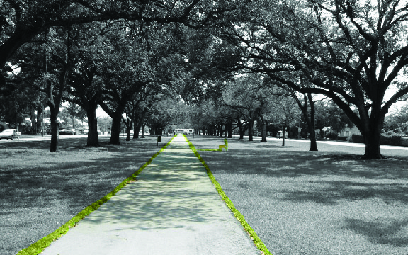
My first example of the public realm is just your basic bike route sign. Located on Meyer, it is a great example of what has popped up over the last few years. In most cases boulevards were designed to be wider road, which makes it easy for the city to encourage bike traffic along those routes. Image 2 is a photo of the historic trolley track trail. This trail is my main example for my implementation because of the ditinct right of way between two roads. Image 3 is also of the Trolley Track Trail where it has its own pedestrian signal crossing at 85th street. It is the only specifically designated trail crossing in Kansas City. Image 4 is a photo of the shared use trail along Emanuel Clever II Blvd. This is a great example of having a shared use trail along the side of a roadway. Image 5 is also along Emanuel at Tracy Ave. It is an example of what Kansas City is implementing as a complete street, which has a bike lane and a shared use path along the roadway. Last is Image 6 which is a photo of the Curtiss Parkway Median Park in Miami Springs, Florida. It is a great example of using the space provided in the median to create a pedestrian park with a shared use path.
DIAGRAMS OF THE PUBLIC REALM
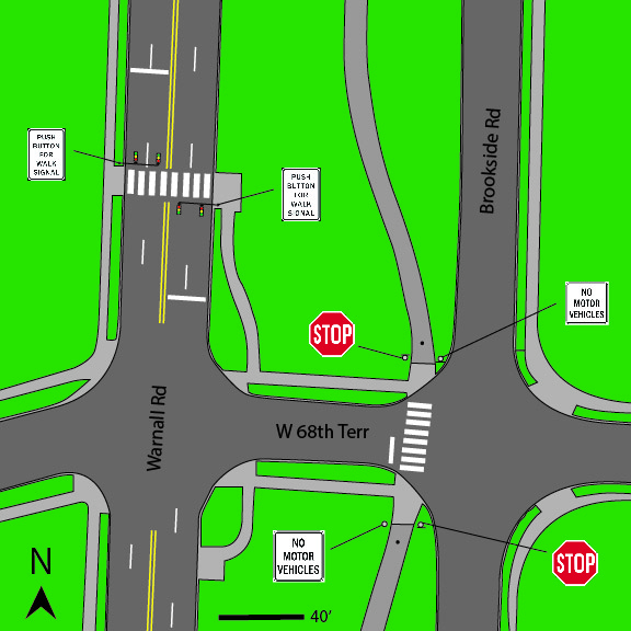

Figure 2-3 ©BKeller
Figure 2 and 3 are diagramatic examples of a couple precedents of the public realm. Figure 2 is a diagram of the Trolly Track Trail crossing at 68th Terrace. It shows the trail offsets to allow for safer pedestrian crossings while using the trail. Figure 3 is a diagram of the Trolley Track Trail crossing at 85th street. To make it safer for pedestrians and easy for the drivers, the crossing was designed to be at a 90 degree angle. The element of signs play an important roll in these diagrams, as they inform pedestrians of the safest ways to utilize the trail system, and to notify motorist when to stop or yeild for pedestrians.
Implementation

©BKeller
For my implementation, I added a shared use trail and bike lanes along the median of Ward Parkway. My focus for this idea was to utilize the space, which is already available to implement without having to change the streetscape. Though the Trolley Track Trail is not a median, it does act as one because it has roadways on both sides. This shared use trail would be very similar to the Trolley, but could has a different surface material. The bike lanes, which are designed to allow commuter cyclist their own lane, but also seperate them from the traffic on Ward Parkway, which can be very dangerous for a cyclist during rush hour. To make it safer for the pedestrians and make it easier for the drivers. All of the trails will merge to create one crossing at each intersection. Below is a perspective view of what the intersection could look like.
Before and After
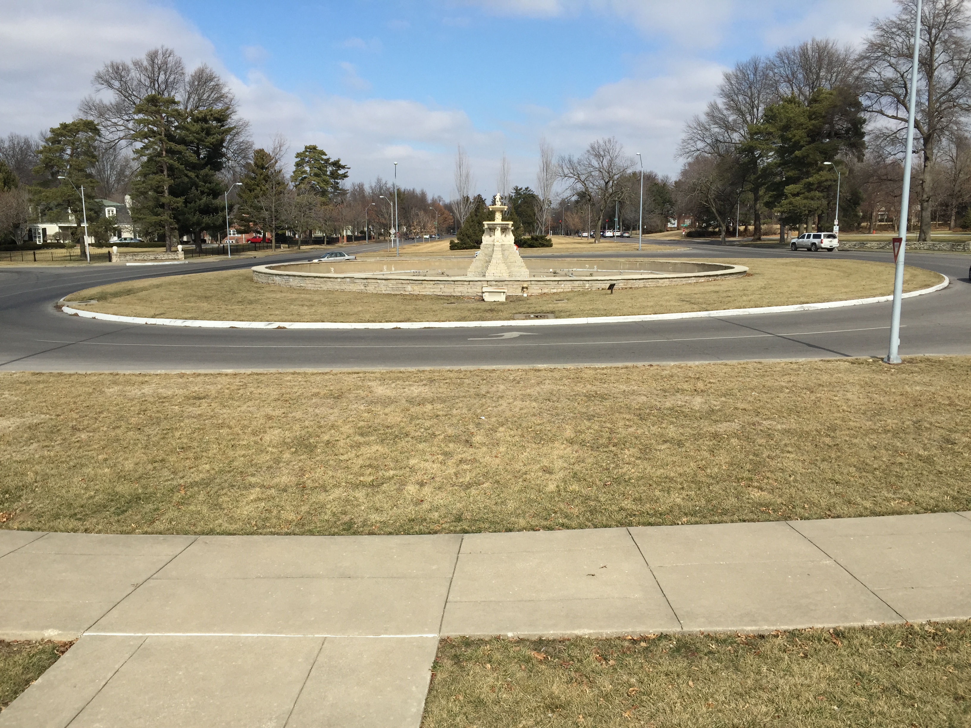
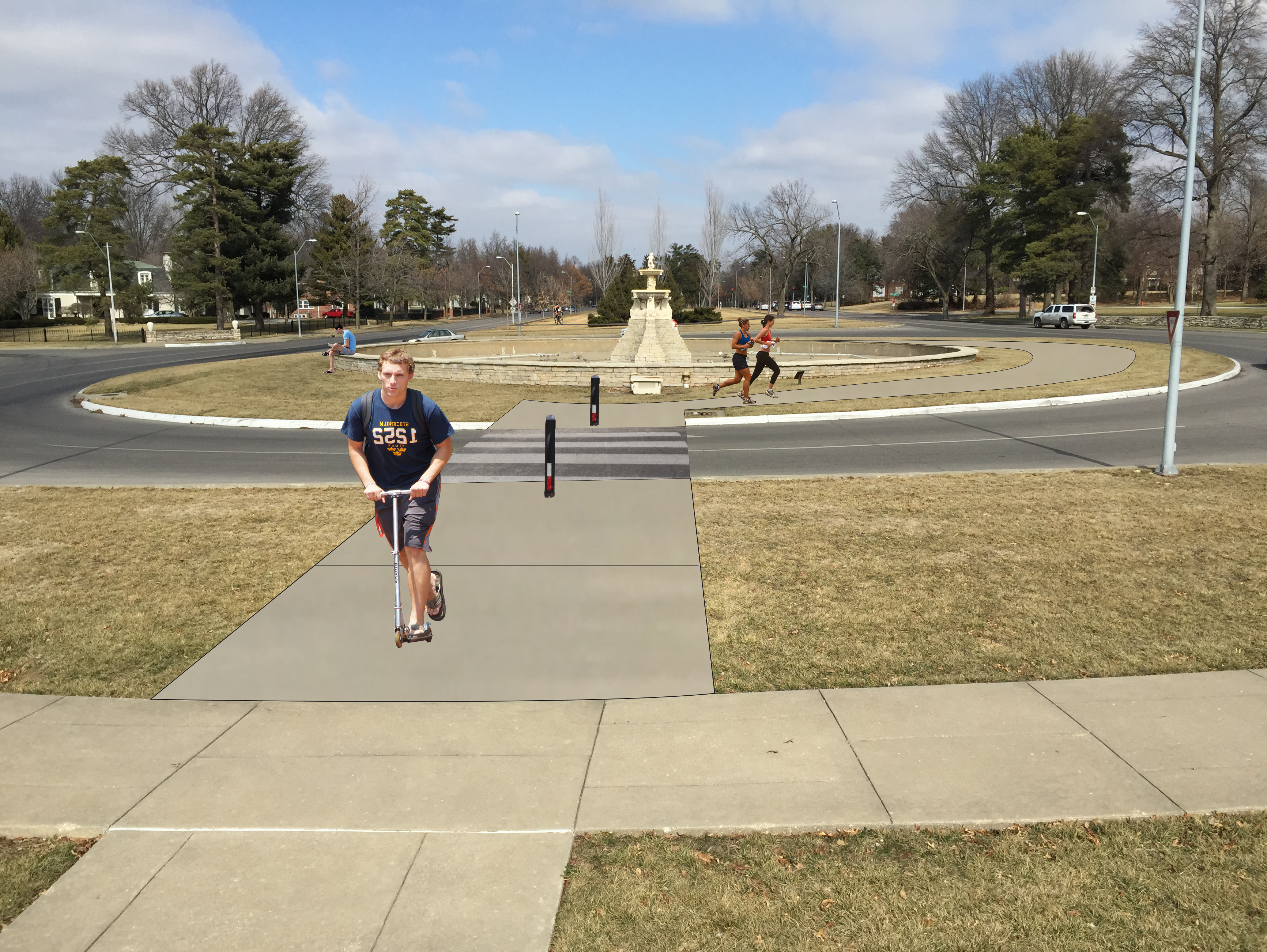
Image 7-8 ©BKeller