
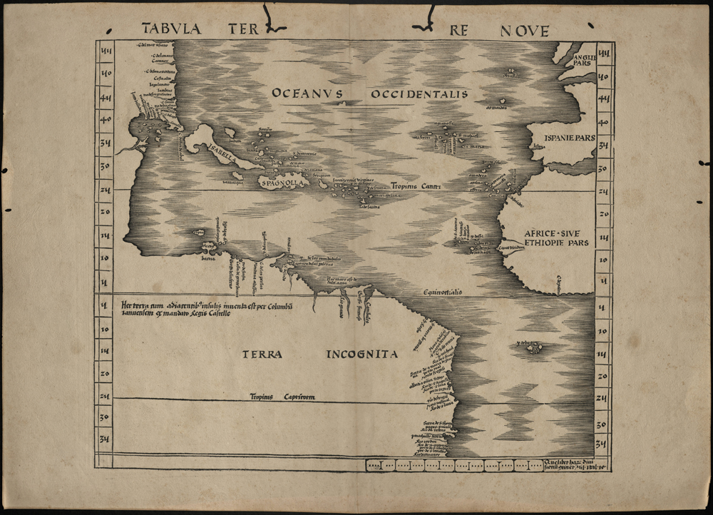
The collection of maps in the LaBudde Special Collections never fails to interest and astonish me. Here we have a map from 1513 that is the first printed map to show the Americas, broad swatches of which are simply labled “Terra incongnita”. A whole new world about to be explored.
One of the first maps to show the Americas.
“Martin Waldseemüller ‘Tabula Terra Nova’ from Claudius Ptolemaeus Geographia, Strasbourg, 1513. One of twenty maps containing new information gathered from many travels and voyages of discovery, which earned the work the title of ‘first modern atlas of the world.’ It was also the first printed map to show part of America.”–Cf. Martin Waldseemüller ‘Tabula Terra Nova’ WWW site / British Library Board, August 22, 2012