In 1950, the area between 31st Street and Armour Boulevard on Troost Avenue was a dense community of almost exclusively white residents. This changed drastically over the next fifty years. The population density greatly decreased as many Kansas City residents relocated outside the city center and the population became decentralized. These changes also led to differences in race and class. As many wealthy, white residents expanded outward, this area of Troost Avenue was left to predominately low-income, minority residents. By the 2000s, Troost Avenue had become a dividing line. Residents on the west side had a more even distribution of race and a higher median income. Residents on the east side were predominately minorities with a lower median income.
All posts by Lauren Uhls
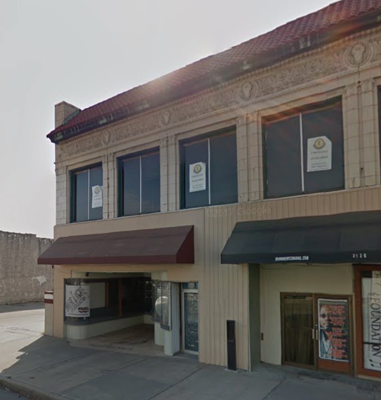
Troost Ave. Between 31st St. and Armour Blvd.
Since 1896, the area between 31st Street and Armour Boulevard on Troost Avenue has evolved from a neighborhood of scattered homes, to a bustling commercial and entertainment district, to a graveyard for abandoned properties. The 1896 Sanborn maps show many large, undeveloped lots, with homes scattered around the street–the area was entirely residential. By 1951, however, the area between 31st and 33rd streets had developed into a commercial district full of theatres, drugstores, bowling alleys, banks, and rest stops. South of 33rd St. remained primarily residential, and it was a dense neighborhood with many homes. Today, only a few houses remain, and many properties–both commercial and residential–have been destroyed or abandoned, leaving the area an empty shell of its former self.