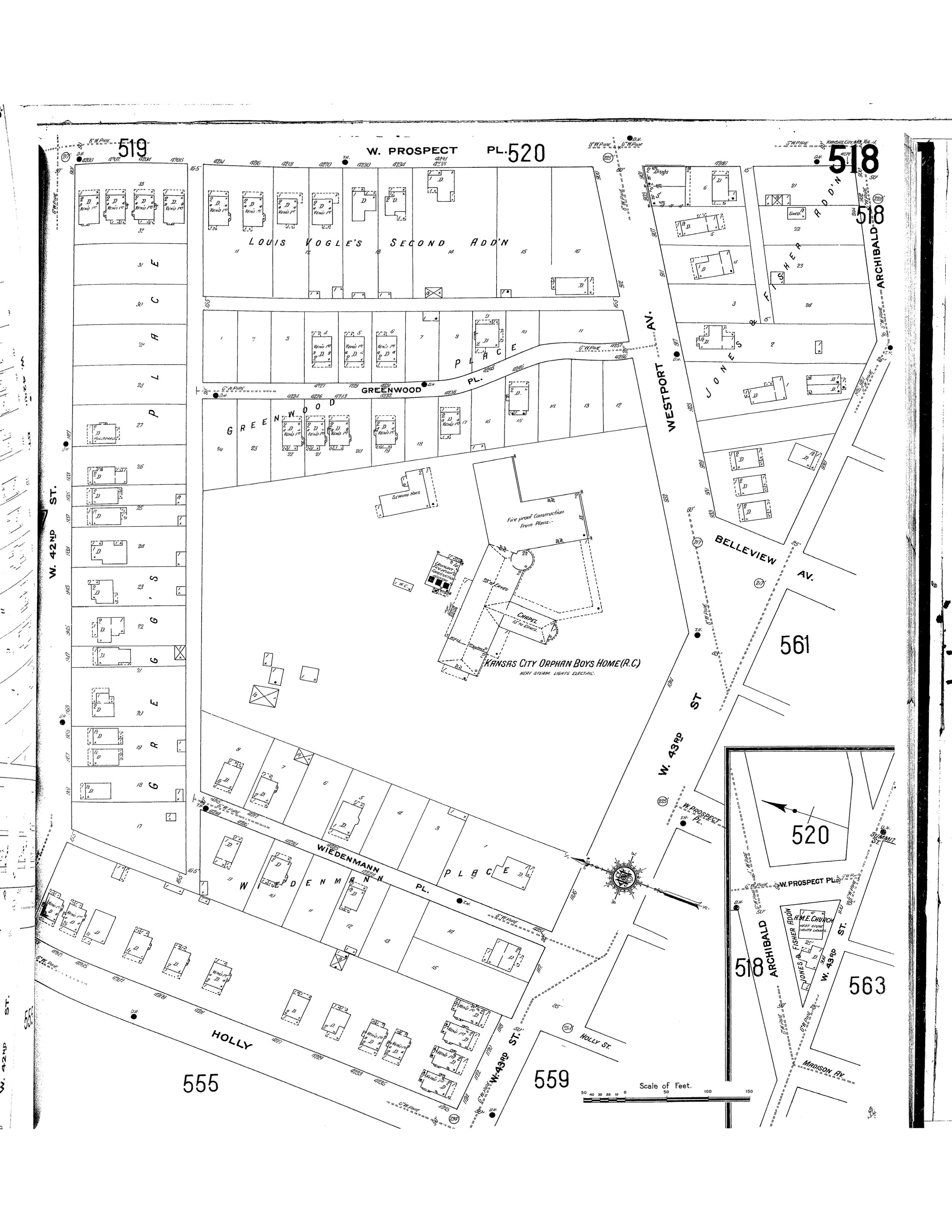
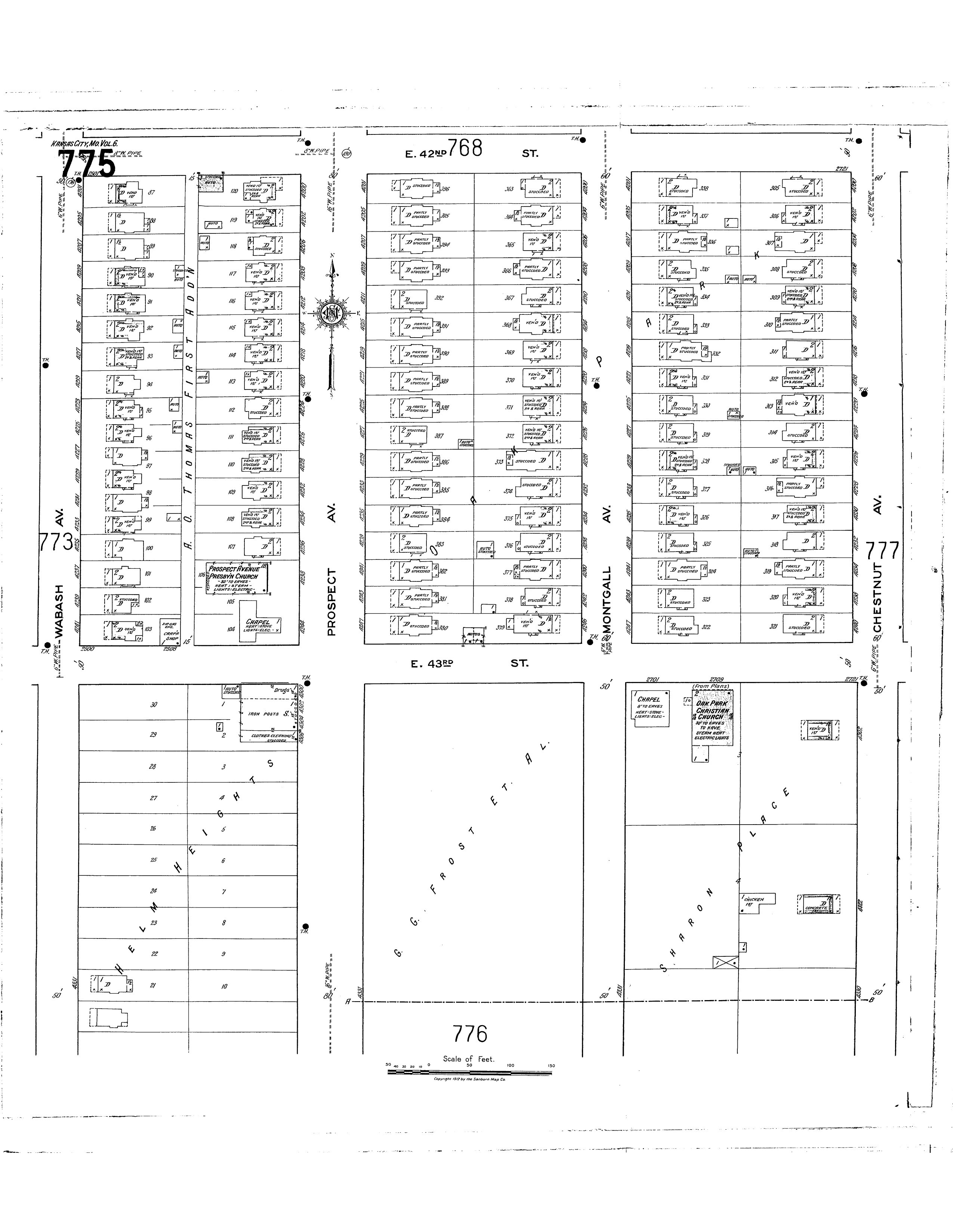
The Map on the left is a Sanborn Map from 1909 showing 42nd street to Prospect and the Map on the right is a 1917 Sanborn Map. With the Map on the left showing roads that angle, they were reconstructed sometime between 1909 and 1917 to form a more grid like pattern. With new construction of the block came more lots that are formal to each other throughout the block. This made it easier to sell for dwellings on the evenly divided lots. The 1917 Sanborn map is what the block looks like currant day with a few less houses.