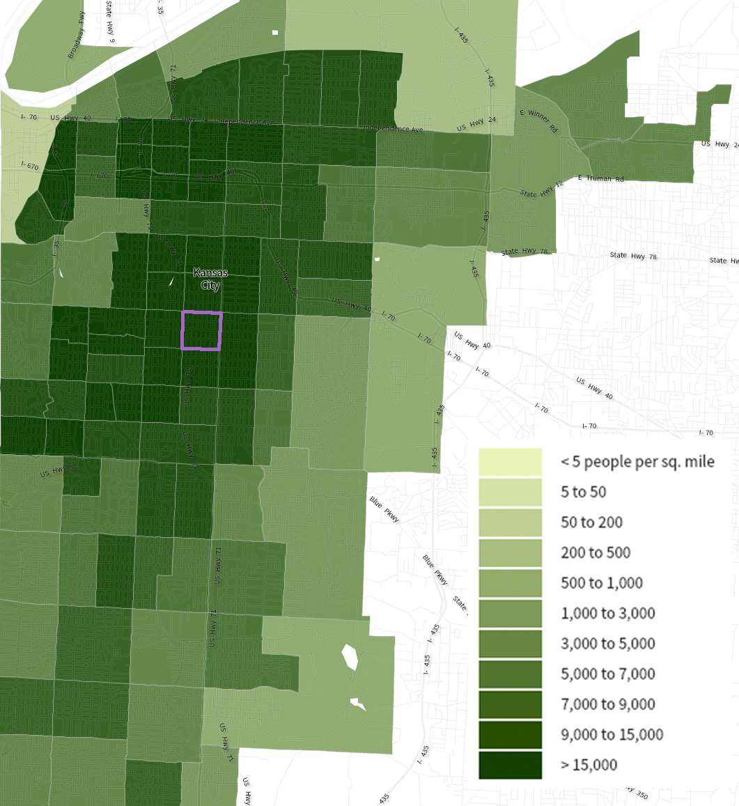
Census tract 54 includes the stretch of Linwood Boulevard from Park Ave to Wabash Ave. It’s bordered to the north by 31st Street, to the south by 35th Street, to the west by Woodland Avenue, and to the east by Prospect Avenue. In 1950, it was populated by residents living in both single family and multi-family dwellings. Public buildings included stately churches, apartments, and the Ivanhoe Masonic Temple, among others. Looking at Figure 1 below, you can see that this small pocket of Kansas City was a densely populated community at 22,096 people per square mile.
The above map gives us an idea of population density, but U.S. Census Bureau statistics provide more detailed data on the people inhabiting this tract. In 1950, it had 5,397 residents and was about 1% of the city as a whole. When we look at variations over the course of sixty years, there is a consistent downward trend in census tract 54’s population. The 2010 census revealed a population at only 17% of its 1950 level. In contrast there has been little change in the entire city population: the 2010 count stands at 99% of its 1950 level. See Figure 2, below:
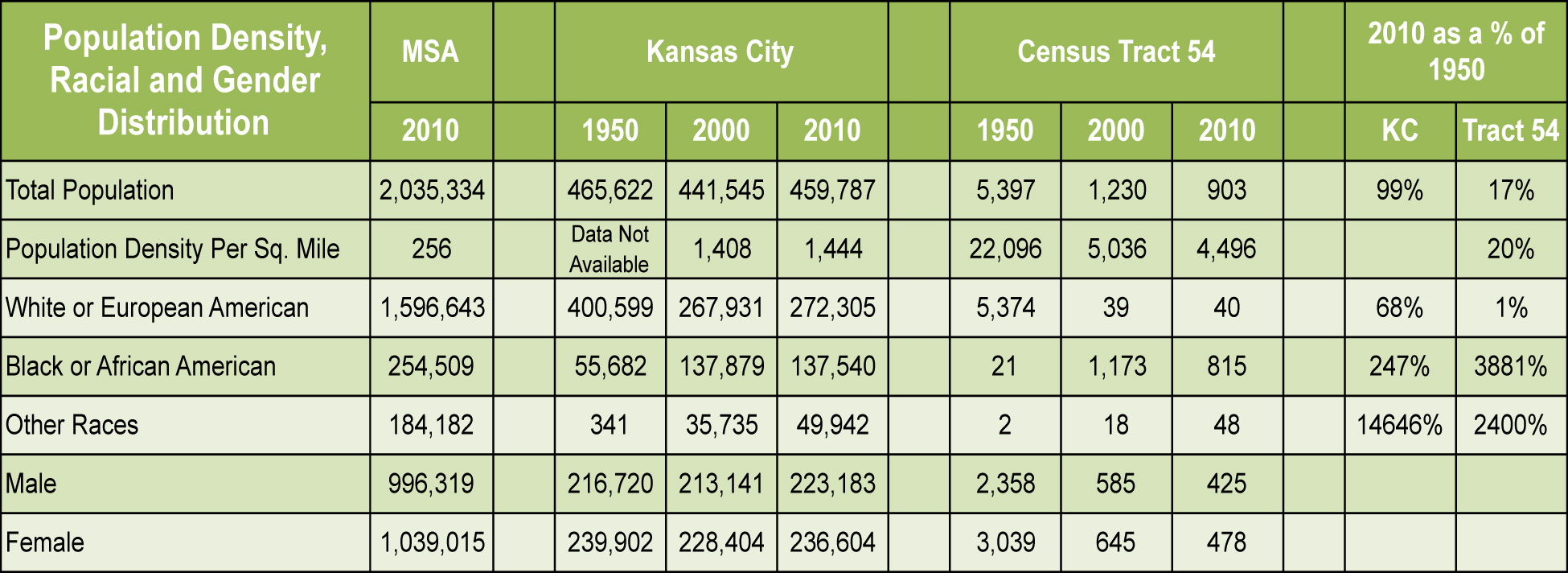
As Figure 2 shows, census tract 54 was racially homogeneous in 1950, with 99% of the population identifying as white and less than 1% black. This trend of a white majority and a black minority is completely reversed by 2010, with the white population reduced to 1% of its 1950 level and the black population increased almost forty-fold of its 1950 level.
Since the entire city’s white population in 2010 is 68% of its 1950 level, and in the metropolitan statistical area whites outnumber blacks more than 6 to 1, we can conclude that the changes in census tract 54 are not aligned with the shift in the racial makeup of Kansas City as a whole or the surrounding MSA. With such a sharp turnaround in both population and racial makeup, we must look at historical events to gain insight into what led to these changes.
Racist housing policies began to take shape prior to the 1950’s with the use of block busting, threats of violence toward blacks, developers and community builders constructing suburban subdivisions with racially restrictive covenants, and redlining. Race relations in Kansas City were tumultuous in the 1960’s and continued to be tense throughout the rest of the twentieth century.
A second factor that may have contributed to the decline of neighborhoods and thus the population was the 1968 riots following the death of Dr. Martin Luther King. Portions of Prospect Avenue, which runs along the eastern border of census tract 54, suffered property damage during the riots. This led to deteriorated homes and businesses that have never recovered.
The controversy surrounding the new “Southern Midtown Freeway” was a third factor that affected tract 54. The SMF project threatened to displace thousands of residents and businesses. It was eventually built as a smaller, parkway-style system that we know in its current form as Highway 71 / Bruce R. Watkins Drive. Highway 71 cuts directly through tract 54.