Goals:
 Our goal in the Baja Basins program is for student participants to
- increase their scientific inquiry and research skills,
- to utilize an integrative field and lab research approach, and
- to learn international cooperation by collaborating side-by-side with Mexican students, professors, and mining professionals.
The common goal is to characterize the tectonic evolution of economically important rift margin basins in Baja California Sur, México.
Baja Basins Program Participating Organizations:
- University of Missouri-Kansas City (UMKC)—Department of Earth and Environmental Sciences (Kansas City, MO)
- University of California-Davis (UCD)—Department of Earth and Planetary Sciences (Davis, CA)
- University of Oregon (UO)—Department of Earth Sciences (Eugene, OR)
- Nevada Bureau of Mines and Geology (Reno, NV)
- Indiana Geological & Water Survey (Bloomington, IN)
- Universidad Autónoma de Baja California Sur (UABCS)—Department of Marine Geology (La Paz, Baja California Sur (BCS), México)
- Universidad de Guanajuato (UG)—Department of Mines and Geology(Guanajuato, México)
- Minera y Metalúrgica del Boleo (MMB) (Santa Rosalía, BCS, México)
- Caopas Gysum Mine (Santa Rosalía, BCS, México)
- Comsa Gysum Mine (San Marcos Island, BCS, México)
Field Site:
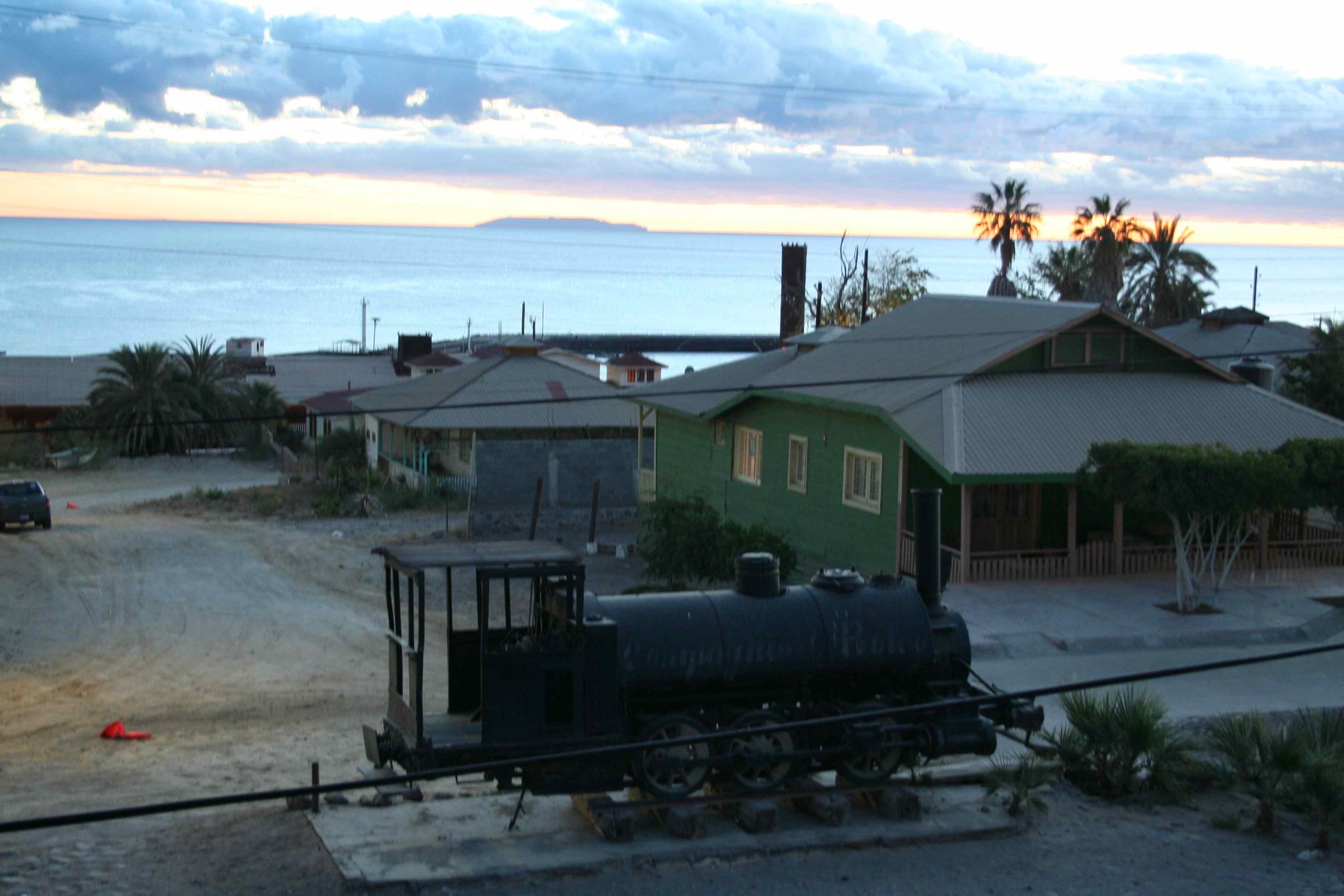
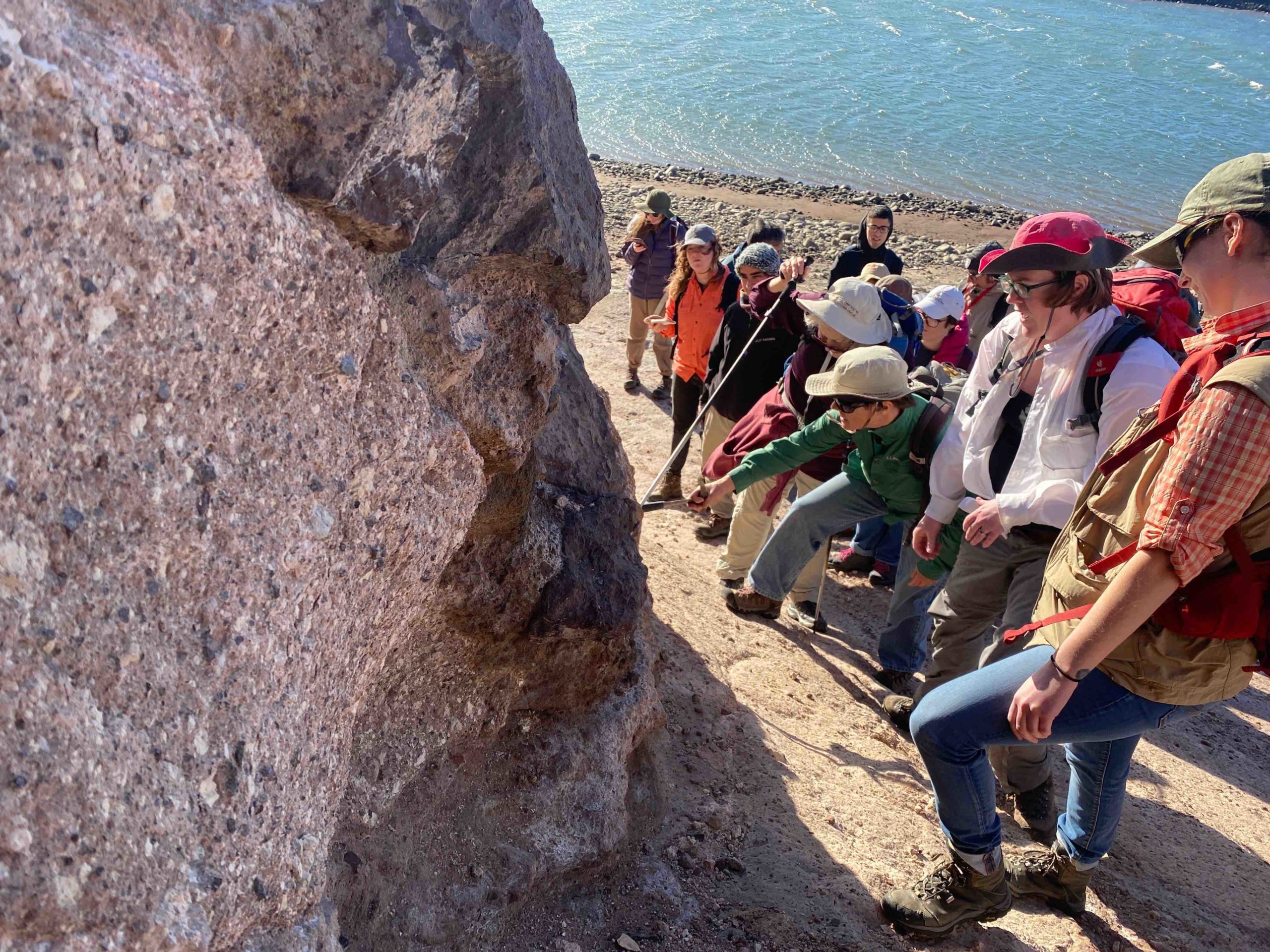
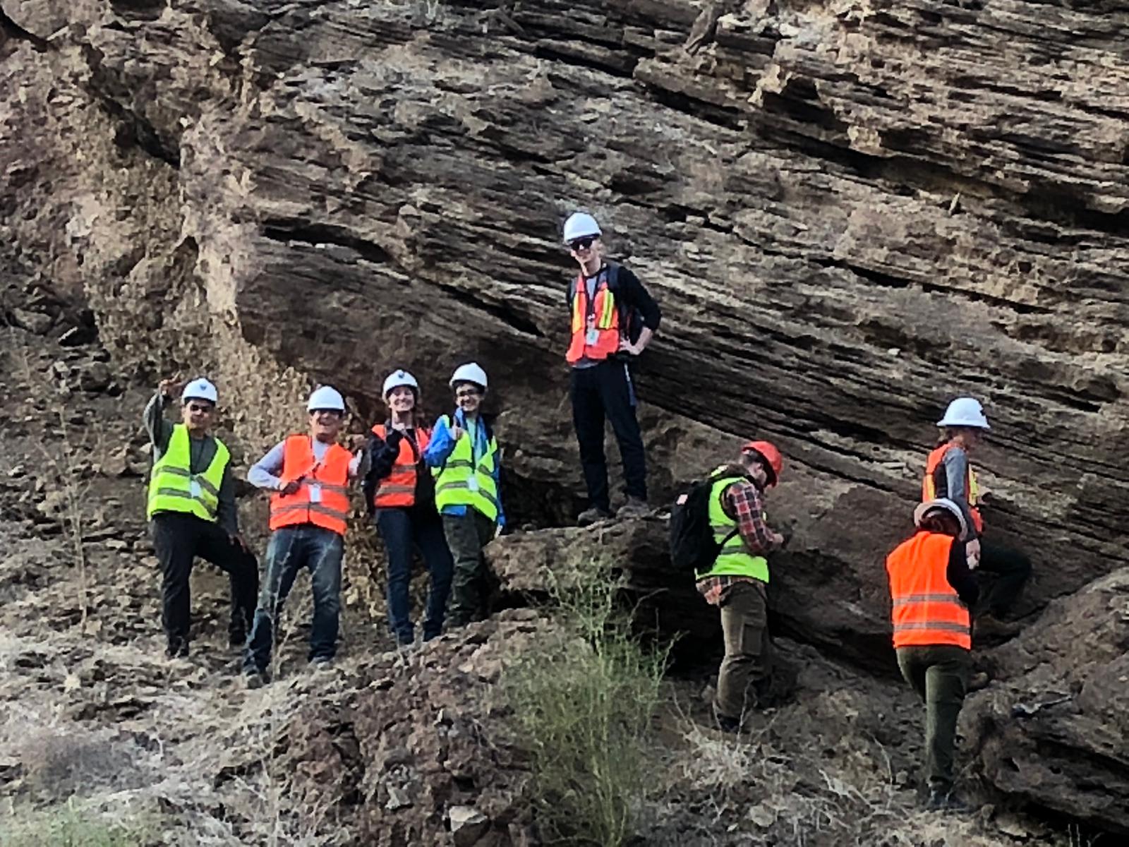
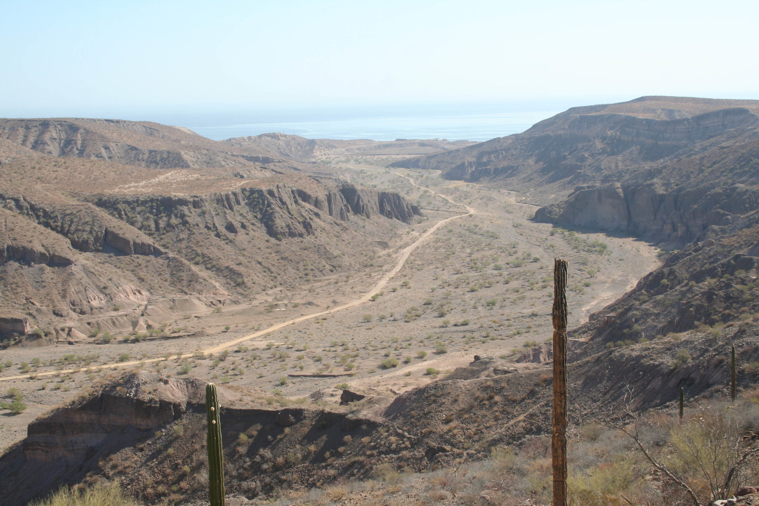
The area of the Santa Rosalía basin, located along the central Gulf of California rift in Baja California Sur Mexico, has not been mapped within the framework of modern tectonic ideas, and thus provides an excellent field location to study the evolution of a rifted continental margin. We propose to study the geologic evolution of this area over the last 22 million years, potentially covering a three-phase transition from intra-arc extension to proto-gulf extension to modern Gulf extension and transtension (e.g. Umhoefer, 2011). The project will develop models for the volcanic, sedimentary and stratigraphic response to rifting, and help to clarify t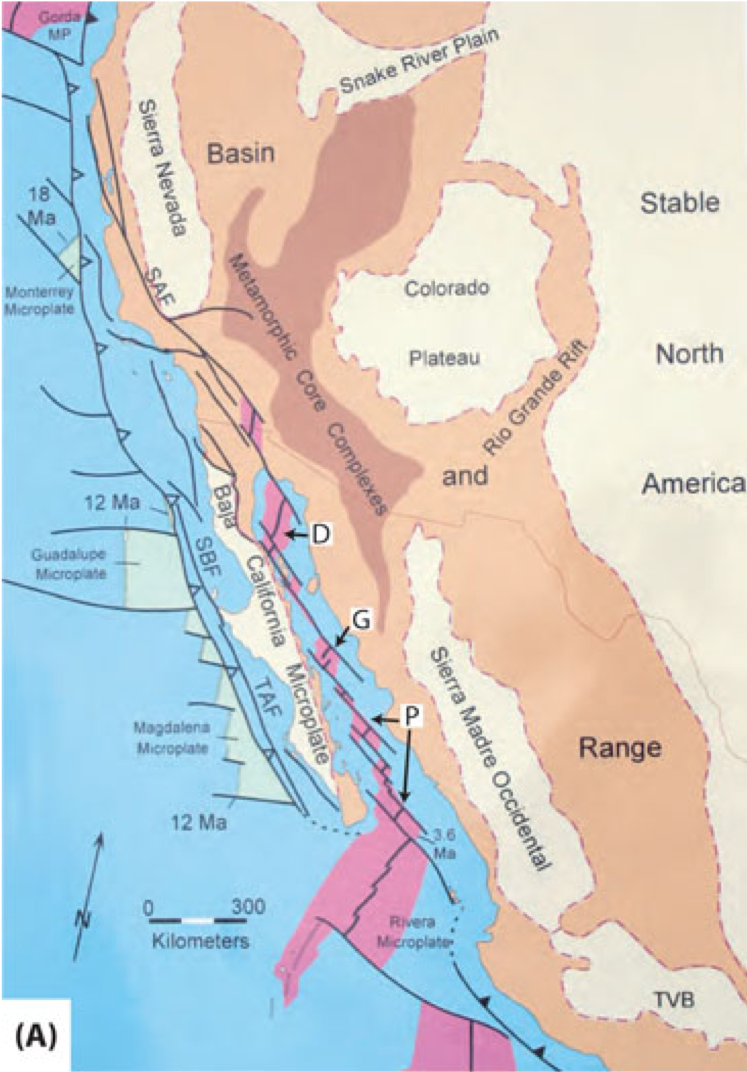 he nature of arc extension and its exploitation by continental rifting. The majority of studies like this have been done in nonmarine basins, probably because the more axial parts of older “successful” continental rifts, where marine fill would be expected, lie deeply buried beneath sag-phase strata. The Miocene-Quaternary Santa Rosalía basin is ideal for this work because it is a young basin whose structural relationship to active spreading centers and transforms has not been modified, and it is very well exposed and accessible. The young age of the Santa Rosalía basin, with its dominantly fossiliferous marine fill, numerous tuffs dateable by the LA-ICPMS U-Pb zircon or 40Ar/39Ar methods, and uplifted terraces dateable by OSL, make it ideal for resolving rates structural development and the resulting depositional systems. This REU site will provide students with an unprecedented opportunity to develop field and laboratory skills in basin analysis and tectonics in a volcanic-sedimentary sequence that is geologically interesting and economically important, within a culturally diverse setting.
Topical Research Groups
(1) Volcanology and Tectonics
 The structure of the underlying Comondú volcanics in the Santa Rosalía area is not known, nor has the western third of the Santa Rosalía basin been mapped. In fact, there are reports of westward-dipping strata in the western Santa Rosalía basin, and a fault zone along that margin, where there is a prominent topographic escarpment within the Comondú Volcanics forming the west margin of the sedimentary basin. An active volcanic field of the La Reforma-Tres Virgenes lies to the north of the basin. This research group will investigate the volcanic sequences in the basin. Some of the questions that we pose include:
- What kinds of volcanic deposits and intrusions are present in the region, and what does this tell us about the types of volcanic centers, and their distribution?
- What was the tempo of construction of volcanic centers, and did faults play any role in their siting?
- Are the volcanic rocks preserved in fault-bounded basins, volcano-bounded basins, or as constructional edifices?
- How could we use volcanic stratigraphy to determine timing and nature of slip on faults?
- What is the rapidity and nature of lateral variation in volcanic strata, and can we define co-genetic units for correlation?
- Do regional-scale unconformities exist that could help us divide and correlate volcanic stratigraphy?
- How rapid was the geochemical transition from arc to rift volcanism, and is this signaled by any changes in volcanic or tectonic style?
- What do field characteristics and textures in thin section tell us about physical volcanic processes of eruption, transport and emplacement?
- How does one distinguish primary volcaniclastic rocks from re-sedimented volcaniclastic material, or volcaniclastic material eroded from older rocks, and why is this important?
- What do the mineral phases, and the relations between them, tell us about the ascent, storage and eruption of magmas?
- What does the chemistry tell us about mantle and crustal processes in arc and rift magmatic settings?
- How does one choose minerals and samples suitable for dating by the Ar/Ar or U-Pb zircon method?
(2) Basin Analysis
 The Miocene-Quaternary Santa Rosalía basin is ideal for stratigraphic work because it is a young basin whose structural relationship to active spreading centers and transforms has not been modified, and it is very well exposed and accessible. The basal Boléo Fm with its copper mineralization marks the onset of marine deposition in the Santa Rosalía basin ca. 7-8 Ma during a proto-gulf rifting phase. The overlying Pliocene Tirabuzón Fm and the late Pliocene to Pleistocene Infierno and Santa Rosalía formations likely record later phases of gulf extension or transtension. This group will investigate the following questions:
- What kinds of sedimentary depositional systems are present in the basin?
- What is their three-dimensional architecture, and how was this controlled by patterns of basin subsidence, sediment supply and relative sea level change?
- What types of unconformities are present in the basin, and how could they be used for correlating and dating strata?
- What were the main depositional processes in the basin, and how did they vary in space and time? Possibilities for the origin of Santa Rosalía basin include hanging-wall rift, foot-wall rift, symmetrical rift, transtensional rift, or drift basin; which is suggested by the stratigraphy and structure, and how did the basin change through time (polygenetic basin)?
- What can petrographic studies tell us about the provenance of sediment in the basin, and how can this be complemented by detrital zircon studies?
- How can clast-count data be used to reconstruct tectonic or volcanic events?
- How does one distinguish primary volcanic detritus form detritus derived by erosion of volcanic rock, and why is this important?
- How do sedmentologists use fossils to date and correlate sedimentary sections?
- How does a sedimentologist recognize tuffs or lavas suitable for dating a sedimentary section, and distinguish them from later intrusions?
- How can detrital zircon be used to provide minimum ages on sedimentary sections that lack fossils or dateable volcanic rocks?
(3) Tectonic Geomorphology
 Uplifted and folded fluvial and marine terrace are found along the arroyos and shoreline of the Santa Rosalia area. These Quaternary deposits are coeval with volcanic flows and detritus and thus provide a unique opportunity to investigate the sedimentary and deformation history through detailed topographic and geologic mapping and dating. Questions include:
- When did the mesa form?
- What does the geomorphology of the mesa surface and stratigraphy of the Santa Rosalía Formation tell us about the paleoenvironment?
- Are the processes that formed the “mesa” still active, or are other faults and deformation styles active now?
- What is the distribution and elevation of fluvial and marine terraces? When did the fluvial and marine terraces form?
- What is the rate and style of the active tectonic deformation recorded in fluvial and marine terraces?
- How has the rate and style of faulting changed over time?
- Quaternary deformation appears to be coincident with the onset of the Tres Vírgenes-La Reforma volcanic complex. How is the Quaternary volcanism related to deformation of the basin to the south? What triggered the uplift of the mesa and the coastal marine terraces?
(4) Mineralogy and Mining
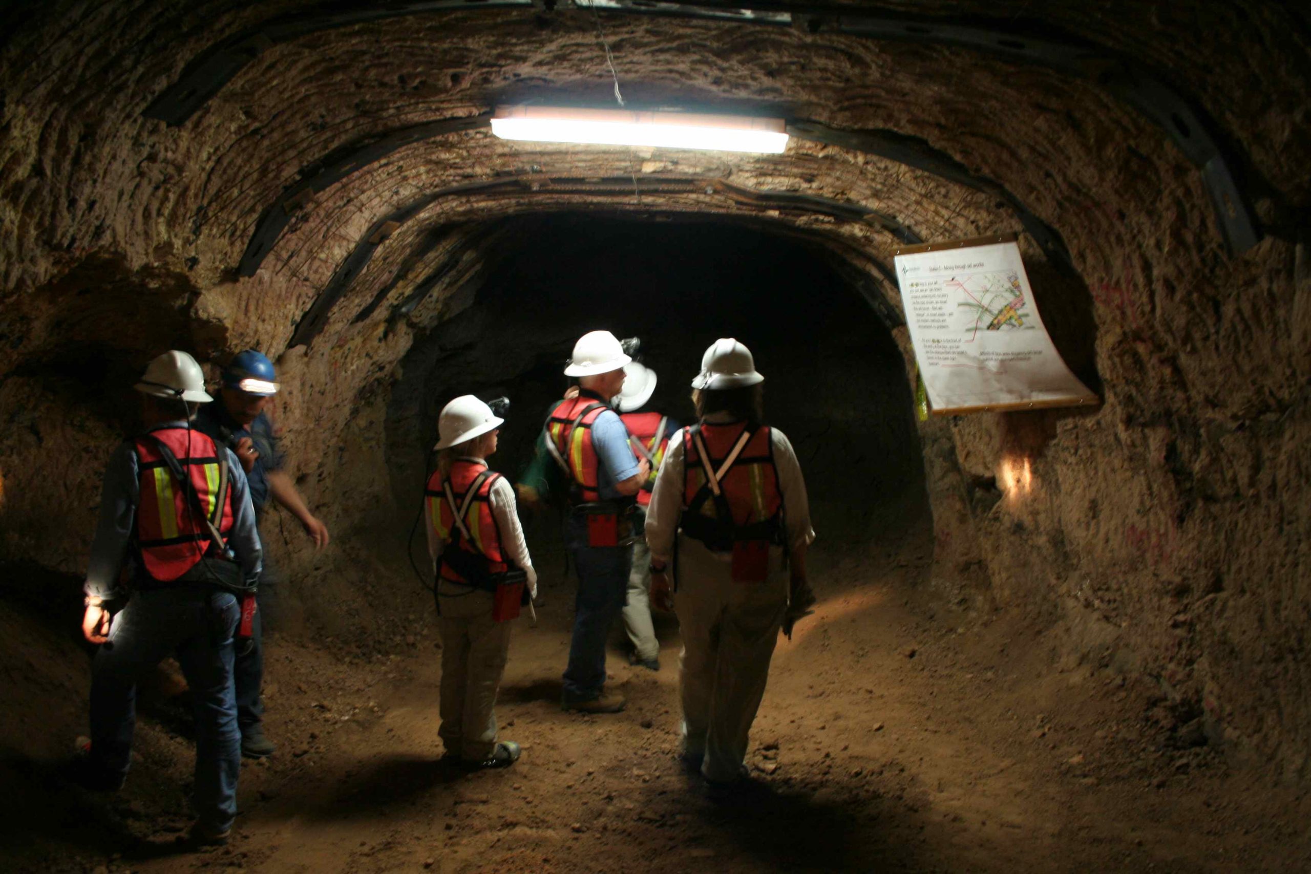 Several lines of investigation will be pursued to test previous fluid flow models and ore emplacement and deposition of economical gyspum including:
- What is the trace element variation across the different units of the Comondú Volcanic units?
- How do the stable isotope concentrations in the volcanics, sediments, and ores vary and what do they tell us about the environment of deposition?
- Based on fluid inclusion analysis of the mineralized veins, what fluid types were present and what is their source (meteoric, igneous, or sea water)?
- Are there elemental trends or gradients from west to east that can be related to fluid flow/reaction and localization of fluid outflow zones?
- What are the depositional processes and controls on distribution and grade of the ore minerals?
- What is the relationship between the evaporitic basin and the ore emplacement?
- What are the controls on gypsum deposition?